Although this trail is described as offering park visitors the
easiest descent into the main Bryce Canyon amphitheater (or ascent back
up from it), the trail is not a loop. You either have to go out and back
on it for a total of about two miles -- the part marked in yellow
on the map below -- or combine it with another trail, such as
Navajo, to get back up to the rim.
Here's part of the park's
official trail map that shows the Queen's Garden Trail. Go to this park
website
link for a larger version with more
of the main amphitheater area trails and overlooks.
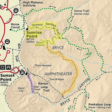
Yellow = about one mile one way.
The spur trail marked in orange gets hikers to
the low end of the Navajo Loop, a
one-way distance of about 1.8 miles.
According to the park newspaper, the most popular loop with Queen's
Garden incorporates one side of the Navajo Loop, usually Wall Street.
The park recommends going clockwise on this three-mile loop, which
means starting at the Queen's Garden trailhead at Sunrise Point, going
down to the low end of the Navajo Loop via a spur trail, climbing back
up the Navajo Loop on one side or the other to Sunset Point, and walking
along the rim to Sunrise Point.
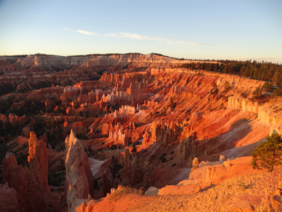
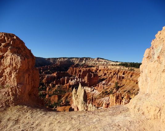
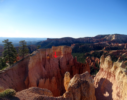
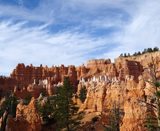
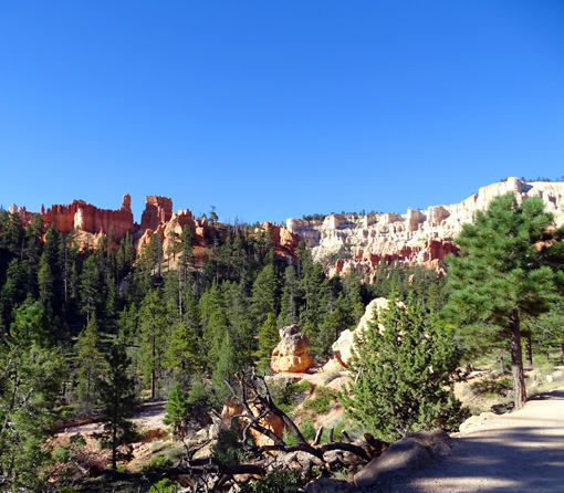
View into the amphitheater from
Sunrise Point; the Queen's Garden Trail
winds through the fascinating
rock formations down in the canyon.
The Queen's-Navajo Loop is a moderately difficult hike if you're in good
shape and acclimated to higher altitudes, but considerably more
difficult if you aren't.
Remember that you're at about 8,000
feet elevation on the rim and not appreciably lower than that down on the
amphitheater floor. Even on cooler spring and fall days the bright sun
can feel quite hot in the canyons by lunchtime.
The effort and southern Utah's very low humidity will quickly suck
you dry so take plenty of fluids, go as slowly as you need (stop and
take lots of photos!), and watch your footing on loose rocks on steeper
sections of trail so you don't fall or slide off a cliff.
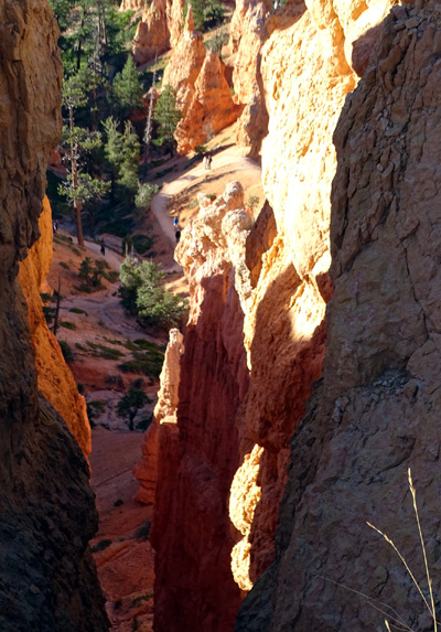
Jim looks down through a crevice
to the rock formations 200-300 feet below.
View from upper part of the
trail through a different crevice to a part
of the trail about 200 feet lower; see the little
people down there?
I've hiked Queen's Garden in different combinations with the Navajo Loop, Peekaboo, Bryce Point, and connector trails, sometimes beginning with
Queen's Garden and sometimes ending with it. My distances have varied
from three to fourteen miles, and you could extend it even farther than that.
In this entry I'll take you on a virtual tour of the Queen's Garden
Trail, beginning at the trailhead at Sunrise Point, and the spur trail
to the bottom of the Navajo Loop. These two sections are marked in
yellow and orange on the map above.
The photos were taken on several different days and show views in
both directions.
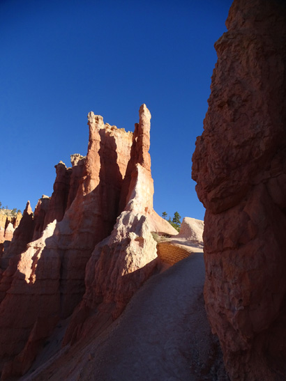
QUEEN'S GARDEN TRAIL
Queen's Garden has some great rock formations and several tunnels to
walk through. It's a fun hike in either direction.
Let's start at the Sunrise Point trailhead:
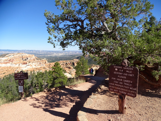
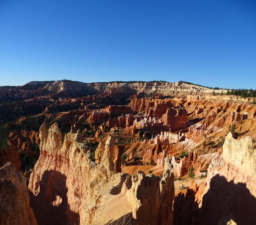
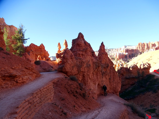
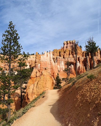
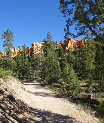
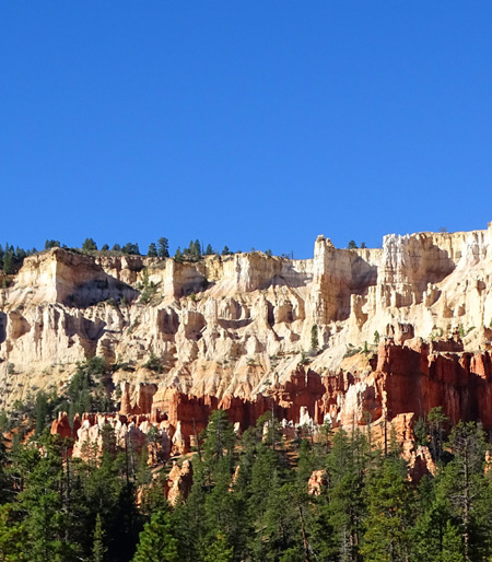
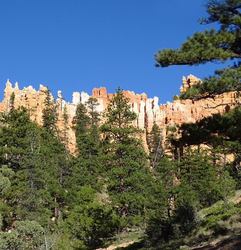
The trail is wide and mostly smooth as it winds through the amazing
landscape.
The initial descent from Sunrise Point is moderately
steep, with some loose rocks -- a sign at the trailhead warns
hikers about this hazard -- but most of the Queen's Garden Trail
has a more gentle grade.
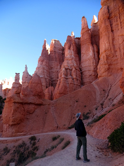
At the beginning of the descent there
are great views of the tops of nearby and distant rock formations.
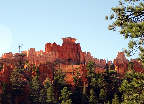
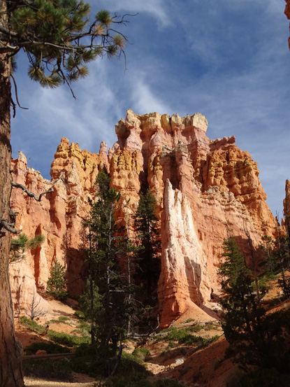
Farther down the trail passes by the bottom of the sculpted walls
and spires.
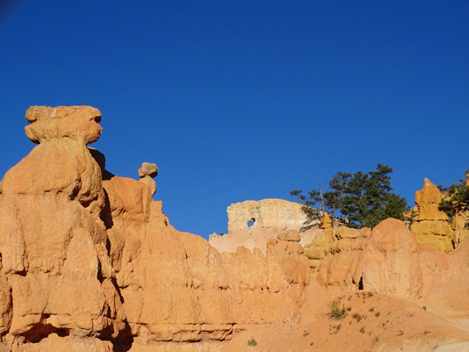
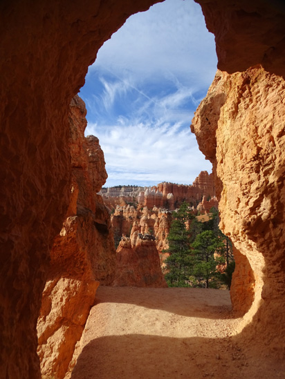
"Framed" view into Bryce
Amphitheater
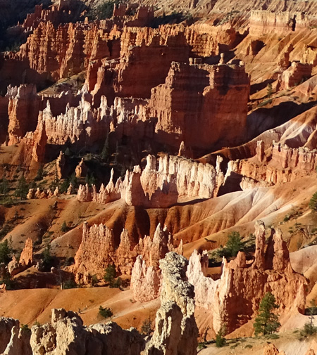
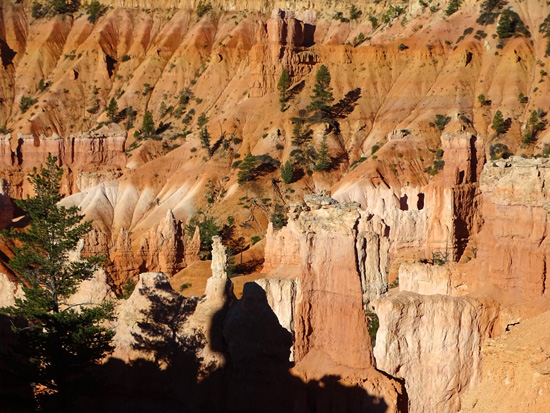
.Above and below: pretty
pastels and darker hues in the canyon
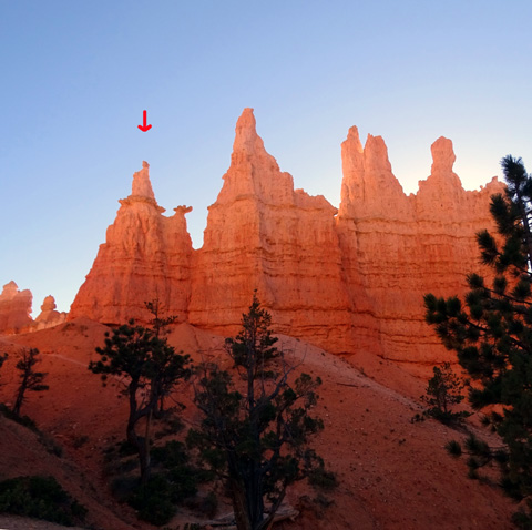
Look closely and you might see the beam of
light below the arrow. The morning sun is to
the left, shining through a window in the
rock wall. You can see the shadow at the lower right.
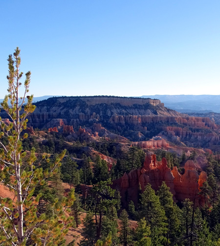
View east toward Boat Mesa
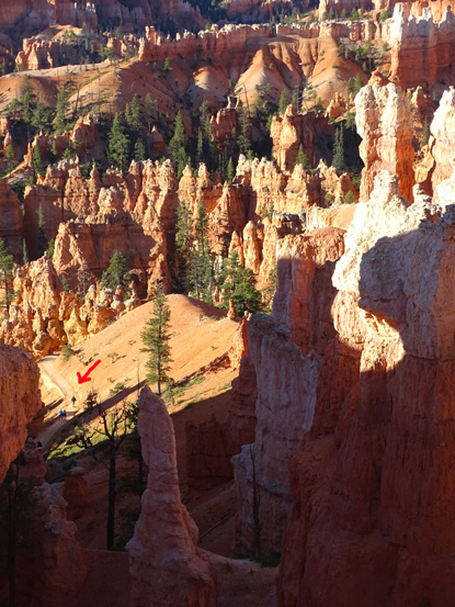
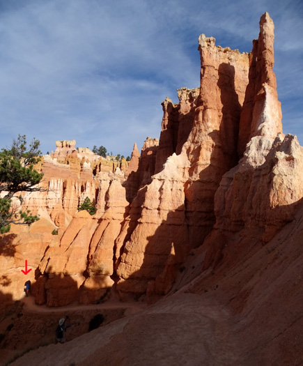
Looking down to a lower part of the trail again;
arrow points to tiny people.
Arches (above) and windows (below) fascinate me, as
do all the pretty rock colors.
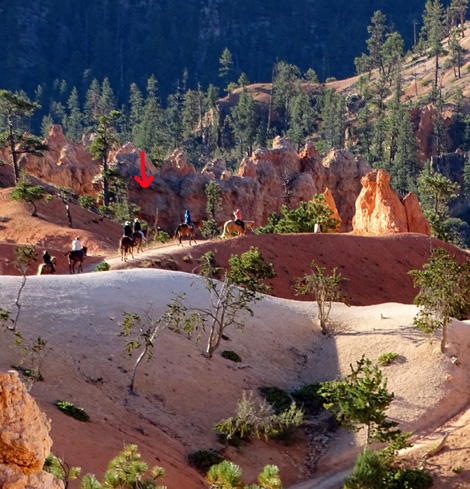
If you time it just right, you can see the morning or
afternoon
guided
horse tours go by on the nearby horse trail.
The Queen's Garden Trail passes through four tunnels that have been
chiseled out of the rocks. This descent goes to the first one:
Tunnel is in the distance, under the arrow.
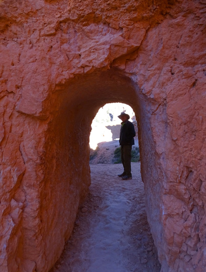
Jim is silhouetted at the other end of the first tunnel.
Four levels of trail are shown here, as they
switchback through the rock formations.
You'll see a lot more if you stop often to look up,
around, and behind you.
People who rush through Bryce's trails miss a lot
of detail.
View through second tunnel; I like to use tunnels
as frames.
There are two more tunnels before reaching the short spur trail to see the
"Queen" hoodoo, with incredible views of rock formations along the
way:
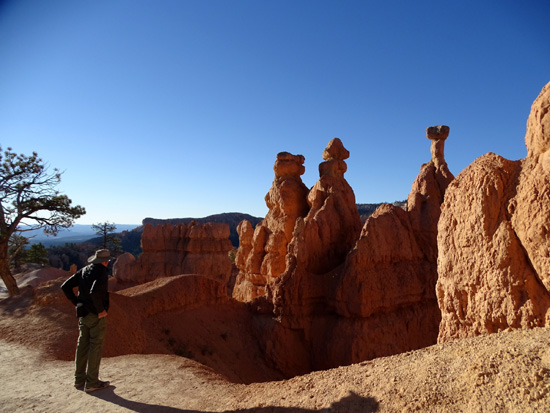
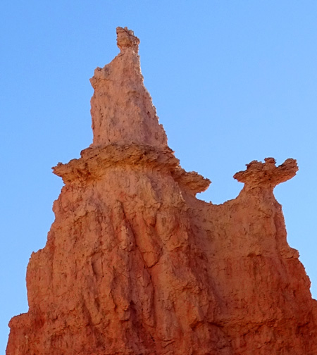
LET'S GO SEE THE QUEEN!
Just after passing through the fourth tunnel, you'll come to an
intersection. Left goes down to the spur trail leading to the Navajo Loop
and straight goes back a couple hundred feet to this sign:
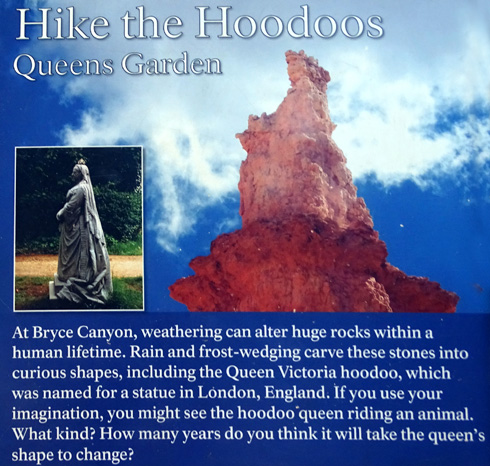
That explains why this is named the "Queen's Garden" Trail.
If you haven't already noticed the tall hoodoos you're facing,
now's a good time to see the Queen Victoria look-alike in rock -- before
it eventually erodes to the point that it doesn't resemble the statue any more!
Now we'll go back to the intersection by the tunnel and head down the spur
trail. It leads you to the bottom of the Navajo Trail, if you're doing that loop
up to Sunset Point, or to the access trail to the Peekaboo Loop.
If not, you can return back up the Queen's Garden Trail to Sunset Point.
With a different perspective hiking the opposite direcction, you're bound
to see things you missed on the way down.
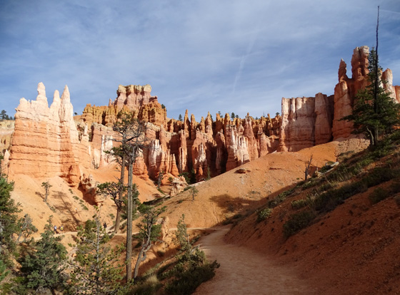
SPUR TRAIL TO NAVAJO LOOP
The spur trail drops gradually along a small wash. Soon you'll
come to a narrow slot between rocks,
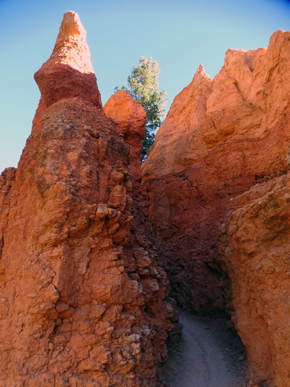
then be more out in the open through trees the rest of
the way to the intersection with the Navajo Loop and spur trail to the
Peekaboo Loop.
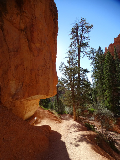
You aren't as close to most of
the carved rock walls and spires on the spur trail but there
are some interesting formations along the way if you stop and look:
One of many strategically-positioned
benches at Bryce Canyon
Before reaching the Navajo-Peekaboo intersection the spur trail
curves around to the west along a wide wash and faces the rim. There are
good views of the carved rocks in the cliff below the
rim and toward the Peekaboo Loop to the south (left) :
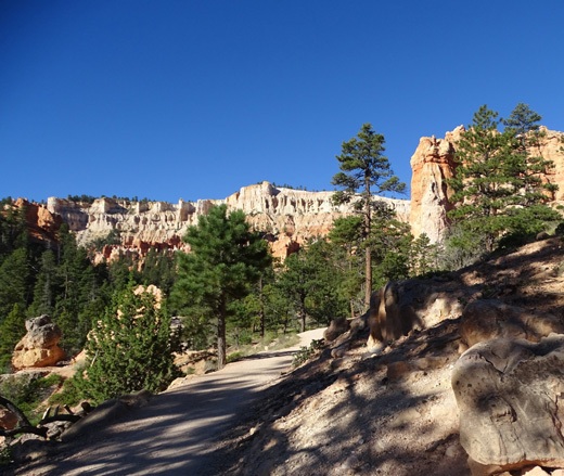
Portion of the rim between Sunset and Bryce
Points; the Rim Trail
follows the edge pretty closely and you can
see these trails below.
Another intersection and another decision to make -- go
right up the Two Bridges side of the Navajo Loop to Sunset Point,
straight ahead to the Wall Street section of the Navajo Loop and up
to Sunrise Point, or left on the spur trail to the Peekaboo Loop.
Or you could do what I did on one really long hike from here -- up
the Wall Street side, down the Two Bridges side, one-and-a-half
times around the Peekaboo Loop, up the Bryce Point Trail, and
back to Sunrise Point on the Rim Trail . . .
Lots of choices and opportunities here! Pick one or all, depending on
the time and energy you have.
Next entry: multi-page virtual tour of the
Peekaboo Loop; this is Jim's favorite Bryce Canyon trail
and my second-favorite one
Happy trails,
Sue
"Runtrails & Company" - Sue Norwood, Jim O'Neil,
Cody the ultra Lab, and Casey-pup
Previous
Next
© 2015 Sue Norwood and Jim O'Neil
