Those fascinating amphitheaters are what every visitor to Bryce
Canyon comes to see!
Most observe the rock formations in the canyons from the "rim," or
edge of the cliff above the amphitheaters. There are five very popular
observation points within the first three miles of the entrance gate
that overlook the largest, most elaborate amphitheaters (Fairyland,
Sunrise, Sunset, Inspiration, and Bryce) and ten more distant overlooks
on the Southern Scenic Drive.
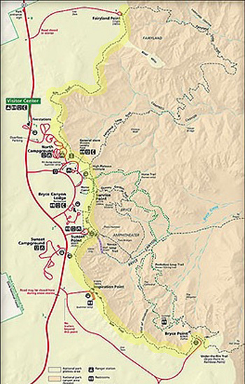
Here's a small detailed map showing the busiest part of the park
near the main Bryce Amphitheater. Check the park
website for the readable version. The
Rim Trail from Fairyland Point (at the top) to Bryce Point is marked in
yellow:
As noted in the last entry, visitors can either drive their own
vehicles to all of these overlooks or use the free shuttle bus system to
access Sunrise, Sunset, Inspiration, and Bryce Points.
Visitors can also walk along the Rim Trail, which extends about six
miles between Fairyland and Bryce Points. That's an even better way to
see more details of the rock formations. (The best way is to get
down into the canyon among the hoodoos, but that's the subject of
subsequent entries.)
This multi-page entry shows scenes from the Rim Trail and almost all
of the park overlooks, starting with the most popular ones above the
main amphitheater.
RIM TRAIL
A wide walking path extends at or near the edge of the plateau rim
from Fairyland Point to Bryce Point, a distance of 6+ miles. It
can be easily accessed from Fairyland, Sunrise, Sunset, Inspiration, and
Bryce Points, as well as North Campground and the lodge.
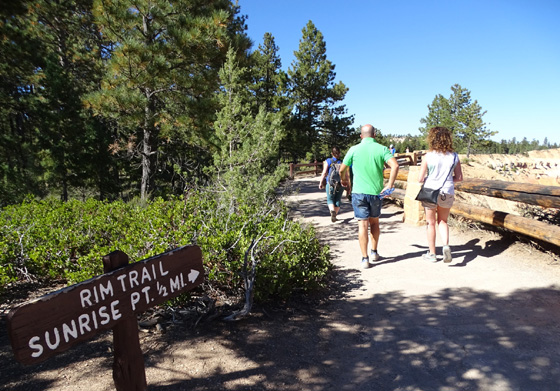
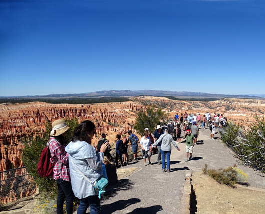
The only part of the trail that is paved and fairly level is the half
mile between Sunrise and Sunset Points above the main canyon
amphitheater. That's also the busiest segment:
The majority of the trail is dirt and it undulates between observation points,
sometimes rather steeply. It is often quite close to the edge of the
"rim" of the amphitheater. If you're acrophobic (or aero-acrophobic) you
can avoid the edge of the cliff by walking on the far side of the path.
I have hiked the entire length of the rim but not all at one time.
Following are some photos of the views from the popular overlooks
mentioned above and the Rim Trail connecting them.
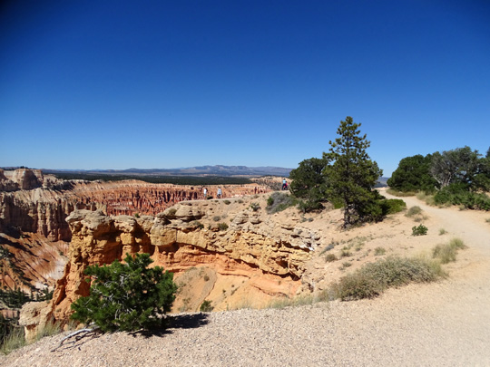
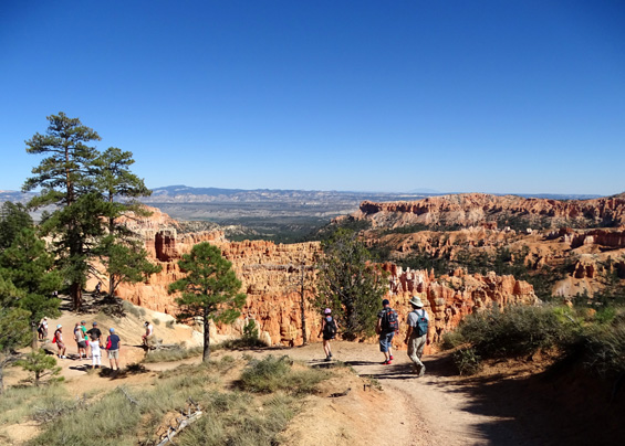
BRYCE POINT TO INSPIRATION POINT
The southern end of the Rim Trail begins at the Bryce
Point parking area and heads north a few hundred feet along
post-and-rail fencing, then drops down to the overlook at the actual
point, which juts out into the canyon.
These photos go
northbound from the Bryce Point parking area:
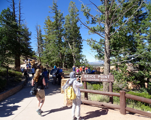
The southern end of the Rim Trail
is at the Bryce Point parking area (elev. 8,300 feet).
"Alligator" formation
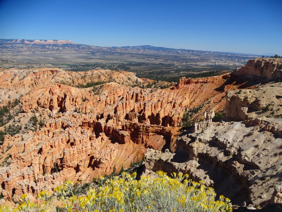
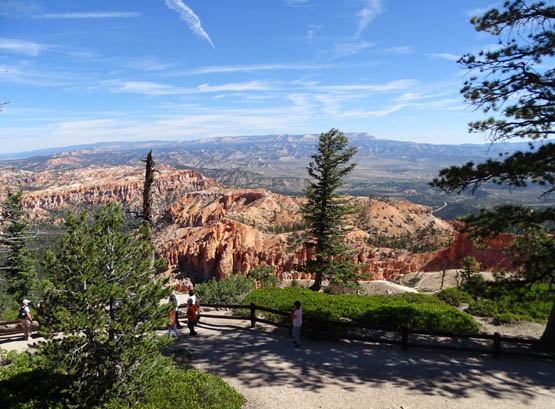
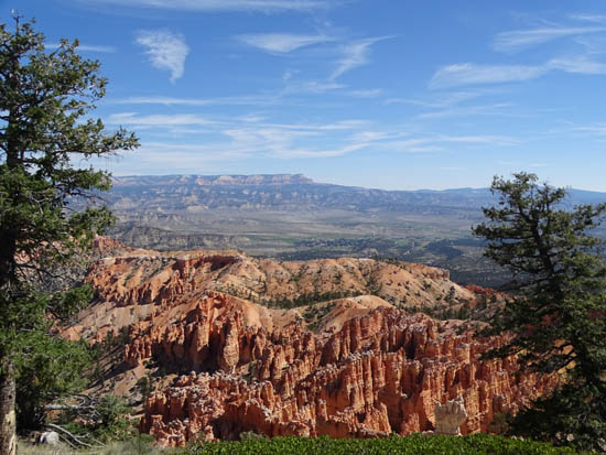
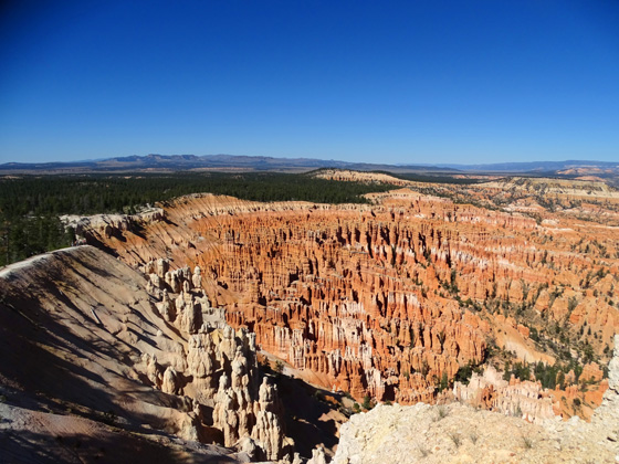
View from the point, east toward the Aquarius
Plateau (upper left) and the town of Tropic in the valley
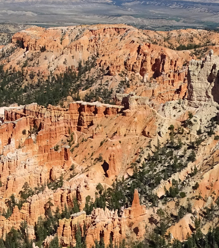
View north from the point to the
large Bryce Amphitheater
Parts of the very scenic Peekaboo
Trail can be seen snaking through the hoodoos.
The next views are from the Rim Trail going north toward Inspiration
Point, a distance of about 1.5 miles:
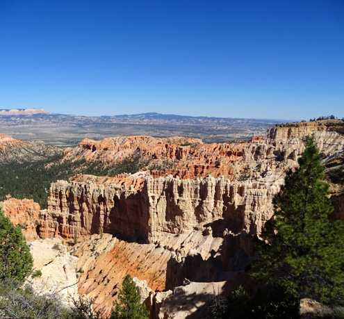
View of the "grottoes" in the
cliffs near Bryce Point; the Rim Trail continues around the bend.
The Rim Trail is often close to
the edge of the cliff.
Arrow marks a large "window" in a
rock fin close to the Rim Trail.
View down to part of the Bryce Point Trail that
connects with Peekaboo Trail
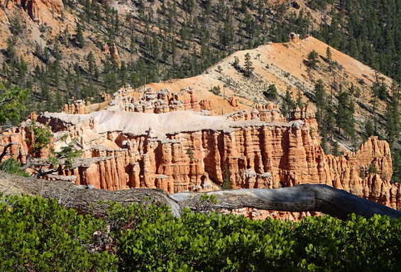
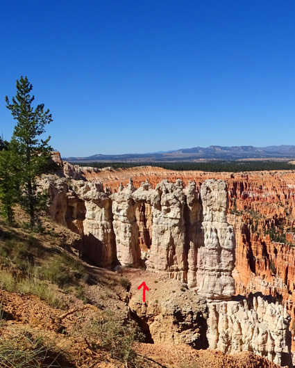
The "back" side of the Wall of
Windows is in the center of this photo. It is much more impressive
seen from below, on the
Peekaboo Trail, when you can see the blue sky through the windows.
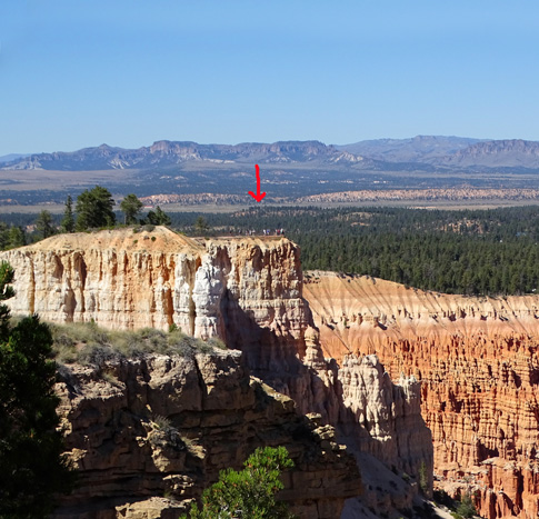
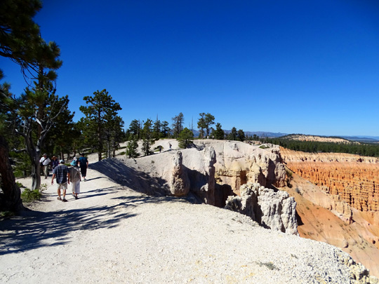
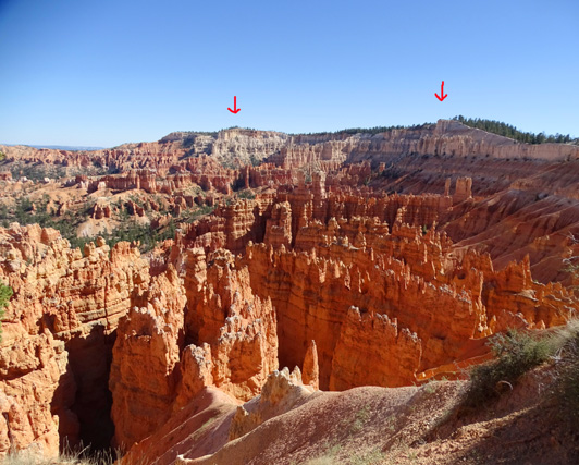
Arrow marks the upper overlook
at Inspiration Point.
The Rim Trail goes uphill to the highest of three
overlooks at Inspiration Point.
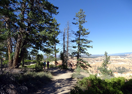
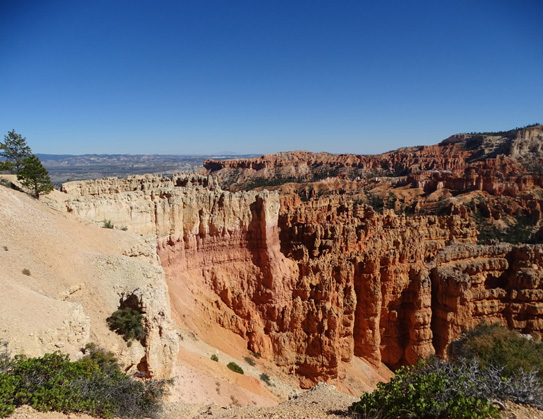
INSPIRATION POINT TO SUNSET POINT
The trail descends, sometimes rather steeply, in 7/10ths
of a mile walking north from the upper overlook at Inspiration Point to
the main overlook at Sunset Point. There are many good views of the
formations in Bryce Amphitheater from the three overlooks and the next
section of the trail:
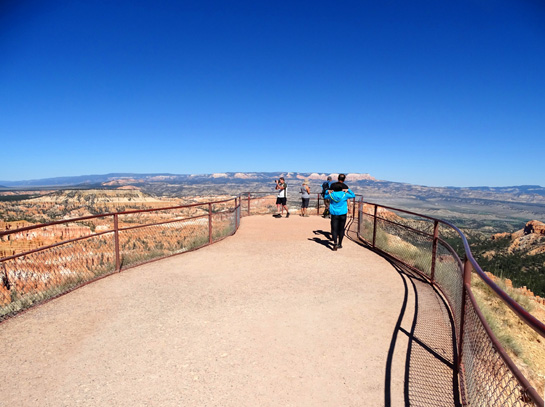
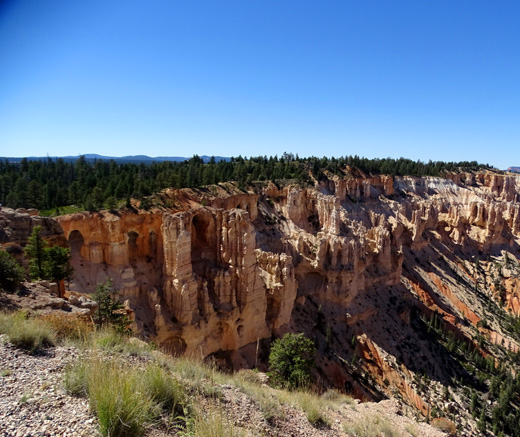
The upper Inspiration Point
overlook, like most of the other points, juts out into the
amphitheater and affords great
views of the rock formations in three directions.
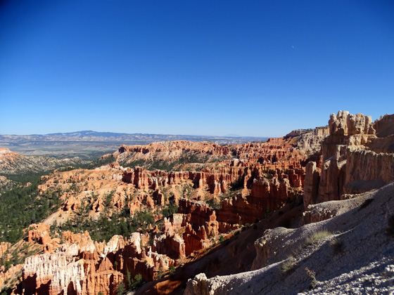
Views north (above) and south
(below) from the upper overlook at Inspiration Point
Rim Trail below Inspiration Point
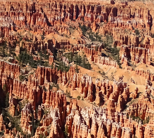
Closer view of formations along the Peekaboo Trail
loop
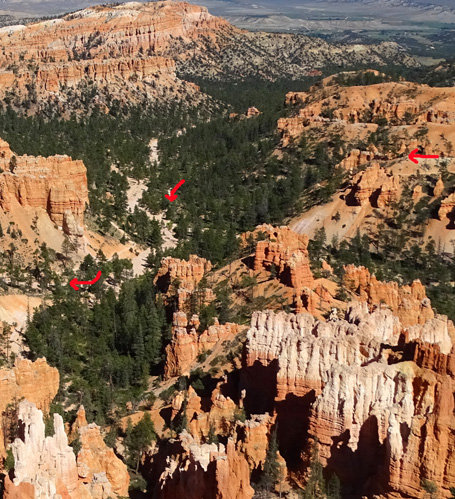
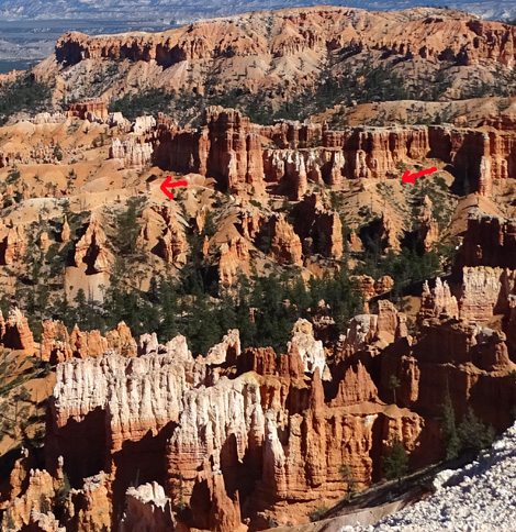
Arrows mark Peekaboo Trail (R),
spur trail (center), and path to
the Wall Street section of the
Navajo Trail loop (L)
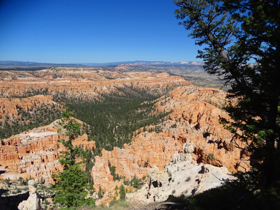
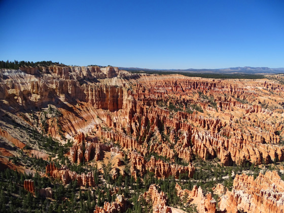
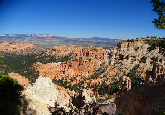
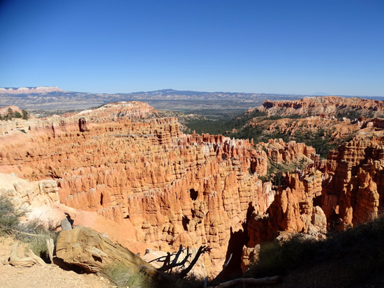
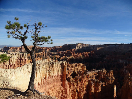
Looking north toward the "Silent
City" formation in the amphitheater below Sunset Point
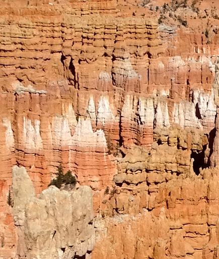
More detail of the pastel-colored
rock walls sculpted by erosion
Getting closer to the "Silent
City" formations
Hilly section of the Rim Trail
approaching Sunset Point
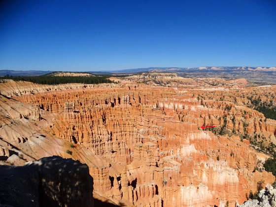
Looking back south to Bryce Point
(L. arrow) and Inspiration Point (R. arrow)
Formations below the rim near
Sunset Point
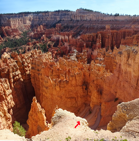
View from rim at Sunset Point
down to switch-backing trail
near top of "Wall Street" slot canyon on
the Navajo Trail Loop
Continued on the next page: scenes from Sunset to Fairyland
Point, including sunrise photos
Happy trails,
Sue
"Runtrails & Company" - Sue Norwood, Jim O'Neil,
Cody the ultra Lab, and Casey-pup
Previous
Next
© 2015 Sue Norwood and Jim O'Neil
