Swirling sandstone mesas, intriguing steep-walled slot canyons,
vermilion cliffs, picturesque washes, smooth sculpted slickrock, hanging
gardens, high desert landscapes, thick forests . . .
Southern Utah is renowned for its varied, colorful canyons and rock
formations. It is full of national forests, state and national parks,
recreational areas, and monuments -- millions of acres of public property
preserved for recreation, scientific research, and discovery.
This map of southern Utah shows some of these areas. Grand
Staircase-Escalante National Monument (GSENM) is shown in lavender:
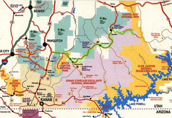
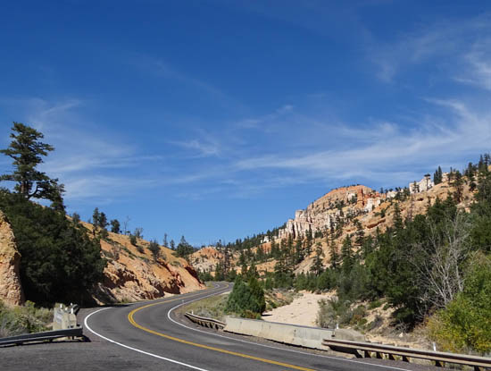
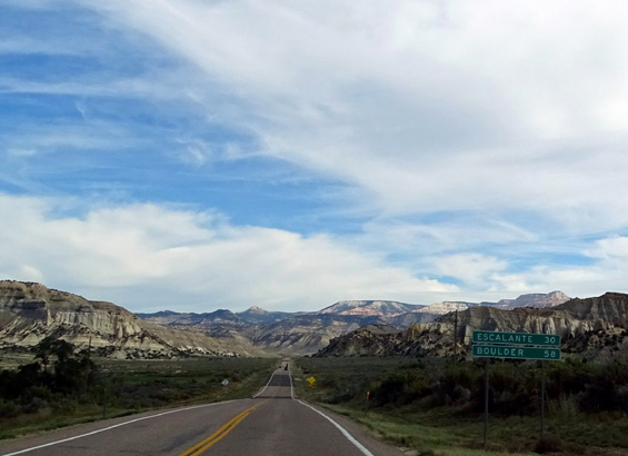
We are camped at Red Canyon, which is about 15 miles west of Bryce
Canyon National Park. I marked the route in green that we took to
explore the northern portion of GSENM.
Grand Staircase-Escalante National Monument, established just 19
years ago and managed by the BLM, has some of the most rugged, diverse
terrain of any of these public lands in southern Utah. Spanning almost
two million acres -- 3,000 square miles -- it is a fantastic
outdoor playground and educational laboratory.
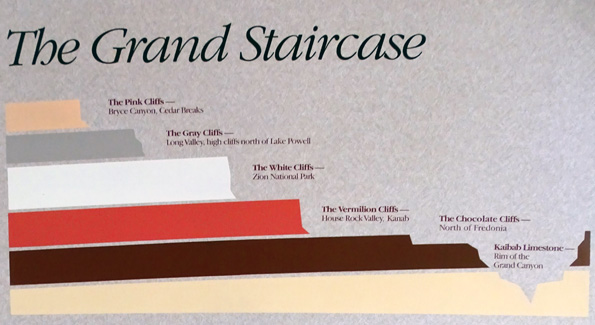
It is named for the Escalante River canyons and for the Grand Staircase,
a series of colorful cliffs that gradually rise from the North Rim of
the Grand Canyon to Bryce Canyon and Cedar Breaks.
The "staircase" is too extensive to see from any one spot but
there are cool models and graphics of it at various visitor centers in
southern Utah. This one was at the North Rim of the Grand Canyon:
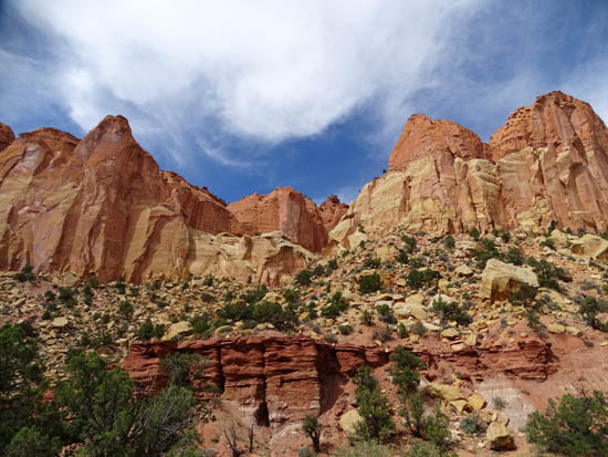
Grand Staircase-Escalante is fascinating but it's not the most hospitable
place for humans, now or for early inhabitants.
There are
good reasons why it was the last place in the Lower 48 states to be
mapped. In addition to its extremely rugged terrain, the weather can be challenging,
no services are available within the monument, and few good roads access
its interior.
You can see all the roads that give access to the monument on the map
above. Solid lines are paved roads, dotted ones are unpaved.
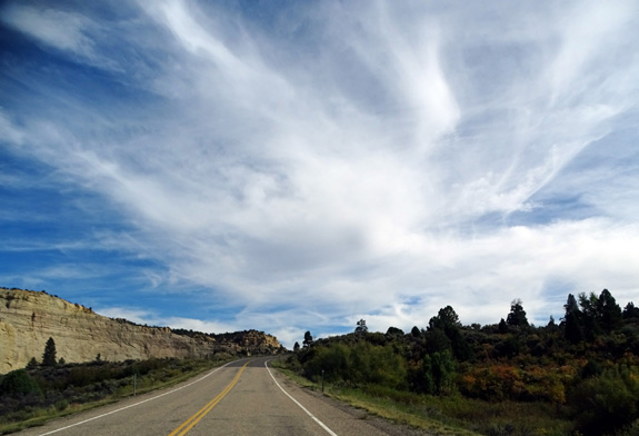
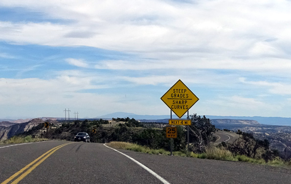
Cool clouds along National Scenic Byway 12
Paved Scenic Byway 12 skirts the northern edge of the monument.
Paved US 89 passes through the southwestern part. Two paved Scenic Backways
access another 47 miles of the monument.
Three dirt, sand, and clay surface Scenic Backway roads go into the
monument from these paved roads -- they are impassable when wet
and suitable only for 4WD vehicles when dry. We don't have 4WD and those
gnarly roads are the ones that access the trails and slot canyons I was
hoping to see.
Scenic Backway Burr Trail is paved but narrow and
generally not suitable for trailers or big rigs.
Since much of GSENM is beyond the reach of the average visitor, how
could we -- and most other visitors -- enjoy
this humongous, scenic playground?
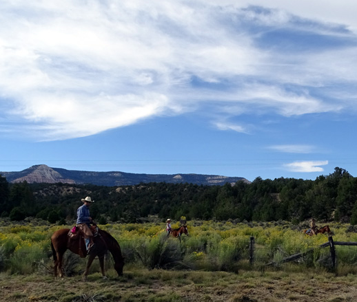
Active and adventurous folks can explore the monument on foot, bike,
horse, ATV, or Jeep. If they want to explore the huge area more
safely or with more company, GSENM has over 100 authorized professional
outfitters that can take visitors on guided hiking, backpacking,
cycling, horseback riding, hunting, fishing, auto, or ATV/Jeep tours.
There are also guided natural history, photography, geology,
environmental education, and other types of tours.
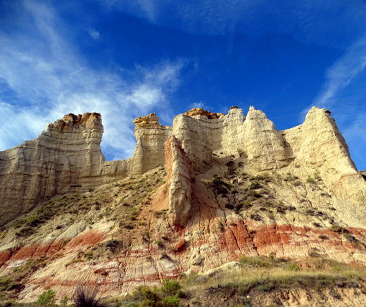
Colorful rock wall on the Burr
Trail
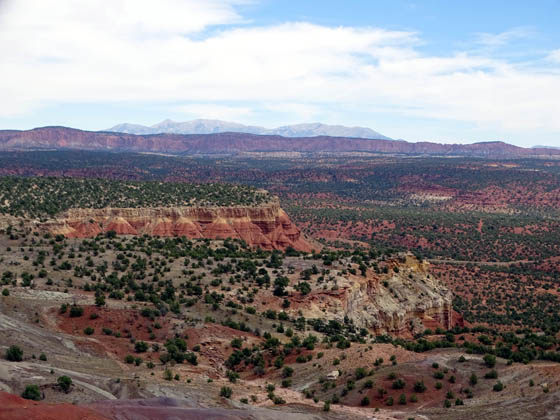
Since there is so much to do and see in the monument and this is our
first time here, we decided to simply take a long day drive with the
dogs in our minivan to get an overall "picture" of the area.
It's amazing how many different kinds, shapes, and colors of rocks
you can see along just the paved highways that travel through Grand
Staircase-Escalante, and you can travel those in any passenger vehicle
or small RV. There are many opportunities to get out of your vehicle at
spectacular overlooks like the one below:
There are also several visitor centers in the towns along Scenic
Byway 12, each offering a different interpretive focus (geology,
archeology, paleontology, history, culture, flora, and fauna) . . .
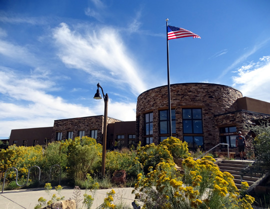
We went into the handsome USFS-BLM visitor
center in the town of Escalante.
. . . interesting little communities with unique shops and
restaurants, shady picnic areas, and even a slot canyon right next to
the Burr Trail -- a slot canyon that doesn't require a restricted
permit like Buckskin Gulch.
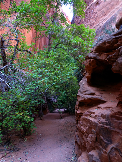
Entrance to Singing Canyon, a short slot canyon on
the Burr Trail
This entry and the next one focus
on a 200-mile round trip we took on the last Saturday in
September on US 12 and the paved part of the Burr Trail through the
northern part of GSENM and the Pike National Forest. I was snapping
photos all day -- most out the windshield or my side window while
Jim was driving -- and I'll share a good many of them here.
Several weeks later we traveled on US 89 through the southwestern
portion of the monument on our way from Red Canyon, UT to Black Canyon,
AZ. I'll write about that later.
NATIONAL SCENIC BYWAY & ALL-AMERICAN HWY. 12
This is the very busy two-lane road that passes by our campground but
traffic is much lighter after the majority of passenger vehicles, RVs,
and tour buses turn off for Bryce Canyon National Park.
It
starts two miles west of Red Canyon Village at US 89 and runs mostly
east and north for 124 miles to Torrey, UT. It ends near the entrance to
Capitol Reef National Park on UT 24.
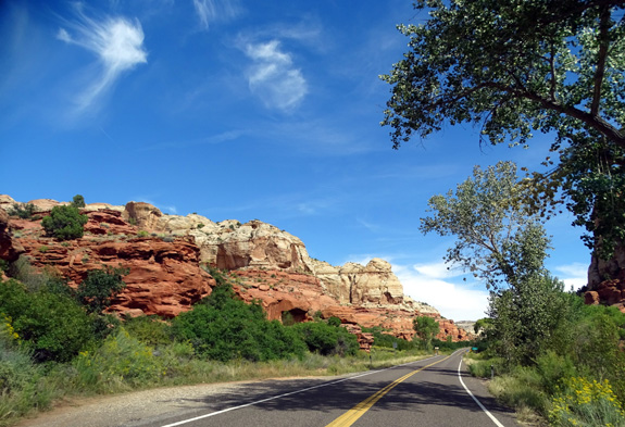
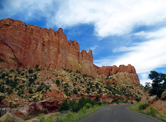
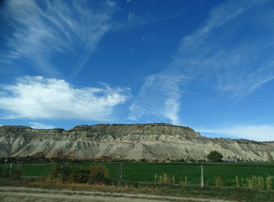
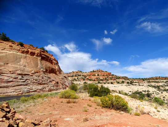
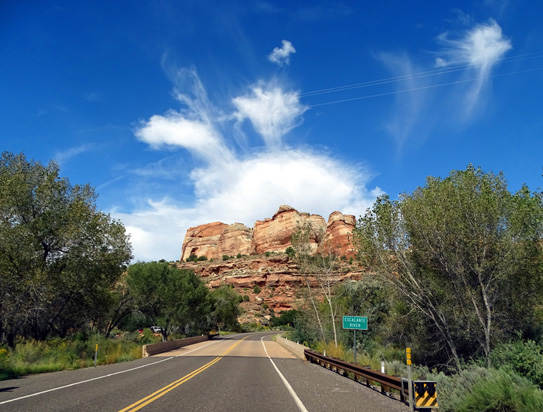
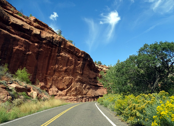
National Scenic Byway 12 winds past very colorful
rocks in GSENM.
Along the way this uber-scenic roadway passes through some of the
most unique landscapes in America. It runs through the middle of Red
Canyon, the northern section of Bryce Canyon NP, parts of Grand
Staircase-Escalante National Monument, and Dixie National Forest. It
accesses Kodachrome Basin State Park, Escalante Petrified Forest State
Park, Anasazi State Park, and numerous 4WD roads, trails, canyons,
lakes, reservoirs, and mountain summits.
It also runs through the small towns of Tropic, Cannonville,
Henrieville, Escalante, Boulder, and Torrey.
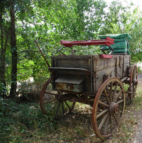
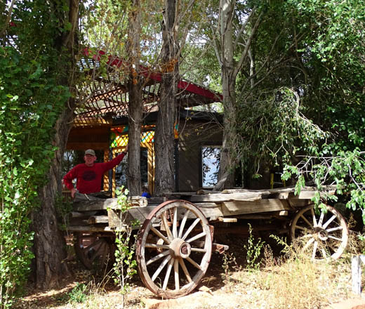
Old wagon at the Burr Trail Grill
in Boulder, UT
You could spend months, maybe even years, exploring this area by
vehicle or on foot. Except for Red Canyon and Bryce Canyon NP, we barely
scratched the surface of this fascinating region on our day drive as
far east as Boulder, UT and out another 19 miles on the scenic road
called the Burr Trail.
I'll show photos from the Burr Trail, a Scenic Backway (never heard
of one of those before!) in the next entry.
Hwy. 12 is suitable for "big-rig" RVs as long as you aren't
in a hurry and have enough engine power:
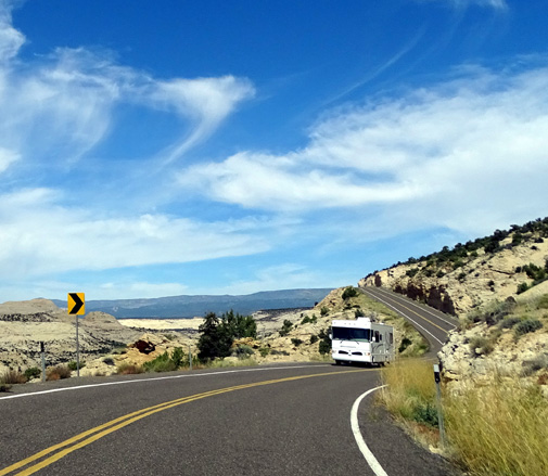
We drove most of the route in our minivan this fall and the remainder to
Capitol Reef National Park in 2016. It is all paved, two lanes wide, and
mostly smooth. It is very hilly, though, as it curves up and down from
valleys and canyons to high plateaus and mountain passes.
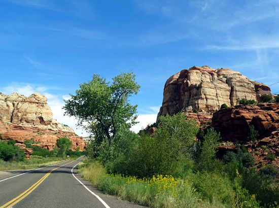
VIRTUAL TOUR OF SCENIC BYWAY 12
Here are some more photos I took along National Scenic Byway 12 this
fall. All but the first two pictures below were on our long day drive.
The scenes are roughly in order from east to west, starting near
Mossy Cave, a little past the main entrance to Bryce Canyon National
Park, and ending at Boulder, UT, where we turned onto the Burr Trail.
I'll have lots of scenes from the Burr Trail in the next entry.
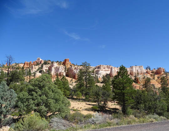
Above and below: pretty
pastel rock colors near Mossy Cave
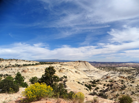
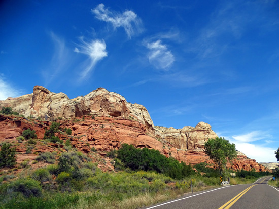
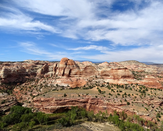
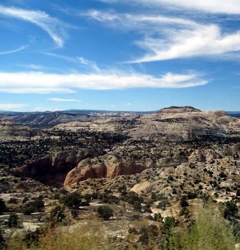
There is an overlook called "Head of the Rocks"
between Henrieville and Escalante with expansive views to the north,
east, and south.
On a clear day like we had, you can see from the Aquarius
Plateau (Boulder Mountain) on the left to the Henry and LaSal Mountains
near Moab to Navajo Mountain to the south:
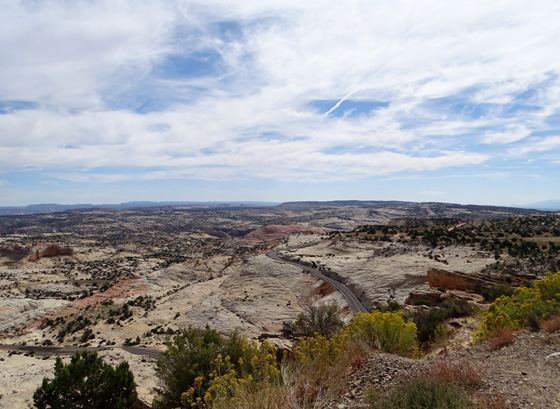
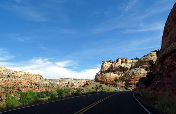
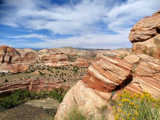
There is a lot of light-colored "slickrock" near the
road as it descends in and out of the canyons visible in the photos
above:
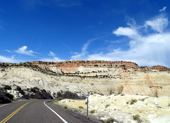
At this point we hadn't been to Moab yet but assumed
these rocks are similar to the slickrock there. (We guessed right.)
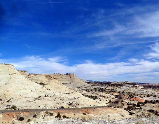
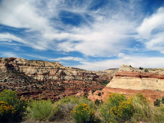
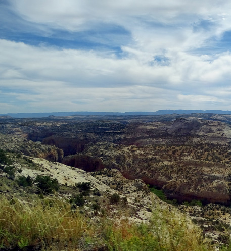
Near the town of Escalante the road crosses the
Escalante River and follows high above its canyons for several miles.
This drainage area was home to several early human
cultures and is relatively lush plant-wise in comparison to the rocky
desert terrain farther from water sources.
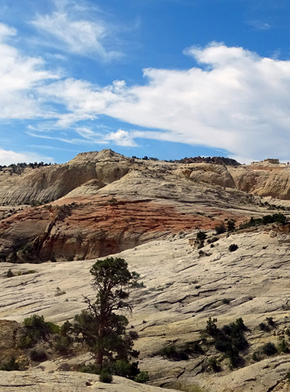
A recreational area with camping is located in the
canyon
below UT 12 about seven miles before we reached the little town of Boulder. The
cliffs in this area are just gorgeous:

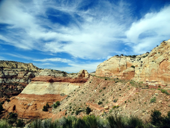
The road continues several hundred feet above this long
canyon for several miles.
One of the more interesting spots was about mile 77-78 a little before
we dropped down to Boulder. The road is along a narrow ridge
with deep canyons on either side -- not for people afraid of
heights but we loved it. There are places for drivers
to pull over for closer looks down into the canyons:
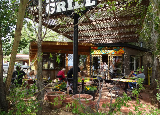
We noticed the Bull Trail Grill and trading post at
the intersection of Scenic Byway 12 and the Bull Trail in Boulder and
had a good lunch there, sitting outside on the shady, breezy patio:
We turned onto the Burr Trail at Boulder and went
out 19 miles and back in the next two hours. I'll show photos from that part of our day drive
on the next page.
Next entry: scenes from the Burr
Trail
Happy trails,
Sue
"Runtrails & Company" - Sue Norwood, Jim O'Neil,
Cody the ultra Lab, and Casey-pup
Previous
Next
© 2015 Sue Norwood and Jim O'Neil
