This irrigation canal is known as the Tropic Ditch and it has
supplied water to the downstream towns of Tropic and Cannonville ever
since being built.
Several miles of the ditch flow through Water Canyon in the northern
part of the national park. It's the only stream I've seen in the park
with water flowing through it this fall (or during two subsequent visits
in 2016). The ditch dried up in a major drought in 2002 but
that's apparently the only time in over a century.

Water Canyon's "ditch"
just above the waterfall on the Mossy Cave Trail has a lot of silt in
it.
The Mossy Cave Trail follows the irrigation canal -- which
looks like any normal creek through Water Canyon -- from the
trailhead to a pretty waterfall and beyond. Visitors can take a fork in
the trail to the "cave," with is essentially an overhanging rock with
dripping water and lots of moss inside.
I was more impressed with the little waterfall and colorful sculpted rock
walls, hoodoos, and windows along the trail than I was with the cave but
since everything is visible on this short trail and spur, go explore
both trails at the fork when you're there.
TRAIL LOGISTICS
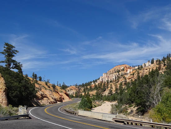
Many visitors probably miss this trail because it is located outside
the main area of the national park on US 12 about three miles east of Bryce
Canyon Road:

On the other hand, since it's outside the entry gate you don't have
to pay to get in -- good for anyone without a park pass.
There's actually the potential for more visitors than those just inside
the main area of the park because the parking area for Mossy Cave is on a busy National
Scenic Byway that connects many visitors to all the natural wonders of
southern Utah's canyon country.
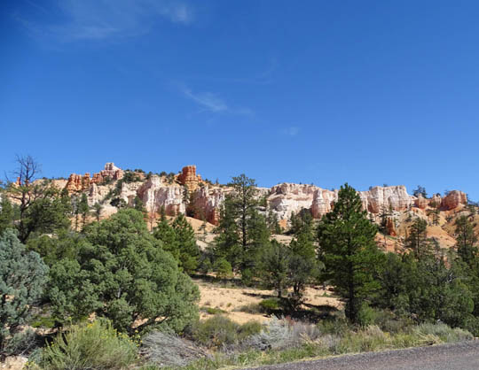
The views along US 12 between Bryce Canyon Road and Mossy Cave are
very scenic. I liked the rock walls visible from the highway as much as
those at Mossy Cave; they are on park property, too.
Note that the parking area at Mossy Cave is relatively small. It will hold
about 20 passenger vehicles or small RVs. People driving larger
RVs have to get there at just the right time to find room to park. People
don't spend a lot of time here, though, since the trail is rather short.
The trail is listed as "easy" because it is only about half a mile
long (one way) to the waterfall and cave, with just a 200-foot elevation gain.
The main trail is rather wide above the creek to the first bridge, then
along the water on the other side to a second bridge crossing the creek.
The trail switchbacks up a little hill to a fork in the trail. The path
to the right goes to the top of the waterfall and the one on the left
climbs up farther to Mossy Cave, as shown in this diagram from a sign at
the trailhead:.

VIRTUAL HIKE ON THE MOSSY CAVE TRAIL
These photos are from the one hike I did at Mossy Cave in late
September. Let's start at the trailhead and hike back to the waterfall
first . . .


Above and below: first
views of waterfall


Water has carved a trench through
the dense dolomite bedrock (limestone fortified with magnesium)
above the waterfall. Dolomite is
also the rock forming the capstones on Bryce's hoodoos.

Above and below: looking
back at the second bridge


Windows in the rocks above the waterfall
and creek; that's a renegade path.

Another narrow renegade path climbs the hill above the waterfall; I didn't go any farther.
WHERE'S THE MOSS??
Back at the fork in the trail another path goes uphill a few hundred
feet to Mossy Cave, an overhanging rock with some dripping water and
moss underneath. This is the description on one of the interpretive
panels at the site:
"This grotto forms as an underground spring permeates the bedrock and
slowly dissolves the calcite that bonds the silts and muds of the Claron
Formation. During the short spring and summer season, in this otherwise
arid landscape, a cool, moist environment becomes a perfect place for
mosses to grow. By late fall, icicles begin to form as water continues
to seep through the rock. Sheltered from the sun, even as the days are
growing warmer and longer, these icicles sometimes last until June"

When I visited the cave in late September there wasn't a
lot of moss left and only a little dripping water since there hadn't been
much rain recently.
The next photo is a weird close-up of the bedrock at top
and some of the moss below it:

I took the next two photos on the narrow cave path going
back to the main trail:


This trail packs some interesting features into a relatively short
distance and is easier to hike than most other trails in Bryce Canyon
National Park. If you have your own vehicle I highly recommend taking
the time to drive around the north end of the park to see it.
If you can't climb the little hill below the fork in the trail
you can see the waterfall and some of the rock formations from the second
bridge.
And if you're super short on time you can still see some
beautiful rock walls and hoodoos from the parking area and within a
couple hundred feet of the trailhead, as well as along US 12 on the ride
to Mossy Cave.
Next entry: day trip through colorful Grand
Staircase-Escalante National Monument
Happy trails,
Sue
"Runtrails & Company" - Sue Norwood, Jim O'Neil,
Cody the ultra Lab, and Casey-pup
Previous
Next
© 2015 Sue Norwood and Jim O'Neil
