This is a varied loop through the wilderness area of Bryce Canyon
National Park that starts and ends at the Swamp Canyon overlook at Mile
6 on the park road.
Hikers can do the loop in either direction. The Park Service
recommends going clockwise, which is the way I went when I did the whole
loop. A couple weeks earlier I had just gone down about half a mile to
see the Swamp Canyon rock formations near the overlook, then back up.
Here's a section of the park map that shows this loop, which I
highlighted in yellow:
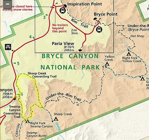
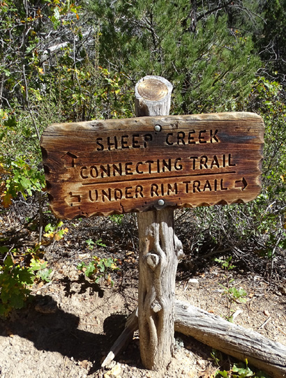
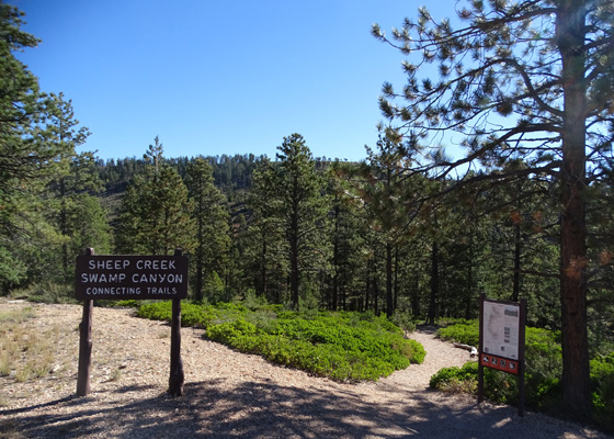
As you can see on the map, the Swamp Canyon and Sheep Creek trails
are listed as connectors to the Under-the-Rim Trail, which starts at
Bryce Point and runs south for 23 miles to Rainbow Point. On this loop
hikers are on the Under Rim Trail for only a little over a mile.
TRAIL LOGISTICS
Trailhead parking at Swamp Canyon, shortly after Milepost 6 on the
park road, is limited to about a dozen vehicles, including a few longer
spaces for RVs.
Since many fewer people drive down the park road past the main
amphitheater area, and few people get out of their vehicles for more
than a few minutes at this overlook, it's not too hard to find a place
to park if you want to hike this loop.
Note that the park shuttle bus system does not go past Mile 3 (Bryce
Point). A few tour buses do go down to Rainbow Point at the end of the
park road. You need your own wheels (or heels!) to get to Swamp Canyon.
The park prohibits hitch-hiking along the park road.
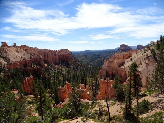
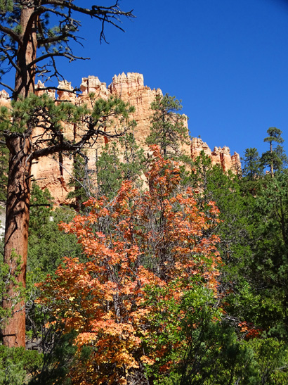
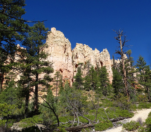
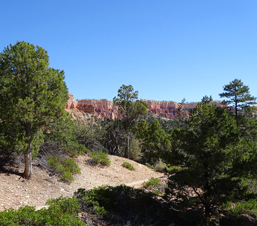
Swamp Canyon from the overlook
The three trails on this loop are all in the wilderness area of
the national park, which means they aren't nearly as crowded as the
popular trails in the Bryce Amphitheater area. I hiked for
2˝ hours on the loop on a beautiful
sunny Friday in early October and saw only five other hikers.
The Park Service rates this trail as "moderate" difficulty but
notes on the webpage link below the quote at the top of this
page that the trail "can be difficult if not prepared."
There are several reasons why they say this, including the relative
isolation of the trail, its location in the wilderness (e.g., one of the
backcountry campsites I passed is closed due to recent bear activity),
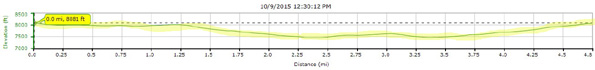
the high altitude (elevations from 7,390 to 8,315 feet), the total
elevation change (about 2,000 feet), and the distance (my GPS said
4.75 miles, which is more than the park newsletter indicates).
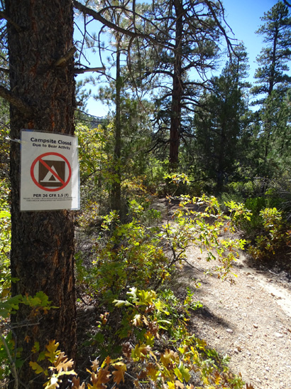
Backcountry campsite near intersection of Sheep
Creek and
Under Rim trails closed in October due to bear
activity.
Since I'm acclimated to higher elevations, more distance and
elevation gain/loss, and rougher trails than these, I'd rate the
loop as "moderately easy."
As always, it depends on how well trained you are. The park visitors
who tackle the wilderness trails are probably better prepared than the
average visitor that is wiped out by the Navajo or Peekaboo Loop in
the main amphitheater area.
Above and below: Swamp Canyon from overlook
Even though I'm pretty experienced hiking wilderness trails, I was
a little apprehensive before doing this loop because the park newsletter
warns visitors that good route-finding skills are required. The park
webpage notes that hikers need wilderness skills to find their way.
I don't worry too much about getting lost on trails because I
figure I can always turn around and find my way back the same way if I'm not able to
continue forward with certainty that I'll end up where I want to end up.
It's hard to get lost on this
loop unless
someone or
something sabotages the signs.
I had absolutely no trouble finding my way on this loop. Every
intersection was well-marked and I already knew which way I needed to
go.
I did carry the map in the park newspaper with me but I didn't need
anything more detailed than that to navigate accurately. I had the route
memorized and can't remember even looking at the map as I was hiking.
TERRAIN AND TRAIL CONDITIONS
Like most trail in Bryce Canyon National Park, this one starts on the rim,
descends into the canyon, and comes back up. Once down, it doesn't undulate
as much as the Fairyland Trail so the elevation gain and loss per mile isn't
that much.
Here's the elevation profile from my hike of this loop.
It's hard to see so tiny so I highlighted the track in yellow:
There are no steep sections on the descent or ascent. The trails
switchback gradually wherever the grades are steeper.
Since this is a wilderness trail, it's not real wide and well-groomed
like Queen's Garden, Navajo-Wall Street, or Peekaboo in the main Bryce
Amphitheater area. Even Fairyland, which is also mostly in the wilderness
area, is wider and smoother than the other trails in the wilderness area
in the southern part of the park.
Even so, this loop doesn't have what I'd consider a gnarly surface with
a lot of rocks or roots. The park website warns of potential blow downs and
washed out trail down in the canyon where the loop follows or crosses
washes but I didn't encounter any problems like that during my hike.
A small wash the trail follows in the canyon for a
little while
The trail consists of dry sand, gravel, and dirt most of the time. I imagine
some places erode or get muddy, like other trails in the park, after a good
rain or snowmelt but they were in good shape the day I hiked the loop.
The park remains open all year, as do most of the trails. Snowshoes or
crampons may be necessary in winter.
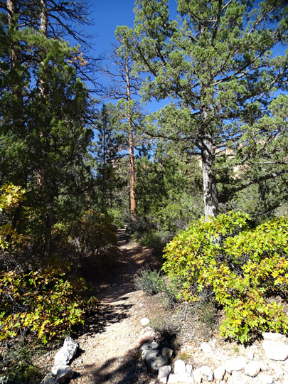
Some of the trail is narrow and overgrown. I didn't see any flowers in
bloom in early October but some leaves were colorful:
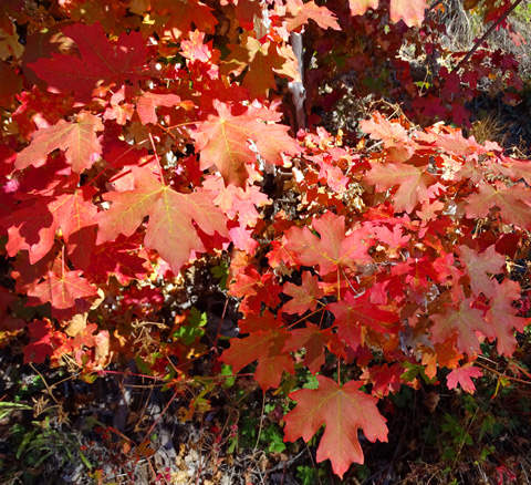
Box elder is a type of maple tree that grows all over Utah.
The park website warns hikers on this loop about bees and wasps in the summer
and deer, bears, and mountain lions in every season. I saw several deer and
lots of birds, little mammals, and rodents but no bears or mountain lions or
their scat -- just the paper signs warning about their possible presence.
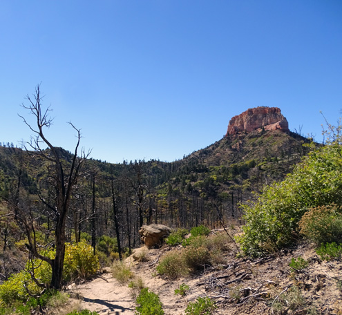
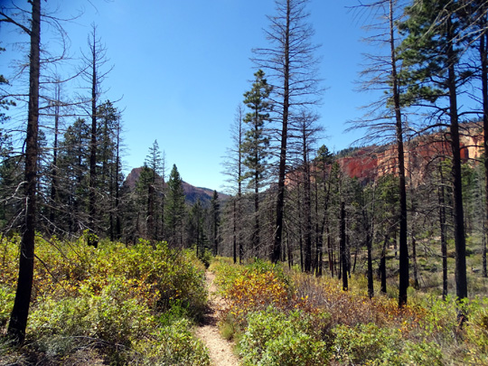
Note that part of the Under Rim and Swamp Canyon trails go through an old burn
area. I liked that section of the loop
the least, although it has a stark beauty of its own:

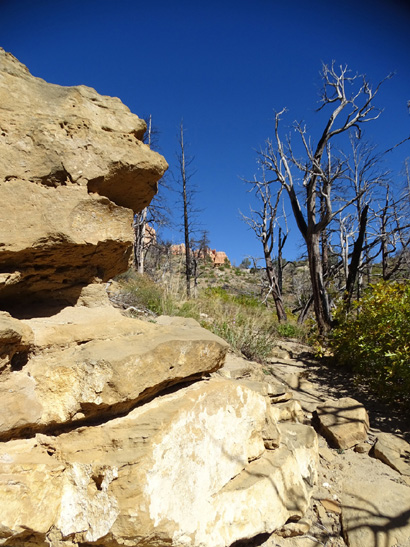
The fire was long enough ago that shrubs and grasses have grown
up but recent enough that new trees have not. The only trees left
in the burn area are ones that escaped the fire.
VIRTUAL TOUR OF THE TRAIL
The remaining photos are from two hikes on this trail -- a short one down
into Swamp Canyon and back out, the other around the entire loop -- and are
roughly in order from the trailhead going in the clockwise direction (Sheep Creek
first, then Under Rim, and back up Swamp Canyon).
As in most of my entries I tried to choose photos that are representative of the
trail as well as the best scenery. Views are in both CW and CCW directions because
I often stop to take in the view all around me, especially when I know I
won't be going back the same way.
A few hundred feet down the trail in the picture above you come to the loop and can
choose whether to go left (north) on the Sheep Creek Connector or right (south) on
the Swamp Connector Trail to descend to the canyon.
I turned left when I did the whole loop and hiked clockwise as recommended.
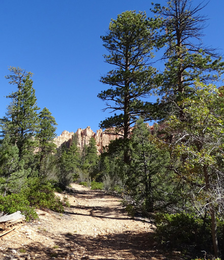
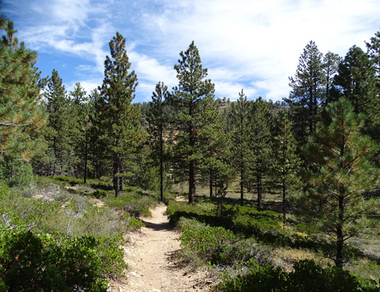
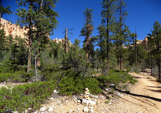
The first part of the Sheep Creek Connector is at the edge of a forested hill.
For a while you can see and hear traffic on the park road:
When the trail arcs east around the north end of the hill and heads south toward
the Under Rim Trail you start to feel more like you're in the wilderness:
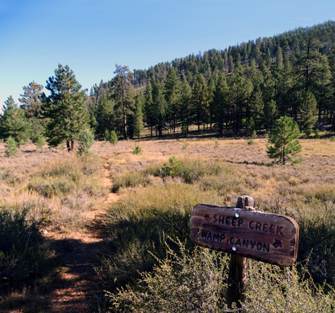
At 2.3 miles from the trailhead the Sheep Creek Connector Trail
dead-ends at the Under Rim Trail. You can go right or left.
For this hike, I went right on Under Rim to the intersection with the Swamp
Canyon Connector Trail. This 1.2-mile segment goes through the burn
area for about half a mile.

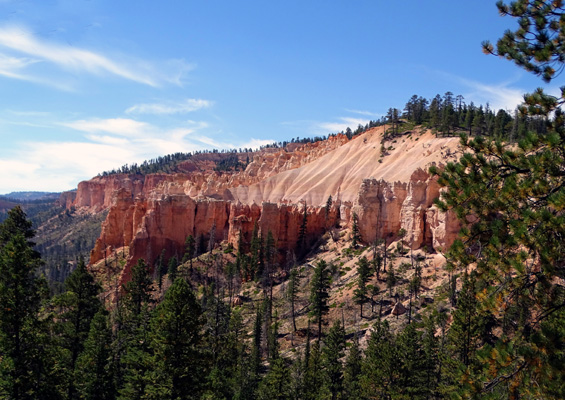
At 3.5 miles I came to the Swamp Canyon Connector Trail
intersection and turned right toward the rim to complete the loop.
Some of this trail goes through the burn area, too:
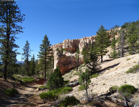
The trail gradually rises 900+ feet over 1.3 miles back to
the trailhead at the Swamp Canyon overlook, with views to the rock
cliffs below the rim and passing some colorful rock formations:
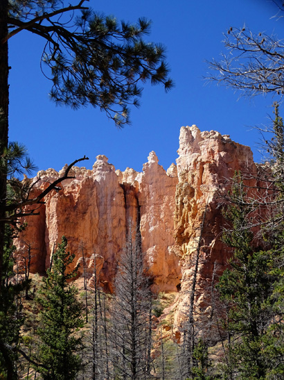
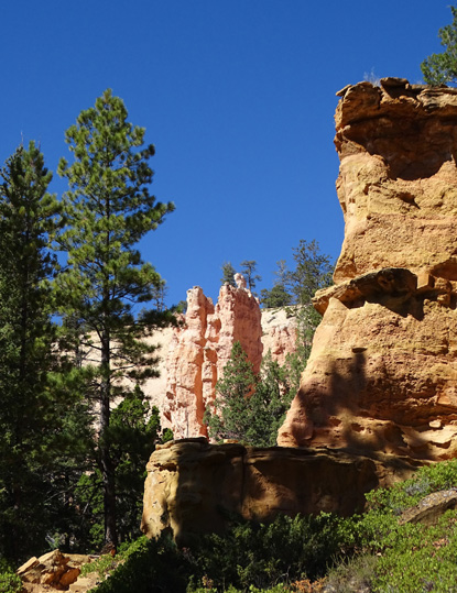
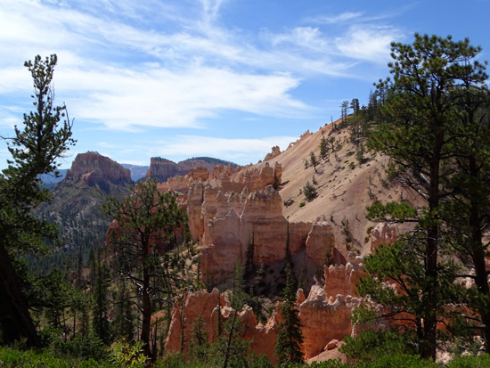
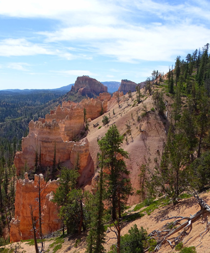
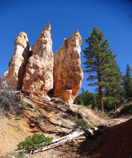
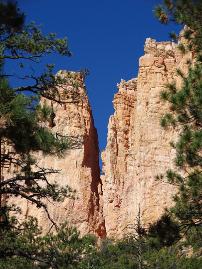
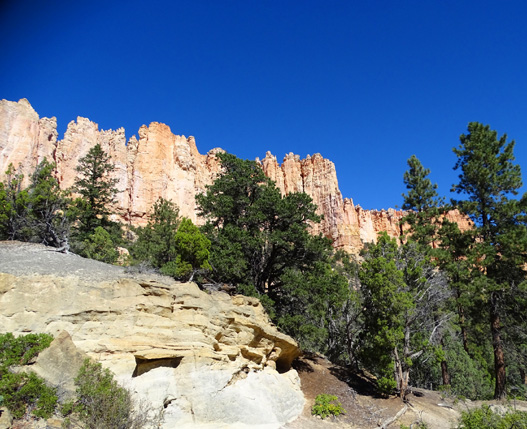
Some of the best rock formations and views on this loop are near the
top of the Swamp Canyon Connector Trail as it passes by this cluster of
rocks that can be used to frame more distant scenes.:
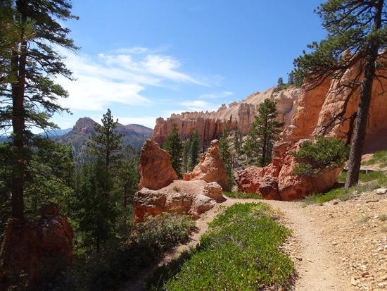
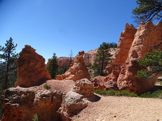
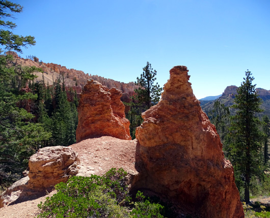
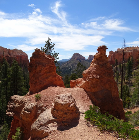
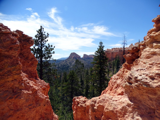
If you want to cut to the chase on this loop, do what I did the
first time I checked it out. I went down Swamp Canyon about half
a mile and back up so I could see these formations.
That's a good option if you have just a short time for this trail.
FINAL THOUGHTS
Every trail in Bryce Canyon National Park is unique and has its own merits.
I'm glad I did this one but, like the trail to Hat Shop, I didn't like all of it
enough to repeat it on our subsequent visits in the spring and fall of 2016.
Most of it is bland in comparison with the front country trails. I
didn't take or show photos of the less interesting parts of this trail.
I offer the same advice I gave in the last entry about Hat Shop:
If you haven't been here before, or your time in the park is seriously limited,
you'll have better memories and photos if you hike the Fairyland Loop and the trails in the main amphitheater first (Queen's
Garden, Navajo-Wall Street, Peekaboo, Bryce Point). The rock formations there
are definitely more iconic and spectacular.
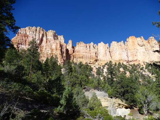
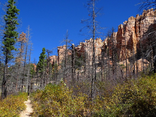
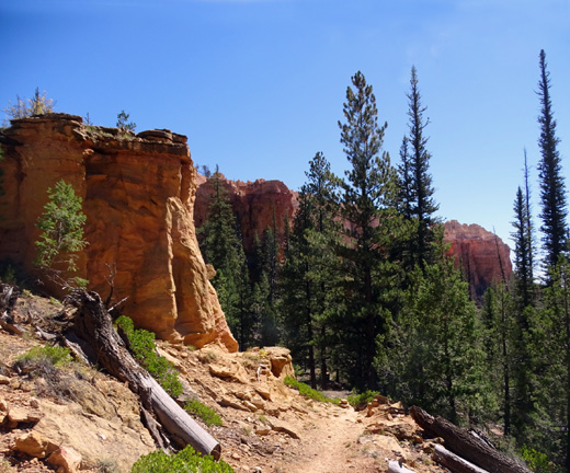
Large fluted rock wall on the Swamp Canyon
Connector Trail
Then, if you have time -- or simply hate sharing trails with
lots of other people -- check out the wilderness trails in the
southern part of the park. The one-mile Bristlecone Loop near Rainbow
Point is the most popular trail in that area. I didn't hike it this
trip but I did in 2016 and will include a description and photos in
that journal . . . eventually.
Next entry: the trail to Mossy Cave, a cool waterfall,
and Tropic Ditch (the lousy name for a
pretty creek that supplies water to the town of Tropic)
Happy trails,
Sue
"Runtrails & Company" - Sue Norwood, Jim O'Neil,
Cody the ultra Lab, and Casey-pup
Previous
Next
© 2015 Sue Norwood and Jim O'Neil
