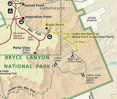
This is one of three trailheads from the Bryce Point parking area at
the southern end of the main Bryce Canyon amphitheater. Bryce Point is
the last stop on the shuttle bus route.
While the other two trails -- Rim Trail and Bryce Point to the
Peekaboo Loop -- run above or down into the amphitheater,
Under-the-Rim to Hat Shop (and far beyond) heads south toward other
smaller amphitheaters, as shown in this map section from the park
website:
In this entry I'll show photos along the Under-the-Rim Trail from
Bryce Point down to the Hat Shop formation and a little beyond, a
one-way distance of 2.7 miles per my GPS on the day I hiked this route. It's a
bit shorter if you turn around right at the end of the
"hats."
TRAIL LOGISTICS & CONDITIONS
The trail is rated as "moderate" in the park newspaper and
"moderately difficult" on the park
website because of the
high altitudes in the park and the elevation gain and loss on this hike.
Many park visitors aren't used to that.
The trail starts high at the Bryce Point parking area (8,300 feet)
and drops over 2.7 miles to 7,350 feet where I turned around
a little past the hat formations (and before a long drop down even farther).
Then you have to hike back up a 950-foot elevation gain.
Because the trail undulates a bit, my total elevation gain and loss
was 2,400 feet over 5.42 miles out and back.
There are enough switchbacks that the descent and ascent are gradual.
There are no steep sections. Since I'm acclimated to the high altitude,
mountainous terrain, high-desert sun, and hiking farther than this,
I thought the hike was moderately easy. It just depends on how
well trained you are for park conditions.
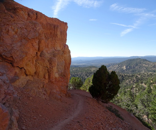
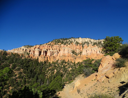
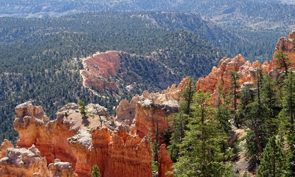
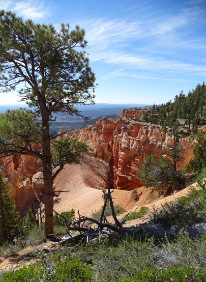
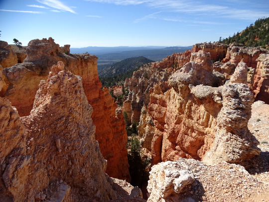
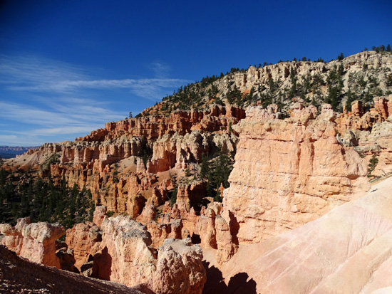
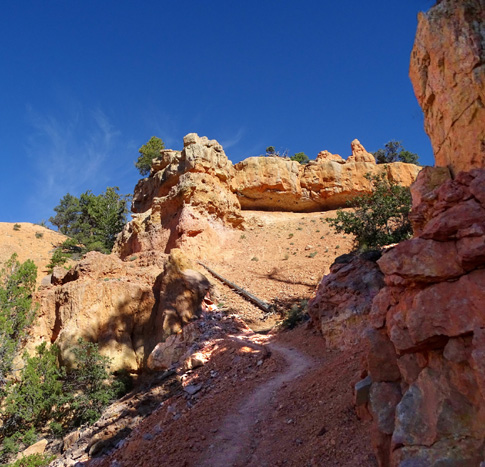
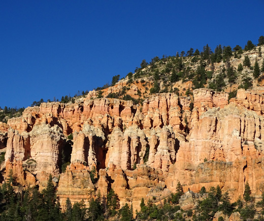
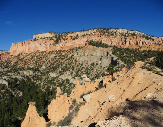
Switchback past a large, colorful rock wall
Visitors begin this hike down the steps from the parking area like
they do for the Bryce Point Trail to Peekaboo. After a few hundred feet
the Bryce Point Trail turns left and there is a sign pointing straight
ahead toward Hat Shop.
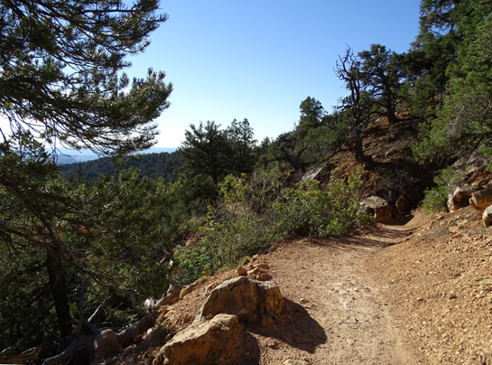
Before long there is a sign notifying hikers that they are entering
the Bryce Canyon Wilderness. The rest of the Under-the-Rim Trail --
all 23 miles or more of it -- is in the wilderness area.
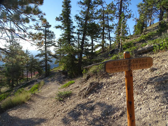
Fairyland, Under-the-Rim, Sheep Creek, Swamp Canyon, Bristlecone, and
Riggs Spring Trails are all in the wilderness area. Although they are
still in Bryce Canyon National Park they are more narrow and rough than
trails in the uber-popular main amphitheater area.
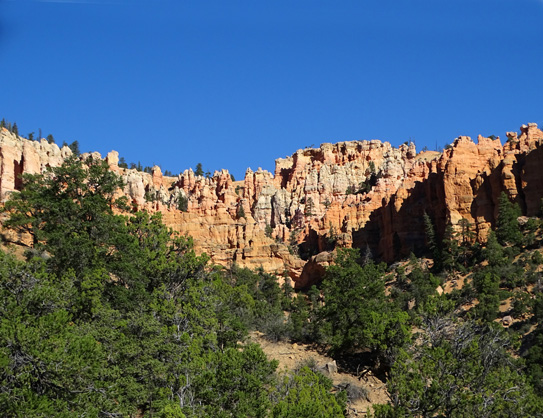
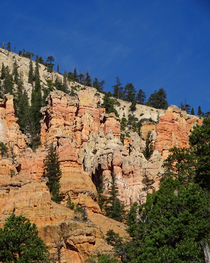
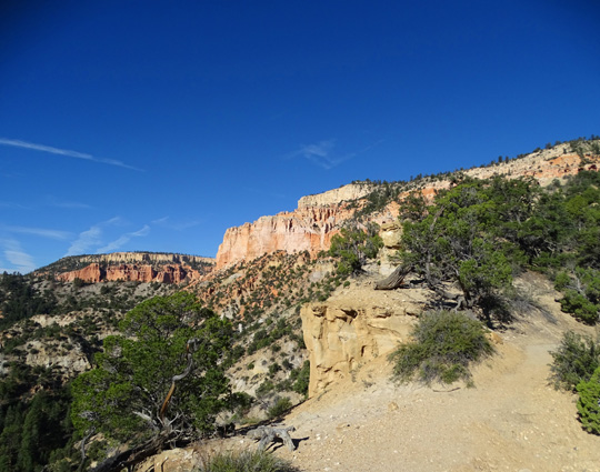
The wilderness trails all have up-close and distant views of interesting rock
formation but the formations aren't as spectacular as the trails in the huge main
amphitheater. In addition, most of the wilderness trails are not served
by the shuttle bus system and tour buses don't have room to park at
their small trailheads -- except Bryce Point.
And all these factors mean that many fewer people hike these trails!
It was nice to be able to take
lots of pictures and not have to wait until other hikers moved on.
If you want to avoid crowded trails like Queen's Garden and the
Navajo-Wall Street Loop, head for one of the wilderness trails. The
beautiful sunny morning I hiked to Hat Shop I saw a grand total of four
other hikers in 5˝ miles -- and they
were all backpackers who were spending one or more nights on the trail.
You can camp in the backcountry with a
$5 permit, but you don't need a permit to day-hike there.
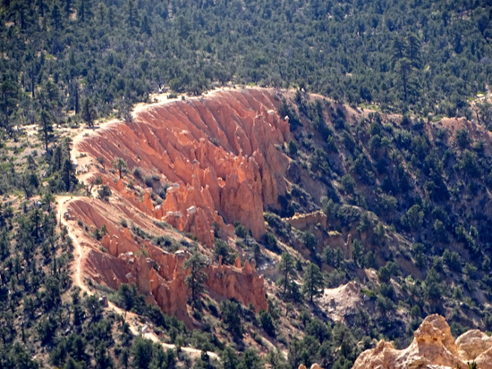
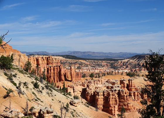
OK, SUE, WHAT IS THE "HAT SHOP?"
Oh, yeah.
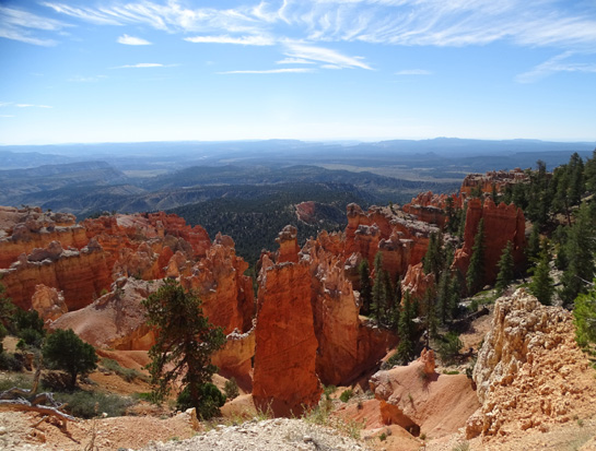
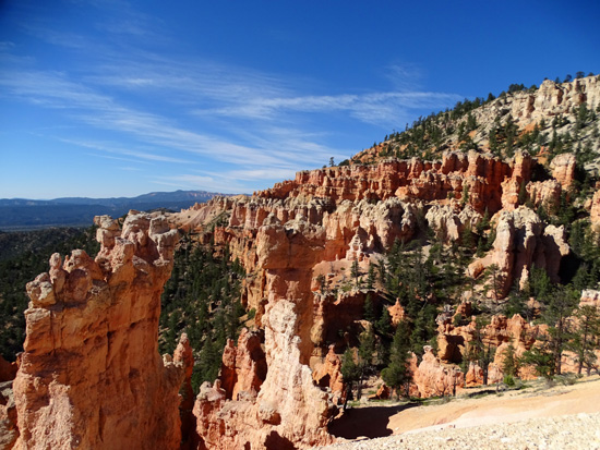
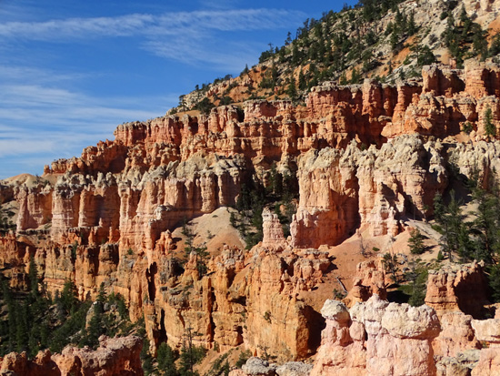
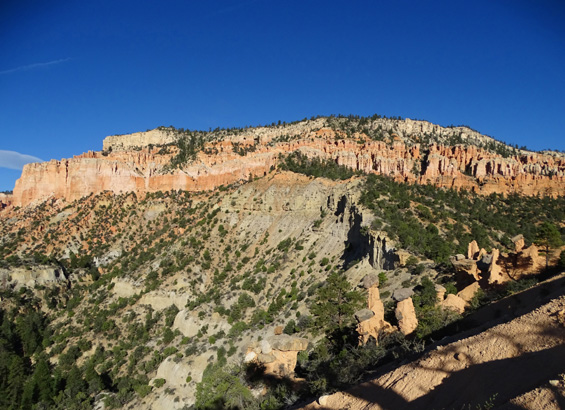
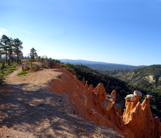
The feature formations on this hike are the "hats,"
separate pillars (hoodoos) of darker sandstone with hat-like, gray or off-white
capstones on top:
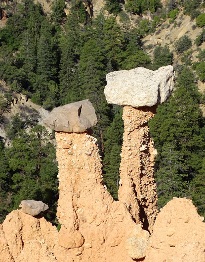
The trail is on the rim right above the hat
formations.
If you use your imagination they do kind of resemble the forms that millinery
and department stores used to use (maybe some still do?) to display their
hats for sale.
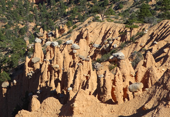
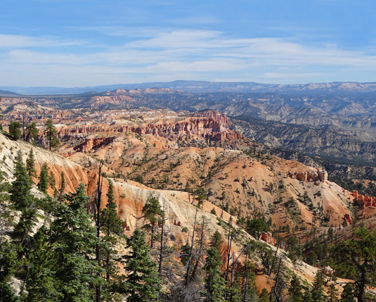
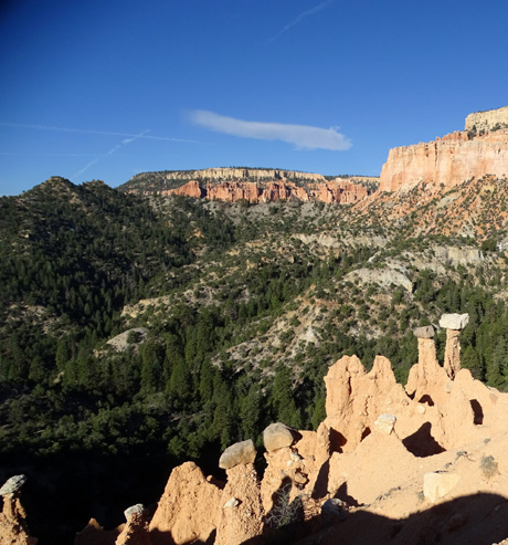
On the way back to the rim I realized after seeing the hat formations at
close range that they are visible from much higher up on the trail.
I didn't know that on the way down because they are hard to see if you haven't
hiked the trail before and don't know exactly what you're looking for.
I was able to zoom in on them from probably half a mile away (as the crow flies)
on my way back out the trail:
The hat formations are just below and
right of the arcing trail in the center of this photo.
Zoomed in
The hat formations are similar to "mushroom" formations we've seen
elsewhere. They are in a later stage of erosion than the
connected pillars we see in many of the rock
formations in the various canyons at Bryce and other places in southern
Utah.
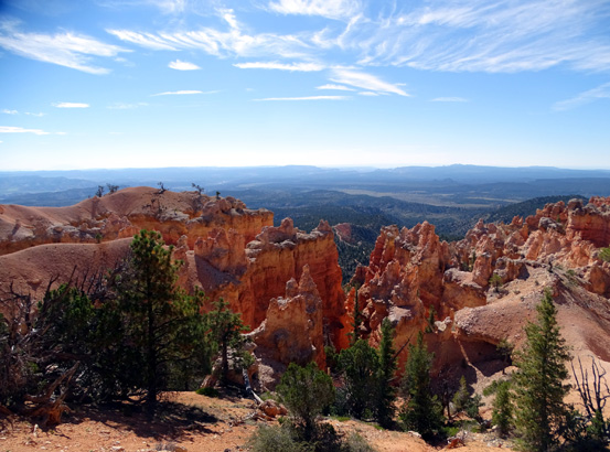
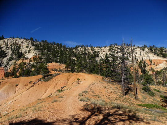
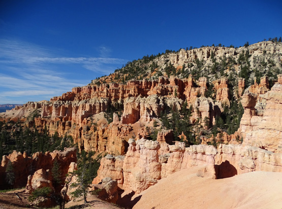
MORE SCENIC PHOTOS
The remaining photos show other scenes that are roughly in order from
Bryce Point down to the Hat Shop formations. Some trail views look
ahead (down), some behind (back up).
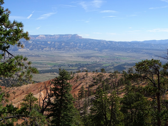
Looking east toward the town
of Tropic (in valley) and the Aquarius Plateau,
which is in Grand
Staircase-Escalante National Monument.
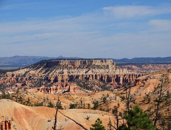
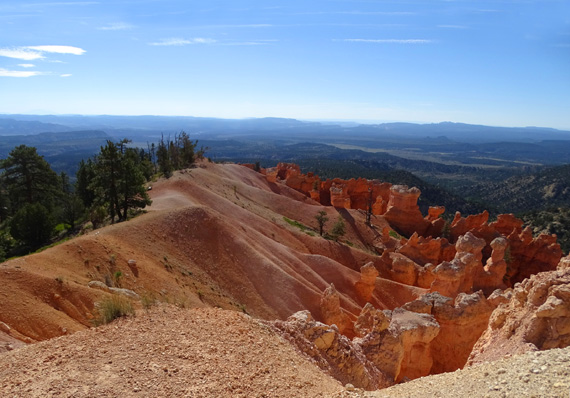
Pretty in pink
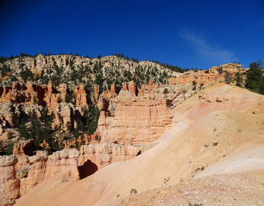
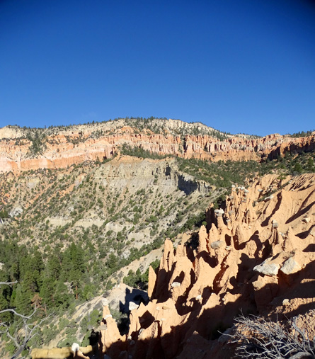
The rest of these photos are looking in three directions
from the trail above the hat formations:
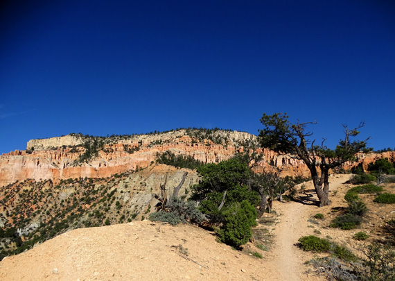
The trail continues south from there through the
Bryce Canyon Wilderness to Rainbow Point, a distance of about 19 miles.
FINAL THOUGHTS
The Under-the-Rim Trail to Hat Shop has views of some beautiful formations,
most of them literally right under the rim, and the "hats" are
fun when you see them the first time. Other parts of the trail that I
haven't shown here are much less remarkable.
This is a good trail to hike if you like solitude and have several days
to spend in the park. If your time is really limited, however, I'd recommend
that you hike the spectacular Fairyland loop and/or the more crowded,
formation-rich trails in the large Bryce Amphitheater first. There are
good reasons why those trails are popular.
Next entry: scenes from the Sheep Creek-Under Rim-Swamp Canyon loop
Happy trails,
Sue
"Runtrails & Company" - Sue Norwood, Jim O'Neil,
Cody the ultra Lab, and Casey-pup
Previous
Next
© 2015 Sue Norwood and Jim O'Neil
