Yep, we'll be back again to this area for further exploration.
In the
last entry I described the Grand
Staircase-Escalante National Monument (GSENM) and showed photos from
the first part of a day drive we did a couple weeks ago along National
Scenic Byway 12 through rugged canyon country in south central Utah.
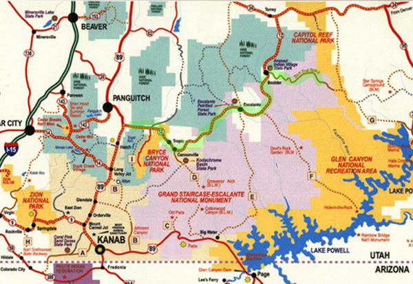
Here's the map again, with both UT 12 and the Burr Trail highlighted
in green. GSENM is the large area in the middle that is colored lavender:
On a pretty Saturday in late September we drove outbound on UT 12
about 80 miles east in our minivan from our RV park in Red Canyon to the
town of Boulder, UT, then another 19 miles on the Burr Trail before
turning around. All of it was paved and in good condition.
We could have gone another 11 or 12 miles on the Burr "Trail" before
it became a dirt road at the boundary of Capitol Reef National Park but
we had sensory overload by then. This is a super-scenic drive!!
Even though the Burr Trail section comprised less than 20% of the
distance we drove out and back, more than half of the almost 400
photos I took that day -- most as Jim was driving, or we'd still
be out there -- are from the Burr Trail.
That should tell you something about how spectacular the Burr Trail
is. We are grateful to some other RVers in our campground for telling us
about this road.
MORE ABOUT THE BURR TRAIL
All the photos in this entry are from the Burr Trail, one of several
more primitive roads through the monument that are designated as
Scenic Backways. The others are all
dirt, sand, and/or gravel.
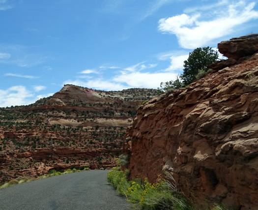
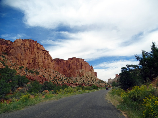
The west end of the Burr Trail is paved for about 30 miles from the
little town of Boulder to the boundary of Capitol Reef National Park.
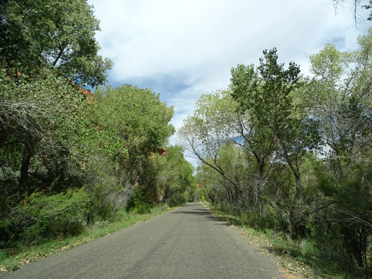
The 19 miles of this we drove are fine for a passenger vehicle or
very small RV but we wouldn't want to drive our 36-foot 5th-wheel coach on
this narrow, winding road. A sign near the beginning of the Burr Trail
warns about steep grades and sharp curves and says the road isn't
suitable for trailers. It's not suitable for larger motorhomes, either.
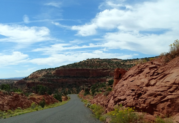
A narrow, winding part of the road on the way
down to Long Canyon
The Burr Trail is graded dirt and gravel the remaining 40 miles
through Capitol Reef National Park and Glen Canyon National Recreation
Area. It ends at the Bullfrog Marina at the north end of Lake Powell and UT 276.
The unpaved part of the road is OK for high-clearance passenger vehicles if
it is dry but even 4WD vehicles may find it impassible after it rains because
of slick clay, washouts, and mud and rock slides. I've also seen pictures online
of a section with tight switchbacks where the road descends about 800 feet
in a mile; that section doesn't look suitable for anything over 20
feet long even if the road was completely dry.
SCENIC TOUR OF THE BURR TRAIL
Here are more pictures from the 19 miles we traveled on this awesome
road. They are roughly in order beginning at Boulder, UT and show views
going both eastbound and westbound. I don't know the mileage or name of
every location, although this
webpage from the National Park Service helps. This
VisitUtah.com webpage also has more
information about the trail.
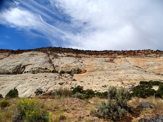
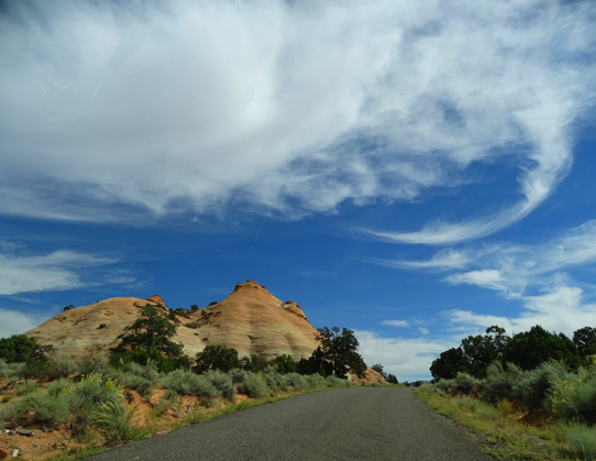
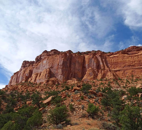
We saw lots of light-colored slickrock soon after leaving Boulder:
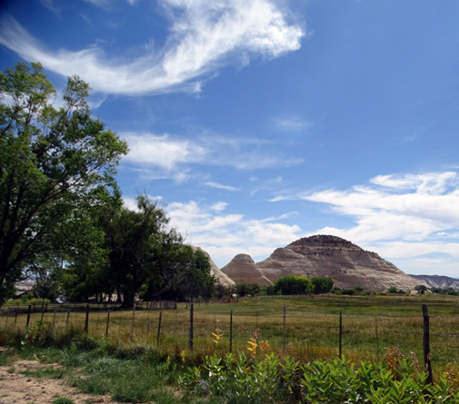
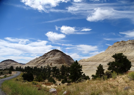
The rocks look like petrified sand dunes, and that
description isn't too far-fetched.
Millions of years ago, real sand dunes were covered by
more and more sand and compressed into stone. Gradually, over the
millennia the overlying sandstone eroded away. Today the light-colored
Navajo sandstone, rounded into hills and domes, resembles the original
sand dunes.
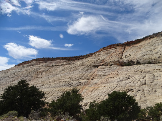
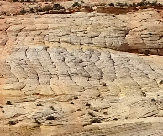
I was fascinated by the vertical and horizontal ridges on the slickrock because
I haven't seen that feature so prominently before. I assumed the grooves were
caused by water or ancient glaciers.I asked a ranger about it at the USFS-BLM
visitor center in Escalante on our way back home and he said that the grooves are
formed by a process of erosion called "cross-bedding" that is caused
by wind and sand erosion, not water, ice, or glaciers:
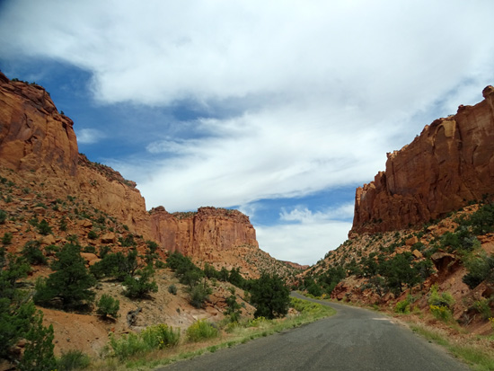
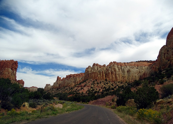
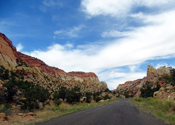
The Burr Trail just gets better and better the farther in you drive.
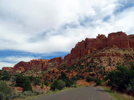
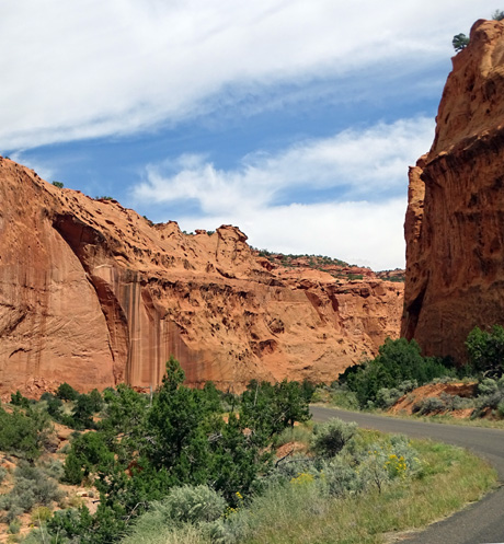
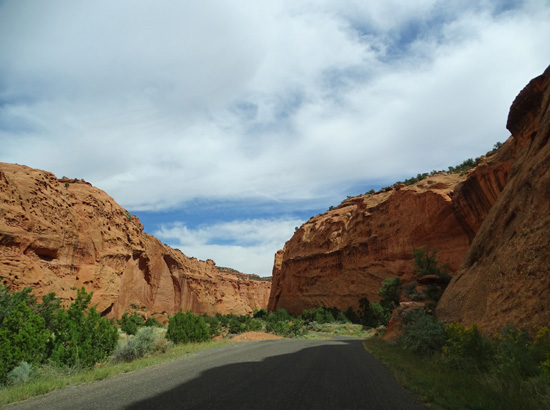
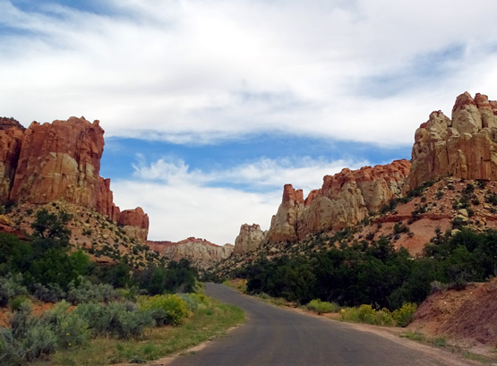
THE GULCH & LONG CANYON
The next photos show the approach to the section of towering rock
walls and fascinating colors in The Gulch and Long Canyon, sister gorges
that stretch for about ten miles.
There is a narrow overlook on Boulder Mountain before the switchbacks
down to these canyons where you can see the entrance to the first canyon
from several hundred feet above it:
At the top of the switchbacks
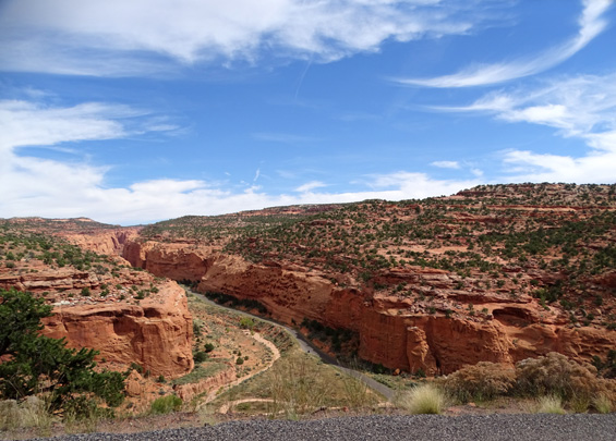
Above and below: looking
down at the mouth of the canyon
Look hard in the photo above and you can see that the walls get closer as you
get farther into the canyon.
Let's go down there . . .
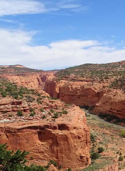
This riparian oasis obviously gets
more water than most areas in GSENM.
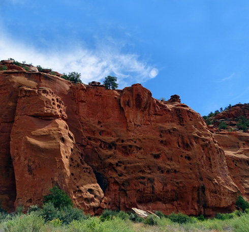
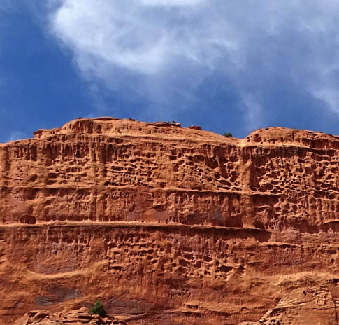
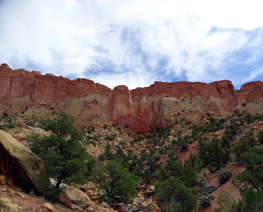
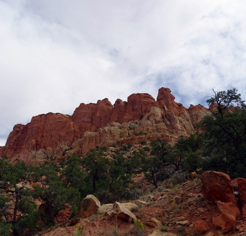
Many of the rock walls have
interesting pockmarks and holes.
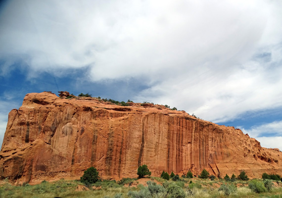
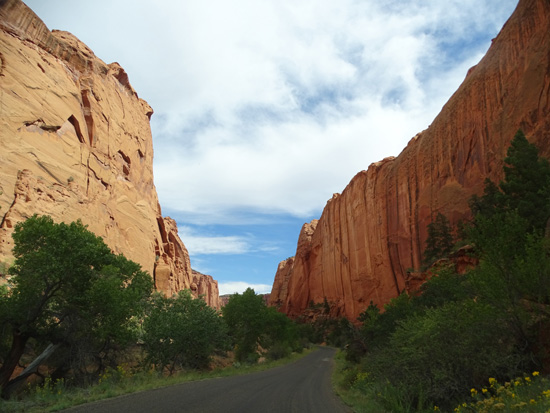
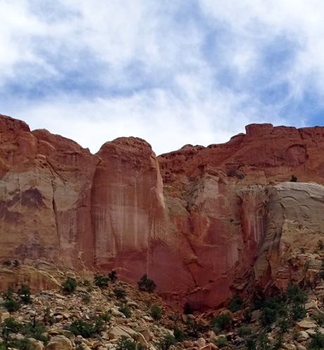
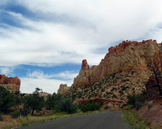
The canyons have sheer walls of Wingate sandstone that
rise several hundred feet above the road.
The sandstone has fractured
and eroded over the millennia, forming sculpted walls and alcoves.
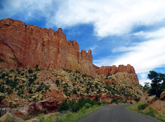
Some of the dark red sandstone has been leached by water to lighter
shades and dark "desert varnish" stains the cliffs:
Above and below: There are
lots of unique "stripes" on these walls and alcoves.
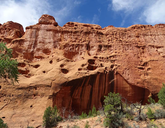
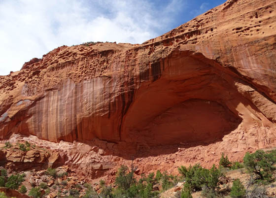
A good example of "desert varnish"
The lacy erosion on this wall reminds me of the
"boxwork"
patterns in Wind Cave in the Black Hills of South
Dakota.
PRETTY IN PINK
. . . and red, burgundy, rust, orange, peach,
gold, cream, white, gray, black, and even purple! There is a wide
variety of jaw-dropping rock and soil colors through these
canyons:
-27-
More awesome rock colors and formations on the
next page . . .
Happy trails,
Sue
"Runtrails & Company" - Sue Norwood, Jim O'Neil,
Cody the ultra Lab, and Casey-pup
Previous
Next
© 2015 Sue Norwood and Jim O'Neil
