Continued from the previous page.
SCENES FROM KELGAYA POINT
Several little paths lead to the top of Kelgaya Point, 1.25 miles from
the trailhead.
The scenery was drop-dead gorgeous from there, making the effort on the
gnarly trail through the forest worth it to me.
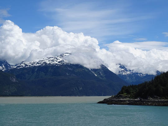
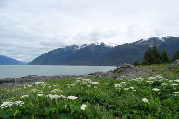
I could finally see the peaks of all the mountains to the south, east,
and north, some with glaciers:
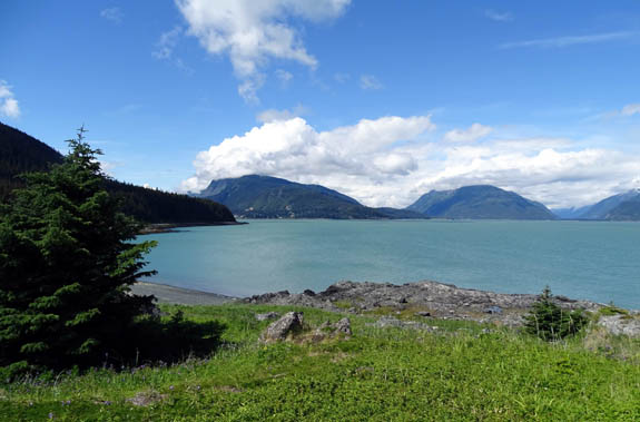
L-R: Mt. Riley, Haines, Mt. Ripinsky,
Chilkoot Inlet to Chilkoot Lake, Lynn Canal to Skagway
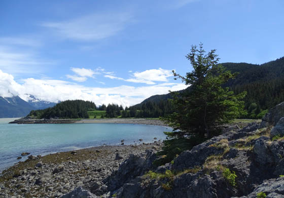
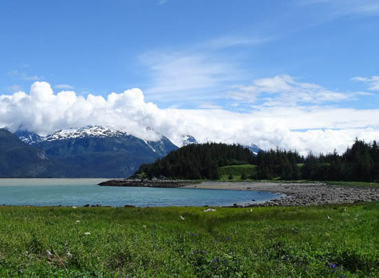
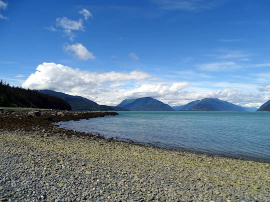
The water in Portage Cove and Kelgaya Bay was a beautiful turquoise
color and I could see the town of Haines in the distance.
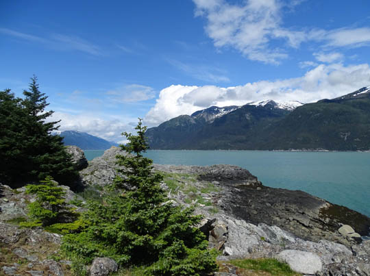
I climbed up to the top of the point (about 30 feet above the water) and
walked 360 degrees around it to
see farther south to Battery Point but didn't walk all the way to it.
What I could see is called False Battery Point on the Garmin GPS track,
not the actual point that's out of view from Kelgaya Point:
It was very scenic none-the-less!
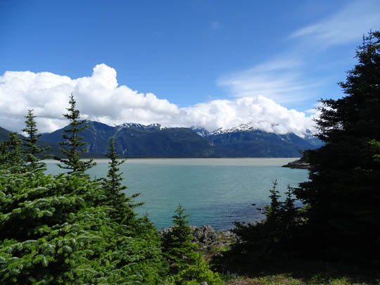
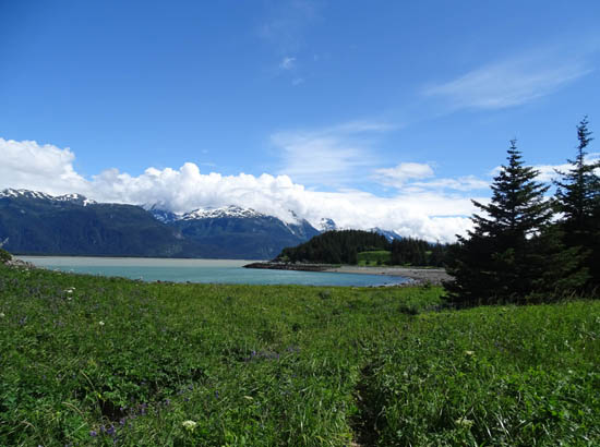
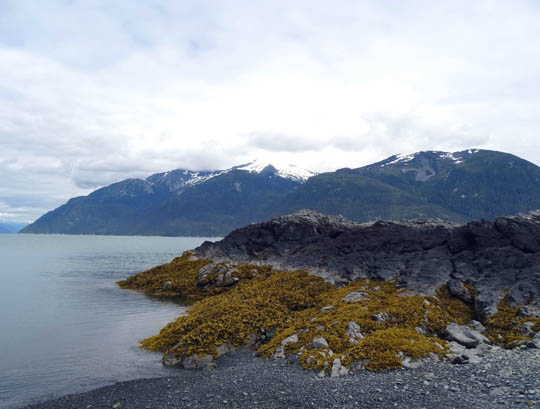
I noted an interesting phenomenon from Kelgaya Point that is also
visible from trails on Mt. Riley and Mt. Ripinsky. There is a distinct
demarcation between the water in Lynn Canal and Portage Cove. The cove
is a beautiful glacial blue, while the canal is cement gray:
The line is very interesting, and similar to the two rivers that merge
at Whitecourt, AB.
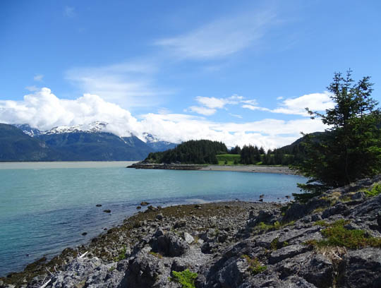
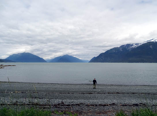
I dropped down to water level between the points and got closer to the
false point, then turned back north
toward Haines and walked along the shoreline to the trail up into the
forest:
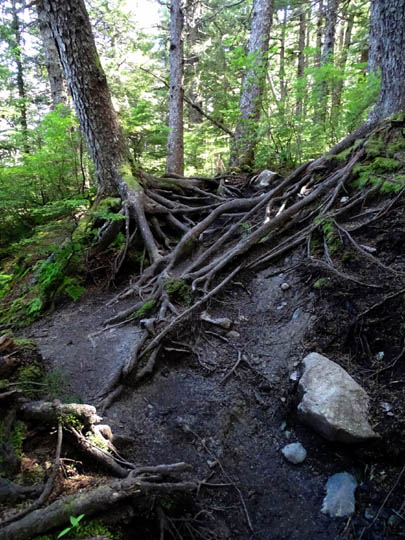
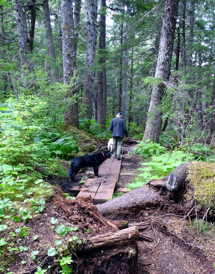
The hike over the gnarly sections back to the
trailhead was easier going uphill. I knew what to expect that time, and
I got through it faster. I had enough energy after the hike to ride my
bike up to Chilkoot Lake again, a roundtrip distance from the campground
of about 22 miles.
DEJA VU: 2ND HIKE TO KELGAYA POINT
I enjoyed the views from this trail so much yesterday that Jim decided
to go with me this afternoon. We took both dogs with us the second time.
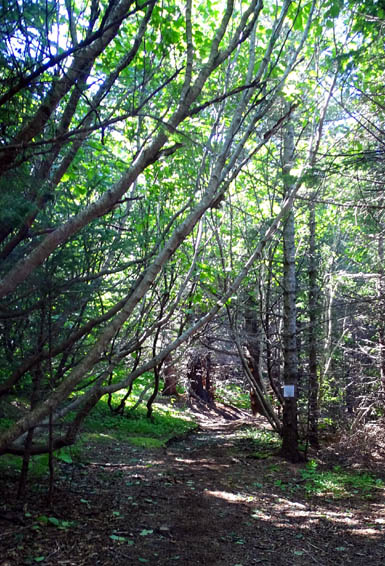
I was surprised Jim wanted to go after I described the trail as
gnarly. I hadn't planned on a second hike out there. He'd read the description
of the trail in our literature, which said it was "gentle." As you
can see from the photos on both pages of this entry, half the trail we hiked
is anything but gentle through the forest!
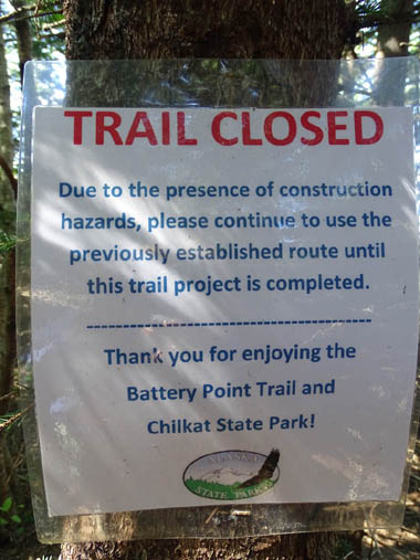
I believe there used to be a partially paved, lower trail along the
shoreline that was easier to hike but it was seriously damaged and
closed. I could see some trail-building equipment and supplies in one
place along the upper trail.
In addition, there is a sign where the upper trail drops to the coast
that says a trail is under construction and not to be used yet:
Even though there is half a mile of rocky-rooty and sometimes-steep
sections, I was game to go back again today with Jim.
Soon after we got to the gnarly part he wanted to turn around. Ha!
I convinced him it was worth it to go on, and he agreed a few minutes
later that the views from the point and cove were worth the effort.
We could tell the clouds were gradually decreasing and it was fairly nice when we
got down to the water.
Jim headed there first so he could throw sticks
for Casey to retrieve:
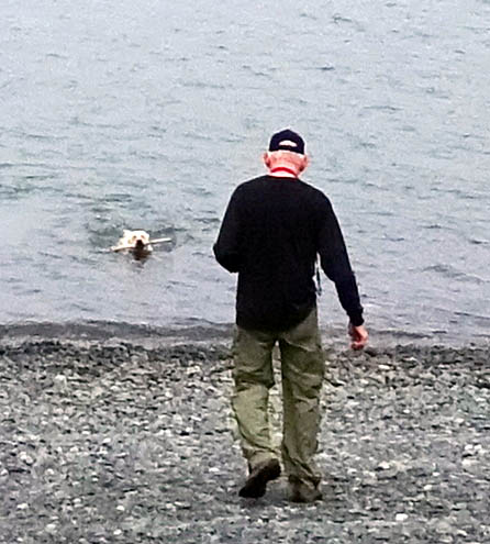
Casey always has fun swimming out to get sticks. Cody does, too, but
not if Casey is present. He knows he can't out-swim his little sister!
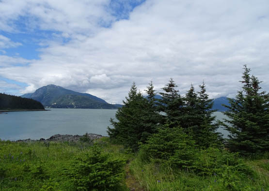
We could see the tops of most of the surrounding
mountains while we were at Kelgaya Point and by the time we got done
with the hike and back into town we had great views everywhere.
We walked toward Kelgaya Point along the
shoreline and explored the point like I did yesterday.
I noticed these succulent sea plants on the
north side of Kelgaya
Point yesterday but didn't walk out to inspect them more closely until
today with Jim:
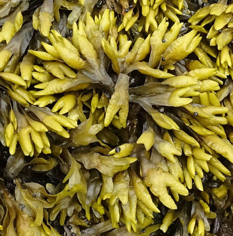
They reminded us of some thin, balloon-like
plants we saw at the Bay of Fundy in the Canadian Maritimes last summer.
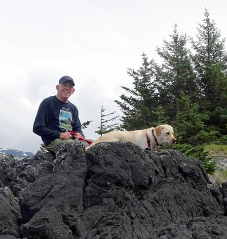
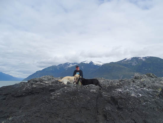
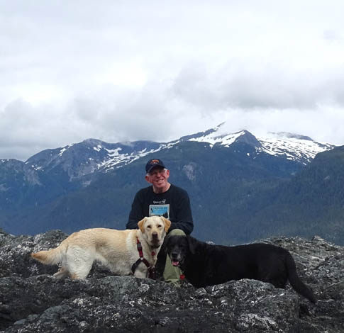
I got some good pictures of Jim and the dogs
when we took a break on the rocky point:
GO DO THIS HIKE!
Total distance of each of our two hikes was about 2.6 miles,
rather short distances for us but abbreviated because there were so many
other things we wanted to do both days.
Out and back to Battery Point is at least four miles, more if you
explore a little bit. I don't know if you can follow the shoreline south
of Battery Point.
If you want a longer hike, you can take the trail up the east side of
Mt. Riley to its summit and either hike out and back or up and over to
the trailhead on Mud Bay Road. We passed the start of that narrow, even
more gnarly-looking trail about half a mile along the Battery Point
Trail.
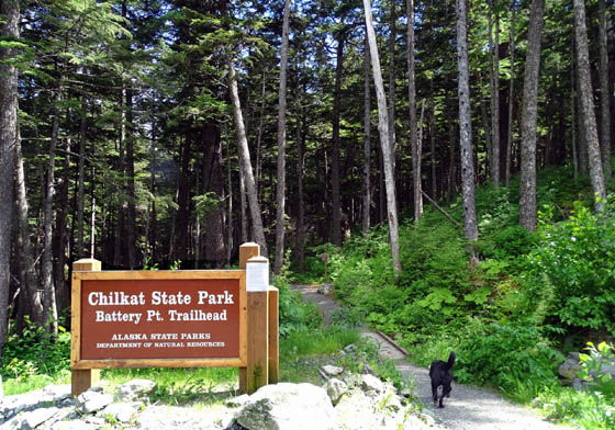
The Battery Point trailhead
is located at the end of narrow, hilly Beach Road about a mile from downtown Haines.
The parking lot is small with minimal room to turn around -- or
park. Don't take anything larger than a pickup truck out there.
Next entry: hike on the other side of Mt. Riley
from Mud Bay Road
Happy trails,
Sue
"Runtrails & Company" - Sue Norwood, Jim O'Neil,
Cody the ultra Lab, and Casey-pup
Previous
Next
© 2015 Sue Norwood and Jim O'Neil
