After we got set up in our campground site at the Haines Hitch-Up RV
Park we drove a few blocks downtown to the visitor center to pick up
more information than we already had about all the things there are to see
and do in the area.
There's a lot for us to do here!
We knew we couldn't do everything in one week so we picked out a few
sightseeing, hiking, and bike riding options that sounded the most
interesting to us, then drove around town right away to get a feel for
the buildings, streets/roads, trailheads, etc. We stayed busy every day.
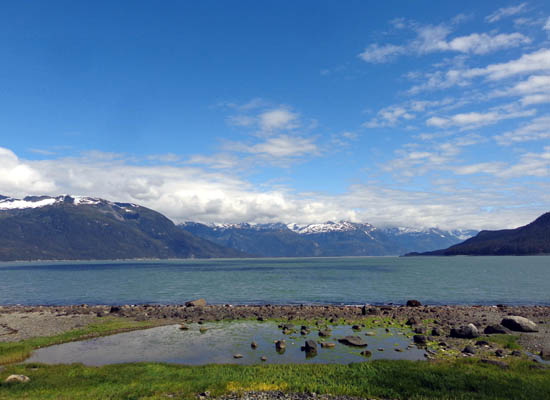
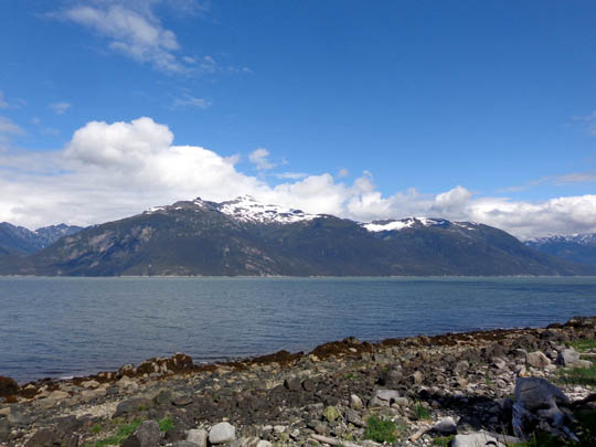
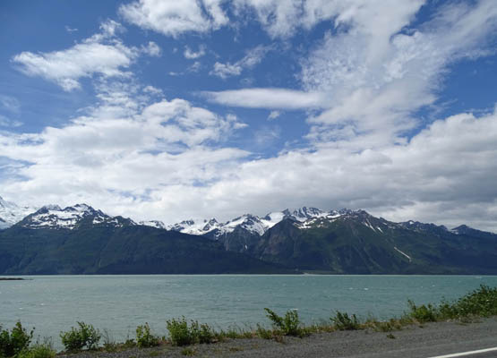
View across Portage Cove from
Lutak Rd. just northeast of town;
Battery Point juts out into the water on the right.
This entry covers a variety of scenes in and near Haines, including
the harbor area, Portage Cove, Fort Seward, totem poles and murals, Mud Bay Road,
Chilkat Inlet, the fish
packing company, and Chilkat State Park.
I'll have
separate entries on hikes to Battery Point and up Mt. Riley and Mt. Ripinsky,
bike rides to Chilkoot Lake State Recreation Site, and a raft trip
on the Chilkat River through the Alaska Chilkat Bald Eagle Preserve.
[Chilkat and Chilkoot are common names around here, and
easy for visitors to confuse. They are the two tribes of Tlingit Indians
who first settled in this area. "Tlingit" is pronounced KLINK-it.]
HARBOR AREA & PORTAGE COVE
Like many small Alaska tourist towns, Haines' population swells from
about 2,600 year-round residents to considerably more than that each summer.
The area didn't feel at all crowded to us this week, however,
probably because most of the cruise ships and ferries continued up the Lynn Canal
another 15 miles to dock at Skagway overnight. That was fine by us because Haines
felt more like a friendly, artsy community than a tourist trap.
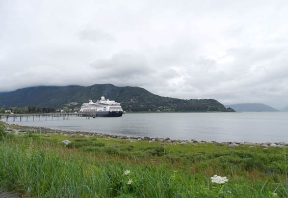
The cruise ship above was docked
in Haines Harbor the first day we were here
but the rest of the time the
little dock looked more like below.
Visitation continues in this coastal Southeast town into late fall
during the second big salmon run up the Chilkoot and Chilkat Rivers,
bringing out the bears and bald eagles. Fishing, photography, and just
watching all the wildlife action brings many visitors to Haines in
October and November.
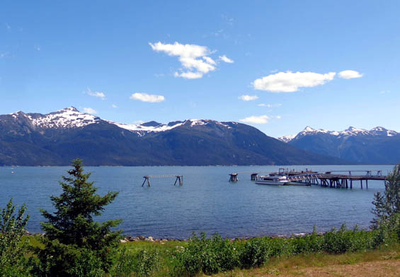
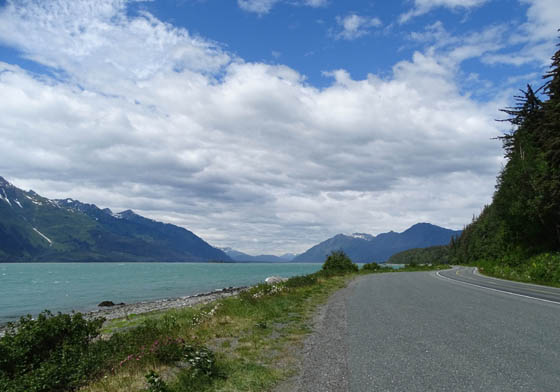
There are good views of the scenic harbor, Portage Cove, and the
surrounding mountains from just about everywhere in town, even at sea
level. The land slopes up from the water to about a hundred feet in
town.
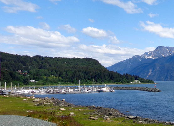
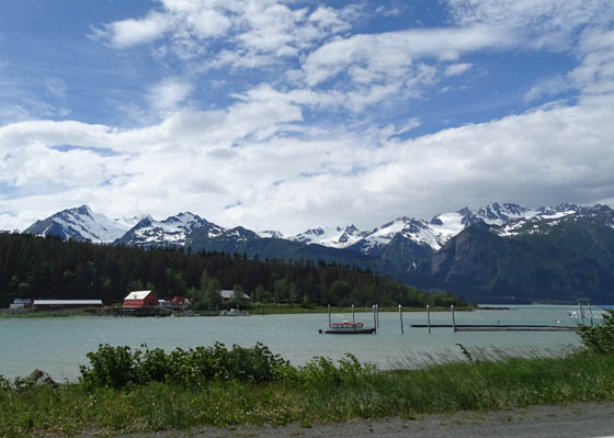
Small boat harbor
Several glaciers are visible in
three directions from Haines.
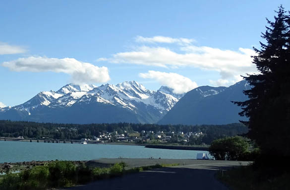
View of Fort Seward from Lutak
Rd.
There are even better views of the water and surrounding mountains
from nearby peaks, such as this one from the slope of Mt. Ripinsky
looking south:
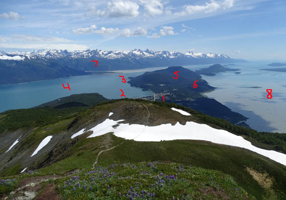
1 = Haines; 2 = Portage Cove;
3 = Battery Point; 4 = Lutak Inlet; 5 = Mt. Riley;
6 = Chilkat State Park; 7 =
Lynn Canal below the Coastal Range; 8 = Chilkat Inlet
That photo pretty well shows where the points of interest are located that
I'll be talking about in this series of entries on Haines. Chilkoot Lake
Rec. Area is farther to the left (NE of town) and the Chilkat
River/Haines Hwy. are farther to the right (NW of town).
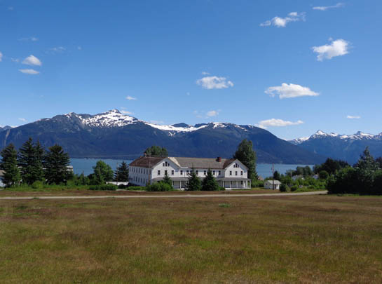
FORT WILLIAM H. SEWARD
Fort Seward, named after the man who brokered the purchase of Alaska
from the Russians, was built in 1903 as a symbol of America's strength
in a border dispute with Canada after the Klondike Gold Rush wound down.
The fort encompassed about 4,000 acres of land that now includes the
town of Haines. During its years of operation from 1904 to 1946 the fort
anchored the local economy.
View of Portage Cove from the old
parade grounds
The post was deactivated after WWII and a group of veterans purchased
the land and buildings. Although the initial cooperative failed, the
residences and businesses continue to be owned by private interests.
The visitor center has lots of old photos and information about the
history of the fort. You can take a walking tour past the remaining
buildings or drive around the large grassy former parade grounds to view
the grand houses the officers occupied and other buildings that have
been restored to maintain their historic appearance.
The houses along the top of the fort, dubbed Officers' Row, are now
privately owned and occupied:
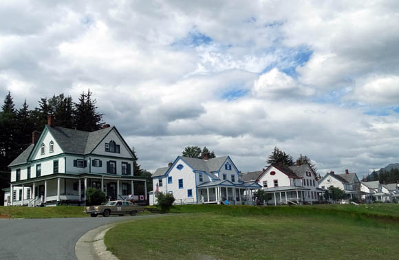
Stately houses originally
occupied by the fort's officers
View from Officers' Row toward
Mt. Ripinsky
Former Bachelor Officers' Quarters, Captain's Quarters, and
Commanding Officers' Quarters now belong to the Hotel Halsingland:
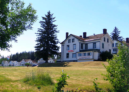
The former Army hospital is now home to Alaska Indian Arts. Some of
the buildings on the former post have been torn down; others have
been restored and repurposed by new owners.
NATIVE CULTURE
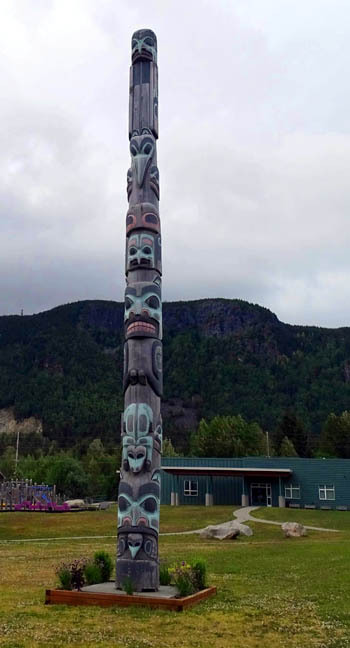
Various totem poles, other carvings, and murals in and near Haines signify the Alaska Native
legacy of the Chilkoot and Chilkat tribes. Most of the poles were carved
in Haines by Alaska Indian Arts, a non-profit, educational group based
in Fort Seward that was established in the 1950s to perpetuate Tlingit
cultural practices.
This is the largest totem, the 40-foot
"Friendship Pole" near the Haines School:
The 16-foot "Eagle Family" totem pole is located at Lookout Park just above
Portage Cove near downtown Haines.
Figures at the top face in opposite directions to the Chilkat and
Chilkoot Valleys:
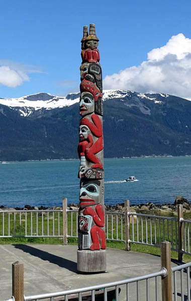
A father figure at the bottom of that pole represents an Eagle chief
holding a form of Tlingit currency that symbolizes wealth.
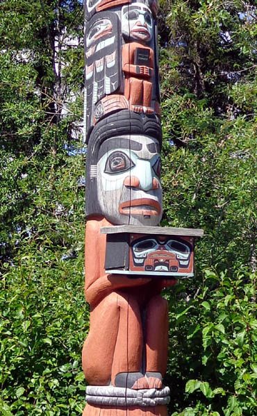
My favorite totem pole is located in a little garden area
outside the Haines library. It's pretty new, carved in 2009. Its unorthodox
design includes bear, raven, frog, woodworm, wolf, salmon, and eagle figures
at the top, representing the clans of each of its carvers:
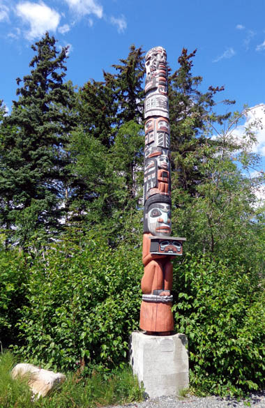
A female figure at the base is holding the Tlingit "Box
of Knowledge," a time capsule to be opened in 2034:
View of the back of the library
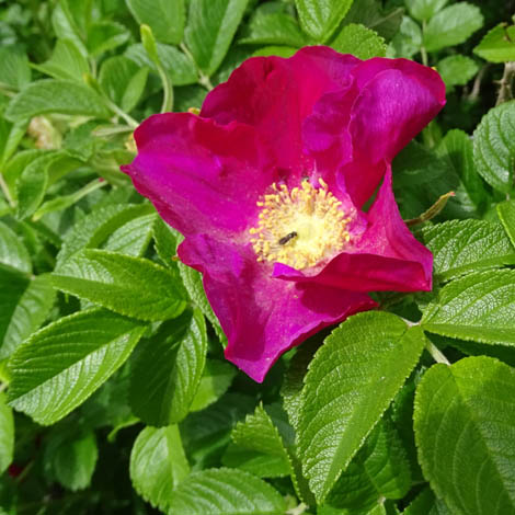
Close-up of a wild rose (with a feeding
ant) near the library; there are
lots of pretty flowers blooming in and near Haines
right now.
There are other totem poles at Fort Seward, the entrance to town, and
the road to Chilkoot Lake State Recreation Site.
You can see a Native American carving of an orca whale outside the
Haines fire station:
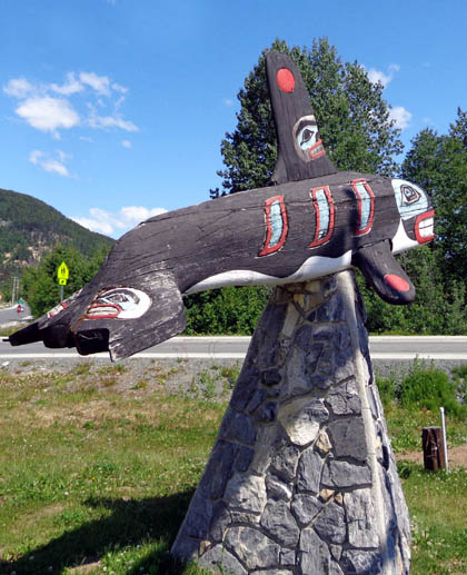
The orca is on the official seal of the Haines Borough (boroughs
in Alaska are similar to counties in the Lower 48 states).
This bold mural with a bald eagle and raven are at the American
Bald Eagle Foundation:
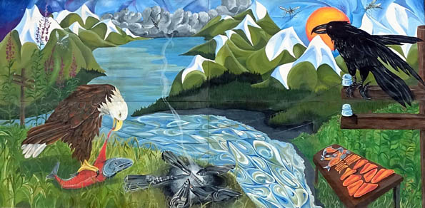
The eagle and raven are both strong Native American symbols.
MUD BAY ROAD
Doesn't sound very enticing, does it?
This is a very scenic
paved road, however, that leads south from Haines along the Chilkat Inlet to some beautiful mountain views, Chilkat State
Park, the Haines Packing Company, and nice houses.
Our first afternoon in Haines we drove all over the place, including
Mud Bay Road. One reason was to find the trailhead to the most popular
trail up Mt. Riley for a hike on another day. We found that, then
continued farther on to the park and the packing company. Those were a
disappointment because of all the clouds (lackluster photos) and the
packing company wasn't processing any salmon that day.
Heading south along Chilkat Inlet on Mud Bay Road
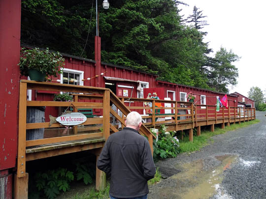
The gift shop was open at the packing
company but no fish were being processed that day.
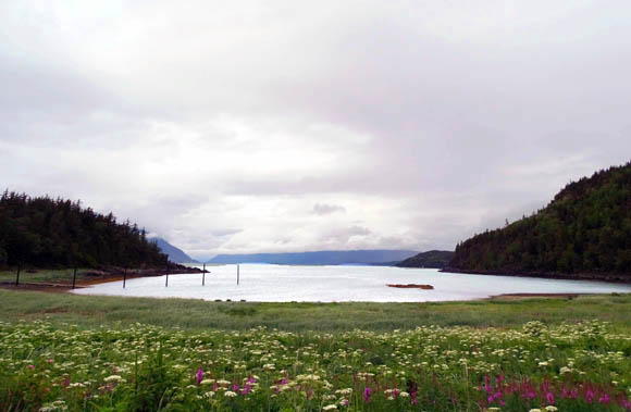
A scenic cove at Chilkat State Park, where
lots of fireweeds and cow parsnips were in bloom.
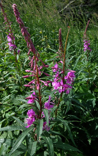
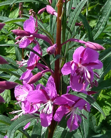
Above and below: the tall
version of fireweeds
On another, more sunny day I drove back out to the packing
company and took these photos of the buildings and the beautiful
mountains that were obscured by clouds the first time I was there:
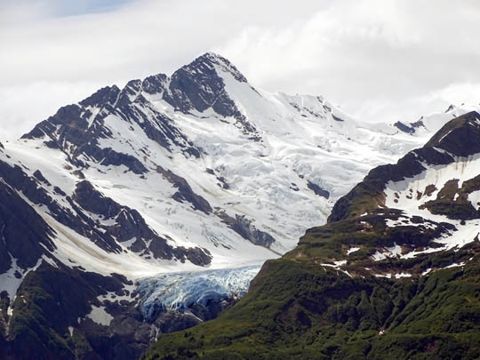
Note the blue ice at the edge of this
hanging glacier.
Above and below: Haines Packing Company
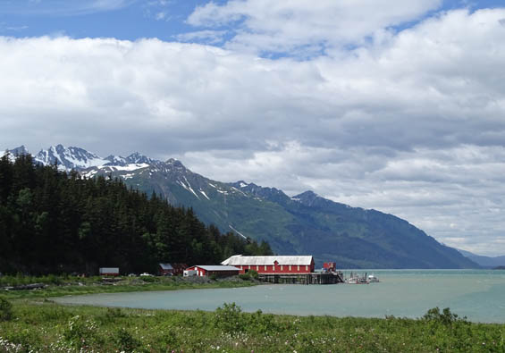
Unfortunately, no seafood being processed that day, either, so
I just took scenic photos of the buildings from across the water. It's
too early for the salmon but Dungeness crabs will be coming in about the
time we leave town.
One last photo in this entry . . .
We both cycled all over the place in the Haines area. A couple
days after our arrival, when Jim was still planning to ride the
Kluane-Chilkat International Bike Relay that ends in Haines, a photographer
from the local paper took this shot of us on our bikes:
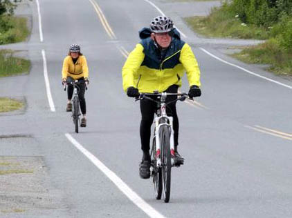
He was writing an article about the race and lucked out when he
found a participant training for it. We got a copy of the paper when it came out.
The guy even had all of our information correct!
Next entry: great scenes from Lutak Road --
Chilkoot Inlet, river, lake, and state recreation site
Happy trails,
Sue
"Runtrails & Company" - Sue Norwood, Jim O'Neil,
Cody the ultra Lab, and Casey-pup
Previous
Next
© 2015 Sue Norwood and Jim O'Neil
