Continued from the previous page.
BYRON GLACIER HIKE #1
After watching the film in the visitor center and viewing the lake
outside we drove back about a mile to the parking area at the
Byron Glacier trailhead.
When we did this hike
with Cody three years ago at the end of June there was quite a bit of
snow remaining on the last part of the trail and we couldn't get very
close to the foot of the glacier. Here are several photos I took that
day (June 27, 2012):
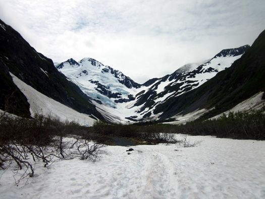
Next four
photos: The snow was pretty but we weren't able without snowshoes
to get near
as close to the foot of the glacier as this year.
Check out
this
entry for the rest of the photos I took
that day.
A lot of the
snow had melted by the second time we hiked back to the glacier that
summer when we went down to Portage Valley on a day trip from Anchorage.
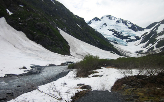
Here are two photos from
August 25, 2012:
We didn't
even know this bench was there in July, 2012.
In August we
went to the first snow bank and turned around.
By late
August, 2012 we could see more glacial ice because less snow covered it.
As you'll see in the next set of photos, the whole
scene was much different today.
Despite
seeing the trail and glacier three weeks earlier in August than our last
time here, because of the very mild winter this year there is
considerably less snow on the trail, the mountains, and the glacier.
I have no
idea if the glacier noticeably shrank since we were here last but it has
probably retreated some in the past three years. I just can't tell from
all my pictures because there was still some snow on it the last time I
photographed it.
I do know
that all the glaciers in the valley have significantly retreated
over the last hundred years; Portage Glacier used to extend to
the location of the visitor center but now you can't even see it across
the lake from there. You have to take a tour boat or air flight to see
it now.
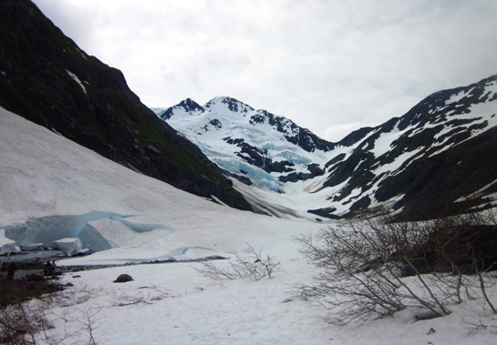
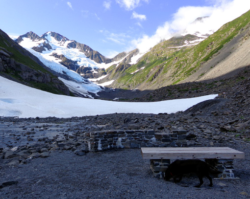
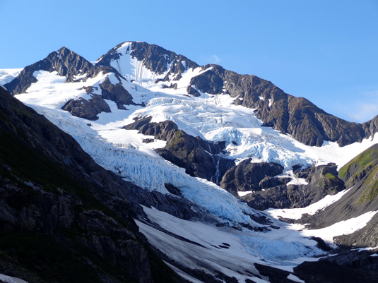
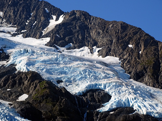
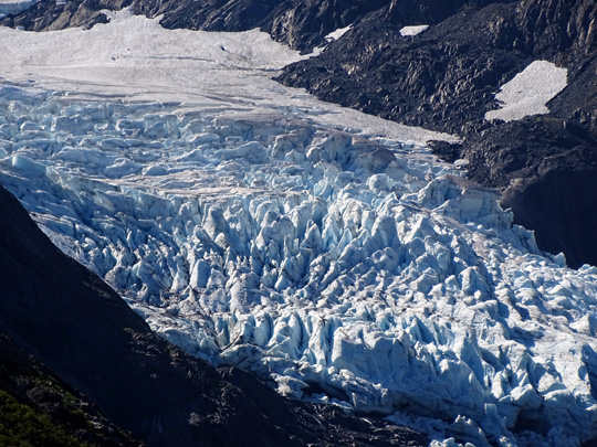
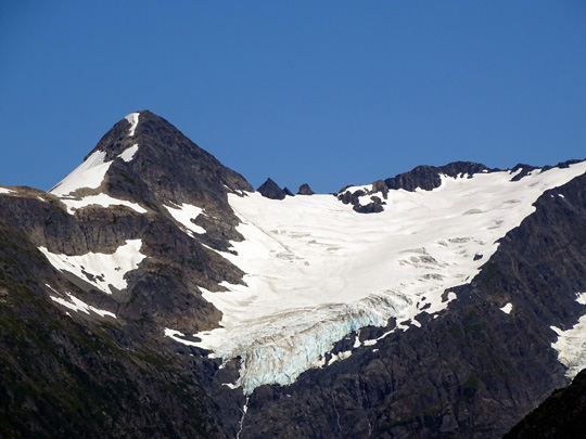
Byron
Glacier now: I saw mostly blue ice today, not snow.
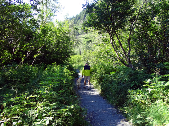
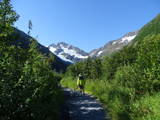
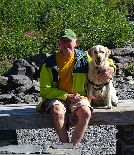
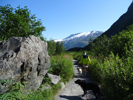
This morning Jim and I walked both dogs back a mile to the viewing area with a
bench.
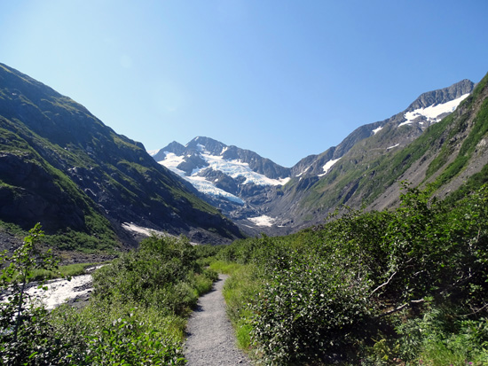
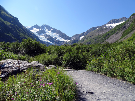
The first thing I
noticed was how much more lush the trail looked compared to those
previous hikes -- almost overgrown in places:
Another indication of
2012's epic snowfall: more flowers are in bloom in early August
this year than in late August that year.
Because this trail is
close to the glacier it's chillier back here than along the Williwaw
Nature Trail. Out there the tall fireweeds are mostly done blooming;
back here, they haven't even peaked yet:
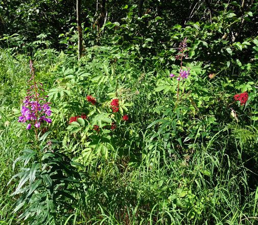
Fireweeds and Devil's club with berries
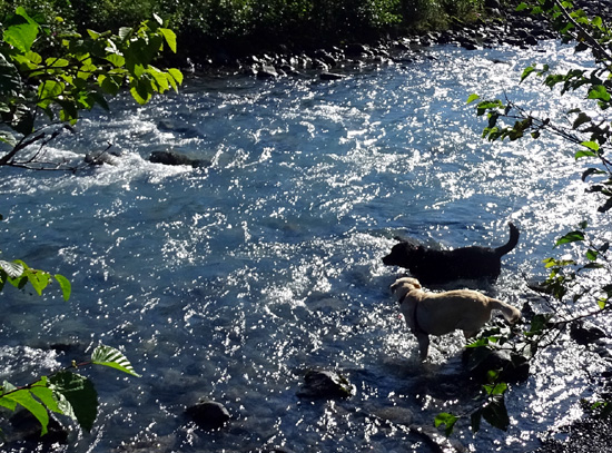
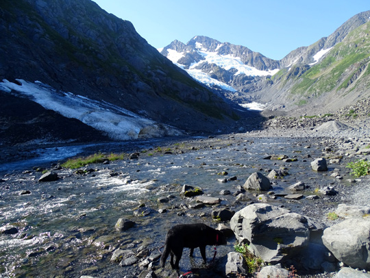
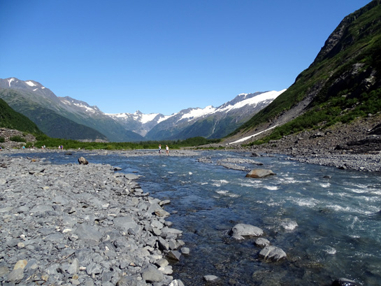
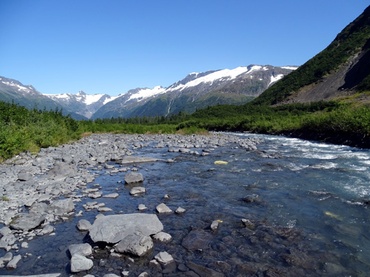
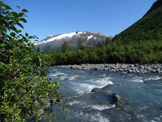
Cody and Casey enjoyed getting into the cold blue glacial water in Byron Creek, which
the trail follows back to the foot of the glacier:
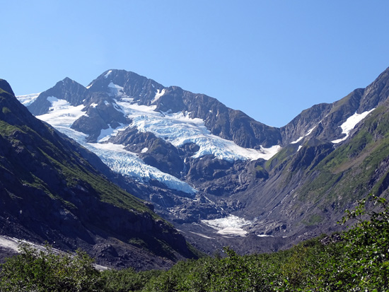
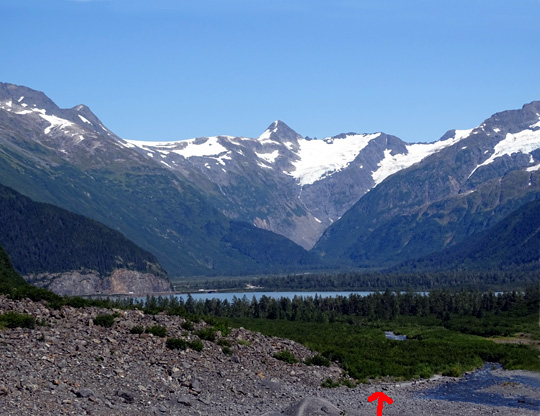
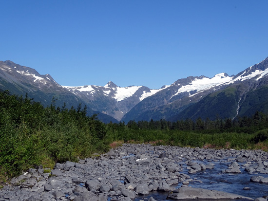
As we approached the glacier we could see more of the ground around us
and the surrounding mountainsides than we could in late August three
years ago:
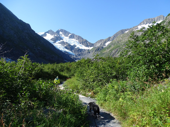
Jim and Casey sat on the bench while Cody and I walked a little further
up and out on the rocks:
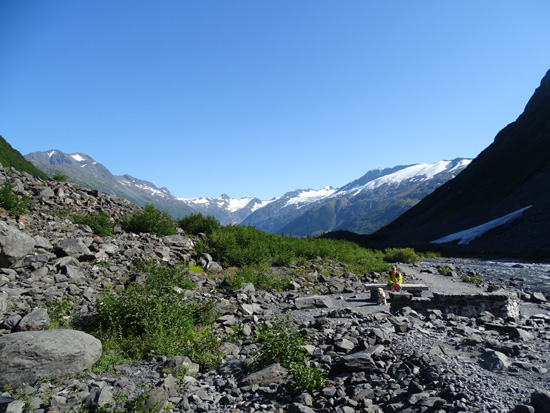
Above and below: looking back at Jim and
Casey
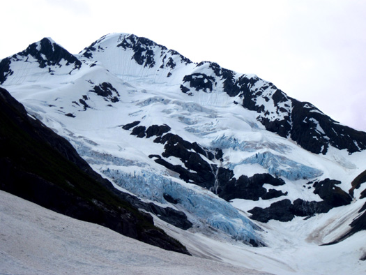
Most of Byron Glacier was finally in the sun by 11 AM
but not all of it. There's a pretty small window of time when it's fully
lit by the sun, even in the summer -- too many nearby mountains!
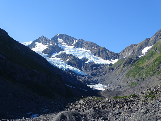
This is as far as I got this morning; mountain on
the left is still in the shade.
Without a point of reference like a person in this
picture, it's difficult to guess how thick the ice is.
I decided that I wanted to return after lunch by myself to get
better pictures and to hike farther back on the rocks and boulders. I
didn't want Jim to have to wait that long for me in the sun. By then it
was feeling quite warm and we were both over-dressed.

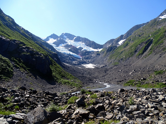
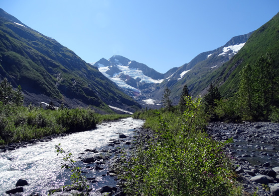
Scenic view of creek going back, with other glaciers in
the background.
We saw about a dozen people coming out, and more than that going in when
we were going back to the parking lot.
BYRON GLACIER HIKE #2
After lunch I went back alone to hike and explore closer to the foot of
the glacier.
The sun was higher and the glacial basin/surrounding mountainsides were
more lit up than they were in the morning. The sun's position to the
south caused some trouble with reflections on my camera lens when I
was facing the glacier; I've
tried to correct for that in the remaining photos.
I had plenty of
company after lunch but most of the people were well spread out.
I counted 38 people coming out as I went in, and a large group of
students was still in the rocky moraine area in front of the glacier.
They were getting ready to leave but more people kept coming in.
The people helped
give some perspective to distances and size of the boulders I was
negotiating to get closer to the foot of the glacier:
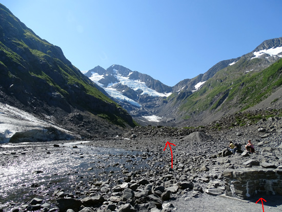
Bench in R. corner is where Jim and Casey sat
yesterday while Cody and I climbed a little higher
to the right. Arrow in center shows boulder pile I
climbed today. It's farther than it looks!
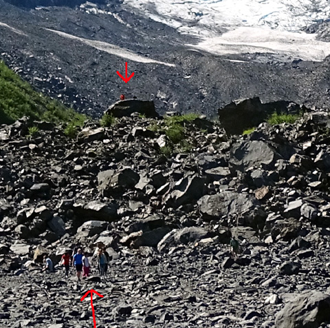
Arrows point to people ahead of me on the boulder
pile.
I saw only two other people go as far as I did up on the big rocks. They
are under the top arrow in the photo directly above. They
disappeared before I got to my farthest and highest point.
I had to be very careful re: foot placement. These rocks are
larger than they look. None of the big
rocks moved but I tested most of them before putting my weight on them.
Going up wasn't as difficult as coming back down. I did kind of a loop
on the rocks, not out-and-back, so I had to pick my lines carefully the
whole time.
I circled three people to show perspective re: the
rocks.
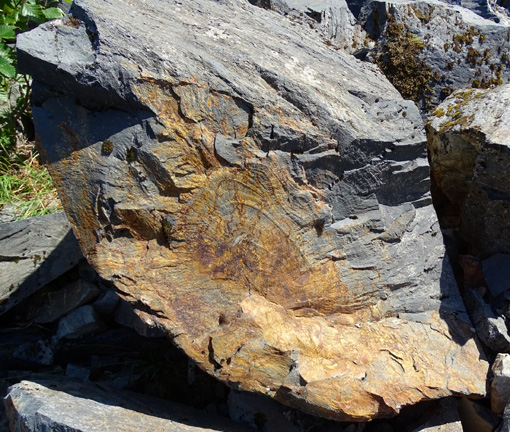
One of the few colorful rocks in the terminal
moraine left exposed when the glacier receded
I was curious about what I couldn't see below the glacier from the viewing point.
Turns out it probably wasn't worth the effort to get back there --
just a stream of very cold water from the ice-snow melt, and more rocks
where the ice has receded!
I'm curious how deep these ice crevices are but
without a person for perspective, I can't tell.
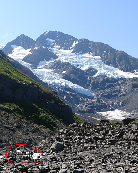
Here are a few more pictures I took from the boulder pile and on the
hike back to the parking area, following Bryron Creek and observing other glaciers surrounding
Porter Lake:
Above and below: Porter Lake is in the
distance in both pictures;
arrow marks the bench at the end of the Byron
Glacier Trail.
FINAL THOUGHTS ABOUT PORTAGE VALLEY
The whole end of the valley around Porter Lake is so beautiful right now
with the blue sky, green foliage/needles, and all the glaciers.
What a
spectacular setting!
I'm glad we've gotten to see a range of snow conditions here. It's fun
to compare how much snow there was three years ago, and the
icebergs on Portage Lake were interesting then. This time the valley is
more lush.
While I was gone this afternoon Jim rode with Casey on the bike in the
campground and up to Explorer
Lake on the Trail of Blue Ice, where she got to swim some more. They
rode/ran about five miles then, another 3˝
miles on the Nature Trail after supper,
plus the two miles they walked at Byron Glacier.
Jim and the dogs on the Byron Glacier Trail
I walked Cody another half mile in the campground when I got back. I had
at least five miles of walking today plus 8+ miles on my bike that I
described in the previous entry.
We've enjoyed our stay here. This is a terrific campground but we've
done about all we want to do in this area. We're ready to continue to
Seward tomorrow.
Next entries: camping at the Seward Military Resort
+ our activities in the area
