I am definitely in awe of every glacier I've seen so far in the Yukon and Alaska.
Today was no exception as we enjoyed the floating blue icebergs in
Porter Lake that have broken off from Portage Glacier, out of sight from our
vantage point, and the beautiful blue ice and sparkling white snow on Byron
Glacier, which we saw close up.
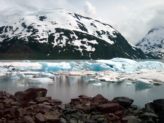
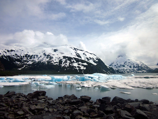
Some of the icebergs floating in
Portage Lake today
This page is a continuation of our day trip on the Seward Highway along Turnagain Arm south of Anchorage.
In the last entry I mentioned that we turned off the Seward Highway
at MM 79 onto Portage Valley Road and drove east about five miles to the Begich, Boggs Chugach National Forest Visitor Center. It is located in a
gorgeous setting on the shore of Portage Lake.
After a quick visit inside we drove to the trailhead for the Byron Glacier Trail and hiked out and
back to the foot of the glacier.
BEGICH, BOGGS VISITOR CENTER
I've got to say, Alaska has some of the most outstanding visitor
centers we've seen anywhere in the USA.
This is one of them -- and we haven't even seen most of it yet
because we were in too much of a hurry and didn't realize until later
that we could have blitzed through for free with our NPS Senior Pass.
We've added it to our list of Things to Do and See when we come back to
this valley again, probably after we've visited the Kenai Peninsula.
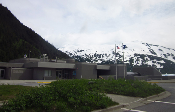
The Begich, Boggs Visitor Center
sits between Portage Valley Rd. and Portage Lake.
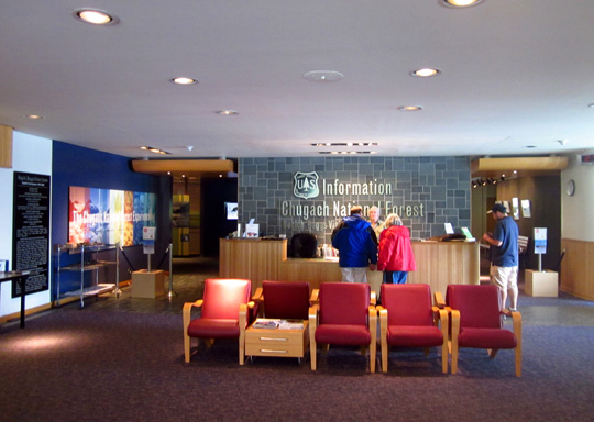
Bright lobby of the visitor
center
The visitor center features the huge Chugach National Forest, which
covers 17˝ million acres of land in South
Central Alaska.
Various exhibit rooms focus on nature, geology, and culture in the area.
There is a 200-seat theater that shows a movie about glaciers (we've
heard it is outstanding) and a 100-seat learning center.
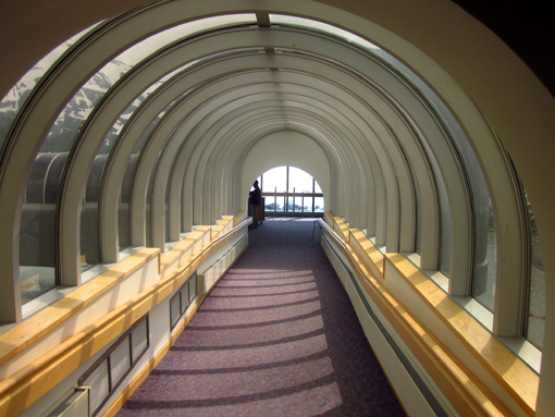
Today we browsed in the lobby and walked down an arched, L-shaped, skylit tunnel
to see the views of Portage Lake from inside:
Anyone can do that and visit the gift shop without paying a fee.
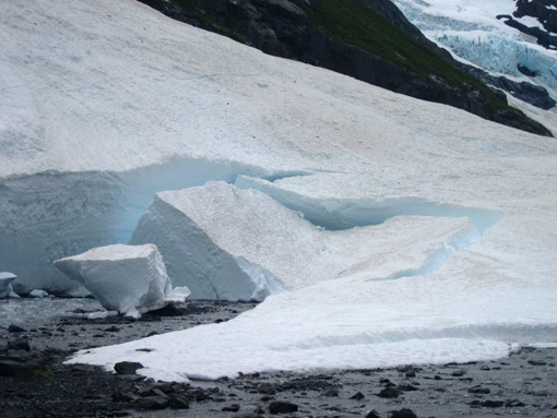
The views were even better outside, despite the clouds in the sky. We
walked along part of the lake shore, admiring the interesting shapes of
the ice as it has melted:
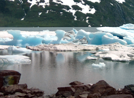
Above and below: ice from Portage
Glacier
If we come back here again in a few weeks it'll be
interesting to see what the 'bergs look like then.
Until the 1970s visitors could see Portage Glacier, the source of
this ice, from the visitor center. It has receded so far behind Byron
Peak that the only way to see it now is to take a boat cruise from the
other end of the lake. I don't know if we'll do that next time or not.
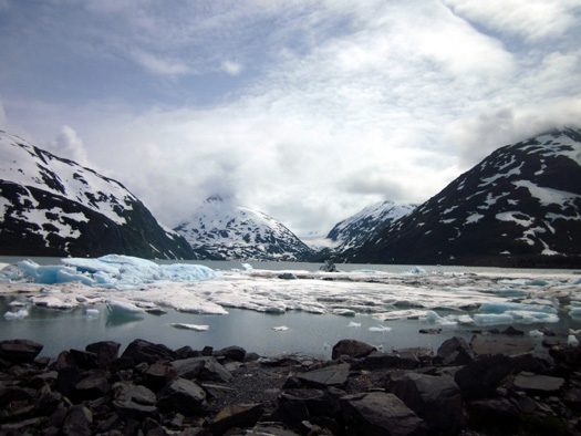
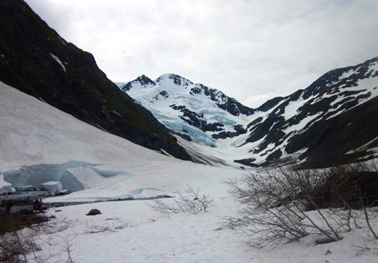
The next picture shows Byron Peak on the right. Portage
Glacier lurks behind it:
There are several smaller glaciers visible from Portage Lake,
including Byron Glacier:
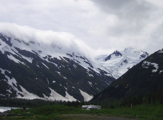
Seeing those two RVs parked near the lake reminds me -- there is
plenty of room in two parking areas near the lake and visitor center for
campers to park unless the place is packed with passenger vehicles and
other RVs. There were only about 20 vehicles in the parking lots during
our visit.
BYRON GLACIER TRAIL
Although we couldn't
see Portage Glacier today
we were able to get close to the base of nearby Byron Glacier. It was
well worth our time.
We drove about a mile back a narrow paved access road to the trailhead
parking area. That lot does not have room for RVs unless they are
very small. If you're in a large camper, leave it at the visitor center
and walk or drive your tow or towed vehicle back the access road.
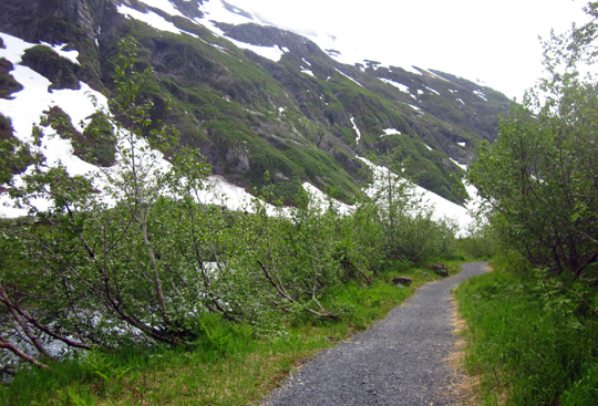
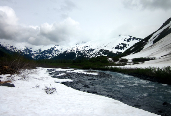
The Byron Glacier
Trail is relatively flat, smooth gravel. It follows rocky, cascading
Byron Creek gradually upstream to its source
at the base of the glacier. The trail winds through a thick
alder-cottonwood forest for most of the way.
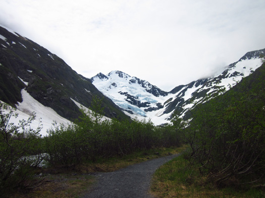
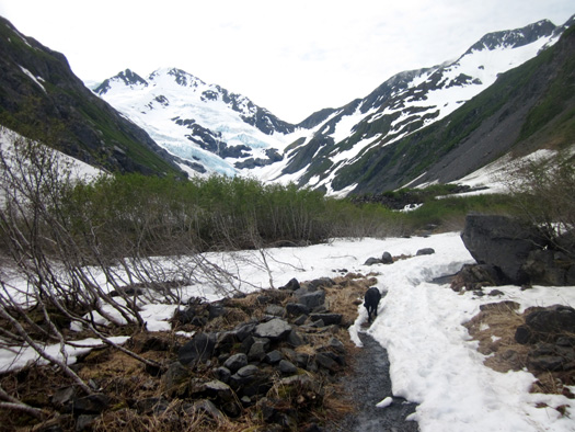
We had good views of
the glacier within the first half mile. It is a beautiful sight.
Near the beginning of the trail we could see a lot of rainforest ferns
and wildflowers but the farther we traveled upstream to the glacier the
more intermittent snow we encountered on the trail:
It was slick, soft, and a little deep in places. We had to watch where
we walked. Cody was in puppy paradise! (Yes, dogs are permitted on this
trail. I think bikes are, too.)
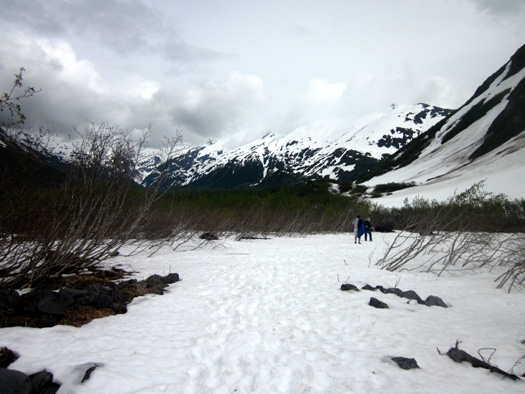
Keep in mind as you look at these photos that it is June 27, well into
summer in the Lower 48 states, and we are almost at sea level! As I've
mentioned previously, Alaska really got dumped on with snow last winter.
These two photos are looking back the way we came:
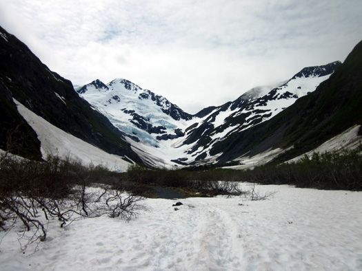
Jim’s knee hurt as he slid around in the snow so he stopped about Ľ mile
from the base and waited while Cody and I went to the end of the trail
-- or more accurately, as far as I was comfortable going. I
couldn't tell where the trail went near the base because it was covered
in deep snow.
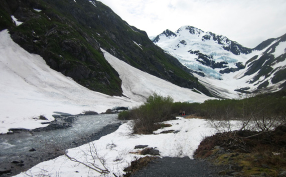
In addition, there are signs warning about getting too close to the ice
so I was even more careful there:
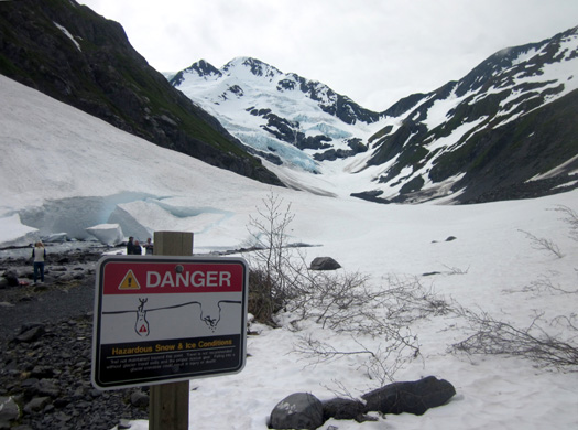
I went perhaps 200 feet beyond this sign and to the right, hoping to
avoid falling through the snow into the creek.
Even when there is less snow later this summer I don't think I can get
much closer to the glacier than I did today. There is no mention of
trails going up the mountainsides on either side of the glacier, just
challenging bouldering through the rocks and terminal moraine.
I loved getting that close to the base of the glacier and getting some good
photos of it up close. There was a small group of people behind the sign
(above) when I arrived but they were soon gone and I had the place to
myself for several minutes.
And yeah, I stood in
awe at the wonder of it all. I am totally fascinated by glaciers.
I searched for details, like these chunks of packed snow that have
broken off into the creek from the snowfield that looks like it may last most of this
summer:
Check out that blue glow from glacial silt. Isn't that cool? If the
water wasn't so doggone cold I would have walked over closer to it. The
stream was shallow there.
The rippled blue ice in the glacier itself is also beyond "cool:"
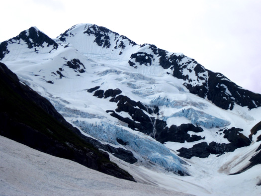

I spent about ten minutes just looking, inching as close as I dared
to the glacier. I reluctantly turned around so I didn't keep Jim waiting too long.
Although he was able to see the glacier farther back the trail I wish
he could have kept going closer to the base. Maybe I can talk him into hiking
or riding his bike farther back in another few weeks when we plan to
return.
It was beautiful with all the snow today but I'm very curious to see
what it looks like when more of it has melted, too.
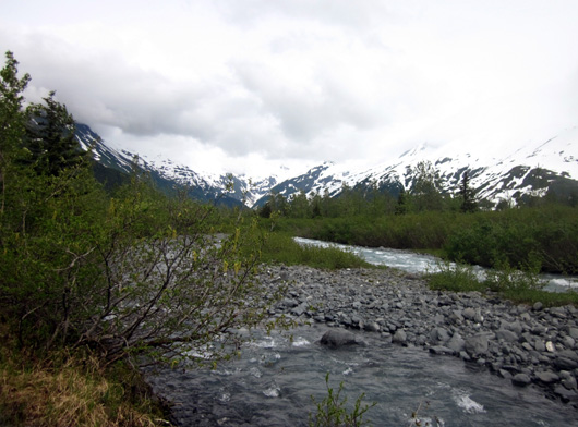
A view of some surrounding
mountains on the way back to the trailhead
This is a special place. It's one of the easiest glaciers in Alaska
to access by car, then foot or bike. There is no fee for the pleasure.
If you're in the area we highly recommend at minimum that you spend
one or two hours doing this hike and/or visiting the Begich, Boggs
Visitor Center. There are many other things to do along the Portage
Valley Road and in the town of Whittier, too. Stay tuned for our future
report.
Next entry: more activities in and near Anchorage
Happy trails,
Sue
"Runtrails & Company" - Sue Norwood, Jim O'Neil,
and Cody the ultra Lab
Previous
Next
© 2012 Sue Norwood and Jim O'Neil
