That quote has relevance to the last
section of this entry regarding Denali National Park's first death by
grizzly bear. But I'm getting ahead of myself . . .
Right now we're still in the Anchorage area.
We had a beautiful day today -- perfect for a road trip down to the
Portage Valley to see Byron Glacier again and for Jim to ride the
Trail of Blue Ice bike path again.
It was mostly sunny when we got up, although the Chugach Range was
mostly under low, billowing, white clouds all day. We drove near the
lower part of the mountain slopes to Portage Valley and back, as you can see
from this map of Turnagain Arm with our route highlighted in yellow:
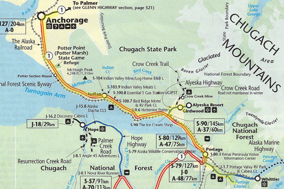
We highly recommend this beautiful drive when the weather is as nice as
it was today.
My photos turned out better today than on previous trips along Turnagain
Arm. It's a wonder! I took the next six pictures as we went
eastbound (into the sun) this morning from inside the truck
(window smears and glare) while Jim was driving (motion):
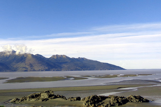
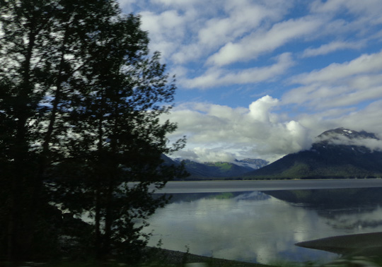
Low tide, looking across Turnagain Arm at its
juncture with Cook Inlet;
the mountains on the other side are on the NW
corner of the Kenai Peninsula.
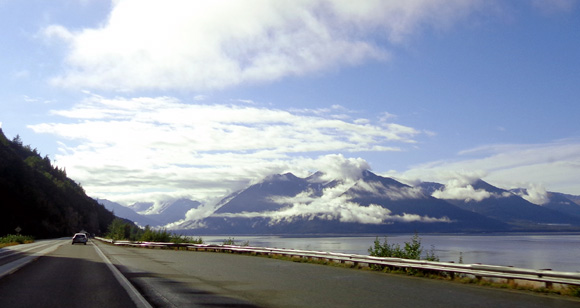
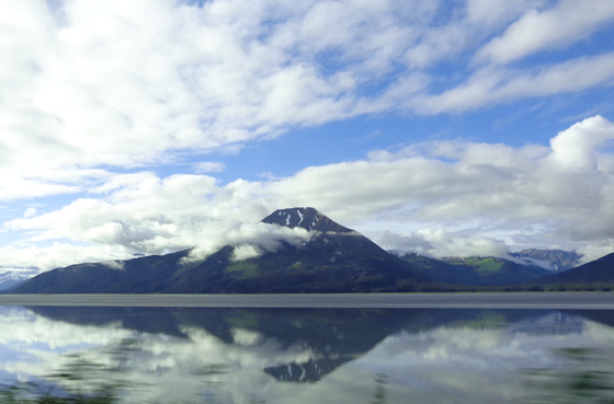
View east to the Kenai Mountains; Chugach Range is
on left and Kenai Mtns. are ahead and right.
Low clouds blanket this part of Chugach State Park on the
left.
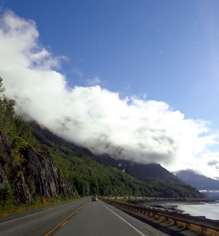
Above and below: interesting cloud patterns
over the Kenai Range to the south
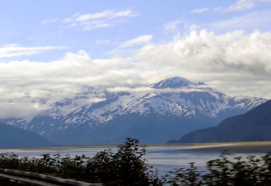
Approaching Portage near the eastern end of
Turnagain Arm we
could see Spencer and other nearby glaciers below
the clouds.
Temps ranged from the mid-50s to mid-60s F. at the campground and a few degrees
cooler along Turnagain Arm, very comfortable for hiking and cycling. The
chilliest spot was in the canyon going back to Byron Glacier in the morning.
BLUE ICE AT BYRON GLACIER
Soon after we curved around the far end of Turnagain Arm at the
former townsite of Portage we turned left (east) on the road through Portage
Valley. It ends at Whitter but we didn't go that far.
I'm including an aerial
USDA photo of the valley here that I
used in one of my entries from
July 15 when we were in the area. It shows the eastern
portion of Portage Valley better than any map or written description I can
provide:
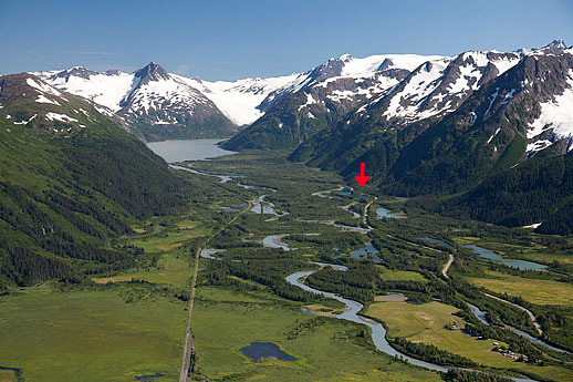
The road we took back to the lake is to the right in that photo. We
haven't been on the road to the left.
The arrow points to the Williwaw National Forest Service Campground
where we stayed a few days in July. The fish viewing platform is near
there. Portage Lake is in the distance.
Note all the streams, mountains, and glaciers in this lush valley.
The Begich Boggs Visitor Center is about five miles back this road from
the Seward Hwy. It sits at the north end of Portage Lake.
This morning we
turned toward the visitor center, then continued about 3/4 mile farther
south on a more narrow road to the
parking area for the trail to Byron Glacier. We got there about 10 AM
and had the place to ourselves most of the time.
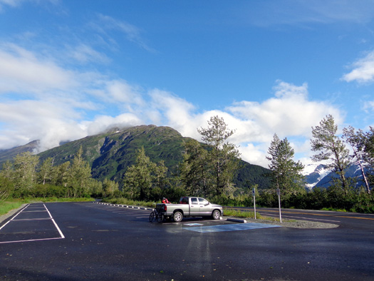
Just us at the trailhead; Jim gets ready to ride
his bike.
I enjoyed the beauty and solitude – and being able to take photos
without strangers in them.
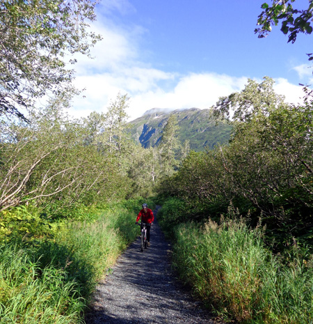
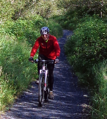
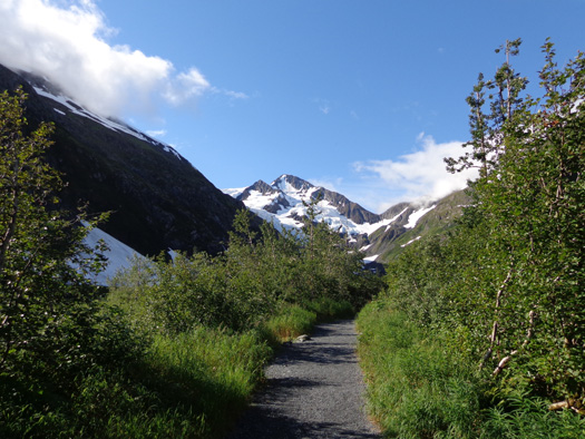
Jim rode his bike one mile back to the glacier on the wide, mostly flat gravel path.
There are no signs indicating bikes are prohibited on the trail,
although we haven’t seen any either time we've been here. Jim
didn't see anyone at all on the trail while he rode out and back and I
didn't see anyone until I was coming back from my hike with Cody.
When Jim and I hiked the path on
June 27 there was still a lot of snow the second half mile.
Jim had trouble negotiating the snow with his bum knee and he didn’t go
as far back to the glacier as I did. We didn't have time to hike back to
the glacier on July 15-16 when we camped at Williwaw Campground.
Although this was our third time in the area, it was just our second
time to go back to Byron Glacier.
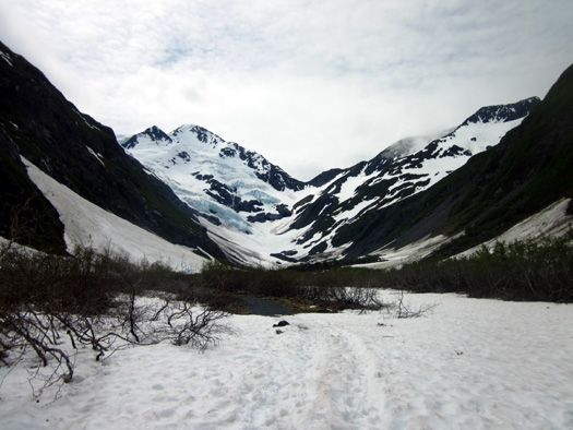
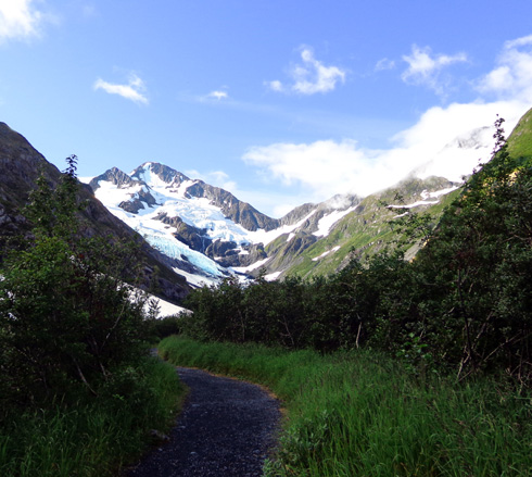
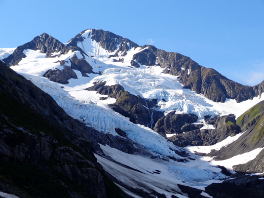
I'm happy to report that today we could both get much closer to the base
of the glacier.
If you have a few minutes, click on the link above and
compare the photos from late June with the ones in this entry. Here are
two from that date:
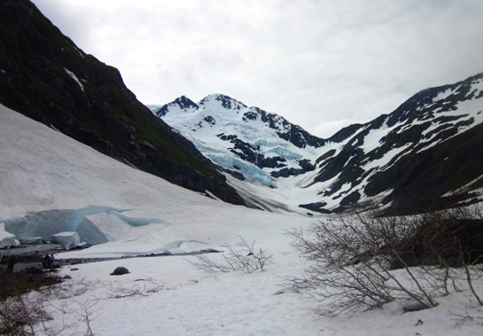
Above:
snow at Byron Glacier on June 27. Below: That's as far
as I felt safe to walk that day.
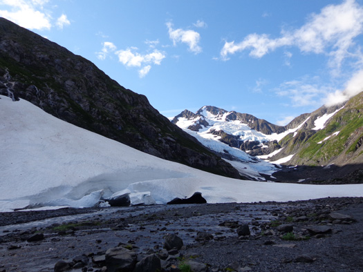
I'm glad we were both able to get closer to the base of the glacier this time.
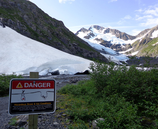
It was very easy to walk and cycle with no snow on the ground:
Several feet of snow covered the trail beyond this point in late June;
it's melted now:
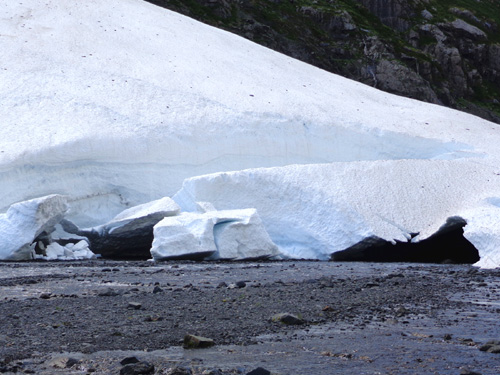
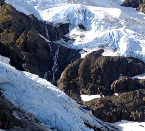
There are still blocks of compacted snow breaking off from this slope
but these aren't the same ones I photographed last time:
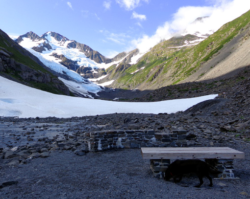
Two months ago this bench and low stone wall were buried under snow:
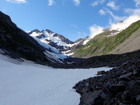
Today it would have been possible to get much closer to the base of the
glacier if I had wanted to walk through several hundred feet of unstable rocks.
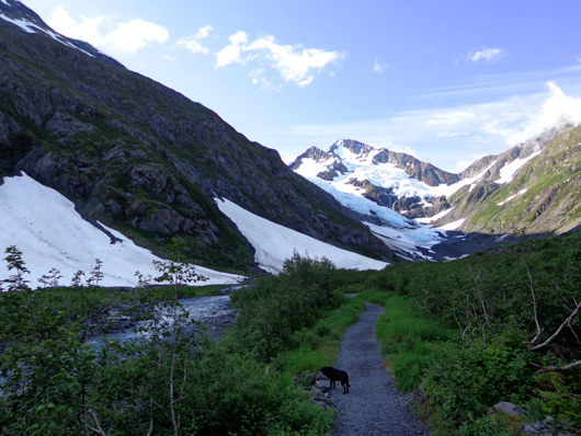
Since I also have rather unstable knees and ankles . . . Cody and I
walked over some of the rocks at the end of the trail but
didn’t go more than about 200 feet past the bench. I was able to zoom in
with the camera well enough there, although I couldn't see all the way
to the top of the glacier from that vantage point:
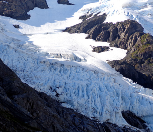
Nor did Cody or I go out on
any of the snow or ice – too high a risk of falling through snow bridges
that have been melting for several months.
Cody waded into the creek farther from the glacier to get a drink two or
three times. He wasn’t interested in full-body submersion in the
freezing water, however. Smart dog.
Continued on the
next
page . . . more photos of Byron and other glaciers and the Trail
of Blue Ice
Happy trails,
Sue
"Runtrails & Company" - Sue Norwood, Jim O'Neil,
and Cody the ultra Lab
Previous
Next
© 2012 Sue Norwood and Jim O'Neil
