That's close enough that when Spurr erupted last
in 1992 it deposited some ash on the city.
I realize Wiki is not the best source of
information so if you're interested in more professional science and history about Mt. Spurr you can do an internet search or go to this Alaska
Volcano Observatory
website. I'll talk more about Mt. Spurr
in a bit.
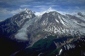
Tiny photo
of the southern side of Mt. Spurr (from
Wikipedia)
Yesterday
was rainy and gloomy, as predicted, so we didn't go for a website entry-worthy
bike ride or hike. We both needed a rest day anyway. We ran errands in
the morning and had lunch at House of Bread. Temps remained in the 50s
F. at the campground all day, even after the rain stopped about 1 PM.
That's chilly for August, even by Anchorage standards.
I didn't take any
pictures yesterday (Thursday). The ones in this entry are from today.
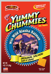
YUMMY CHUMMIES
While we were at
Sam's Club yesterday we
got Cody a new treat called Yummy Chummies. We heard about them on the
radio/TV/internet this week:
http://www.alaskadispatch.com/article/famous-alaska-salmon-pet-treats-going-nationwide-sams-club.
(Please copy and paste, if interested. The link won't go back to the
correct page on our website, at least with Firefox as the server.)
Yummy Chummies are made by a local company, Arctic Paws, that uses
discarded salmon parts and makes them into dog treats. There are several
varieties. Sam’s and Costco sell the “gold” version that’s 95% salmon.
The news this week is that Sam’s Club is going to start selling them in
the Lower 48 states, too. The company has opened a new, smaller
processing plant in Arizona to reduce transportation fees to service the
demand down there.
We joked about the cost of the bag of treats, saying it's wasted money because Cody probably
won’t like them.
Ha! He's never turned down any food ever offered to him, including a
variety of fresh vegetables. He could smell salmon inside the foil bag all the
way home and just about took off my hand when I offered him a Chummy
after he ate his supper. He'd probably eat the whole bag in one sitting
if we let him. He’ll get one after each of his two meals a day and that’s it.
The product doesn’t have to be refrigerated but it won’t last as long as
dry dog bones (supposed to eat within 45 days of opening the package). I
hope we can find it at Sam's Club when we get back down to the Lower 48
because it's cheaper there than online from other merchants.
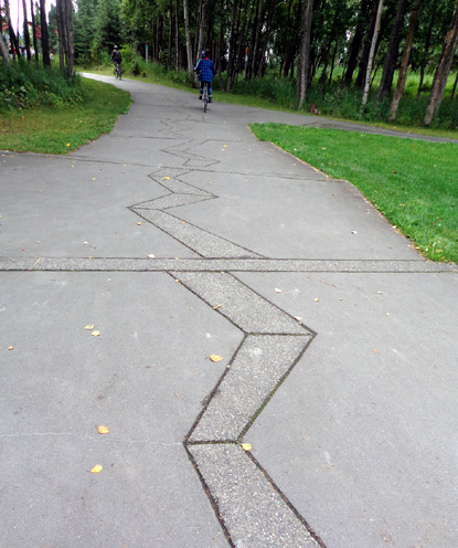
Anchorage has seen its share of geologic (and
weather) disasters, including
earthquakes. This graphic design at
Earthquake Park along the Coastal Trail
depicts the massive destruction from the epic 1964
earthquake in Southcentral Alaska.
By 9 last evening we could see large patches of blue sky. Jim and I took a walk
around the campground with Cody and considered going on a bike ride.
We didn't have enough daylight left, however. Sunset is now about 9:30 PM,
which seems odd after going to bed when it was still light for so many
weeks.
We are reminded every
day that winter is coming to Alaska and we need to consider when to head
south. Ironically, we'll be traveling north before we go south.
TODAY'S BIKE RIDE
The good weather held long enough this
morning for both of us to get in a good bike ride.
I was happy to wake up to a lot of sunshine at 7 AM. Because it was more
clear overnight the temperature was only 47 F. at our campsite. By noon
it was mostly cloudy, with temps in the low 60s F. around town. It
was pleasant while we rode our bikes, even when overcast.
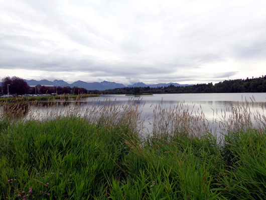
Clouds covered the Chugach Range, Westchester Lake, and most of
the Anchorage Bowl (valley) by the time we got done cycling.
Jim rode to the Coastal Trail from the campground on base again so he could get
in more miles. I drove the truck to Westchester Lake and began riding my
bike toward Jim. We met
up in less than half a mile after I started.
I rode another 1+ mile to the northern end of the Coastal Trail and then turned
around and met Jim at the truck. He stopped to take off his jacket and
get something to eat before we headed south.
We rode mostly together to Kincaid Park at the southern end of the trail, stopped for a few minutes for a
snack, and rode back to the truck separately. It took me longer because
I stopped to take more pictures. Jim went nonstop to the truck and ate a sandwich while waiting
for me.
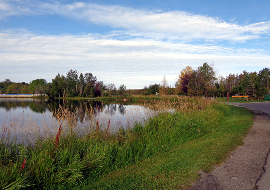
There was a lot more sun when I began riding at Westchester Lake this
morning.
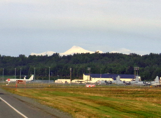
MT. SPURR & OTHER VOLCANIC PEAKS
As we were riding/driving west and south out JBER this morning we could
see a prominent, pointed, snow-covered peak in the distance that we
haven't seen from this perspective before. I knew it wasn’t 21,000+ foot Denali but
thought it might be 17,000+ foot Mt. Foraker.
Jim said it was the wrong direction for either one, so I guessed that it
was the Sleeping Woman west of downtown, although I didn't think it was
that conical. (Jim was riding his bike out
Richardson Rd. and I had just passed him in the truck when I saw the
peak. I stopped and pointed out the mountain to him.):
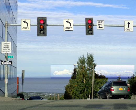
All those guesses were wrong.
When I got to the spot in the next photo as I was driving
through the downtown area
I could see the pointy summit was in a long line of mountains, not just
one peak.
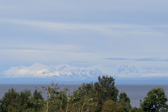
Then I realized it was the northern-most peaks in the
volcanic Aleutian Mountain range across Cook Inlet from Anchorage and
the upper Kenai Peninsula. After consulting maps I think we were looking at
Mts. Gerdine, Torbert, and Spurr, which are all over 11,000 feet in
elevation:
Outbound on the Coastal Trail the volcanic peaks were also more prominent than we’ve
usually seen them on previous bike rides.
I took these photos from Woronzof Point, the high overlook near the
airport:
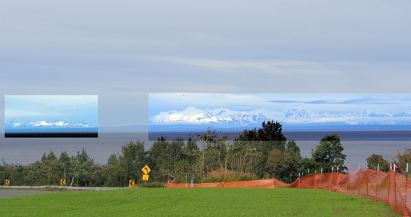
The southern part of the chain (Mts. Iliamna and
Redoubt) is to the left.
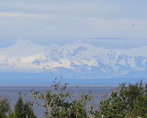
Those mountains probably got more snow this week when it was raining in
the Anchorage Bowl.
On the return they were under clouds. So were Foraker and Denali to the
north:
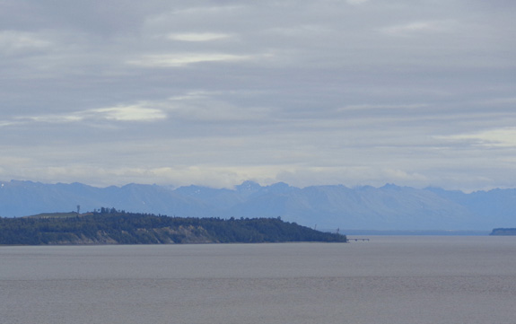
Southern end of the Alaska Range in the
distance; too many clouds
to see the top of Mts. Foraker or McKinley AKA Denali
SEASONAL CHANGES
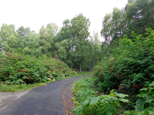
This was a good morning to ride the path. There were some locals and
tourists walking and riding but not a lot of them and most everyone was
courteous and aware of other people using the trail.
It was interesting to see the changes in the foliage since I’d been on
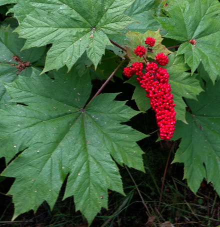
the path the last time – about three weeks ago. There are many more red
berries on two types of shrubs and many fewer flowers still in bloom:
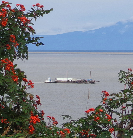
A barge
heads through Cook Inlet to the port; Sleeping Woman is in the
background.
Above and
below: There are lots of these large-leafed berry bushes/trees
along the
Coastal Trail and in the nearby Chugach Mountains.
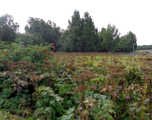
The tall white cow parsnips that were so stately in June and July are pathetic-looking
now at the lower elevations, all brown and stinky:
At least the fireweed stems and leaves turn bright red and the plants
get wispy white fluffy strands that are pretty when they are dying:
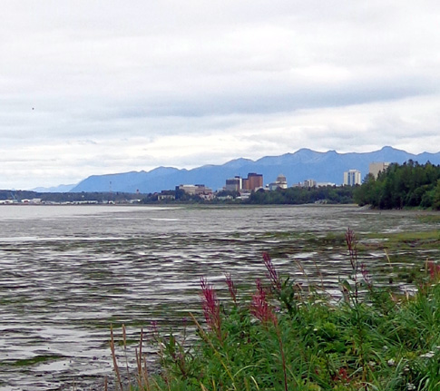
These fireweeds still have a little bit of bloom
left. The Anchorage
skyline and Chugach Range are in the background.
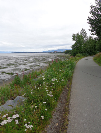
Yarrow flowers are still blooming along the
coastline, too.
Most of the foliage along the bike path is still green. Few aspen and
birch leaves have turned yellow yet at sea level:
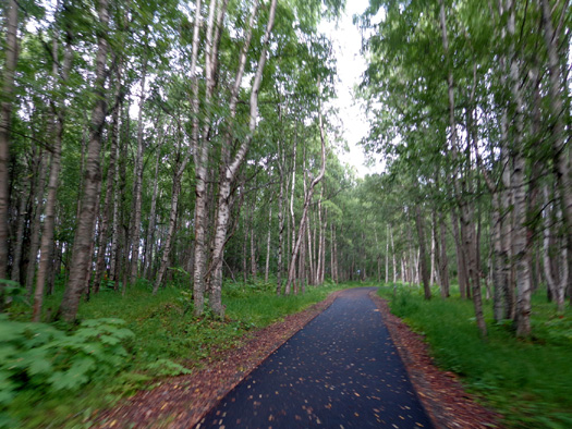
Multi-use paths don't get much smoother than this!
Neither of us saw any big critters this time. We always have our moose
and bear antennae up when riding this bike path because we've seen so
many of them along the trail before.
This may be our last time to ride the Coastal Trail this summer so I
savored today's ride.
I had a total of about 22 miles. Jim did about 32 miles.
YAY -- GOIN' BACK TO
DENALI NATIONAL PARK!!!
We did it. We decided to spend eight more days at Riley Creek Campground
at Denali, starting Sunday. That gives us a sure place for the Labor Day
weekend.
Our plans have
morphed all summer in Alaska as we learn about more places we want to
visit and return to ones we've really enjoyed.
Every day we talk
about where to go next, especially as time runs out. Winter weather will
be coming soon up here. We pay attention to the weather predictions and
other factors that may affect the areas where we want to go.
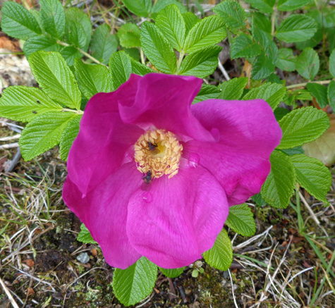
Some of the
wild roses are still blooming along the Coastal Tral.
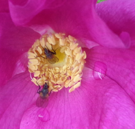
Busy bees
Our recent discussions have centered on whether to remain in Alaska
another week or two, or to start heading south.
It’s still in the 80s and 90s F. in areas of Montana and South Dakota
where we want to stay for a few days or weeks before we travel back to
our house in Virginia. That's pretty hot after we've spent most of the
summer in chilly parts of Alaska.
However, we don’t want to stay so long in Alaska or Canada that we get stuck in sub-freezing and/or snowy
conditions. We have to cross the Canadian Rockies. We haven't decided which
route to take through Canada yet. We're considering going back to Montana
via Lake Louise and Banff but that will depend on the weather when we
get down that way.
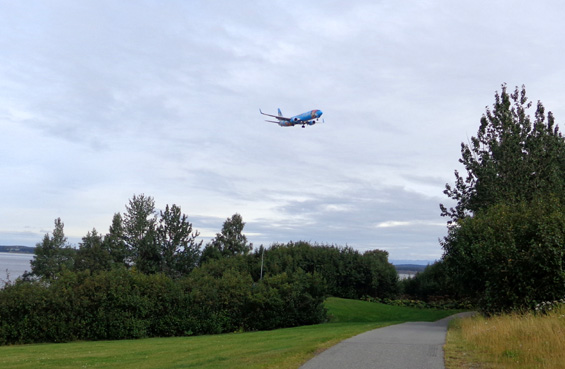
A colorful
Asian passenger plane flies low over the Coastal Trail
as it aims
for a nearby runway at the international airport.
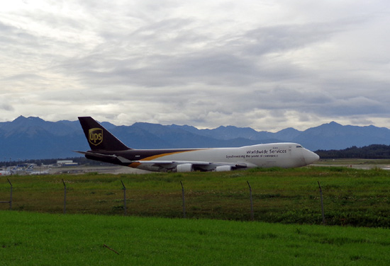
A UPS plane
taxies on a runway close to the bike path as it prepares to take off
from another runway.
Our thoughts
keep going back to Denali National Park because we loved it so much the first time we
were there. Our original plan back in the spring was to leave the state
via Denali and Fairbanks.
We've hesitated,
however, because it's been raining at Denali
the past few days, too, and Fairbanks has had air quality advisories due
to forest fires south of the city.
Since no structures are at risk officials are allowing the fire to
burn naturally.
Currently next week's weather
prediction is pretty good for Denali so our plan reverts to the
one we had earlier, with travel to Denali for a over a week, then Fairbanks
for a few days, then Delta
Junction and Tok to the Alaska Hwy.
This way we’ll also be able to say we
drove the entire Alaska Hwy. We missed the part from Tok to
Fairbanks when we came into the state and went south to Valdez.
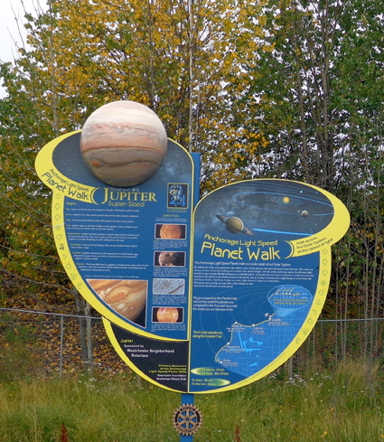
One of the signs along the "Light Speed Planet
Walk" on the Coastal Trail;
signs for the five outer planets (Pluto, Neptune,
Uranus, Saturn, and Jupiter) are placed
proportionately along the trail as they are in
space. It's fun for curious "kids" of all ages.
We’ll decide how long to stay in Fairbanks when we get there. It depends
on how much smoke (if any) is still there from the fire south of town, the
weather, how much we like the Ft. Wainwright campground, how many
interesting things we find to do, and our travel
whims.
Folks are beginning to see the northern lights in the interior of
Alaska. I’m hoping we can see them on a clear night when we’re up at
Denali or Fairbanks.
That's probably more likely than spotting Jupiter in space!
So much to see and do
in Alaska . . . Even three months isn't nearly enough time for us.
Next entry: another day trip to Turnagain
Arm, the Trail of Blue Ice, and Byron Glacier
Happy trails,
Sue
"Runtrails & Company" - Sue Norwood, Jim O'Neil,
and Cody the ultra Lab
Previous
Next
© 2012 Sue Norwood and Jim O'Neil
