This is the fourth time we've driven past Kluane (clue-AWN-ee) Lake --
outbound in June and back in early September, 2012, then outbound this past June
and back now in late August.
I've just looked at my photos from our last three passages
through this area of far western Yukon. Each time there were lots of
clouds and even some rain but at least we could see the mountain ranges
on both sides of the lake.
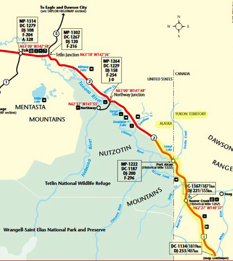
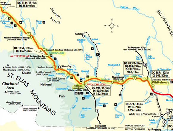
Today's route is highlighted
in yellow, starting at the top map just west of the border
and continuing with the bottom
one to Whitehorse. Maps are from
The Milepost online.
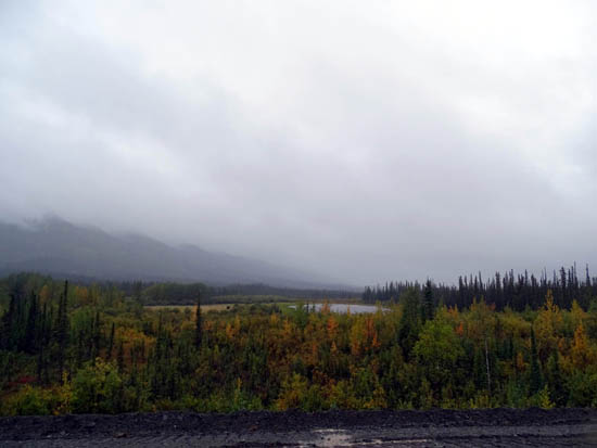
Today it was so foggy/rainy and the clouds were so low that we could
barely see across large Kluane Lake, let alone see any of the higher
mountain peaks in the region.
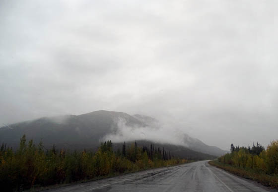
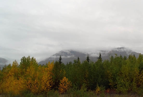
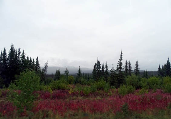
Most mountains were just vague shapes in the mist, like this part of
the Kluane Range above a different lake:
'Fraid I'll be whining about all the rain in this entry again. If you
don't want to hear it, just scroll through the dreary pictures and hope
that tomorrow's are prettier.
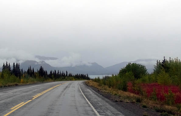
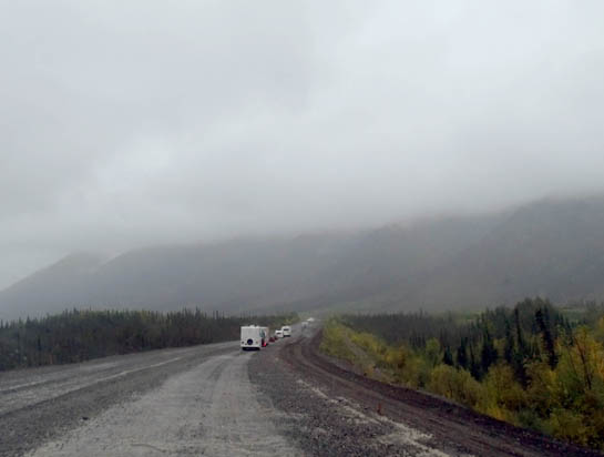
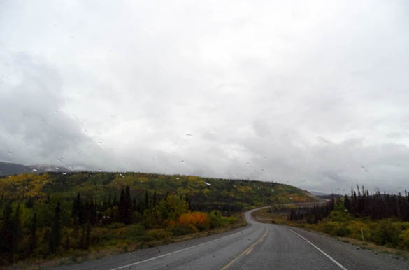
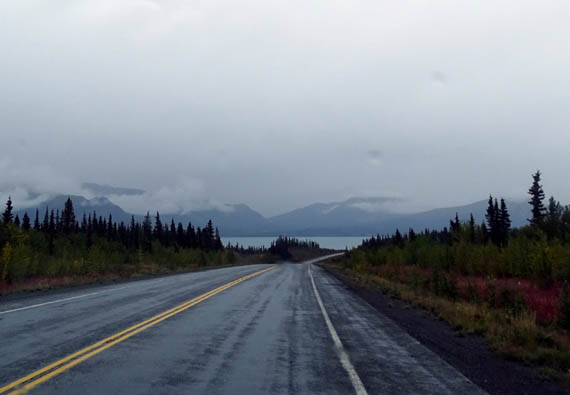
This photo approaching the northwestern end of Kluane Lake is about
as good as it got today:
It was cold (40s F.) and rainy all day, we couldn't see much of the
beautiful mountains surrounding us, the road was positively awful from
Beaver Creek to the north end of Kluane Lake, and we're both in a rather foul mood
tonight, trying to decide how long to stay in Whitehorse and where to go
next.
We had considered
heading south on the Cassiar Highway through British Columbia tomorrow.
We'll reach that junction before Watson Lake, YT tomorrow.
However, the weather
forecast for Stewart-Hyder and Banff-Jasper is crappy for the next ten
days. If it was going to be nice soon we'd kill time in Whitehorse,
where we have full hookups, WiFi, and cable TV for a reasonable price.
We've checked the
weather predictions for major points east on the
Alaska Hwy. and it looks like we can get into better weather this
weekend by continuing on it instead of going south on the Cassiar.
We
want to be able to see more of the new scenery along the Cassiar than
something like this.
Dammit. We've already missed some fantastic scenery while traveling
during the past week and I'm still frustrated that we couldn't enjoy Denali
any longer because of the rain. Now it isn't practical to check out a new
section of British Columbia.
Good thing we had better weather and better memories of this trip to the
Far North until about a week ago.
Meanwhile, it's in the 80s F. in Montana (that sounds good to us right
now!) but thick, obnoxious smoke from wildfires is predicted in Great Falls,
Billings, and other areas for the next week or more. Not sure how long
we'll want to stay there, either, unless the prevailing wind changes
direction.
TODAY'S DRIVE, INCLUDING THE BORDER CROSSING
We left our pull-out at MP 1251 a bit west of the Canadian border in the
rain just before 9 AM today and reached Pioneer RV Park
in Whitehorse about 6 PM = nine hours of tedious driving in the rain.
We had only one short
wait of a few minutes for a construction zone:
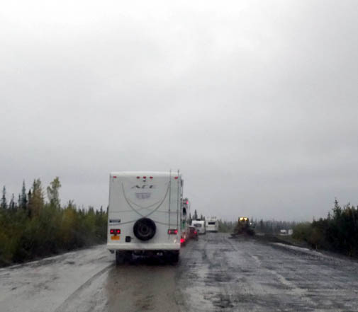
Above and
below: There were four RVs directly in front of us and several
more
farther up ahead
through this section -- all wisely headed south and east.
We stopped only three
other times: 1) at a pull-off around noon to eat lunch, 2) at
the Tachal Dahl visitor center (next photo below) at the southwestern
end of Kluane Lake to take a break, and 3) at the FasGas station in
Haines Jct. for fuel ($1.289/liter). Canadian total
was $103.33. Our Visa charge was only $78.42 US.
The exchange rate is very good for us right now -- 76 cents US to
a dollar CA -- but quite lousy for Canadians.
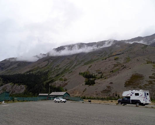
This is supposed to be a good place to observe
sheep on the mountainside
but we've never seen any in the three or four times
we've stopped here.
The border crossing was very quick into Canada, just like three years
ago.
The agent's questions took just a minute or two:
-
passports? (a quick glance at them)
-
residence?
-
dogs' vaccinations up to
date? (didn't ask to see proof)
-
cash over $10,000? (we
wish!)
-
firearms? alcohol?
-
raw eggs or chicken? (glad we cooked
them last night!).
Nothing re: the produce we had left, vehicle registrations, proof of
insurance, prescriptions drugs, or a dozen other things he could have asked.
Thank you, sir! Hope the US border crossing is as easy as that in a few
days.
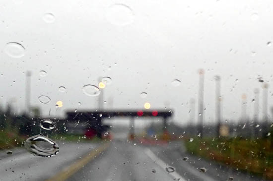
Rainy,
blurry photo of the border crossing; they don't want people taking pictures
of it anyway.
We "lost" an hour when we crossed into the Yukon and we'll lose another
one at the BC/AB border. Now we're in Pacific Time.
There was minimal traffic all day until we got to Whitehorse at its
afternoon "rush hour." With a population of only 25,000 people
+ summer visitors that's
not so bad, especially since we didn't go downtown (with just the truck)
until after supper. Our campground is located out on the Alaska Highway
where traffic isn't as congested as the city streets.
It seemed like we saw more RVs than semis or other vehicles today --
many going the other direction toward Alaska.
What's with that?? Reverse snowbirds? Alaskans returning back home after
vacationing in Canada and the Lower 48?
It just seemed
counter-intuitive to me.
Elevations ranged from about 2,000 feet at Haines Jct. to over 3,500
feet north of Kluane Lake. We mostly traveled at 2400-2600 feet, where
there was a good amount of leaf color. Although it was raining the whole
time today I tried to get some photos of the nearby leaves and lakes
that we could see.
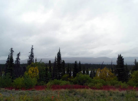
The red fireweed stems and leaves (two photos directly above) were the
most colorful at the higher elevations.
We saw no wildlife
along the road today, yet another disappointment in such a remote area.
WHITEHORSE -- NOW WHAT?
This is the third time we've stayed at Pioneer RV Park in Whitehorse. We
were surprised that it is as full as it is tonight but we were able to
get a spot without a reservation. No one parked on our doorside, which
would have been really close to us (sites are arranged so doors open to
doors and utilities face utilities).
We have full hookups, WiFi, and cable TV for $32+ CA with Good Sam discount.
Our true cost is about 3/4 fewer dollars US, which is very good for a
private campground. Jim went out to get fuel at Petro =
$1.249/liter, less expensive in this larger town than earlier
today in Haines Jct.
Since it was raining
and we've been to this RV park before, I didn't take any pictures of our site.
Here's another picture approaching Kluane Lake instead.
Cody is as off-balance today as
yesterday but he's eating well, sleeping well, and eliminating normally,
with our help propping him up. We can see the confusion in his face re:
being so disoriented -- what the heck is going on??
We hope tomorrow will
be a better day as we continue east on the Alaska Hwy. I don't like
being so negative. PLEASE LET THERE BE SOME SUNSHINE!!
Next entry: Whitehorse,
YT to Muncho Lake, BC
Happy trails,
Sue
"Runtrails & Company" - Sue Norwood, Jim O'Neil,
Cody the ultra Lab, and Casey-pup
Previous
Next
© 2015 Sue Norwood and Jim O'Neil
