OK, less whining about the weather today.
Even though it was mostly
overcast today and there was some rain, we're both in a better mood
tonight because we
could see more of the mountainous scenery and we finally saw some big
wildlife:
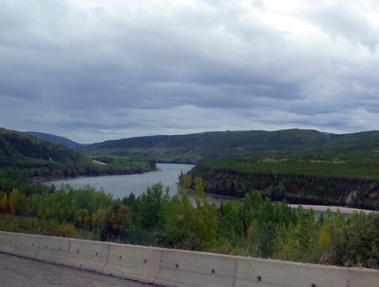
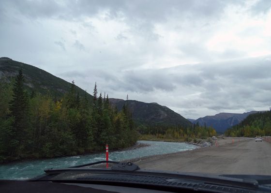
Liard River
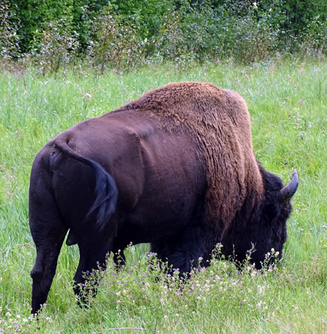
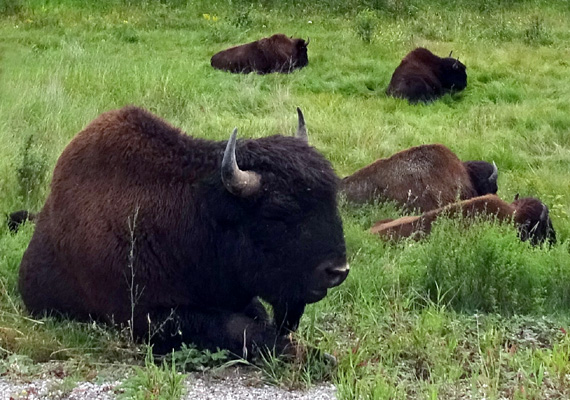
Grazing bison a few feet off the road
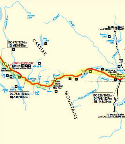
Today we drove on the Alaska Highway from Whitehorse, Yukon to
a large pull-off at the north end of Muncho Lake, British Columbia at KM
712/Historic MP 463.
That looks like a lot of miles with a big rig on the Alaska Highway but we did it in
just nine hours with several stops and some road construction. The
road was less remote today and we were able to drive faster.
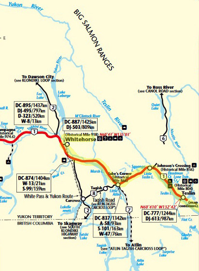
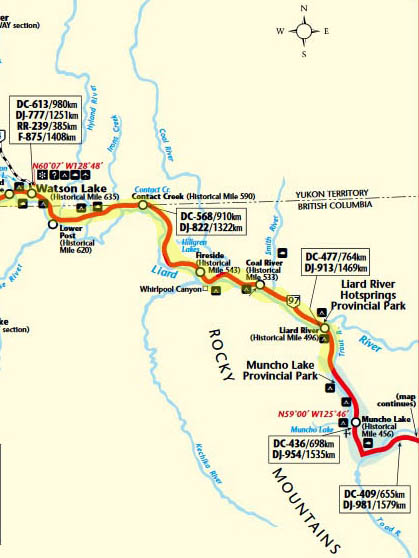
Here is today's
route. Read these
Milepost
map sections from the top down:
We weren't sure how far we'd get today. We reached Watson Lake at 2 PM and didn't want to stop that early. We made such good
time that we kept going several more hours.
We stopped at two different pull-offs to fix lunch and walk the dogs and
got diesel at the Tags/Tempo station in Watson Lake for $1.059/liter
Canadian.
This is the section of road by Canyon Creek west of
Watson Lake that washed out
in June, 2012 and shut down the Alaska Hwy. for an
unprecedented five days.
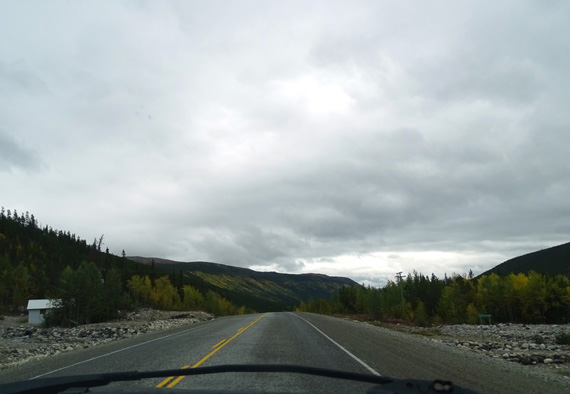
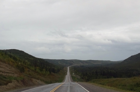
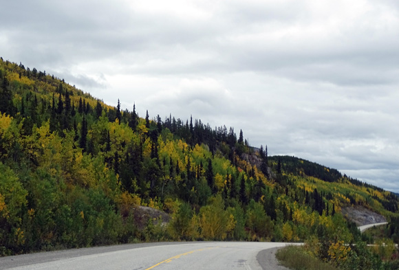
The highway was mostly in great condition today.
Several miles of roadway are being realigned along the beautiful
blue Trout River. They are realigning it and doing a
lot of work on the river banks -- must be a problem with
flooding. They started working on this section after we came through
here in early June.
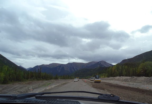
Then there was a 52 Km section of chip sealed pavement with dust before and around Muncho
Lake, where we spent the night. We like dust better than mud!
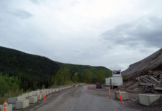
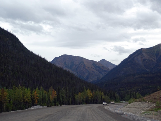
Long view of road with no traffic -- love it!
Traffic was minimal. There were very few passing lanes up hills but no
one who wanted to pass had to wait more than a mile to do so.
We saw quite a few RVs going in each direction again today. Some were
probably just out for the weekend, not going home in Canada or the Lower
48 from Alaska.
MORE WEATHER CONSIDERATIONS
It was cold (low 40s F.) and raining when we left Whitehorse. Overnight
low was 41 F. and rain/snow is predicted there for tomorrow!
When Jim got into the truck to leave this morning he told me to write
down "cold hands, cold toes x 4" to remind him not to come back
up here again. I wouldn't be surprised if he never wants to visit Alaska
again, even though we had a good time and better weather for most of
this trip than we did in 2012.
I reminded him that the high in Great Falls today and tomorrow will be
about 92 F. (then it drops to the low 80s and upper 70s before we get
there.) That is probably what motivated him to drive so many miles today
-- he's looking forward to some warmer, drier weather!
We had intermittent showers until we got to Liard Hot Springs (i.e.,
most of the way today). The clouds were higher today, though, so we could see
more mountains and farther into the distance.
It was mostly overcast and in the upper 50s F. during the afternoon. We did get some
glimpses of the sun along the way but not for long. It was bright enough
to charge up our batteries pretty well with the solar panels in transit.
We didn't have to use the generator much this evening except to fix
supper in the microwave and recharge the batteries before bedtime.
We had no rain in the evening at our overnight rest spot
at Muncho Lake, and no wind.
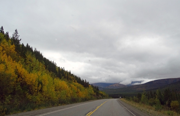
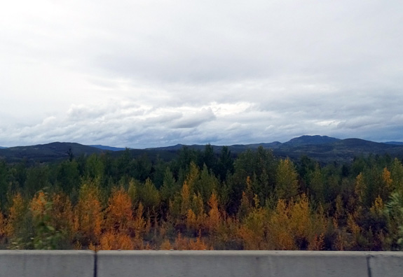
Elevations ranged from 1500+ to 3200+ feet before and at the Continental
Divide. We were mostly above 2,200 feet all day. We drove more east than
south today but there was less fall color than yesterday and very few
patches of red fireweed stems and leaves.
We passed numerous streams and lakes. Marsh Lake south of Whitehorse and
then Teslin Lake are both very long and narrow, with nice views from the
road:
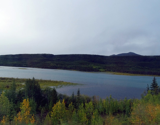
Marsh Lake
Teslin Lake,
approaching the town of Nisutlin from the west
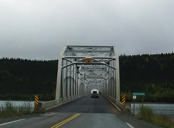
We crossed the long Nisutlin Bay bridge with no incident. At 1,917 feet,
it is the longest water span on the Alaska Hwy.
I've literally
had nightmares about that one since we crossed the very wide bay twice
in 2012:
As we neared the Cassiar Hwy. intersection before Watson Lake the sky
was brighter and it wasn't raining.
It was tempting to turn south and follow our original plan, but we
continued on the Alaska Hwy. because the weather forecast is much
better that way right now. So are road conditions.
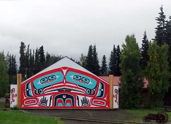
Colorful First Nations motif on a building near
Nisutlin
We plan to go to Banff-Jasper National Parks and Stewart-Hyder another
year, preferably in the fall when the bears are there (the salmon run
late August to early September).
Of course, we said that last time when
we didn't go that direction and we haven't done it yet . . .
BISON CENTRAL
Until this afternoon we've seen zero big wildlife on the Parks,
Richardson, or Alaska highways since we left Denali -- another
disappointment.
But in the section of the highway that dips down into British Columbia
after Watson Lake, then back up to the Yukon border briefly again, and
between the Coal and Smith Rivers in BC, we saw over 100 bison in singles,
pairs, and two herds.
We were forewarned
with diamond-shaped yellow signs with bison silhouettes and this large
electronic sign:
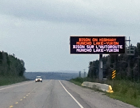
English and French are both official languages in
British Columbia;
just English is official in the Yukon and Alberta.
One herd must have had 70-80 bison in it. We stopped at that one in
several spots so I could take multiple photos.
The bison were just a few feet off the road, presumably because there
was lush green grass nearby for them to graze::
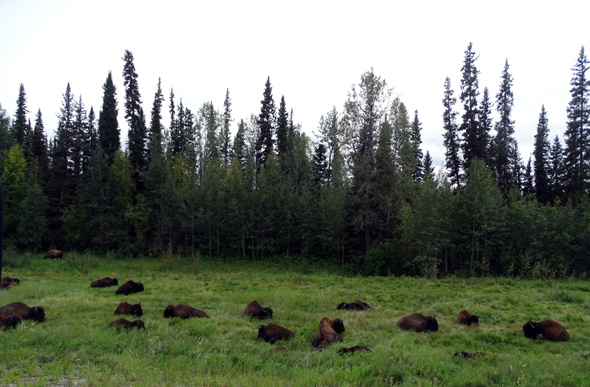
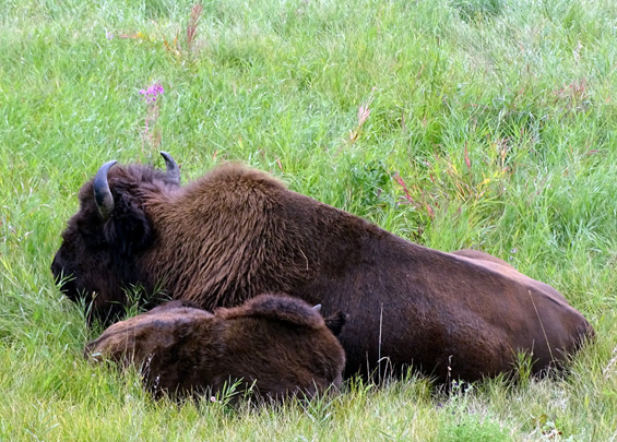
A couple previous times
when we've
passed through this area we've had to stop for one or more bison in the middle
of the roadway. You wouldn't want to hit one of those!
We've also seen stone sheep between Liard Hot Springs and Muncho Lake but didn't see any of those today
-- maybe tomorrow as we continue past the lake.
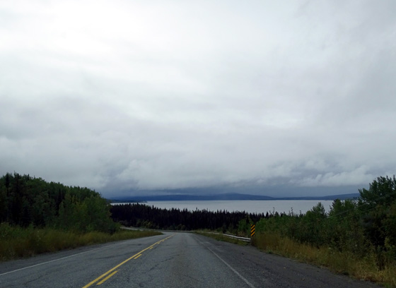
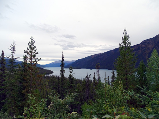
MUNCHO LAKE VIEWPOINT
We have nice views from the north end of Muncho Lake and the surrounding mountains
-- Terminal Range to the south, Sentinel Range to the north --
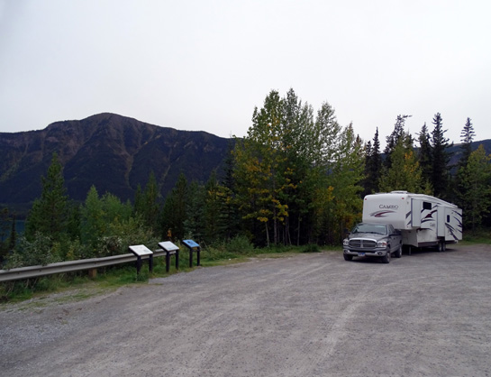
at tonight's boondocking site at Historic MP 463:
The large crushed gravel viewpoint is
off the road far enough to be quieter than most pull-offs.
Some folks have stopped to read the interpretive panels but no one else
has parked to stay overnight. We'd feel safer if someone else was here
(in a nice RV) and just hope no Friday night revelers stop by. [None did;
it was quiet all night.]
We hope to
reach Great Falls, MT on Tuesday -- four more days on the road
-- see what the weather is like (too much smoke from wildfires still?),
and decide how long to stay there.
The plan for tomorrow is to drive to Charlie Lake just north of Fort
St. John, BC and stay at the Rotary Club CG again. It's good to have
electricity, water, and WiFi every other day.
Cody is getting better. He is still wobbly but wants to walk farther and
hasn't fallen down today. He was playful tonight when I got on the floor
with him; he loves to wiggle around on his back and get massaged
along the spine.
Next entry: Muncho Lake to Charlie Lake, BC
Happy trails,
Sue
"Runtrails & Company" - Sue Norwood, Jim O'Neil,
Cody the ultra Lab, and Casey-pup
Previous
Next
© 2015 Sue Norwood and Jim O'Neil
