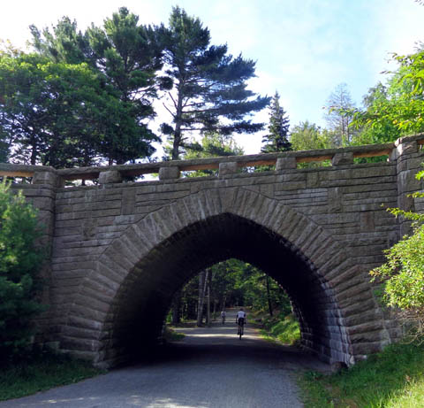
One of John D. Rockefeller, Jr.'s legacies is this beautiful
network of crushed stone carriage roads and picturesque arched rock
bridges. He employed local residents to do the work, then donated the
structures to the national park.Riding the carriage roads on our
bikes gave us the opportunity to see much more of the park than we could
have seen by just driving through it or even hiking. Since we can't run
any more, we can't cover as many miles on foot per day as we used to.
Our bikes give wings to our feet!
All of the public carriage roads are also open to hikers and
runners. Most are open to equestrians. No visitors are allowed on the
carriage roads on private property; those are clearly marked.
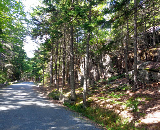
No motorized vehicles are allowed on the carriage roads, which are
smooth and plenty wide enough to meet oncoming trail users:
Bikes are also allowed on the paved park loop road but it isn't
nearly as safe because of all the passenger vehicles, RVs, and tour buses.
Bikes and horses are not allowed on the trails within
the park. Dogs are, however. Many national parks prohibit dogs on
the trails. At Acadia you can hike with your dog on the trails, roads,
and carriage roads.
LET'S GO!
We didn't waste any time exploring Acadia.
The first afternoon (Wednesday) we went to the visitor center, drove
the park loop, and drove up to the summit of Cadillac Mountain. I
covered that in the previous entry.
The second day (Thursday) we both cycled 17 miles on the carriage
roads. Jim did two more rides on them during out weeklong stay, starting
from our campground five miles away and riding some different carriage
roads than I did.
The photos in this entry are ones I took during our first ride. Jim
didn't take any additional photos when he rode solo.
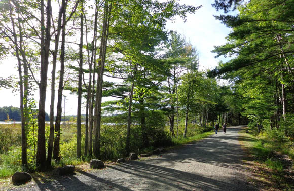
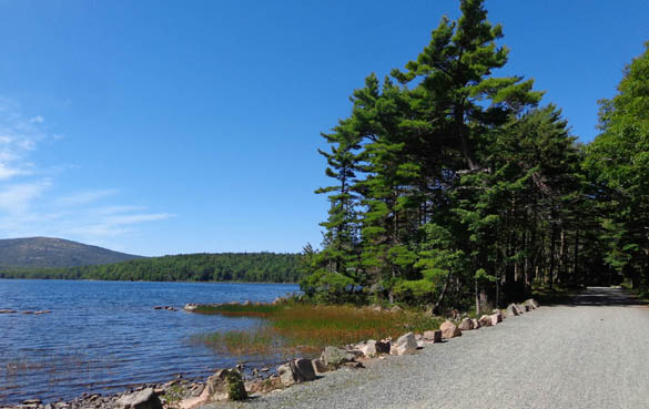
That day we parked the truck at the visitor center and began our ride
there. The trail from the parking lot was the most narrow of any we rode
that day (next photo). It soon widened up to 12 feet or more.
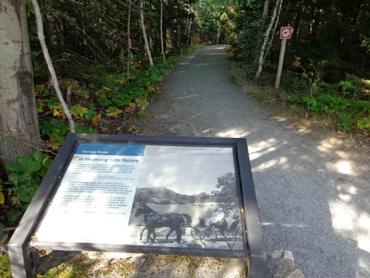
One of many interpretive signs along the carriage
roads
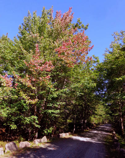
Some of the leaves are starting to change color.
We had detailed maps of all the carriage roads. Without those we
would have probably either gotten lost or covered more miles than we intended.
Road intersections are marked well but most of them don't include a
"You Are Here" type of map. You can
get detailed maps at the visitor center or print them out from the park's
website.
Here's the GPS track of our initial 17-mile ride:
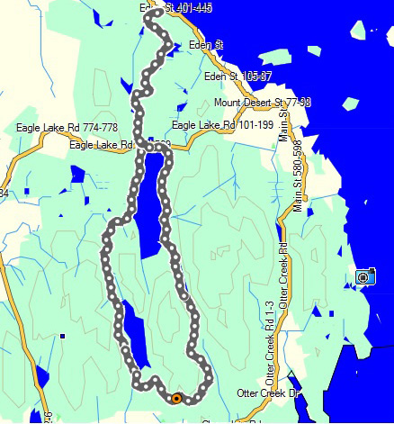
We rode counterclockwise on the loop around the lakes and out-and-back on
the section between the visitor center and the north end of Eagle Lake.
I highlighted our approximate route on this map of the main part of the park:
We figured the most scenic route for the distance we
wanted to ride would be the trails closest to Eagle Lake and
Jordan Pond. There were scenic indeed, especially the northern end of Eagle Lake.
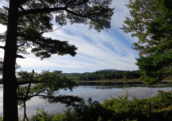
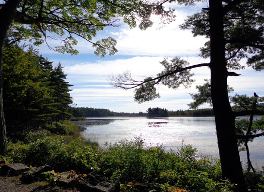
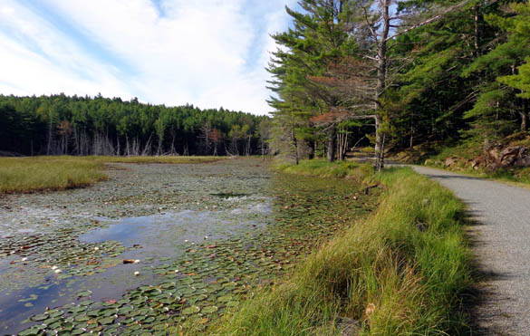
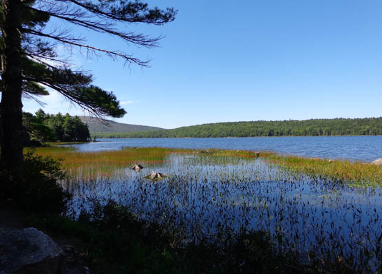
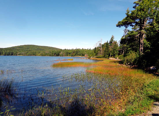
We also passed by several smaller lakes and wetlands:

This route is fairly hilly but not killer on a mountain bike or
hybrid. The rolling terrain was more interesting to us than most flat rail trails we've
ridden.
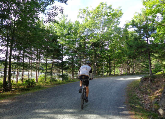
The carriage roads are smooth, well-packed crushed stone so traction
wasn't an issue for us. I ride a Specialized TriCross cyclocross bike, which is a hybrid
of a road and mountain bike. Sometimes I have traction problems with
rocks, sand, or mud but these carriage roads are perfect for this type
of bike. Jim had no problems riding them with his Specialized Stump Jumper, a pure MTB.
One of the longer ascents going
CW is the loop southeast of Jordan Pond. It wasn't steep, though.
I don't know if the carriage roads are suitable for skinny-tire
road bikes -- perhaps one with tougher tires than normal would be
OK. I do know I couldn't ride my Terry Isis road bike here.
The scenery was constantly changing and always interesting. I took a
lot of pictures, some while riding my bike and some while stopped
briefly:
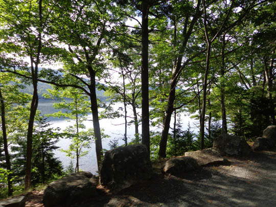
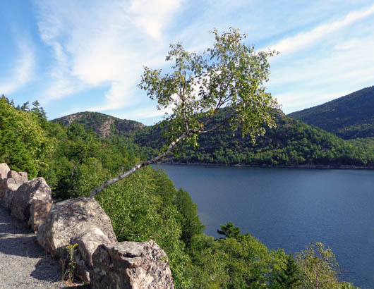
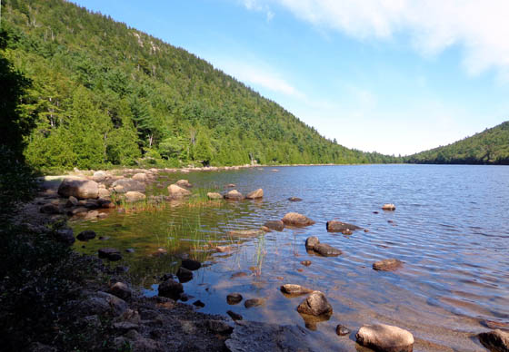
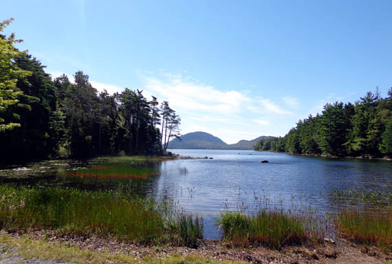
Above and below: west side
of Eagle Lake

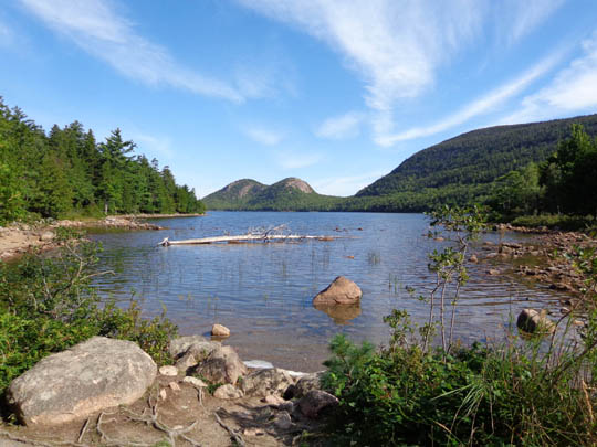
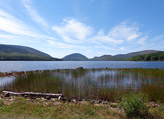
Above and below: Jordan Pond
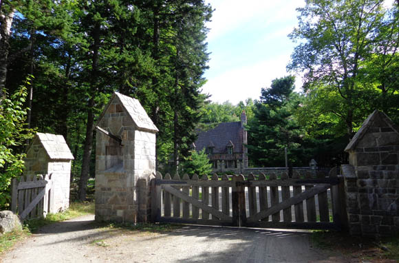
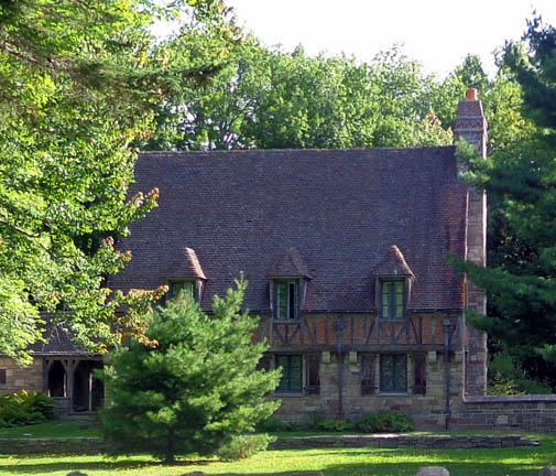
Above and below: Gate House at southern end
of Jordan Pond
About three-fourths of the way through our loop we took a scenic lunch break
at the end of Bubble Pond, then rode right next to the shore as we
continued heading north to Eagle Lake and the visitor center:
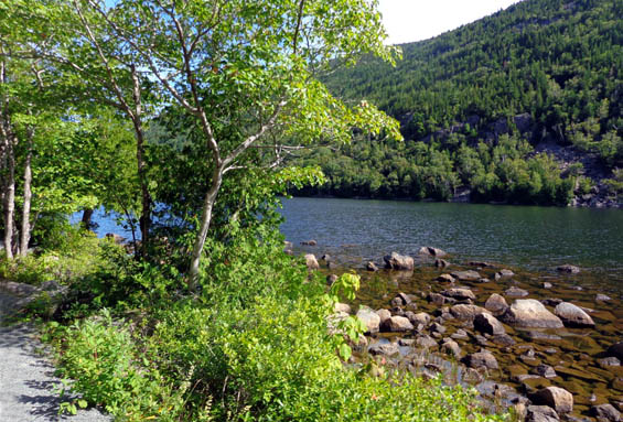
The next photos are from the northeastern and northern end of Eagle
Lake, which was just gorgeous on this sunny day:
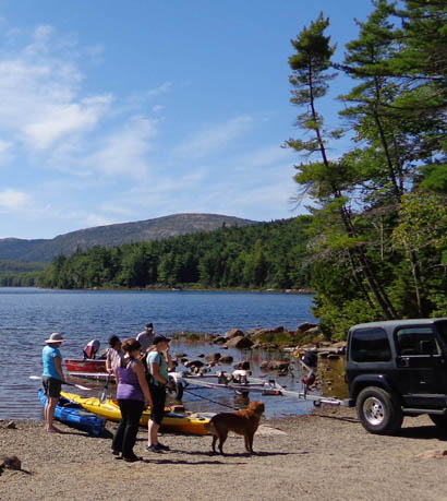
Folks preparing to kayak on Eagle
Lake
We saw a lot of people cycling, hiking, and running on the carriage
roads all three times we rode them. It's a great way to see more of the park!
Next entry: hiking the trails within the park is an even
better way for me to see the details. I'll show you photos from my
Cadillac Mountain hike first, then even more beautiful scenes from two
coastal walks.
Happy trails,
Sue
"Runtrails & Company" - Sue Norwood, Jim O'Neil,
Cody the ultra Lab, and Casey-pup
Previous
Next
© 2014 Sue Norwood and Jim O'Neil
