That mountain is named Cadillac, and of course we had to go to its
summit. That's how we're wired.This is one of the easiest mountains
to summit, however. Anyone in a vehicle can do it by road. If you're
more athletic you can ride a bike on the same winding road to the top or hike up
one of several trails. The elevation at the top is just 1,550 feet.
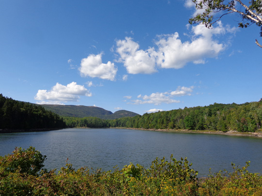
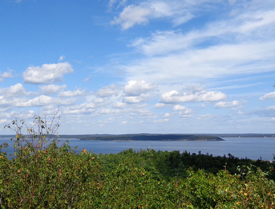
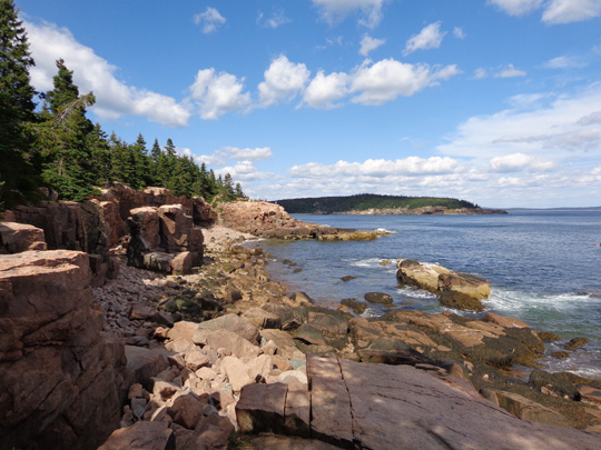
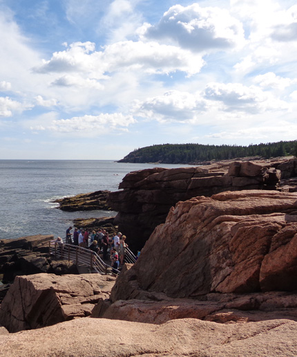
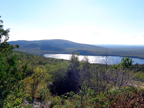
Partial view of Cadillac Mountain
from Otter Cove
On our first afternoon on Mount Desert Island we drove around the park loop road
and to the top of Cadillac Mountain to see the views. Later we learned
how popular it is to drive up the mountain to see the sun set. A couple
days later we did that and, once again, we were surprised by how many
other people were up there.
It's September, for goodness sake! Shouldn't all the other
tourists be home by now?? (They were probably thinking the same
thing about us.)
That was the same day I hiked up and back on the southern trail
approach to the summit. If we'd been here longer I probably would have
hiked up one of the other trails, too. Instead, I hiked twice along the
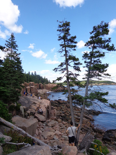
rugged coast so I could see the rocks, trees, and water at closer range.
We also cycled all over the island on the dirt carriage roads. I'll
have entries about those rides and my coastal and mountain hikes in
subsequent entries. This one features panoramas from Cadillac
Mountain the two times we drove up there, as well as other views along
the park roads and from overlooks.
In other words, you can enjoy all the scenes on this page --
and many more -- from a passenger vehicle with very little
walking.
SCENES FROM THE PARK LOOP ROAD
Here's a map of the main part of Acadia NP from the park's website.
To view it larger, click on the "View Park Map" link on the
homepage.
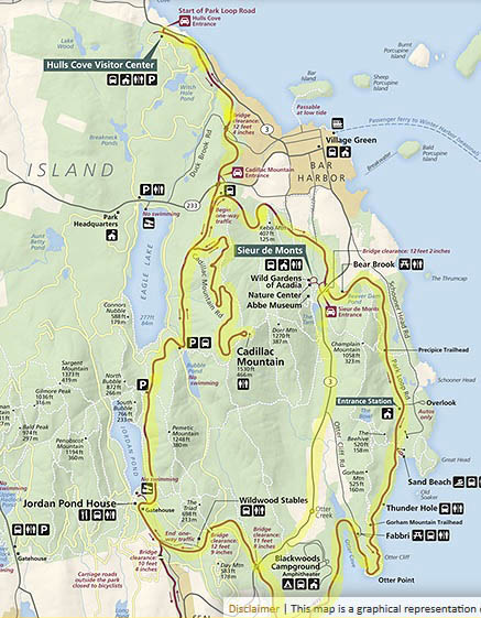
I highlighted the roads we drove in the main area of the park,
including the serpentine road up to the summit of Cadillac Mountain. The
photos on this page are from that loop and the mountain.
A faster way to reach some parts of the park and the rest of Mount
Desert Island is ME 3 inside the eastern part of the loop, also
highlighted. I parked along that road, for example, when I hiked up the
south side of Cadillac Mountain. Although you can't see the coast from
ME 3 you are closer to Cadillac Mountain on that road.
I've just mentioned Cadillac Mountain so far. Note that there are
other scenic, but shorter, mountains in the park. You'll see some of
them in the photos in this series.
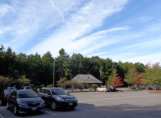
HULLS COVE VISITOR CENTER
The best place to begin a visit to Acadia National Park is its
spacious visitor center located at the north end of the park.
You can gather brochures and maps, look at a large relief map of the
park, get information about the carriage and hiking trails, learn about
the local history, culture, flora, and fauna, and figure out how you
want to spend however much time you have in the area.
Path and steps to visitor center
are behind the roofed kiosk in the background.
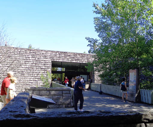
Main entrance to visitor center
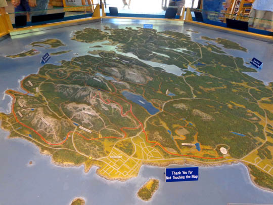
Large relief map of Mount Desert
Island; the park covers most of the island.
The main parking area is located well below the visitor center; a
paved path with steps leads to the entrance. If you're unable to
negotiate steps you can drive up the hill to another entrance for handicapped
visitors.
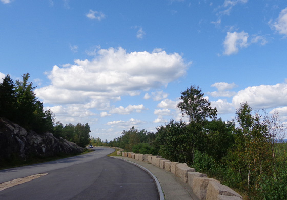
PARK LOOP ROAD
One reason to get a park map before embarking on any road trips, cycling
tours, or trail hikes is to determine where the park road is one-way. Most
of the eastern and southern side of the park loop is one-way CCW. The western
side of the loop and Cadillac Mountain Road are two-way.
The loop road is paved and can accommodate large RVs and tour buses.
There are overlooks and great views all around this loop, including the
ones below:
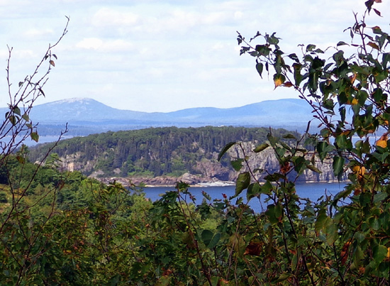
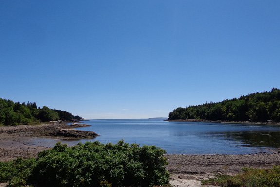
Otter Cove
I'll show more coastal views in the next section.
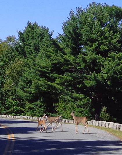
The best advice I can give you re: driving the park loop
road is to drive slowly so you can see more (and avoid hitting cyclists,
or wildlife like the deer in the middle of the road, below) and get there
very early if you want to enjoy super-popular venues like Sand Beach and
Thunder Hole.
Parking lots and overlooks in popular areas along the loop fill
up quickly. When we did our first loop drive the day we arrived on the island
we couldn't believe how many people were out there on a weekday afternoon.
That day we were unable to park in some places where we were hunting for
trailheads, like the Jordan Pond House area, and in a few other locations
such as Sand Beach where I wanted to take photos.
We did, however, score a parking spot fairly close to Thunder Hole and
had a short walk there to see some of the beautiful coastline in that area.
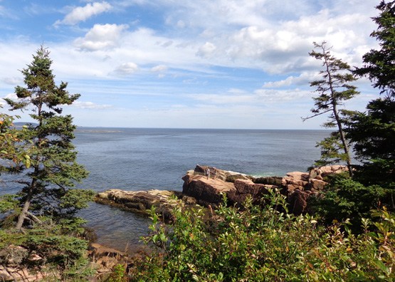
COASTAL SCENES NEAR THUNDER HOLE
We enjoyed the rocky cliff views from the loop road but it's even better
to get out of your vehicle and walk down to the rocks where you can see
more and be able to take better pictures.
The coastline near Thunder Hole in the SE part of the park is one of the
best places to do this. Unfortunately, it's also crowded on pretty days.
Despite that, I was able to get some good photos that first day:
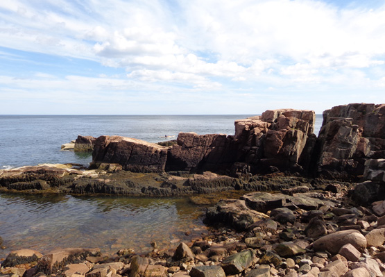
The granite along the Maine coastline is pretty resistant to the
relentless onslaught of the Atlantic waves but large blocks of
rock sometimes break loose to create rectangular chasms.
Thunder Hole is a large, partly submerged crevice with vertical
granite walls, one of many chasms along this shore. When waves roll into
Thunder Hole, especially when the tide is rising, air in the hole is
compressed and sometimes makes a sound like thunder.
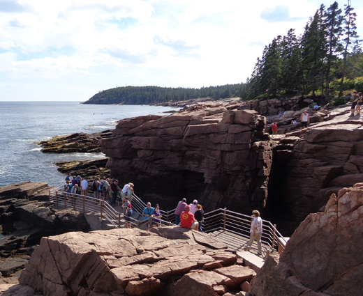
You have to be there at the right time to feel and hear the thunder sound,
though. All I heard the two times I stood above the hole was
sloshing and gurgling but I was mostly interested in the views anyway.
In another entry I'll show more photos from this area from a hike I did
several days later -- early in the morning before it got crowded.
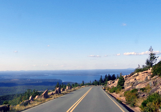
CADILLAC MOUNTAIN SCENES
The winding road to the top of Cadillac Mountain affords great views to
the west and south to Ethan Pond, Eagle Lake, and the surrounding mountains
that were rounded and polished by glaciers many thousands of years ago.
Cadillac Mountain Road is wide enough, and the parking area on
the summit large enough, to accommodate RVs of any size. Tour buses go up
there, too. The grade isn't steep.
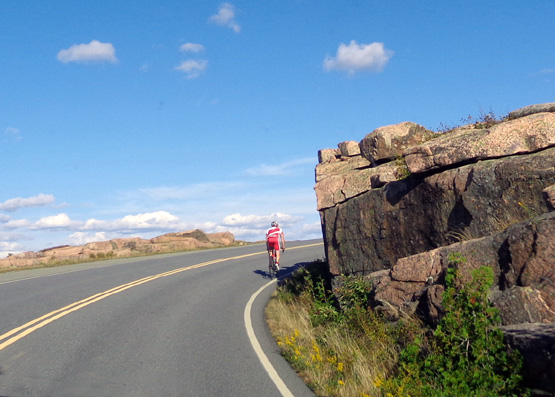
Cyclist riding up Cadillac Mtn. Rd.
Looking down at Eagle Lake
View to the east from an overlook
on the way up the mountain
View of lakes on the descent
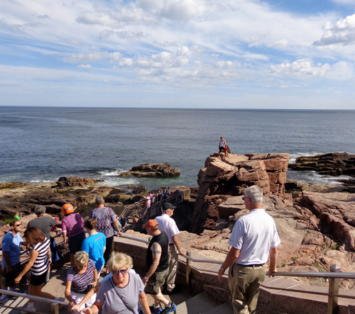
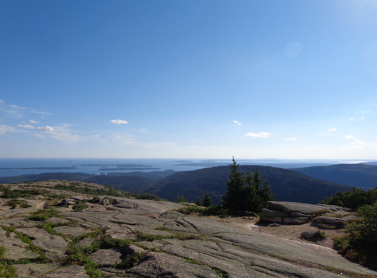
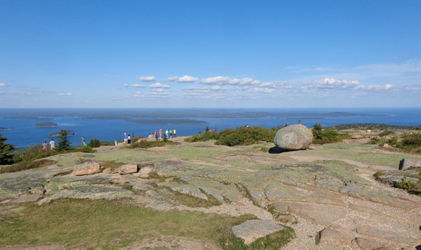
The panoramic views from the summit are even better. Paved paths
with interpretive signs allow visitors to see water, coves, islands,
and mountains in every direction -- as far away as Mt. Katahdin
in northern Maine.
It's also easy to walk on the smooth granite bedrock.
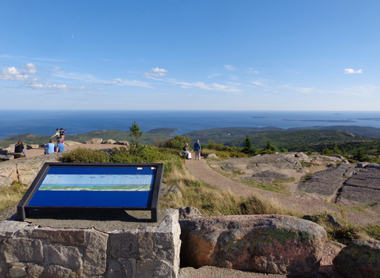
This interpretive panel identifies the highest
mountains in the distance.
View south to Otter Cove; I showed a
roadside photo of the cove above.
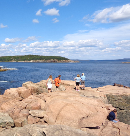
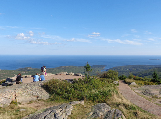
That first afternoon we walked all over the summit to get a
360-degree perspective of the park and surrounding terrain. I
spent even more time up there on my hike to the summit two days later.
It's fun from the summit to watch the teensy-looking boats come
and go from Bar Harbor:
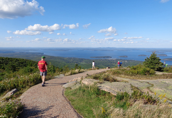
Walking to an overlook above Bar Harbor
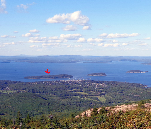
I mentioned in the last entry that you can walk to Bar Island from Bar Harbor
on a wide sandbar when the tide is out. We did that after seeing the island
look like a real island from this vantage point on Cadillac Mountain. I
marked Bar Island with a red arrow.
Somewhere in the back ground of that photo is Mt. Katahdin, which has special
relevance to us. It's where we finished our Appalachian Trail Adventure
Run-Hike nine years ago.
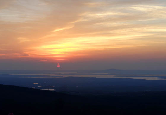
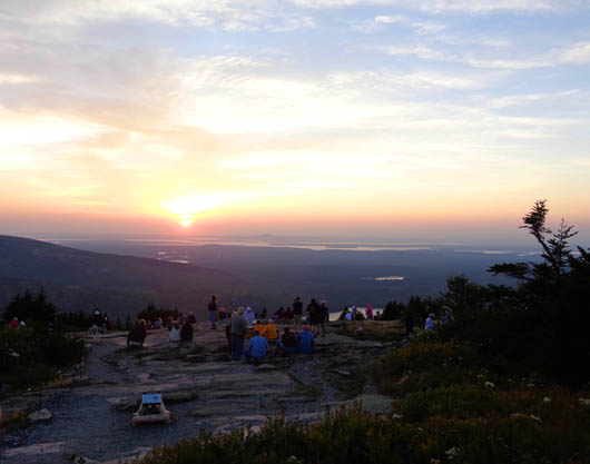
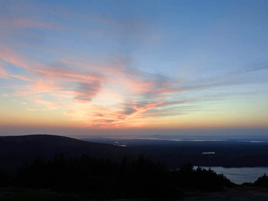
SUNSET FROM CADILLAC MOUNTAIN
The day I hiked to the summit of Cadillac we both drove back after an
early supper to watch the sun set from a high overlook on the western side
of the mountain.
We knew where we wanted to go because we'd already driven up there. We also
knew we'd have lots of company so we got there early enough to get a good
parking spot. Once again we were amazed at the number of people around us.
This is just a few of them:
Jim and the dogs were able to see the sunset from the truck,
where it was warm and comfy.
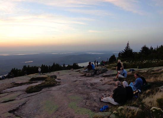
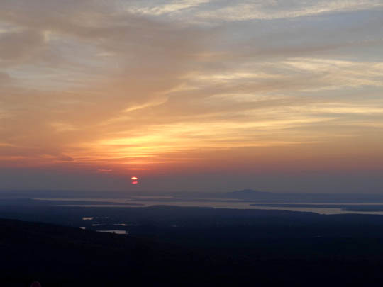
In order to take pictures I walked a little way down the rocky
slope where most other observers were watching the sun as it sank lower
and lower over the lakes in the valley below. It was chilly and very windy
so I stood in an area that was more sheltered by trees.
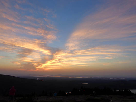
As I walked back to the truck I could see the full moon rising:
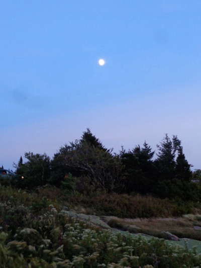
That was interesting but we decided the sunsets were just as nice at
Hadley Point, a quarter mile from our campground. Hardly anyone else goes
there and the colors are very pretty reflected in the water.
A DON'T-MISS NATIONAL PARK
Acadia National Park is gorgeous and we have thoroughly enjoyed
our week here. If you haven't been to Acadia, go, even if you
have just a day or two to spend in the area.
This was Jim's first time visiting the park. It may as well have
been mine, too, because the first time I was there was right after the
Boston Marathon in April, 1986. It was so foggy my ex and I couldn't
even see Cadillac Mountain!
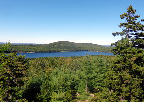
View of Eagle Lake from the park loop road
This time Jim and I had near-perfect weather for a week and we were able
to spend every day outside, enjoying it. I hope we'll be able to return
again in a few years.
Next entry: cycling Acadia's extensive network of
carriage trails
Happy trails,
Sue
"Runtrails & Company" - Sue Norwood, Jim O'Neil,
Cody the ultra Lab, and Casey-pup
Previous
Next
© 2014 Sue Norwood and Jim O'Neil
