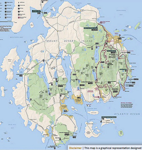
When you look at this map of Mount Desert Island from the Acadia
National Park
website you can see that the park covers
half or more of the island's 108 square miles:
Although we spent most of our time during our week's stay on the
island in the national park, we
were also curious about the rest of the island. We knew there were
several scenic coastal towns like Bar Harbor, lots of lakes and a large fjard
(not a misspelling), a lighthouse, and probably some other interesting
things to see and do.
Indeed there are. In this entry I'm including a variety of photos I
took on two driving tours of the island.
The first time was after a morning of hiking on Cadillac Mountain in
the national park; I took the long way home and explored part of
the eastern side of the island.
I enjoyed it so much that I wanted to show it to Jim the next day.
He saw how little traffic there is once you get away from Bar Harbor or
the park and decided to include some of the little rural roads in one of
his long bike rides.
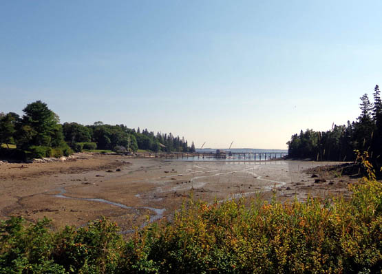
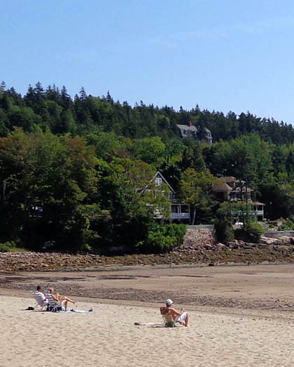
A cove at low tide
Long story short, we loved Mount Desert Island, particularly the
park, the quiet and scenic rural areas, and the little coastal towns other
than Bar Harbor. That town is too crowded and too much of a tourist trap for us but we can
certainly see why the island is so popular with tourists and the people who
can afford to own houses there.
SEAL HARBOR & NORTHWEST HARBOR
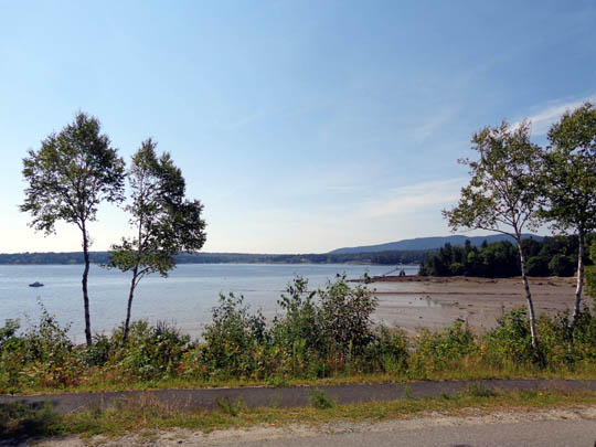
The first time I explored the island west of the national park I
followed Rt. 3 to nearby Seal Harbor and Northeast Harbor, two small
coastal towns at the southern end of Mount Desert Island:
Above and below: Seal Harbor at low tide
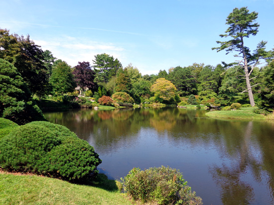
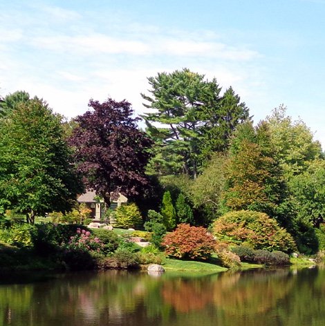
I took photos of an azalea garden with a beautifully landscaped pond on
the way into Northeast Harbor . . .
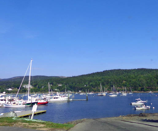
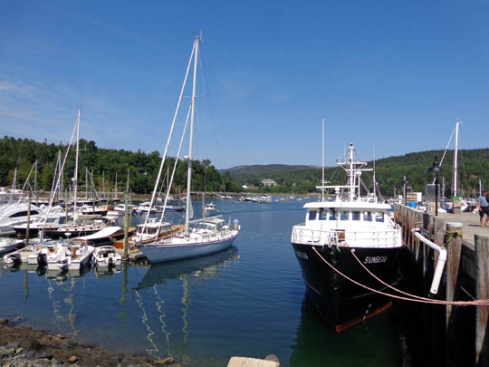
. . . and parked at the marina so I could take pictures there, too:
I was impressed with the
colorful flowers at two homes near Northwest Harbor:
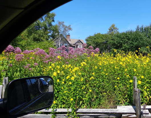
No place to
park in front of this house, so I took a picture from inside the truck.
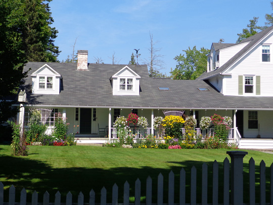
There are a lot of very nicely
landscaped yards on Mount Desert Island.
The next day I took Jim with me on
a drive around the island so I could show him some of the interesting
things I'd seen. In the town of Pretty Marsh we saw a house with lots of
beautiful impatiens in bloom across the length of the front yard.
Later, when Jim did a long bike
ride, he saw the owner of the house outside, tending the flowers. Jim
stopped to talk with him for several minutes.
The man was pleased to hear how much we enjoyed his yard.
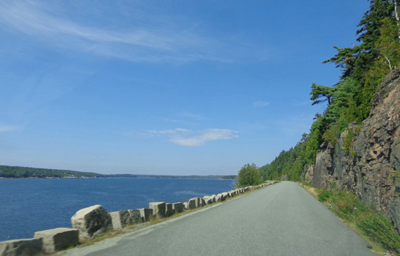
SOMES SOUND
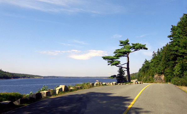
On my solo drive through the middle of the island I followed Sergeant
Drive north of the town of Northeast Harbor.
It hugs the shore of Somes Sound, which is described as the only
fjord on the east coast. More accurately, it is a fjard, a
protected "drowned bay." We know about fjords but we'd never heard of a
fjard before. This is a scenic one on a sunny day:
When I took Jim there the next day the sky was overcast
but he could still see how beautiful it is.
Maps and signs warn drivers that this road is for
passenger vehicles only because it becomes quite narrow. As you can see
in the next picture, there isn't anywhere to go if one vehicle is too
big. Don't drive an RV here.
Between a rock wall and . . .
more rocks!
When Jim and I were exploring the island together we also drove a
loop through the western half of Mount Desert Island.
We drove around the northern end of Somes Sound and followed ME 102
past Echo Lake through another part of Acadia NP. Below the town of
Southwest Harbor we took a scenic loop past the Seawall Campground (also
part of the park) and over to the Bass Harbor Head Lighthouse.
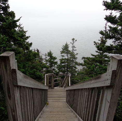
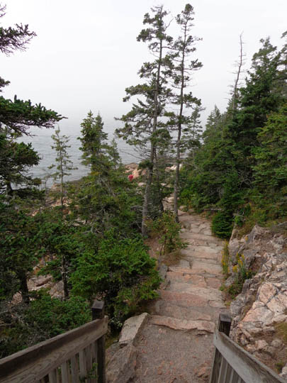
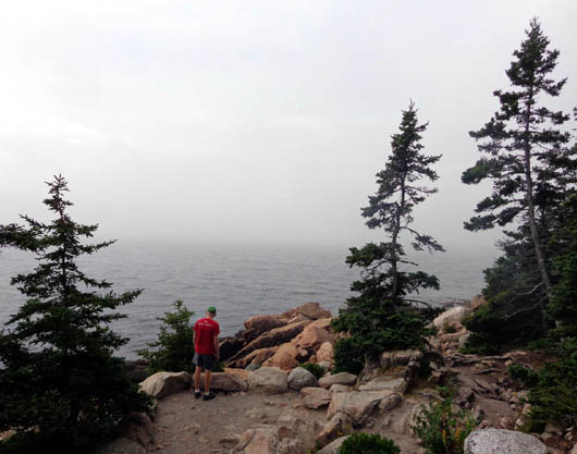
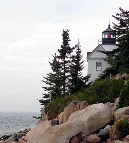
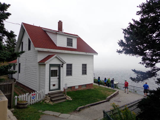
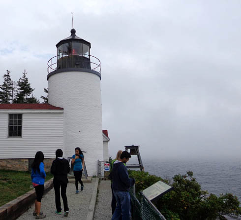
BASS HARBOR HEAD LIGHTHOUSE
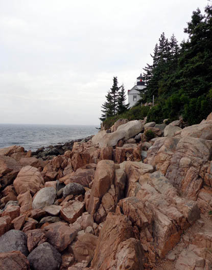
We did some hiking at this interesting lighthouse, which is also on
national park property. You can follow paths in two directions from the
parking lot.
We walked first on a forest path at the far end of the parking lot to
a steep embankment with steps down about 200 feet to the rocky coast,
where we could get a glimpse of the lighthouse from below. It was so
foggy it was hard to see where the ocean met the sky but we were
still able to see the lighthouse in the distance:
Note the red light:
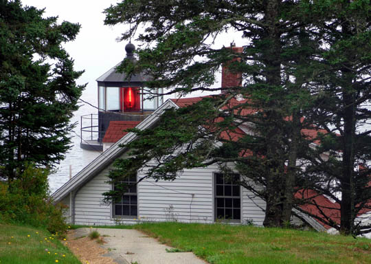
We walked back up the steps to the parking area and
followed a paved path past some interpretive panels describing the
history of the lighthouse, which has stood in this location since 1858.
The red light was electrified in 1949 and automated in 1974:
After leaving the lighthouse we continued our CCW loop
around the far western side of the island through non-park land past
Seal Cove, Seal Cove Pond, the town of Pretty Marsh, and back to our
campground on the north end of the island.
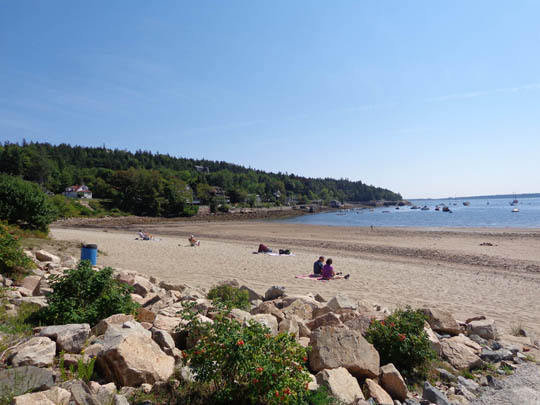
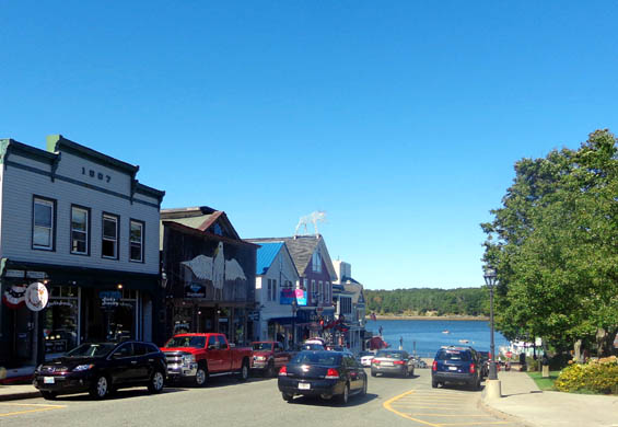
BAR HARBOR
Just about everyone has heard of Bar Harbor, pronounced without the
r's by many New England natives. It has some beautiful houses, lots
of unique shops and restaurants, and a beautiful harbor.
It's also very crowded, even in September. Good luck finding a place
to park near any of the destinations visitors are interested in. That's
the main reason we spent very little time there. We did, however, enjoy
the views from the water and walking out on the sand bar to Bar Island
at low tide.
Here are a few shots I took when we were in town:
If you look squint you can see a
large metal wire moose on the roof of one of the shops.
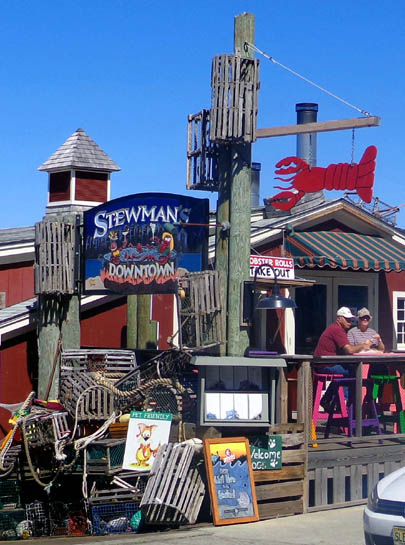
One of many seafood restaurants
in town; we ate at another one but
I liked the outside decor here
with the lobster traps, ropes, etc.
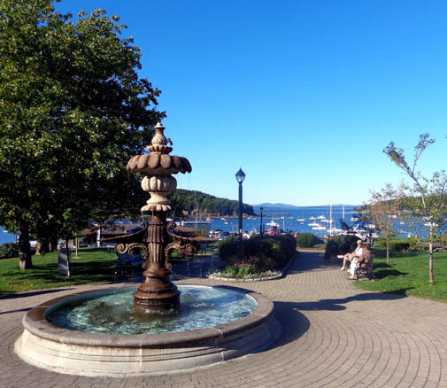
Pretty park above the harbor
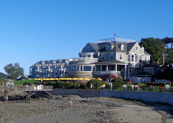
Bar Harbor Inn at low tide; water
is up to the wall when the tide is high.
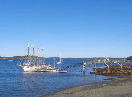
The four-masted schooner Margaret
Todd docks at the end of the pier
in front of the inn; I'll have
another entry re: our cruise on the boat.
There are several small islands in the water to the north and east of
Bar Harbor.
The closest, Bar Island, becomes accessible on foot during low tide.
It was fascinating to see the island surrounded by water when we were
looking down at it from the summit of Cadillac Mountain, then be able to
walk to it at low tide one day:
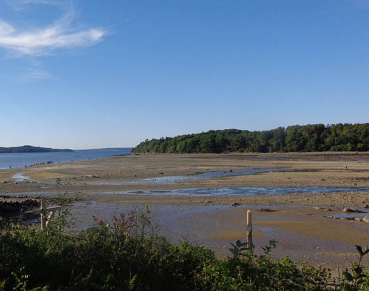
Above and below: a couple
hours earlier, this was covered with water.
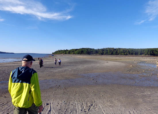
We didn't take the time this trip to walk all the way over to Bar
Island to hike its paths. Maybe next time . . .
Just about everyone can find something of interest to see and do on
Mount Desert Island in addition to the obvious tourist stops of Bar
Harbor and Acadia National Park. I encourage other visitors to take some
time to explore the whole island.
Our main goal during our visit was to explore the national park,
however, so most of the remaining entries and photos of this area will
be from Acadia.
Next entry: scenes from the road in Acadia National
Park, including daytime and sunset views from the summit of Cadillac Mountain
Happy trails,
Sue
"Runtrails & Company" - Sue Norwood, Jim O'Neil,
Cody the ultra Lab, and Casey-pup
Previous
Next
© 2014 Sue Norwood and Jim O'Neil
