We've explored only a little bit of massive Adirondack Park around the
Whiteface Mountain and Lake Placid area and we're impressed with its
beauty and the range of possible activities throughout the year.We're
glad our first visit to this area was during peak autumn leaf season. I
can't imagine the place could be any prettier in any other season.
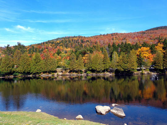
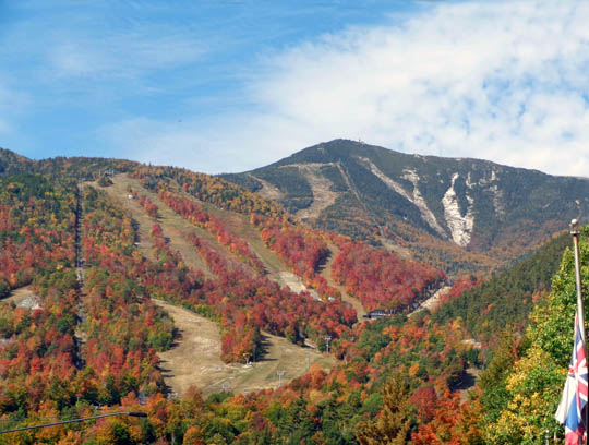
Colorful scene from Forest Rd. 72 near Whiteface Mountain
This entry focuses on photos I've taken while driving around on
several different days to several different locations. I'll do my best
to describe their locations. I don't think there are any bad
views around here, so if you're ever in this area in the fall, just get
out and drive. You'll see plenty of fall color everywhere.
DRIVING THE WHITEFACE MEMORIAL HIGHWAY
Two days ago I hiked up the north side of Whiteface Mountain
on a gnarly trail and had the place practically to myself, including 20+
minutes alone on the summit. The toll road was closed for repairs that
day and the Atmospheric Sciences Research Center's observatory on the
summit was also closed.
The scenery was so spectacular that I wanted to share it with Jim. I
knew he'd enjoy the views, as well as the exhibits and equipment in the
observatory. Since the
toll road and observatory were open
this weekend, and it was another beautiful sunny day today, we decided
to drive to the summit.
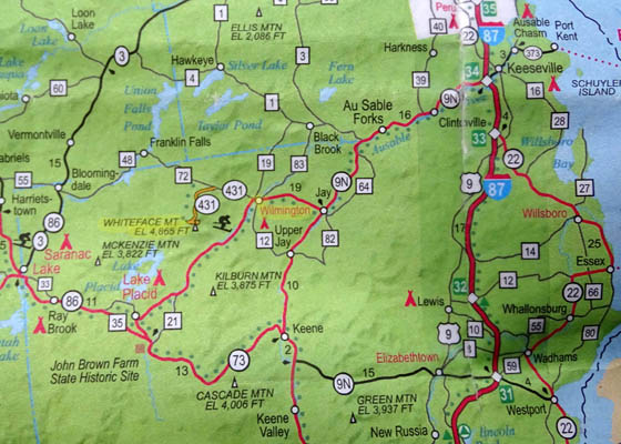
Here's a map of the area again. The road to the summit is part of NY
431:
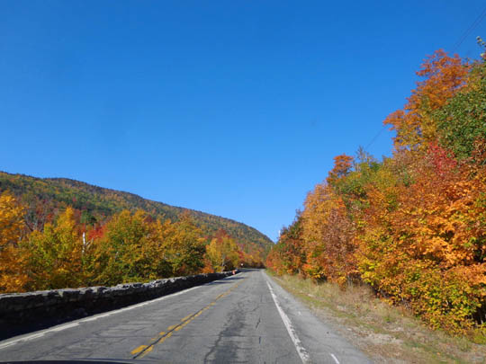
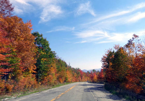
Hwy. 431 before the turn to Whiteface Mtn.
We had been advised by the campground owners that we'd have plenty of
company on the mountain today so we got to the toll booth as soon as it
opened at 9 AM.
That advice was spot on. The person who took our fee said a record
number of people drove up the mountain yesterday, and at least as many
were expected today. When we came back down at 11:30 AM there was a very
long line to get in.
People had to wait until enough other visitors came back down before
more were allowed up. Parking at the summit is rather limited.
More haze in the valley today but the colors
were still very pretty
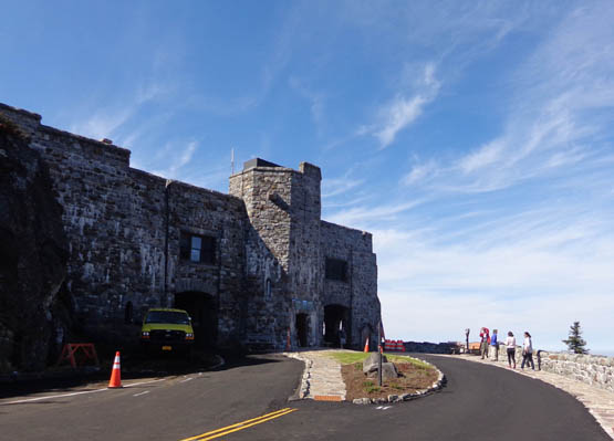
The "Castle"
The road is about five miles long from the toll booth to the "Castle,"
the elaborate rock building 300 feet below the summit. It houses a cafe,
gift shop, and restrooms.
About 200 feet below the castle is a long tunnel leading to an elevator
that takes visitors up to the summit. There is a second option. We
walked up the steep, rough rock "trail" (with some handrails) to the
summit buildings and descended via the elevator so it was easier on our
knees. The tunnel and elevator were bored through solid billion-year-old
granite back in the 1920s.
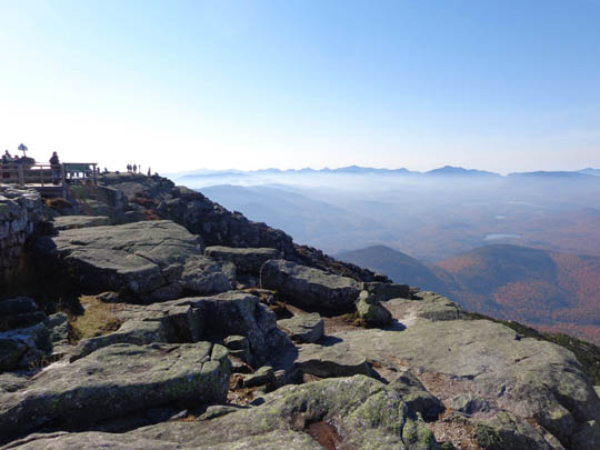
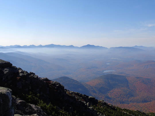
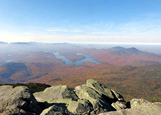
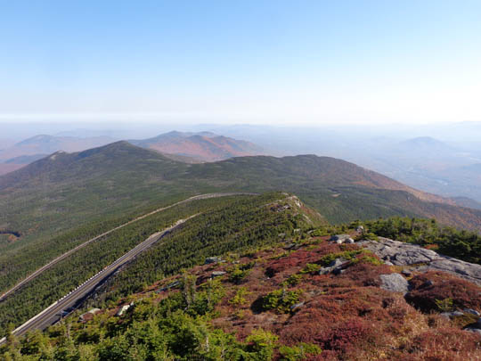
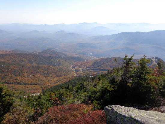
Here are three views
looking back down as we ascended the rock trail to the summit:
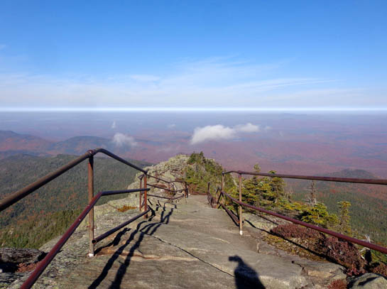
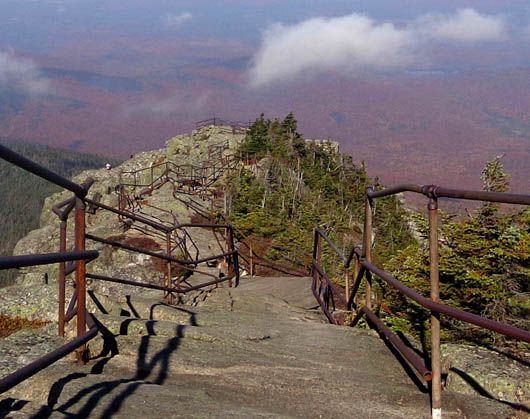
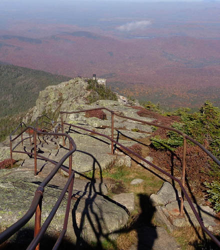
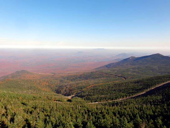
Today was more hazy in the valleys than it was when I was on the summit
Friday. The red leaves below weren't as vibrant and it was more
difficult to see the lakes but the haze made the surrounding mountains look
interesting:
After having the summit all to myself on Friday it was odd to see so
many people up there today. Jim really enjoyed the views, the
observatory, and the experience -- so did I -- making it
well worth the $17 fee ($10 per vehicle and driver, $7 per each
additional passenger).
Before driving back down we ate lunch in the cafe. Although it was
rather pricey the food was delicious. Jim had a turkey sandwich
with apple slices, tomato, etc. and I had a vegetarian Mediterranean
crepe with feta cheese. Both came with a much better salad than most
restaurants serve.
This is the tunnel to
the elevator we took to go back down to the parking lot near the Castle
:
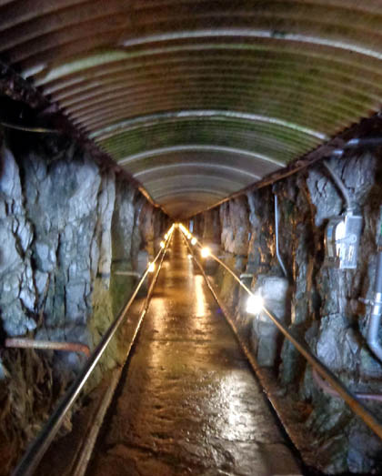
That was literally "cool."
We saw several cyclists riding their bikes up and down the toll road to
Whiteface:
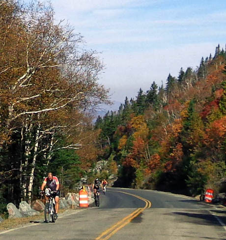
Jim talked to one of the riders when we first got up there. He probably
would not have ridden that road even if he hadn't been resting up for,
or recovering from, his bike race in Vermont because there isn't much if
any shoulder.
After passing through the toll booth at the end of the Whiteface Road Jim
pulled over so I could take pictures of scenic but small Lake Stephens
:
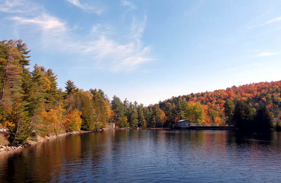
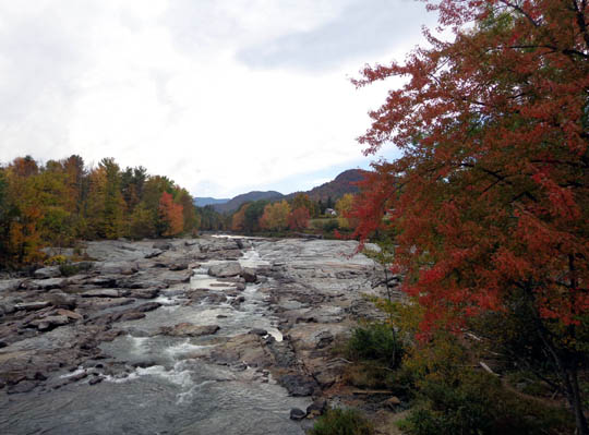
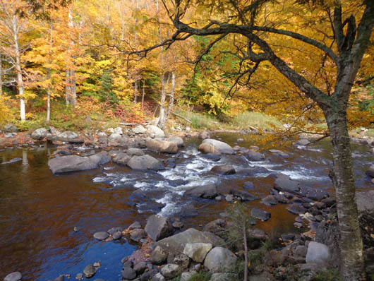
FOREST ROAD 72
After we came down Whiteface Mountain we turned left on FR 72 and drove
about five miles west through beautiful autumn colors to Franklin Falls.
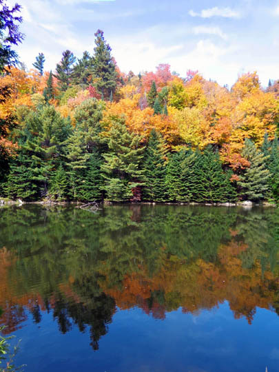
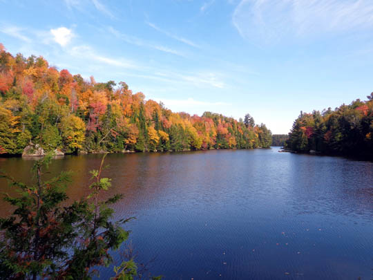
We didn't drive far enough to see any falls but enjoyed picturesque Union Falls Pond and
another pretty blue lake:
JAY COVERED BRIDGE
One day we drove a little loop from Wilmington to Jay
and Upper Jay and back through the scenic Au Sable River Valley. The
little towns of Jay and Upper Jay were founded in the late 1790s. Early
settlers were attracted to the fertile river valley, vast forests,
abundant water power, and iron ore deposits in the area.
The original Jay covered bridge was destroyed by severe
flooding of the Au Sable River in 1856. It was rebuilt the next year and
is the only remaining Howe Truss Bridge in Adirondack Park:
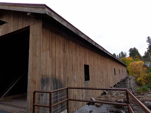
View from bridge
Today the bridge is open only to pedestrian traffic.
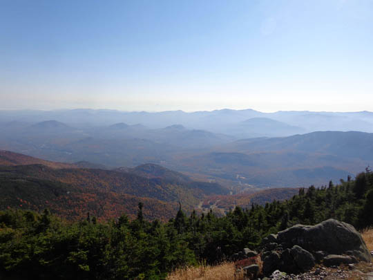
SCENES ALONG NY 86
This scenic highway runs south from Wilmington to Lake
Placid and west to the towns of Lake Saranac and Paul Smiths. I took
photos in the section between Wilmington and Lake Placid on several
occasions when accessing trail heads and driving to Jim's bike race in Vermont.
On clear days there are great views from the road and
pull-offs of Whiteface Mountain, the ski area, and streams:
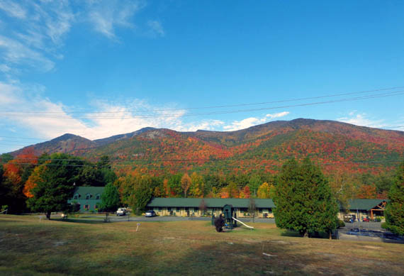
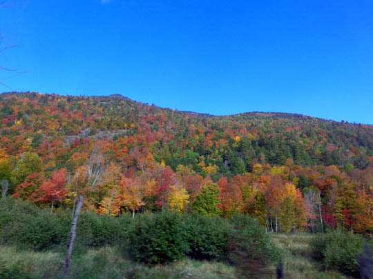
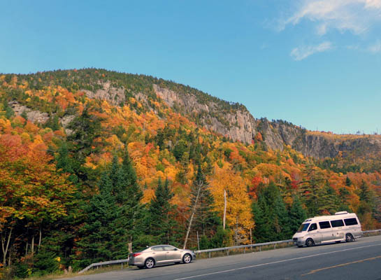
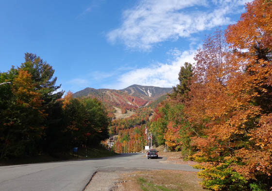
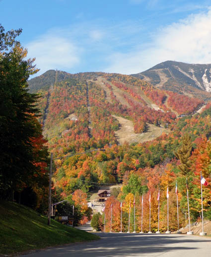
Pretty, huh?
In the next entry I'll show photos from three hikes I did in this area.
Happy trails,
Sue
"Runtrails & Company" - Sue Norwood, Jim O'Neil,
Cody the ultra Lab, and Casey-pup
Previous
Next
© 2014 Sue Norwood and Jim O'Neil
