At 4,867 feet, Whiteface is one of the Adirondack 46 High Peaks,
mountains ranging in elevation from just below 4,000 feet to 5,344 feet
in elevation. You can read all about the ADK 46er club
here. Its
purpose is similar to the
AMC's 4,000-Footer Club in the White
Mountains of New Hampshire, where 48 peaks top 4,000 feet. It is the
goal of many hikers, particularly those who live in or close to these
states, to climb all of these peaks either during their lifetime or
within a certain period of time.
That wasn't on my mind when I decided to climb Whiteface Mountain
today. Whiteface is the only Adirondack 46er I climbed while in the
area. I simply chose it because of the panoramic views from the summit and its
close proximity to our campground in Wilmington, NY:
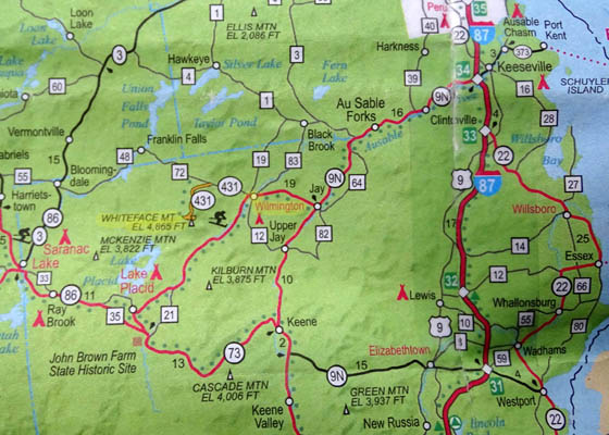
AAA map section
Also note the proximity of Whiteface Mountain to Lake Placid,
site of the 1964 Winter Olympics. I saw remnants of ski lifts and runs
on the eastern side of the mountain as I climbed it.
THERE ARE EASIER WAYS UP THIS MOUNTAIN . . .
. . . than hiking up about 3,000 feet on one of its trails.
You can pay $16 to drive a motorized vehicle up the paved road to the
parking area 300 feet below the summit, then take an elevator --
or short, steep rocky path -- to the top. We did that, too, so
Jim could see the amazing views from the summit.
But first I hiked up there on what is described as the primary trail
of four paths that lead to the summit. It's not an easy trail and I saw very
few other hikers.
I liked the solitude. The trail below tree line, not so much. It was
very rough and had few views.
Usually on a pretty day like today there would be hoards of people
driving up the road and milling around the summit.
Right now,
however, the road is open only on the weekends due to road construction so I had the mountain
mostly to myself on this weekday -- and the crews who are repairing
the road. More about them later.
I'm going to go into some detail about this hike so others will know
what they're getting into. I have enough photos to divide the entry into
two pages. If you don't want to read everything feel free to just scan the photos.
LET'S GO!
Today was beautiful -- mostly sunny, some morning fog and clouds
clearing up before noon, warm (mid-70s F.), minimal breeze.
Since Jim has a
bike race tomorrow he opted out of this hike (wise move). I hiked
solo. Although I didn't know the poor condition of the trail I chose, I
did know the ascent and descent would be too long for 11-year-old Cody
and too hard for me to hike with rambunctious young Casey.
Jim dropped me off at the trailhead at the Atmospheric Sciences Research
Center off Hwy. 431 and I began hiking at 8:10 AM:
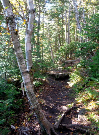
The trail was smooth for about one-third mile as it dipped to the lowest
point at 1,896 feet,
then rose over the next four miles to 4,867 feet at the summit. I
reached the summit about 11:30 = over three hours to hike only four
miles. I took a lot of pictures but didn't take any long breaks.
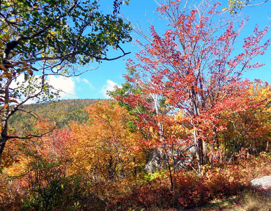
The leaves were still pretty green at the lower
elevations. As I climbed higher the leaves became increasingly colorful,
as you'll see in the succession of photos that follow.
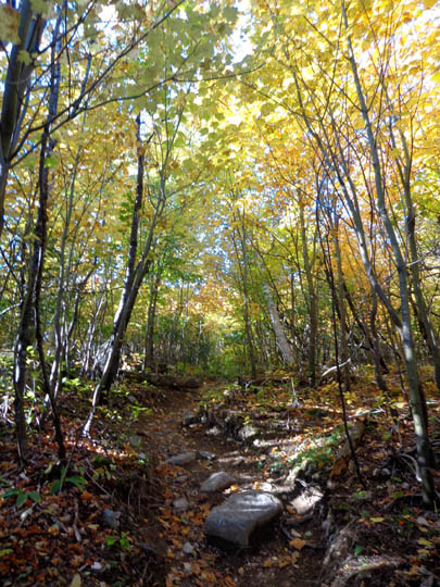
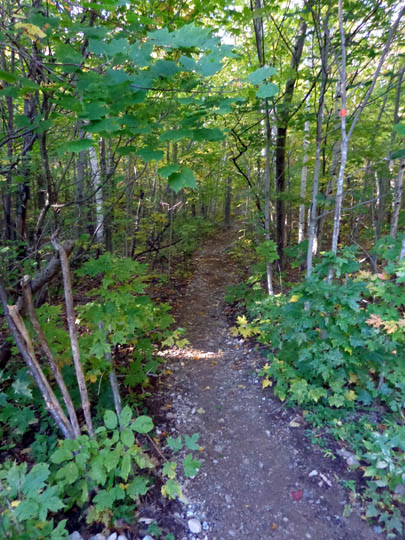
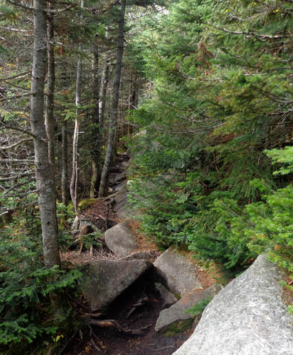
The trail also became more gnarly pretty quickly.
Most of the first mile was very steep and rough up a former ski lift
slope. There were large concrete blocks on either side of the trail
about every 1/10th mile where the structure of the lift was supported.
It came down in the 1950s and now the forest has grown up around what's
used as a trail.
The "trail" looked more like a rock-strewn dry stream and I was
determined not to have to descend on it. There are two other trails that
go down to Hwy. 431 or 86 that I intended to take at the end. Even
though they are longer than returning to ASRC, they are reportedly less
steep.
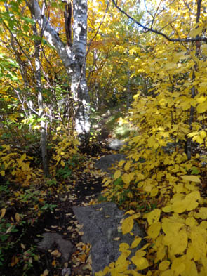
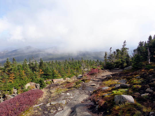
Vibrant trees near the first trail intersection, with one of the few
views below tree line
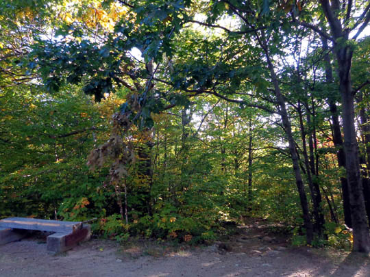
At the trail intersection at one mile for those other trail options I
met two young male backpackers who spent the night nearby. After packing
up their tents they caught up to me at the intersection for the trail to
Lookout and Esther mountains, two other 4,000+ footers. They are two of
the folks who are trying to hike all 46 of the 4,000-footers in NY.
As rough as the trail is, I didn't want to hike out and back on the
trail to either or both of these peaks until I came down from the
summit, in case I didn't have time for them.
When I saw the guys later as I was descending from the summit they
showed me a photo of a large black bear paw print -- they and a
day hiker told me about the fresh bear prints on the saddle between
Lookout and Esther mountains. Although none of the guys saw any bears,
it made me realize I shouldn't go there alone without bear spray.
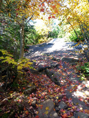
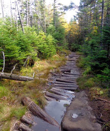
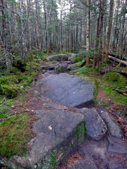
The second and third miles were partly along a ridge between Marble and
Whiteface mountains. There were very few views because of all the trees.
The trail remained rough most of the way, with large rocks, numerous
roots, puddles, and mud along the ridge. The next series of photos is
from this section.
Not so bad yet . . .
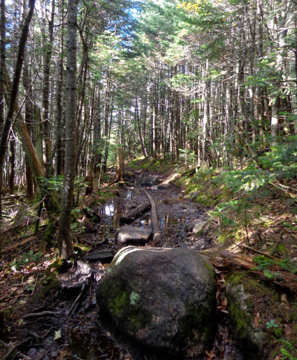
Rocks, roots, branches, mud
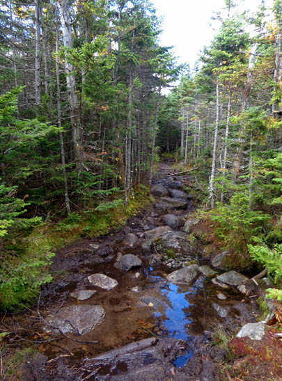
Plenty of water
Slick, wet mossy rocks
Boulder jungle
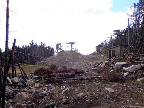
There was also an unattractive area where trees have been cut for ski
runs. Maybe it's prettier in the winter when snow covers
everything:
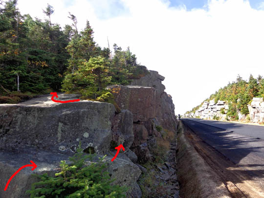
With about 3/4 mile to go to the summit the trail passes right next to a
large stone retaining wall along the paved toll road that goes up to a parking
area 300 feet below the mountain's summit.
For me, the toughest rock climb on the trail was right there at the road. It's
hard to see how high those steps are without a person standing next to
them:
I would have preferred walking up the road but the crew was working
right there, laying new asphalt:
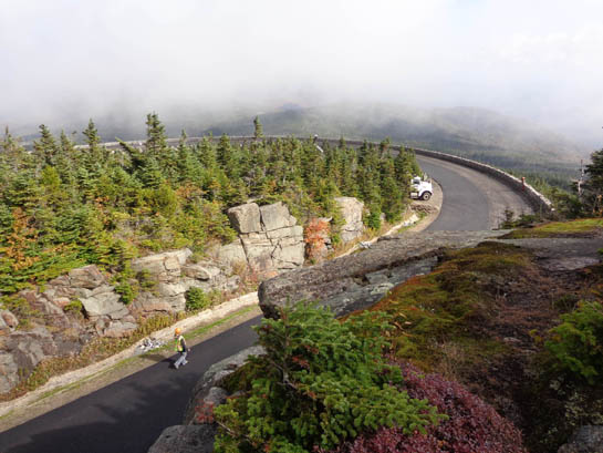
Sub alpine terrain just above the roadway; the trail
is close to the road for a very short distance.
I assumed no one was supposed to be on the road until tomorrow so
I didn't even ask if I could walk up the road to the summit.
I'm glad I didn't.
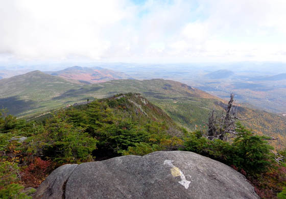
My favorite part of the trail was the next part above tree line where
it wound over exposed rock ledges. I could finally see down into the
valleys and up to the summit.
The rocks were easier to negotiate uphill when they became more smooth
granite bedrock instead of large boulders -- and the views became
amazing!
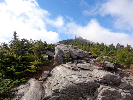
Finally! A view!
Observatory at the summit
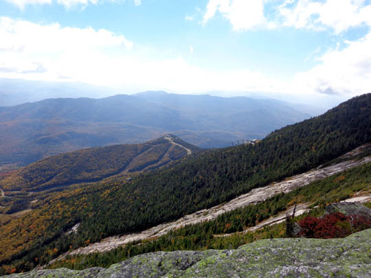
Ski slopes to the east
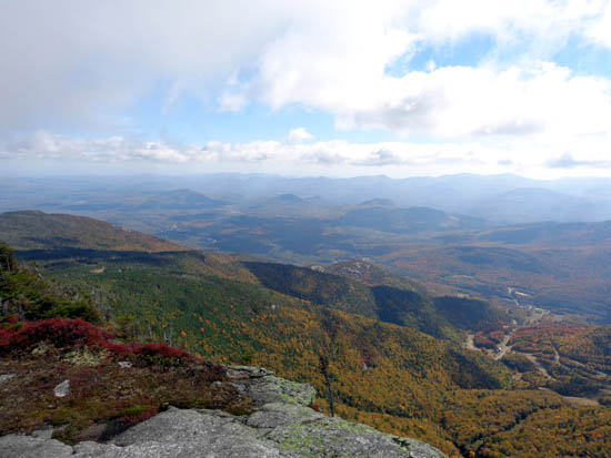
Valley to NE (toward Wilmington)
I saw the day hiker who saw the bear paw print coming down when I was on the exposed rock ledges. We
talked for a bit and he told me no one else was at the summit. Cool! He
was disappointed because clouds obstructed his views while he was up
there.
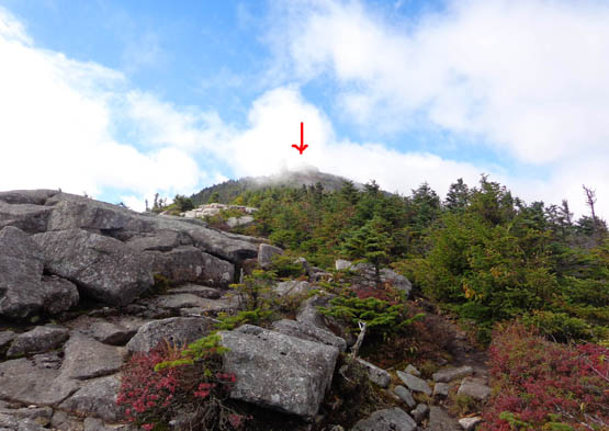
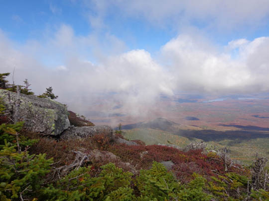
Some low clouds were still blowing through as I climbed to the summit
but they were gone when I got there. They made some of my pictures even
better. My timing was perfect. No more low clouds came in while I was
there.
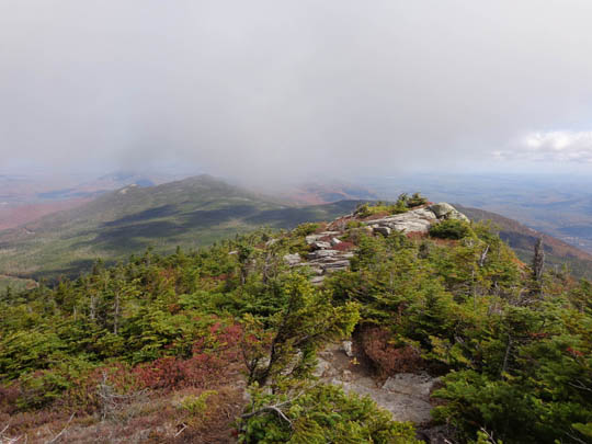
Above and below: views looking back to the
north, where I just hiked
Red leaves far down in the valley to the west
Summit photos continued on the
next page, plus the descent -- how did I decide to go back down??
Happy trails,
Sue
"Runtrails & Company" - Sue Norwood, Jim O'Neil,
Cody the ultra Lab, and Casey-pup
Previous
Next
© 2014 Sue Norwood and Jim O'Neil
