Continued from the previous page.
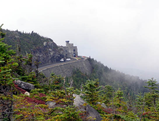
As I approached the summit of Whiteface Mountain I could see down to the
rock structure called "The Castle" at the end of the road. That's where
visitors in vehicles park:
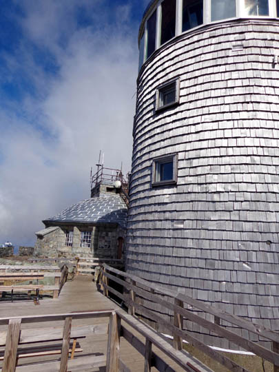
I continued up the trail through the tundra and reached the Atmospheric
Sciences Research Center's stone observation tower and building
at the top of the mountain about 11:30 AM, called Jim, and
spent the next 20-25 minutes wandering around the bedrock on the summit.
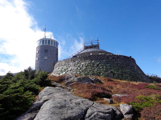
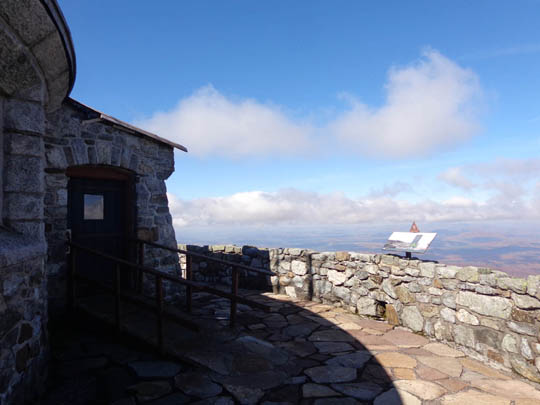
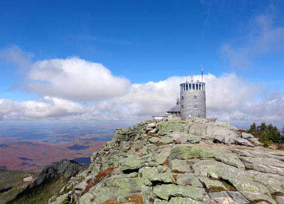
The buildings were
closed but there were expansive views in every direction and lots of
interpretive signs to read.
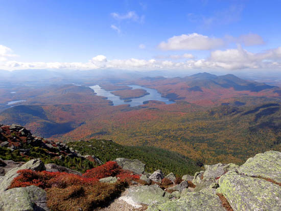
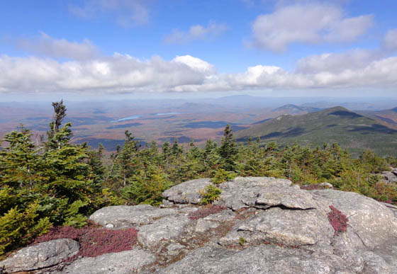
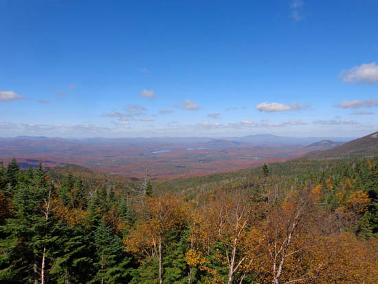
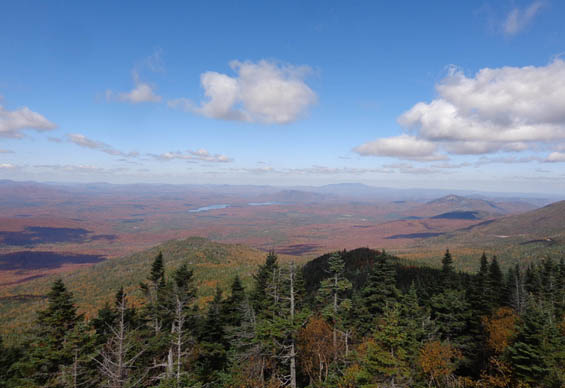
I loved the view to Lake Placid (the lake
itself), other lakes, all the red leaves in the valley, and the "blue
ridges" to the south and east where most of the Adirondack high peaks
are located. I could see east to the Green Mountains in VT but probably
not as far as the White Mountains in NH. Both of those ranges are in the
Appalachian Mountain chain.
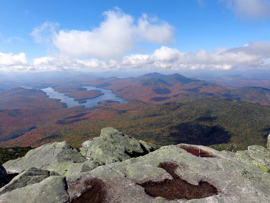
Above and below: awesome views south to U-shaped Lake Placid; note
all the red "carpet" in the valley.
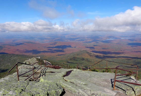
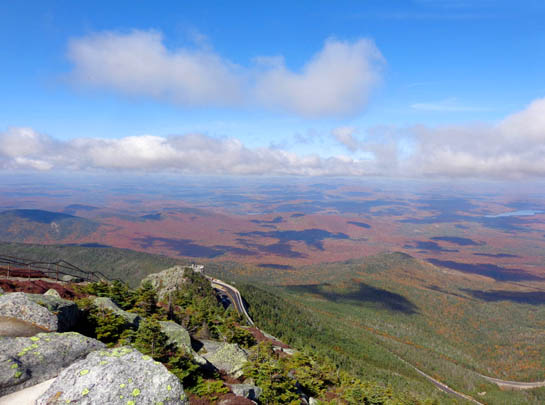
Above and below: looking down to "The Castle"
and the beautiful valley to the west
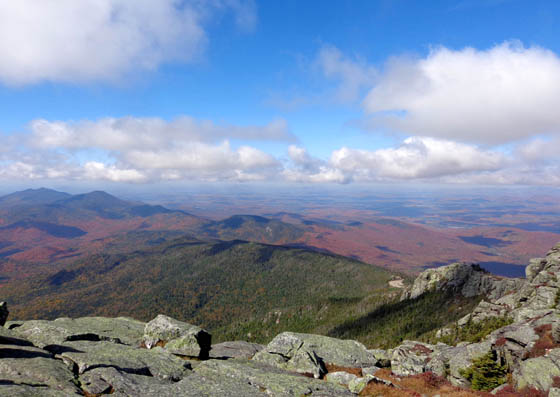
View to the southeast
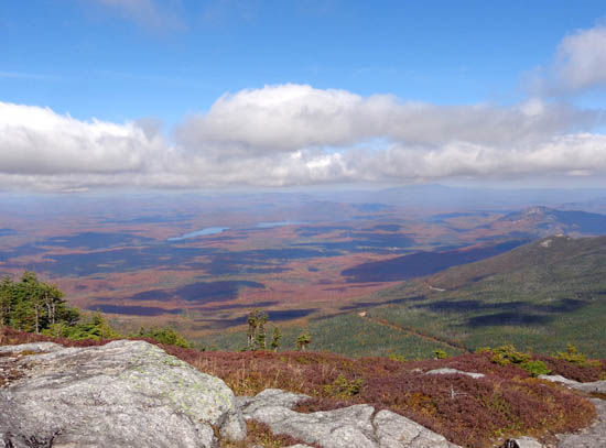
Lakes to the northwest
WHAT GOES UP MUST COME DOWN
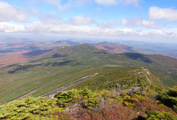
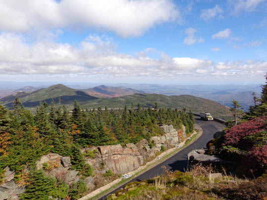
From the summit I could look down on much of the Whiteface toll road going to the
top. I could see construction workers along most of its length, and a
silver car going back and forth between multiple job sites.
Oh, how I wished I
could just walk back down that road!
I knew going back down the same trail was going to be very difficult on my knees.
Plan B was to go down the south or east side of the mountain instead of
the north slope. However, I couldn't find the trail down the other side of the
mountain that leads to the ski area on Rt. 86 or to Lake Placid. The
drop from the summit looked even steeper on that side. Forget that.
I called Jim again and told him I planned to go back most of the the way I
went up but would take one of the lower trails
going to Rt. 86 across from our campsite so he didn't have to come pick
me up where he dropped me off in the morning.
After eating a Clif bar I started back down the trail. The first part
was fairly easy on the dry bedrock above tree line and the views kept me
happy.
Then the bedrock got more slick where it was shaded by higher bushes and
trees and it was difficult to keep my footing. I had to go down some of
the large boulders/steps on my butt or backwards to protect my knees.
I was already tired when I got down to the one place where the trail
meets the road, and the worst was to come.
Despite the sign at the bottom of the road that said no pedestrians,
bikes, or cars could use the road on weekdays while construction was
going on, a new plan was formulating in my brain.
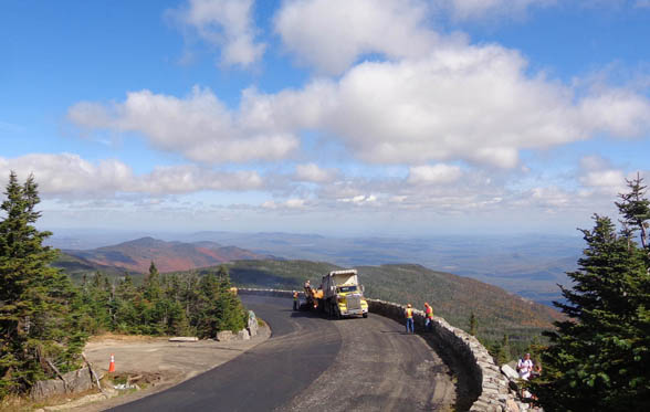
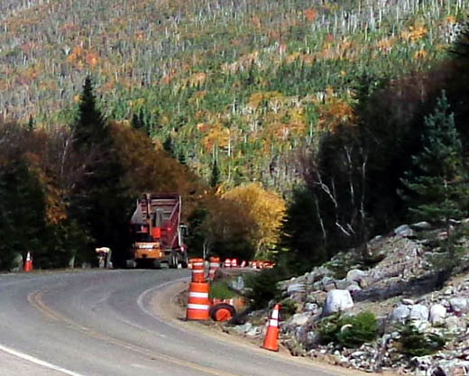
I hesitated when I saw even more trucks and road crew at this juncture:
I started down the trail a little ways, then called up to one of the men to ask
if I could please walk down on the road. I told him I hurt
one of my knees coming down from the summit and didn't think I could get
down the rest of the way on the rough trail. He asked if I was hiking alone and was alarmed
that I was.
Although I didn't really hurt my knee, both knees were sore and I knew
the likelihood of slipping and falling or otherwise getting hurt was
fairly high so I didn't feel bad exaggerating my condition to him.
He said yes, it was OK for me to walk down on the road.
He also told me to watch for the supervisor, Randy -- the guy driving the
silver car -- because he could drive me down to the main road.
I'm so glad I asked! I loved that road walk.
I did more than three miles on
the nice, smooth road and my knees didn't hurt at all. I did have to be
careful because of all the big trucks going up and down the road. In
addition, work of various sorts was going on in lots of locations --
repaving, laying pipes, embedding large boulders along the side, etc.
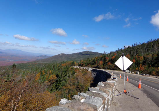
The views were good most of the way because there weren't as many trees
blocking them and I made much better time than on the trail.
About three miles up from the toll booth Supervisor Randy saw me and stopped on his way up the
mountain. I told him my "plight" and he offered me a ride down. I
declined, saying I might take him up on it when he went down the next
time.
I really didn't want to bother him while he was working and I was
enjoying my road walk. I had fun talking to the workers (male and
female) and seeing the views as I descended the road.
Randy, who is about my age, stopped again on his way downhill and I
accepted his offer of a ride less than a mile from the toll booth. I had
already walked eight miles and was OK with stopping. Randy was on the
way to his office in Wilmington so he drove me all the way to the
campground. That was very nice and saved Jim a drive to get me.
(Randy and his wife live in Lake Placid. He's an engineer on contract
and in charge of this two-year road project.)
Despite the difficult trail, I'm glad I went up it to the summit on a
day when hardly anyone else was there. I'm also glad I was able to come
down the road most of the way back. My legs were sore enough and would
have been trashed if I'd had to return all the way on any of the trails.
I'm also glad I didn't take Cody or Casey with me. Neither one of them
could have gotten up or gone around some of the rocks and I couldn't
have lifted them up.
Next entry: Jim's Stone Valley 50-mile gravel grinder
bike race
Happy trails,
Sue
"Runtrails & Company" - Sue Norwood, Jim O'Neil,
Cody the ultra Lab, and Casey-pup
Previous
Next
© 2014 Sue Norwood and Jim O'Neil
