Continued from the
previous page . . .
My attitude about the
trail vastly improved when I finally reached the ridge. My favorite part
of almost any hike is the part above treeline, where I can see expansive, beautiful
vistas -- and I have very fond memories of hiking this ridge nine
years ago.
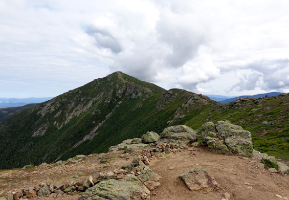
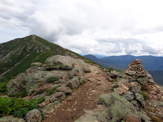
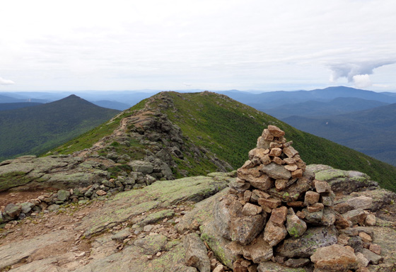
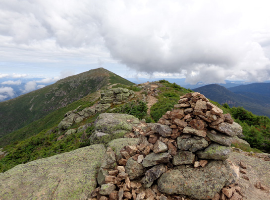
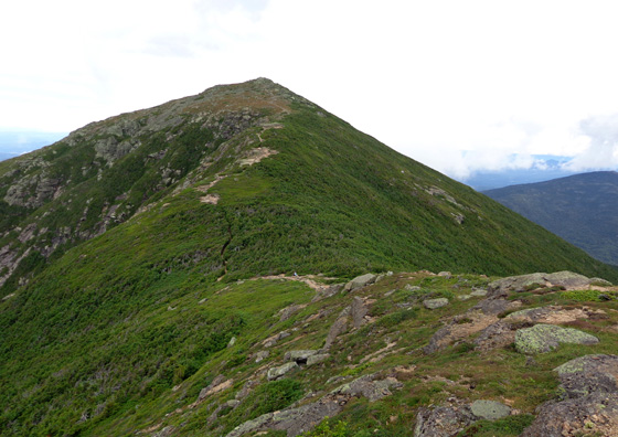
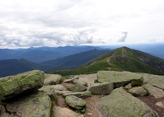
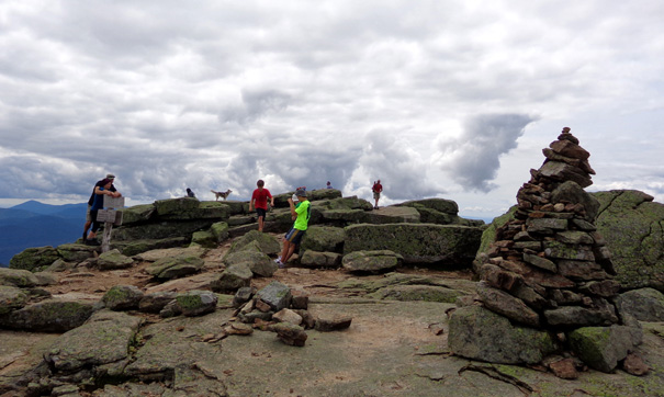
View north from Little Haystack Mountain to Mt.
Lafayette
Too bad Franconia Ridge
comprises just under two of the nine miles of this loop. Fortunately
there is another mile above timberline on the way down to the Greenleaf
Hut from Mt. Lafayette.
Since rain didn't look imminent, I made my time on the ridge last as
long as I reasonably could. I dawdled all the way from the summit of
Little Haystack Mountain (4,780'), over Mt. Lincoln (5,089'), and up
to the summit of Mt. Lafayette (5,260'). Most of the photos on this
page are in chronological order as I hiked north from Little Haystack.
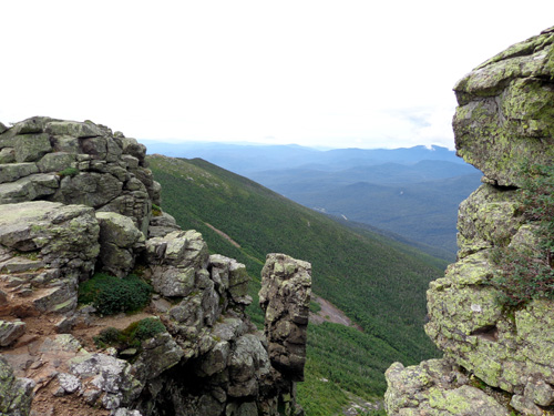
It was interesting to look down into Franconia Notch,
across to Cannon Mtn., and beyond toward the south and west, the
Pemigewasset Wilderness to the east, and clouds moving through the
valley to the north (toward the Twin Mountains).
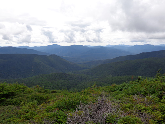
View to the east
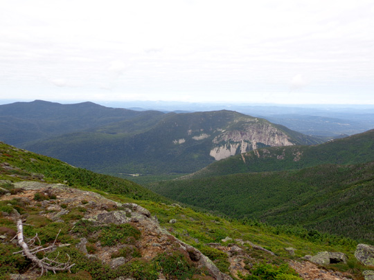
View to
the west (Franconia Notch)
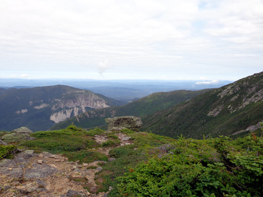
View to the northwest
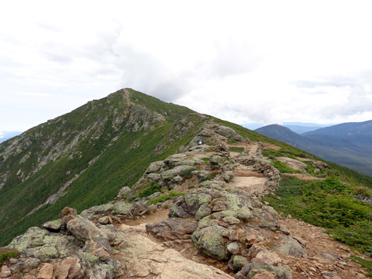
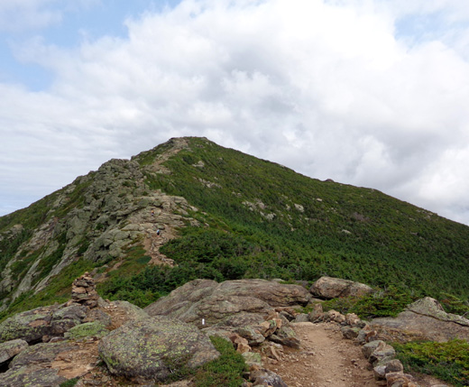
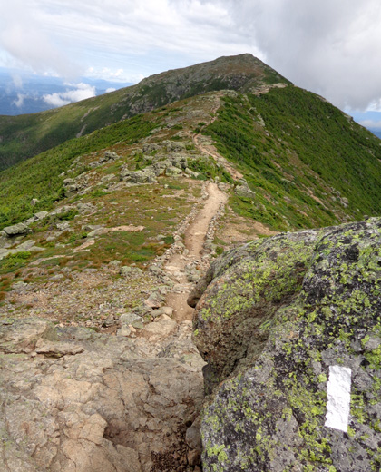
View north,
the direction I hiked
Continuing north, toward Mt. Lincoln:
Looking back south to Little Haystack Mtn. from Mt.
Lincoln
Here's a refrain
that's becoming my mantra this summer: the Franconia Ridge Trail,
which is also the Appalachian Trail, was rougher than I
remembered from nine years ago.
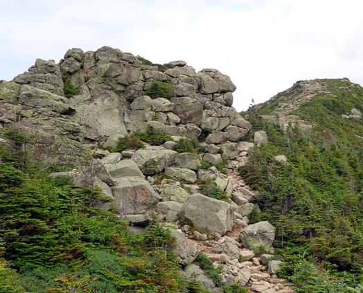
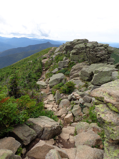
There were lots of rocks and rock outcrops to
climb up and down along the ridge. I just kept following the white
blazes and rock cairns:
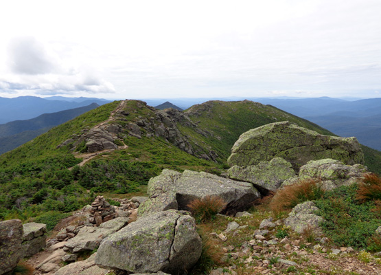
Looking
back to the south, where I already hiked
Looking
back again
Franconia
Notch, framed by rocks on the ridge
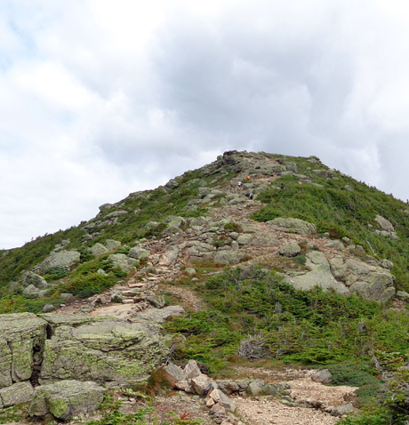
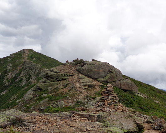
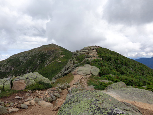
Hiking up
to the summit of Mt. Lincoln behind some other hikers
Looking
back from Mt. Lincoln
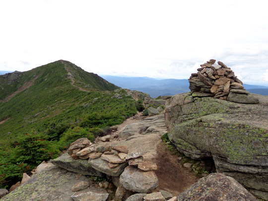
Almost to
summit of Mt. Lincoln; Mt. Lafayette is the pointed peak in the
background.
When I got done I realized that hiking up and down and
around the rocks on the ridge was easier than negotiating the rocks, roots,
streams, and steep grades on the trails up or down the mountainsides.
I can't whine about the difficulty of the trail on the ridge because the
views make all the effort worthwhile.
I was above treeline the whole time on the ridge except for a little patch of short
evergreens in a sag between Mounts Lincoln and Lafayette. The trail
continued to undulate between these two peaks:
Down into the short trees before the final climb to
Mt. Lafayette
I saw more people on this heavily-used ridge than on the three side
trails I used, which totaled about seven miles. I was able to take most
of my photos without other people in them, however.
Because the ridge is a fragile alpine environment, hikers are admonished
to remain on the established trail.
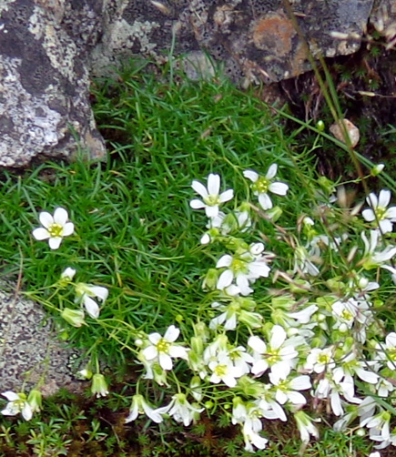
Tiny
alpine flowers on the ridge
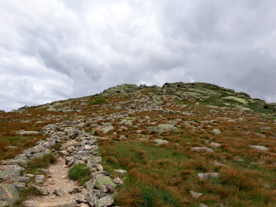
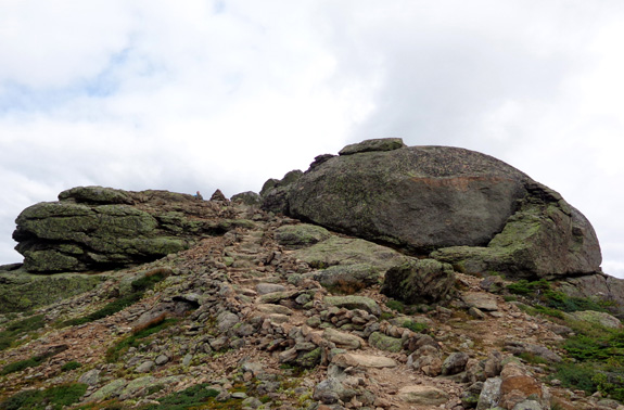
Ascent to Mt. Lafayette's summit
More rock formations to climb over or around
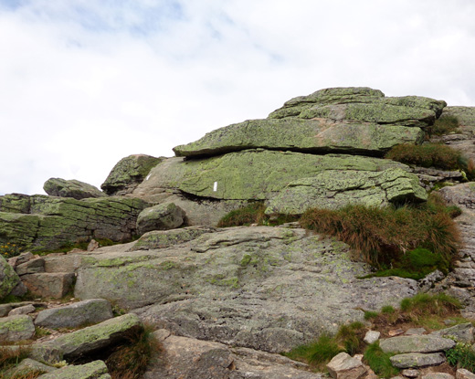
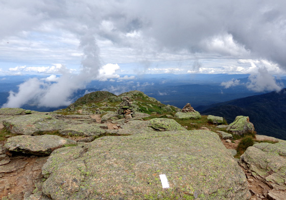
The trail along the ridge
was easy to follow except up and down some of the rock outcrops where
the blazes weren't as obvious as those in the photo above. Low rock walls
define the trail part of the way. In some places hikers
have placed smaller, flatter rocks vertically along the top of the
walls, sometimes ingeniously.
I took my first break on Little Haystack Mountain when I first reached the ridge
and the second at the summit of Mt. Lafayette before I began my
four-mile descent.
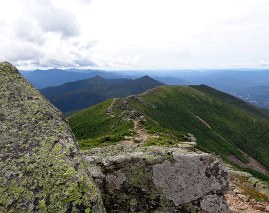
Here are some panoramic views from the summit of Lafayette:
South toward Little Haystack and beyond
East
North, where I followed the Appalachian Trail nine years ago
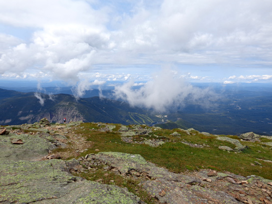
West toward Franconia Notch, the direction of my
descent from Lafayette
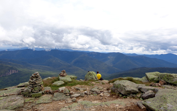
Several other people were on each summit but I chose beautiful
vantage points where I could sit in some solitude and enjoy the gorgeous
scenery:
The summit of Mt. Washington to the NE was under clouds the whole time I
was on Franconia Ridge but there were no clouds over my ridge. There was
very little wind on top of Lafayette so it was very pleasant sitting
there in the sun.
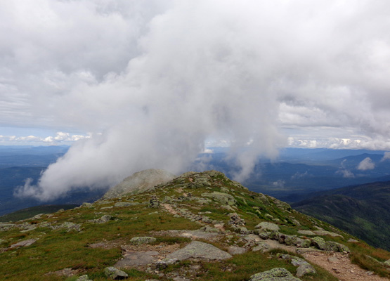
I enjoyed watching some clouds float over the lower peaks on the ridge
just north of Lafayette before my descent:
Continued on the next page: the scenic descent to the
Greenleaf Hut and back to the trailhead
Happy trails,
Sue
"Runtrails & Company" - Sue Norwood, Jim O'Neil,
Cody the ultra Lab, and Casey-pup
Previous
Next
© 2014 Sue Norwood and Jim O'Neil
