Continued from the previous page . . .
I made a second call to Jim from the summit of Mt. Lafayette to let him
know where I was and how slow I was going. I still had four miles to go
and from what I'd heard from other hikers and one of the trail
maintenance crew workers, I knew it would be a tough descent for me.
My number one goal was to avoid any injuries. Not only did I want to not
get hurt, I knew it would be extremely difficult to be rescued from any
of the trails I was on today.
So I went slowly and avoided any tripping or falling. On some of the
steep descents I went down backwards or slid on my butt down smooth
bedrock to reduce pain in my knees.
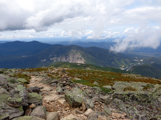
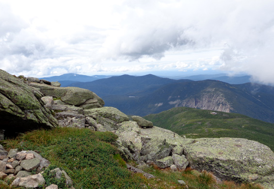
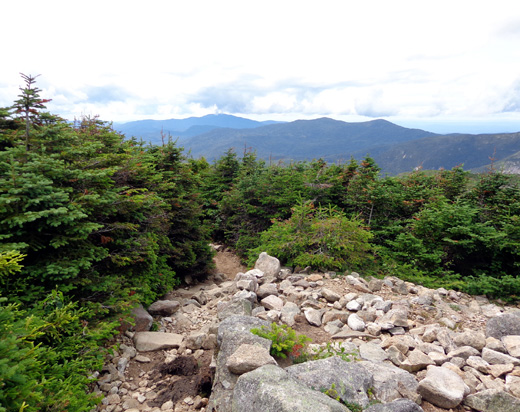
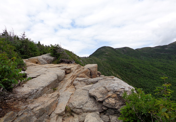
Over the edge: beginning my descent to the hut (in
distance, in center of photo)
About noon I began my descent on the Greenleaf Trail to the Greenleaf
Hut, which is 1.1 miles below Lafayette's summit. It's the only
New Hampshire hut I didn't see during my A.T. hike nine years ago.
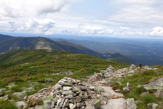
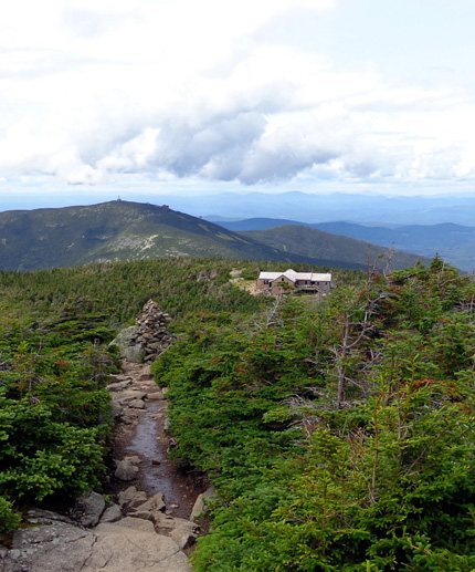
I could see the hut for two miles as I walked along the ridge. I took
the next photo (with the hut highlighted in the center) about half a
mile from the summit of Mt. Lafayette:
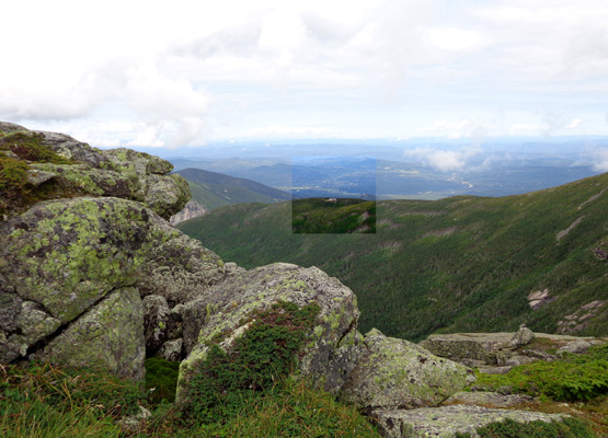
I could also see the hut most of the way down to it from Lafayette's summit.
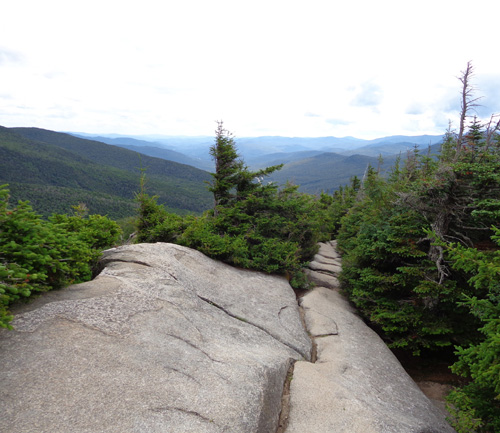
I remained above treeline until I was about a quarter mile from the hut.
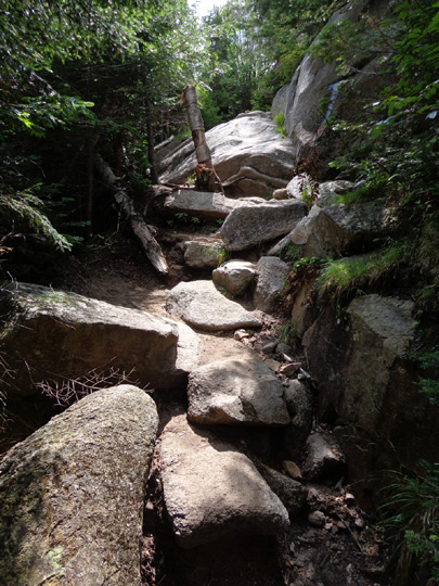
There were a lot of rock steps going to the hut but walking was fairly
easy there and I loved the views going down.
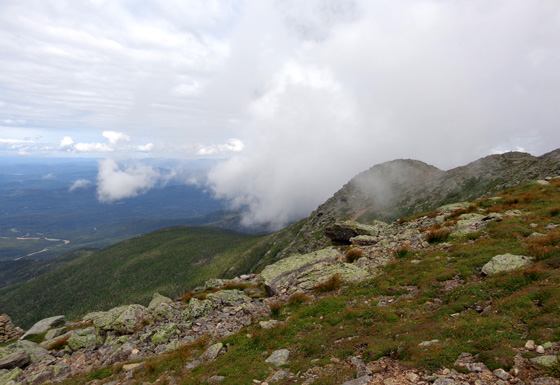
Nearby clouds were interesting to watch float in
and out above me.
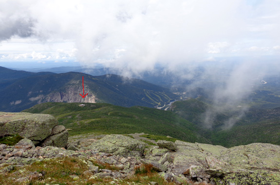
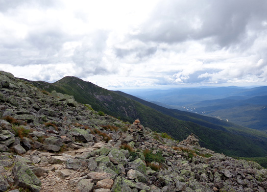
Greenleaf Hut is below arrow, about a mile away.
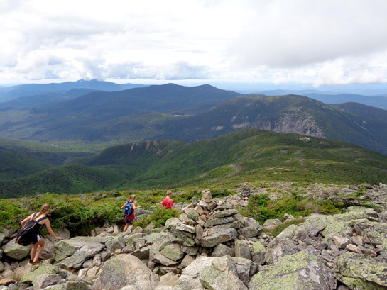
Young folks practically flew past me on the way
down through the rocks.
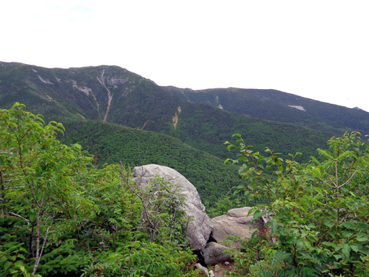
Cairns mark the way down the rocky trail; view of
Franconia Notch to the SW in the distance.
I wouldn't have wanted to
go up this side because I'd miss the beautiful valley views unless I
stopped and turned around frequently to look
back down into the Notch. That's one more reason to do this loop
hike in the CCW direction.
Above and below: approaching treeline
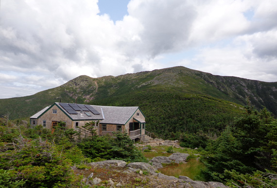
View of Mt. Lafayette from Greenleaf Hut
The trail passed through a couple wet areas just before the hut. There are two
boggy lakes here (Eagle Lakes) that you can see from the hut.
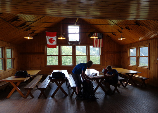
I went inside to eat some 32-bean soup (watered down and not as good as
other soups I've had previously at huts) and relax for a few minutes.
YOU MEAN HORSES USED TO CLIMB UP THIS TRAIL???
Surely you jest.
I left the hut about 1:30 PM, calling Jim first to let him know
the last three miles on the Old Bridle Path would probably be tedious
and slow.
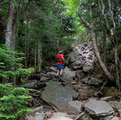
And they were. It took me about three hours to reach the truck. At least
I got there without incident. It was so rocky, with many areas of
bedrock and ledges, that I kept wondering how horses could ever navigate
this trail.
Turns out, only the lower portion of the current 2.9 miles from
the hut to the parking lot in Franconia Notch was ever used by horses.
Here's part of the White Mountain Guide's description going UP
the Old Bridle Path:
. . . Old Bridle Path affords fine views, particularly down into and
across Walker Ravine, from many outlooks in the upper half of the trail
. . .
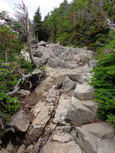
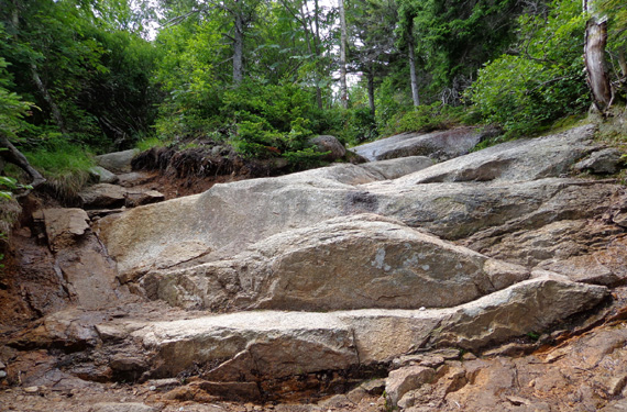
This kind of
smooth bedrock can be very slick when wet or icy.
. . . The trail then begins to ascend the steep part of the ridge
[2 miles from the parking area, going up to the hut], sometimes
called Agony Ridge, a name that originated with hut people who had to
pack heavy loads up this steep section. At one point, the trail
struggles up a steep kike of slippery red-brown rock known as Red Rocks
. . .
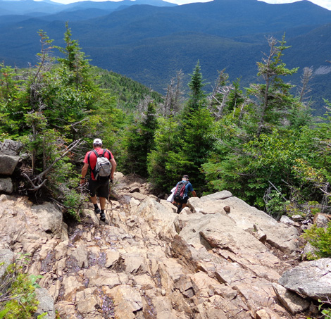
Despite all the rocks and bedrock, this trail was easier to descend than
Falling Waters would have been. Even where the bedrock was wet, I could
usually get a grip OK descending on it.
Not so on the Red Rocks.
Several of us got backed up in this 150-foot
drop because a two-year-old chocolate Lab
named Cody refused to descend the narrow lower part after slipping farther up.
He weighed about 100 pounds, much bigger than Casey or our Cody,
and the young couple had trouble coaxing him down.
Most of us two-legged critters went down on our butts in the worst part
of that section. In the photo above you can see the hiker in blue shorts
and shirt using his arms to climb UP the rocks. (I think that's
part of the Red Rocks section.)
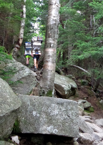
On my way down the Bridle Path I saw four college-age hut crew members
lugging large amounts of supplies up to the hut. One was a young woman,
shown below in lime-green shorts.
She had a lighter load than the men but it was 'way more cumbersome than
any backpack:
I also saw lots of other people, mostly kids, teenagers, and people in
their 20s and 30s, hiking up to the hut and/or ridge. I saw only a
handful of people in their 50s-60s on this loop today.
I was very tired after this hike but also exhilarated. I really wanted
to get up on that ridge again to savor the wonderful views and relive a
bit of my A.T. Adventure and by golly, I did it in daylight and without
getting hurt.
Mission accomplished!
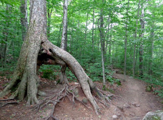
Interesting tree in the lower part of the Bridle
Path
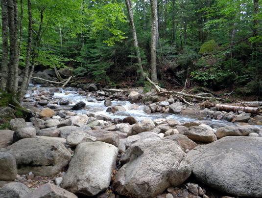
Stream close to the trailhead
This hike was worth every sore muscle! I hope I'll
be able to do it again someday.
Next entry: our kind of birthday celebration --
hiking and kayaking with friends in the White Mountains
