Before our arrival in Valdez the only information we had about hiking
trails in the area was the little bit that is included in The
Milepost and Alaskan Camping books.
We hadn't researched bike paths much but assumed we could ride our
bikes around town and on nearby roads. The 2012 Valdez
Vacation Guide we picked up in Tok on our first day in Alaska showed
parts of a bike path in town but we didn't know how far out it extended.
Finding more information about hiking and cycling
opportunities was one of the main things we wanted at the visitor
center and Chugach NFS office when we got to town.
The visitor center has a nice color booklet, "Summer Trail Map
Guide," published by the City of Valdez
Parks & Recreation
Department. It includes descriptions of several popular
trails in and near
Valdez, directions to reach them, color topo maps, distances, and
estimated times to hike them. The information can also be found on their
website.
Note that there is a winter trail map guide online for
snowshoeing and cross-country skiing.
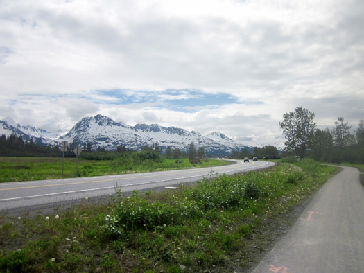
We were able to see much of the bike path along the Richardson
Hwy. as we drove into town and we found a map that shows where it goes:
Because of all the snow remaining on most of the trails around Valdez
I was able to hike on only two of them and only at sea level -- the Dock Point
Trail east of the Small Boat Harbor and the lower part of the Mineral
Creek Trail. Jim joined me for the one-mile loop hike at Dock Point.
We also did a short hike on the Overlook Trail above the Civic
Center. That one isn't included in the booklet but it's well worth the
short time it takes to walk up the hill for 360-degree views around
Valdez.
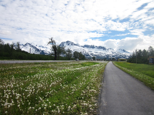
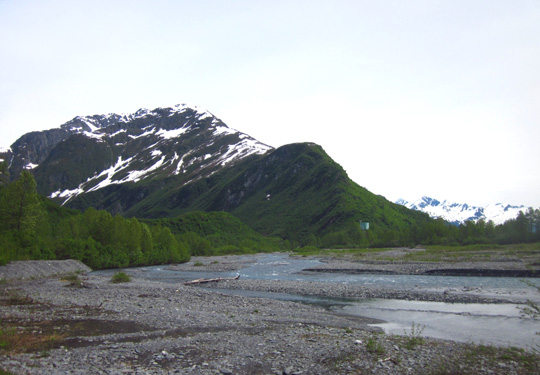
Scenic view from the bike path across Duck Flats to Dock Point
(nice trail where those
trees are located) and the Chugach Mountains south of
Prince William Sound.
The remainder of the walking we did was along the harbor and through town.
I showed numerous harbor photos in the preceding pages of this series.
In this entry I'll show photos from the bike path and the three
trails we were able to hike. Because of the large number of photos I'm
including (42) I split this entry into two pages.
At the end of the second page I'll briefly describe the other trails in the area. I'm
sorry I wasn't able to go on any of those because the views of Prince
William Sound would have been spectacular from several hundred or
thousand feet in the mountains.
BIKE PATH
A paved bike path extends from the eastern end of town to a point
about five miles out the Richardson Hwy. A loop in town goes around the
hospital, merges into Meals Ave., then parallels E. Egan Drive until
returning to the intersection with the Richardson Hwy. Total distance
with no repetition is about six miles.
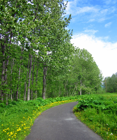
Part of the loop that isn't along
the highway
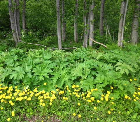
Lush under story plants and lots of dandelions in
bloom along the bike path
We added on significant distance (20+ miles) by riding our bikes
to/from the Valdez Glacier Campground and all around the streets and
roads in town.
Valdez may
have only 4,100 residents but it has a bunch of streets that are great
for cycling -- even those next to and around the harbor where
more people congregate.
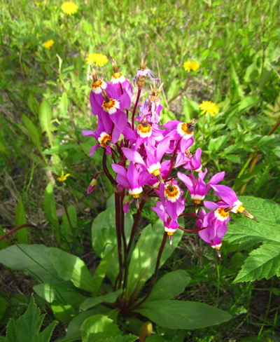
Colorful shooting stars in the wetlands along the
bike path
Jim also rode out Airport Road past our campground to Valdez Glacier
and on Dayville Rd. as far as we could (after about four miles only
authorized traffic is allowed to continue on to the Alyeska Pipeline
terminal). He got in two long rides while we were in Valdez.
I did my one long ride separately and took lots of pictures along the
way. I found two dirt paths I could ride a short distance. One was a
dirt road leading to the Mineral Creek trails, the other a wide dirt
path on the lower part of the loop on Dock Point.
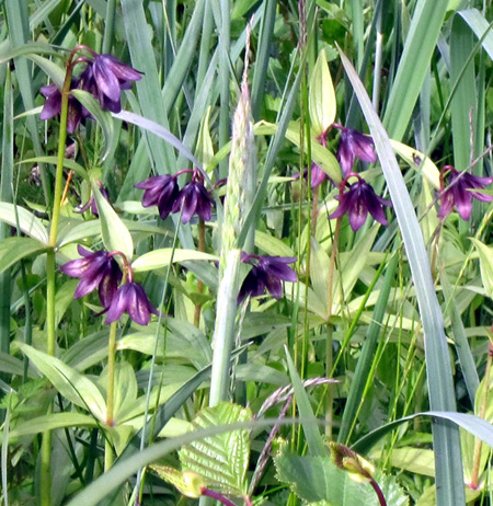
Chocolate lilies in the wetland along the bike path
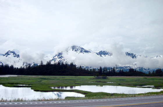
Although the paved bike path follows close to the highway most of its
length there is a very scenic section just before reaching the National
Forest Service cabin east of town.
There are wetlands full of birds,
mammals, and flowers on both sides of the path/highway and beautiful
views of the mountains to the north and south:
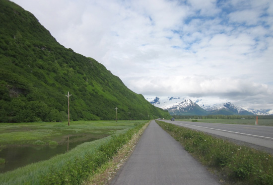
Wetlands to the right and left of
the bike path (Duck Flats are out of view to the right)
.
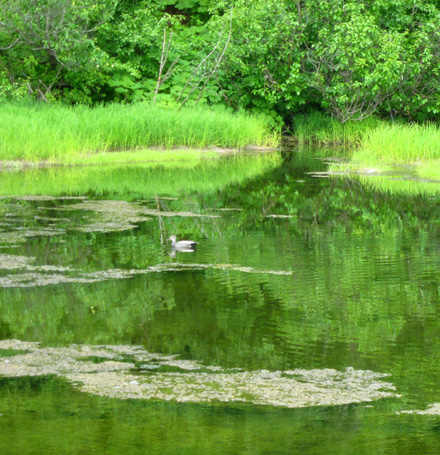
A duck floats on still,
reflective water in the freshwater wetland.
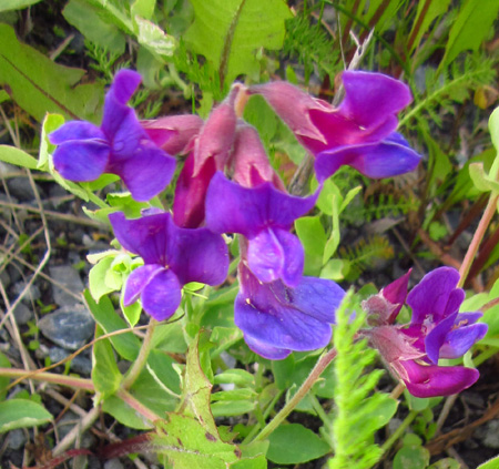
Bright flowers in the sweet pea family
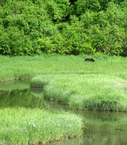
One day as we were driving into town Jim spotted a bear in this area,
grazing in the tall grass:
The bike path can be used for walking, too, but we mostly rode our
bikes on it.
OVERLOOK TRAIL
This is a short hiking trail with a bunch of steps that lead up to a
covered pavilion overlooking the city, harbor, and surrounding mountains:
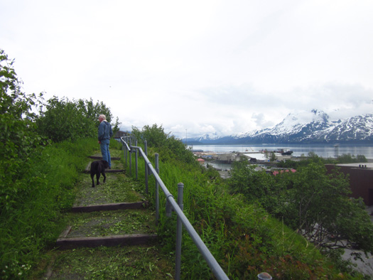
Jim and Cody approach the top of the overlook.
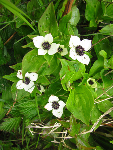
Lots of flowers were blooming along the path, including
large clumps of these bunchberries AKA dwarf dogwoods, a common
groundcover in Alaska and the Yukon:
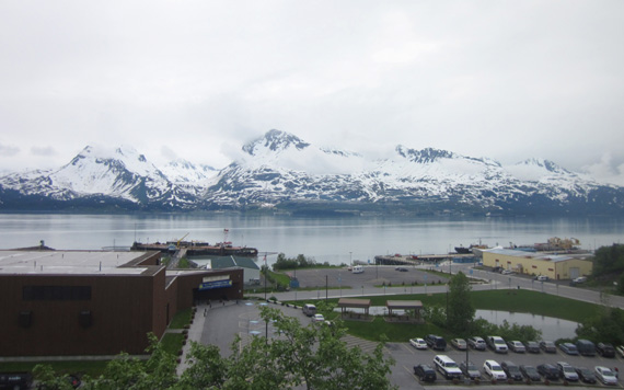
From the top of the overlook there are panoramic views in every
direction.
This photo looks out over the Civic Center, Ruth Pond, the
Sound, and over to the Alyeska Pipeline Terminal:
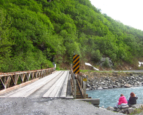
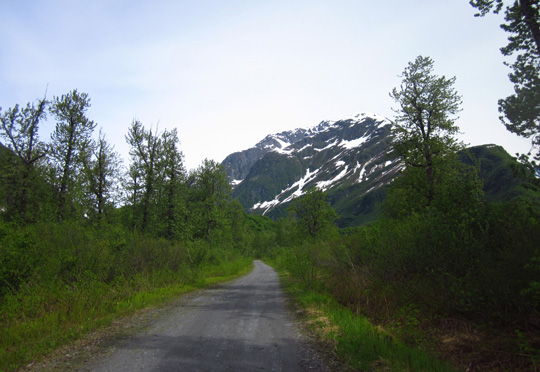
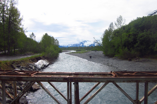
MINERAL CREEK TRAIL
When there is considerably less snow on the trail than there is now,
hikers can go up the canyon along Mineral Creek on the west side of Valdez to an old gold
stamp mill 6+ miles from the trailhead at the Mineral Creek Bridge:
Hikers can also walk on either side of Mineral Creek for about a mile
between that bridge and the W. Egan Street bridge across the creek. That
part of the trail is wide and fairly smooth.
That's mostly where Cody and I hiked today because we didn't have
time to go much more than two miles and even at sea level, there was
still snow piled up in a neighborhood we passed.
Following are three other photos I took along the lower part of the trail:
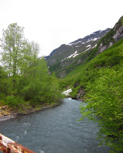
Looking downstream from Mineral Creek bridge
The trail guide describes the Mineral Creek canyon as very scenic as
it ascends between two 5,000-foot mountains to the gold stamp mill
located at about 800 feet elevation.
The mill was built in 1913 in conjunction with the Mountain King
Mine, which was located at 3,000 feet elevation. Although that mine is
no longer in operation there is evidence of more recent gold-mining
activity in the valley.
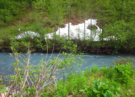
Above and below: You can
see the beautiful blue color of this glacial stream in these
two photos of Mineral Creek near
the bridge. Note the lingering snow at sea level . . .
The "trail" is mostly a rough gravel road that leads past several
waterfalls and the ruins of the McIntosh Roadhouse.
Past a gate the trail becomes a dirt footpath for the last mile to
the stamp mill. Bikes and motorized 4WD vehicles are permitted on the
road unless snow or rockslides make it impassable.
The trail guide rates this trail as moderate. The elevation gain is
not so great but the surface sounds pretty rough.
This is one of several trails I'd like to hike on another visit to
Valdez when there is less snow on the ground.
Continued on the
next page: my favorite
scenic trail in Valdez + information about other interesting trails in
the area
Happy trails,
Sue
"Runtrails & Company" - Sue Norwood, Jim O'Neil,
and Cody the ultra Lab
Previous
Next
© 2012 Sue Norwood and Jim O'Neil
