Continued from the last page.
DOCK POINT TRAIL
This one-mile loop trail packs a lot of variety into a short distance.
It's my favorite of the three trails I hiked in Valdez this week.
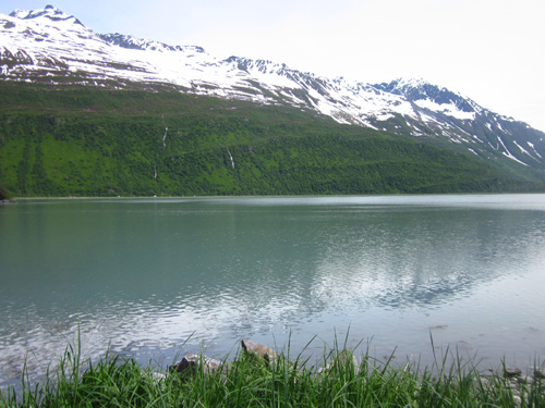
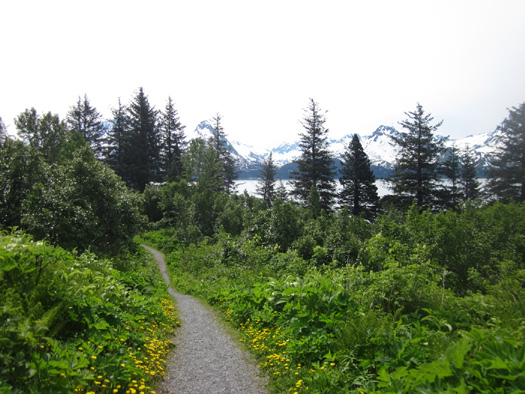
It begins at the end of a large parking and picnic area east of the
Small Boat Harbor with beautiful views of the mountains across Harbor
Cove and the northern end of Prince William Sound:
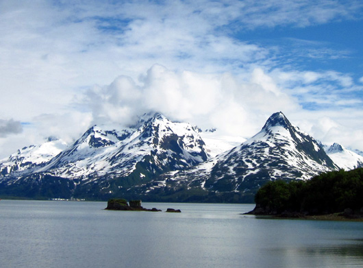
Above and below: Harbor
Cove
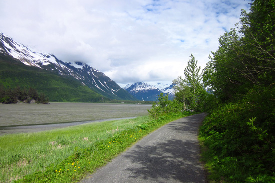
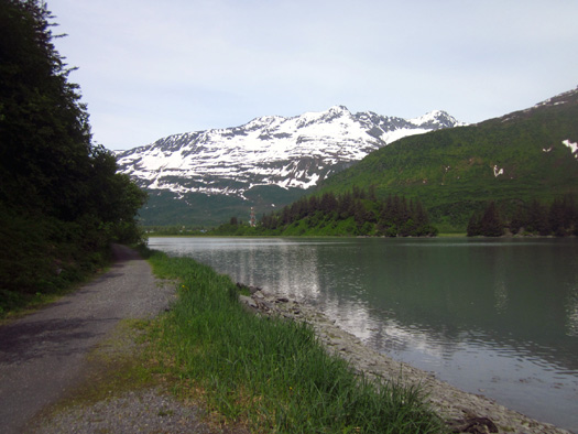
The north side of the loop is a flat dirt road overlooking wetlands
and the Duck Flats between Dock Point and the Richardson Hwy.:
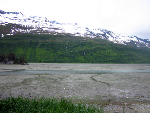
I have to share a comical "Duh!" moment here.
When I rode my bike on this path yesterday the marshland along the
dirt road was mostly mud, as in the photos directly above and below:
I didn't think much of that until today when Jim, Cody, and I hiked
the whole loop and I immediately noticed that the marshland was full of water!
It looked so different, like I was on another trail entirely:
I did a double-take before remembering that this is part of an
ocean, after all, and it is affected by tides.
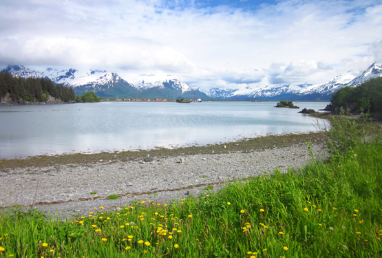
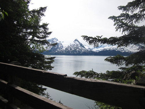
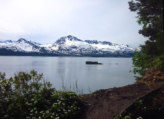
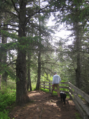
The south side of the Dock Point loop ascends steeply at either end
to the east and west overlooks above Harbor Cove, with views toward the
Port of Valdez at one end and Mineral Creek Islands at the other:
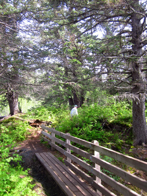
The upper trail goes in and out of meadows and wooded areas full of
spruce trees, a variety of deciduous trees and shrubs, and other lush plants common in temperate
boreal forests in Alaska:

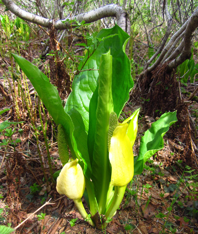
Most of the trees and shrubs were already leafed our but
some plants were just coming up, like these young skunk cabbages:
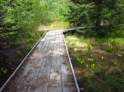
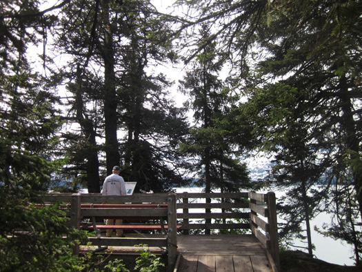
Where the ground is wet and/or fragile there are boardwalks and
handsome decks with interpretive signs:
Although this trail is rated easy in the trails booklet we got only
the lower dirt road is flat and smooth.
Access to the upper loop is rather steep, it has some steps and large
roots, and there was some mud. I highly recommend it for anyone who can
hike in such terrain because the views and flora are so interesting.
OTHER TRAILS IN THE AREA
1. SOLOMON GULCH TRAIL
This is a popular four-mile (out-and-back) trail that begins near the Solomon Gulch
Fish Hatchery on Dayville Rd. It ascends through coastal spruce forest
to Solomon Lake, with views overlooking Valdez, the bay, and the Chugach
Mountain Range "behind" the town.
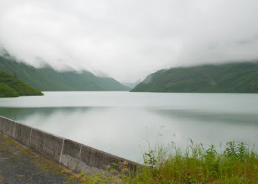
I scanned this small photo of the lake from
some promotional material about Valdez.
2. SHOUP BAY TRAIL AKA GOLD CREEK TRAIL
This trail begins on the west side of town and roughly follows the
shoreline for about 9˝ miles to Shoup Bay
and the Shoup Glacier.
The first 3Ľ miles are the easiest,
leading hikers to Gold Creek. That's an easy to moderate hike of about
four hours round trip traversing the scenic West Mineral Creek Flats
along the base of the Chugach Mountains. There is a campsite at Gold
Creek for backpackers. The trail guide cautions hikers about frequent
flooding along parts of this trail. What wasn't flooded this week was
still under snow and not navigable, according to the volunteer at the
visitor center, so I didn't even hunt for the trailhead.
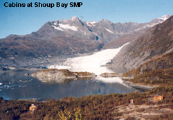
Tiny photo of Shoup Bay and Glacier from the link
below
Hikers can continue past Gold Creek
another 6.3 miles to the Shoup Bay
State Marine Park cabins below Shoup Glacier. This
part of the trail is rated difficult because it is steep in some places,
may be very muddy, and may be difficult to follow through extensive
vegetative growth. The photo of Shoup Glacier and Bay are enticing,
however. This would be a beautiful hike in the middle of a
drier-than-normal summer.
3. KEYSTONE CANYON PACK TRAIL
The next three trails connect with each other and are full of
historical significance.
From the City of Valdez Trail Guide: The original
"Pack Trail" was a trail from the Port of Valdez to Eagle, Alaska built
in 1898 by the U.S. Army to provide an "All-American" route to the
Klondike gold fields. When the gold rush ended the Army kept the trail
open to connect its posts, Fort Liscum in Valdez and Fort Egbert in
Eagle. By 1910 it had grown into one of the most important access routes
to interior Alaska and at that time it was upgraded into a wagon road.
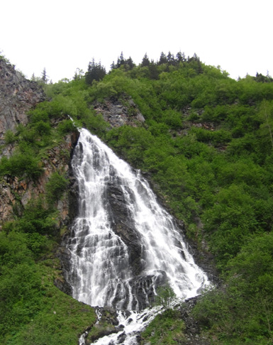
The Pack Trail winds along
Horsetail Creek just above Horsetail Falls.
Later the wagon road and eventually Richardson Hwy. were relocated
along the Lowe River through Keystone Canyon.
Hikers can still access the old pack trail, which runs for 2.6
miles one way above the canyon and river. There is a trailhead at either
end, so hikers can either go point-to-point (if vehicles are "spotted"
at each end) or out and back. This section is rated moderate.
4. GOAT TRAIL & WAGON TRAIL
More history from the Trail Guide: Because of the
increased use of the 1898 Pack Trail, it was upgraded in order to
accommodate sleds, wagons, and eventually automobiles. The route was
difficult to maintain, however, because of massive snow, snow slides,
and rock slides. Bridges were periodically damaged or destroyed and had
to be rebuilt.
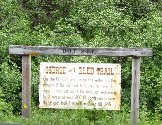
The Goat Trail/Wagon Road was in use until 1945, when a major flood
took out a bridge over the river near the mouth of Keystone Canyon.
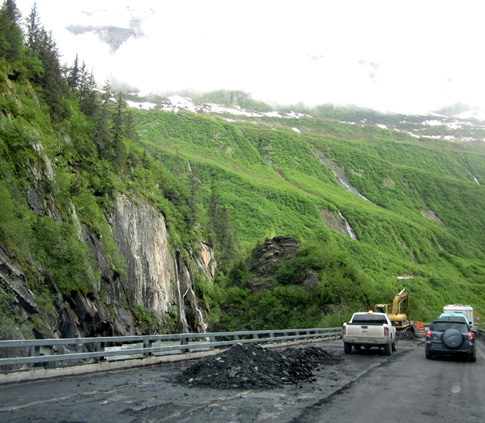
Now vehicular traffic is routed over the nearby Richardson Hwy. --
which also has floods and washouts because it is right next to the river
for several miles. That whole section of roadway was being repaired when
we traveled through the Canyon to reach Valdez, with one-way traffic led
by a pace vehicle:
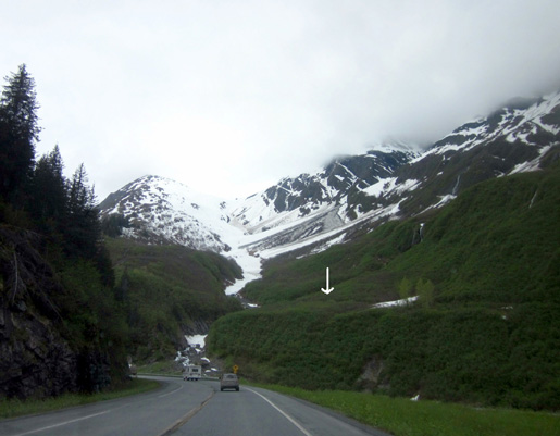
Once a thru-trail, the Goat Trail and Wagon Road are now considered two
separate trails because of the destruction in a flood of a long bridge at
Snowslide Gulch in 2006. The bridge has not been replaced.
I believe the next photo shows Snowslide Gulch. I took this a few days ago
as we were approaching Keystone Canyon from the northeast. I drew an arrow
indicating the bench where the Wagon Road is located:
The trail guide indicates that crossing the gulch is prohibited
because of the swift current. Hikers must turn around at the
gulch on both trails, meaning they have to be hiked out and
back. Each has only one trailhead.
The Goat Trail is 3.2 miles out and back and is rated
moderate in difficulty. The Wagon Trail is 6.6 miles out
and back and is rated easy to moderate.
We were able to see part of the Wagon Road going either
direction on the Richardson Hwy.:
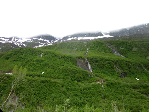
White arrows show location of the old wagon road,
which is now a trail.
There are numerous waterfalls coming down the slopes all along
the Goat Trail and Wagon Road. The trails have bridges over some
of the streams but they are subject to damage every year.
I'd like to return to Valdez either after a winter when it
hasn't gotten above-average snow or later in the season so I can
hike some of these longer trails. It's such a beautiful area and
I'd like to see the views from higher up the mountainsides.
Next entry: Valdez Glacier and its namesake
campground (with information about other campgrounds in the
area)
Happy trails,
Sue
"Runtrails & Company" - Sue Norwood, Jim O'Neil,
and Cody the ultra Lab
Previous
Next
© 2012 Sue Norwood and Jim O'Neil
