Continued from the previous page.
SCENES FROM THE ROCKY SPINE
After the switch-backs end the Savage Alpine Trail rises more gradually
along the rocky spine of the mountain.
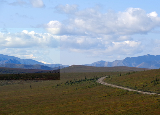
On a day when Denali isn't obscured by clouds there would be great views
of the mountain up here. Around noon today it was pretty clear on
this mountain, but not that one. I highlighted Denali's location
on the left in the next photo but clouds already covered most of it:
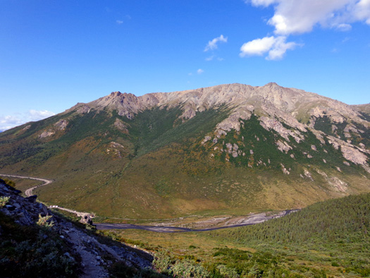
I had excellent views of Mt. Margaret to the immediate west:
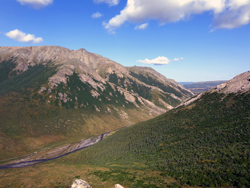
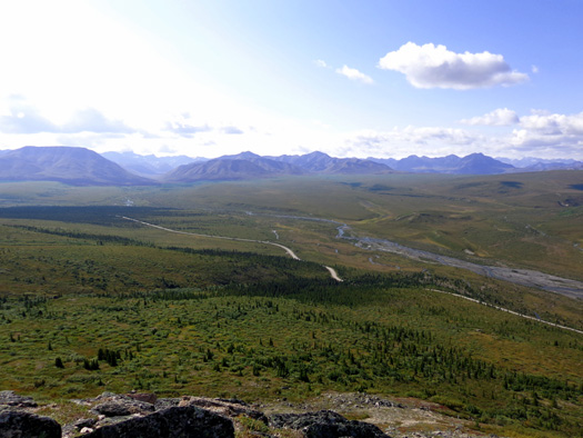
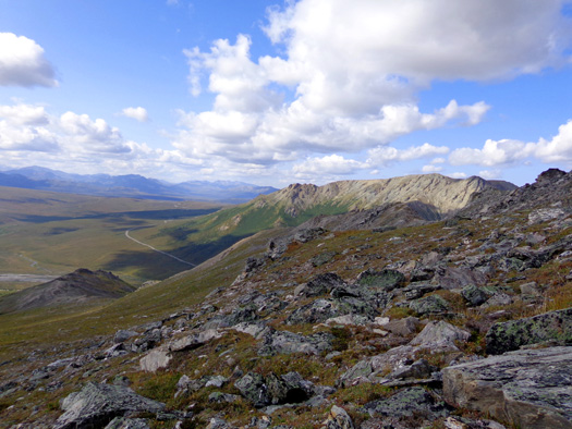
I could begin to see beyond the Savage River Canyon to the northwest (below) but
would have better views of that when I got higher and peered over Healy Ridge:
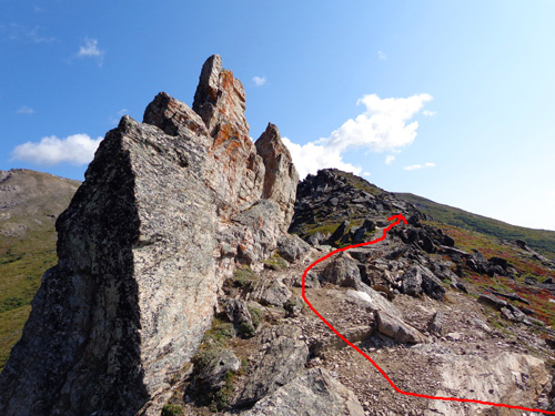
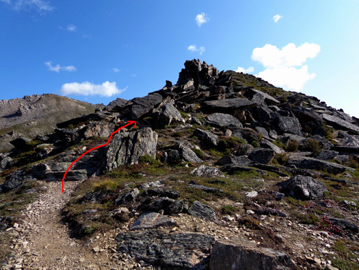
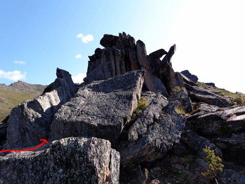
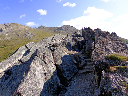
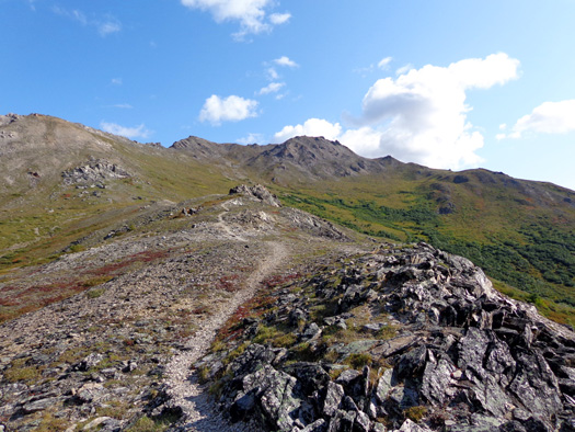
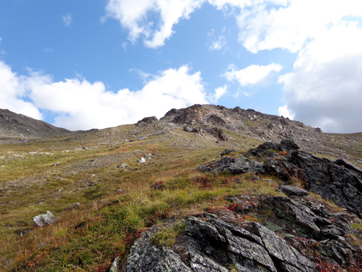
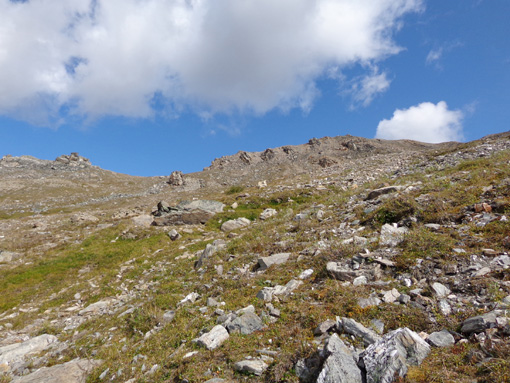
On the spine of this mountain the trail passes through some interesting rock
formations that reminded me of Dragon’s Tooth, Carvin's Cove, and other
parts of the Appalachian Trail near Roanoke, Virginia:
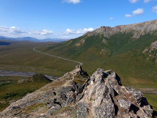
Looking back at the trail I've climbed on the
rocky spine; I didn't mean
for it to look like an extension of the park road in the
distance!
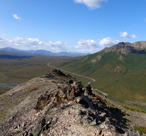
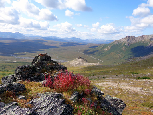
Expansive view to the south, toward the Alaska
Range
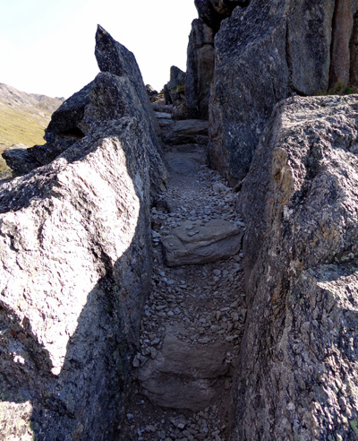
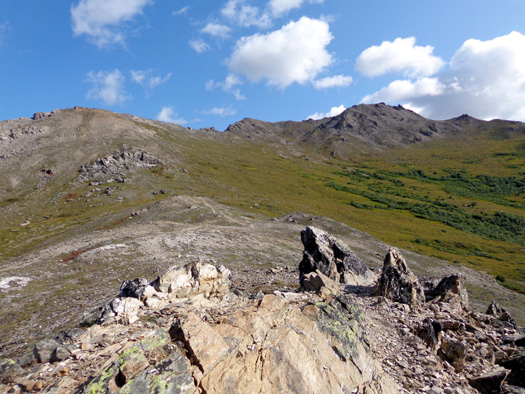
This is the skinniest slot along the spine:
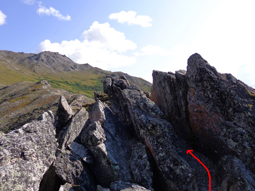
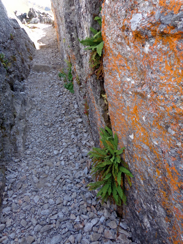
I had to lean to one side to get through that one! There was still some
more rocky spine left to negotiate after that:
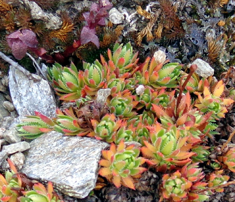
These plants look like a kind of sedum or other succulent:
The next picture looks back to the last slot in the rocks:
You could probably bypass most of these rocks by hiking down a little
bit on either side of the ridge top but what would be the fun in that??
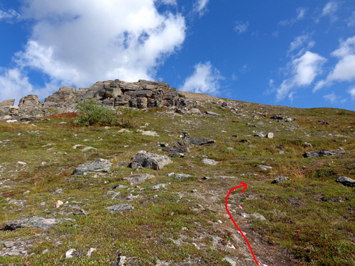
After the last rock formation I came to a sign at about 3,650 feet elevation.
It said the maintained trail ended and the remainder is under
construction:
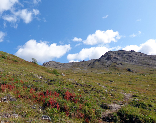
Even if I hadn't seen a small but distinct trail ahead I would have kept
going through the tundra. I had to see what was over the ridge!
WANDERING THROUGH THE TUNDRA
Soon after I passed the sign I saw a young couple from Germany coming
back from hiking farther up the ridge.
That further encouraged me to keep going. I saw some pink flagging where
the trail will be extended so it will eventually connect with another
trail coming from the Savage River Campground about two miles away.
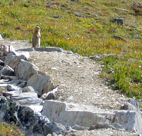
After following a faint trail for several hundred feet I came to a
definite "constructed" section of trail about 50 feet long -- and
a cute little ground squirrel waiting for me at the end of it:
Pretty soon I wandered into a group of ptarmigan
(TAR-ma-gan), handsome birds whose feathers turn white in the winter
to provide camouflage in the snow:
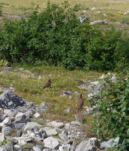
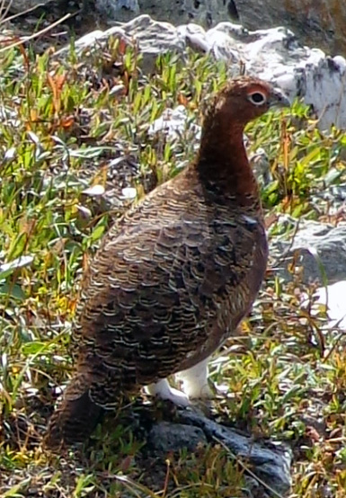
They're one of the creatures that
adapt well to arctic conditions instead of hibernating or migrating.
Like grouse, they try to lead hikers and other intruders away from their
nests. I'm usually able to get quite close to them before they scurry
off.
Looking ahead (to the east)
Looking back (west) to the rocky spine in the
center of the photo and the Savage River below
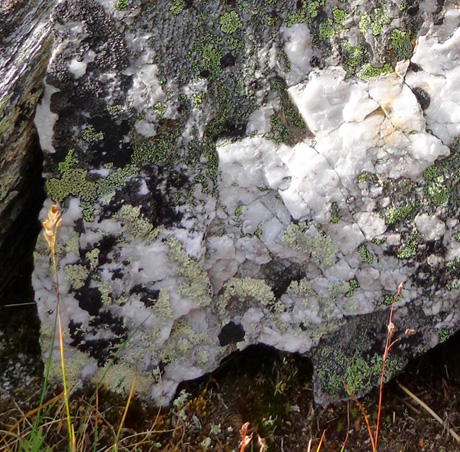
Interesting section of a boulder with quartz in it
and "decorated" with various colors of lichens
CLIMBING UP TO THE RIDGE
After about half a mile I got off the narrow trail to go up to the
ridge where I could look over the edge and see what was to the north.
Looking north to part of the ridge
Looking west along the lower part of the ridge
toward Mt. Margaret
Continued on the
next page -- views from the ridge, the descent,
and photos of a caribou in the riverbed
Happy trails,
Sue
"Runtrails & Company" - Sue Norwood, Jim O'Neil,
and Cody the ultra Lab
Previous
Next
© 2012 Sue Norwood and Jim O'Neil
