Today we took the opportunity to explore the
area around the Savage River day use area 15 miles into the park road.
This three-page entry describes the first hike I did; the next
entry describes my second hike into the Savage River Canyon.
While I was hiking Jim rode his mountain bike,
starting at the river and going outbound on the park road. He turned
around after several miles and rode back to our campground near the
park entrance.
Unfortunately, he didn't take any photos today
so you're stuck with just mine. I think you'll enjoy them, especially
the ones of two caribou I was able to get relatively close to.
Here's a sneak peak at one:
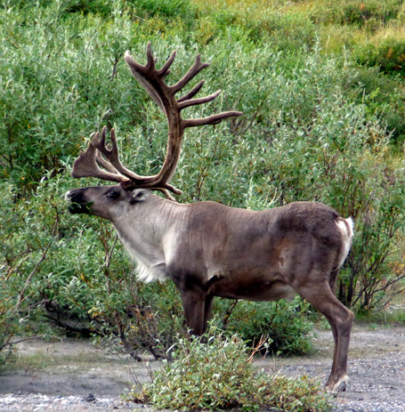
Caribou bull
stripping leaves from a willow along the Savage River
No need for a 400mm camera lens to "capture"
that handsome fella!
Caribou are one of the Big Five animals most
popular with visitors to Denali National Park. Jim and I had never seen
one in the wild until we came to northern Canada and Alaska this summer.
TAKING ADVANTAGE OF ANOTHER
GORGEOUS DAY
As soon as Jim got up he said he bet the mountain is “out” this morning.
It was clear, cold (42 F. at 7:30 AM), and sunny at the Riley Creek
Campground near the park entrance.
View of the eastern end of Healy Ridge from the
park entrance area
Of course, we had no way of knowing whether Denali was "out" from
our location because the awesome peak, the highest in North America, is a cloud
magnet and not visible from Riley Creek.
All we knew was that it was mostly sunny at the campground.
That was enough for us.
We can’t believe our good luck with weather while we’ve been at Denali.
This morning when I talked to our campground hosts, CJ and Monnie, they
said that this is the best good spell of weather at the park they’ve had all summer. July
was particularly wet. They said we must have brought the sunshine with us!
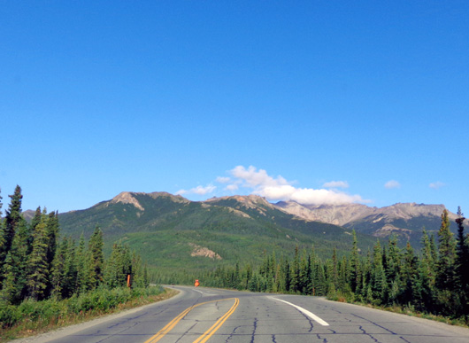
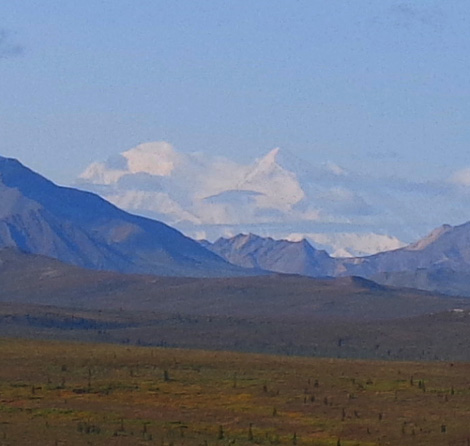
Above and below: view of Denali from Mile 10 on the park road this
morning;
by 10:30 AM it was already starting to hide under some clouds.
CJ asked if we’d been out to hike at Savage River yet and I said no, but we were
thinking of going out there either today or Wednesday. He encouraged us to go
today while the weather’s still good.
The forecast is good for all week
but . . . these are the mountains and there aren't any guarantees.
I had already suggested to Jim that we drive our truck out to Savage River instead
of taking the free shuttle bus, which takes an hour to get there from
Riley Creek because it makes seven or eight stops along the way.
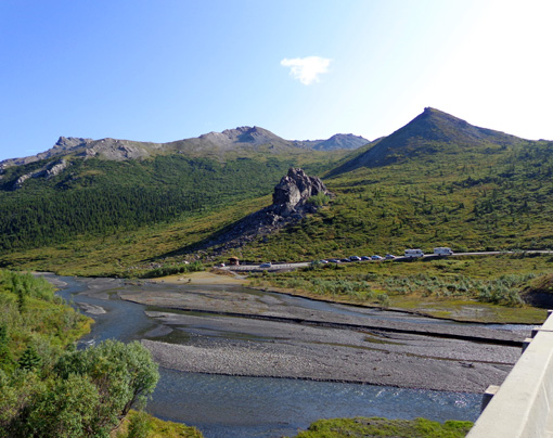
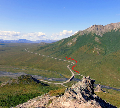
View of Savage River from the far side of the
bridge, looking east to the main parking area,
rock formations, and west end of Healy Ridge; the
river is wide and rather shallow here.
The main reason I wanted to drive was so Jim could take his bike in the truck. I thought he’d
have more fun riding west from there -- possibly 14 miles to the Teklanika River
Campground, then back to Savage River -- than in the first 15 miles where anyone can
drive their personal vehicles. There is significantly less traffic from
Miles 15-92 on the park road.
Jim liked that idea. We left the campground about 10:15 AM and
drove 15 miles out to the Savage River day-use area in our truck.
Road crews continue to work on about 200 culverts under the paved road so it
took a while to get there. I took this picture of
a crew about a mile before we reached the river:
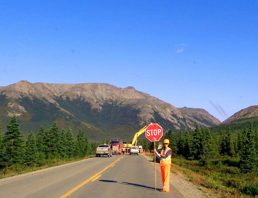
Alaska has two seasons: winter and road work
The ridge in the background in the photo above is Mt. Margaret. The
trailhead for that peak is a couple miles beyond Savage River. I plan to
hike there in a couple days if the good weather holds.
The small parking area on the near side of Savage River was full so we
went across the bridge, told the ranger in the hut what we were doing, and parked in a
larger overflow lot just past the little building:
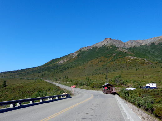
All traffic, even shuttle and tour buses, must stop at this ranger hut
before proceeding. Personal vehicles are allowed past it only if they have reservations
that day at the Teklanika River Campground. (There are a few exceptions, but that's
the general rule all summer.)
Buses stop so rangers can briefly board to greet the passengers, answer
any questions, and discuss a few
"rules of the road" during their tours beyond this point.
If your destination is the Savage River day use area you can park on
either side of the river. There are bathrooms and trailheads on both sides.
By parking on the far side of the river, however, I did have to choose between
walking over the long vehicular bridge or fording the river at the
beginning and end of my first hike. I chose the bridge. In the next
entry I'll talk about fording the river during my second hike.
That was fun!
JIM'S BIKE RIDE
I started hiking and Jim began riding his bike about 11 AM. He rode a total of 26 miles today.
Jim decided to ride only five
miles westbound from Savage River, not all the way to the Teklanika River Campground.
Past Savage River the road is smooth dirt. The first two miles were uphill and fairly difficult.
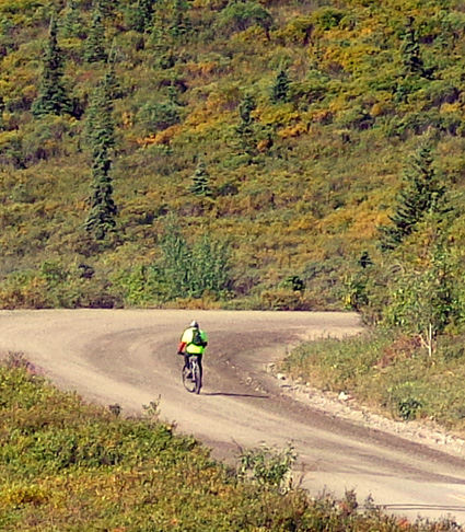
You can see the
beginning of his route in this picture I took while climbing up the
Savage Alpine Trail in my first hike:
He went from about 2,600 feet to 3,184 feet, then basically plateau-ed
for a few miles. Most of the return to the truck at Savage River was
easier because it was net downhill.
That made a total of ten miles so far. He left me a note to say he was
also riding the paved 15 miles back to the camper (despite the traffic on that
section). That let me know I was free time-wise to do my second hike in
the river canyon. Jim also rode a short trail to Savage Cabin and
through Savage Campground.
He thoroughly enjoyed his ride even though he didn’t see any large
wildlife this time. He made sure I knew it was a tougher 26 miles than
riding at JBER (Joint Base Elmendorf-Richardson). <wink>
CURIOUS AS EVER
I had a lot of fun hiking, too.
I broke it down into two very different hikes, stopping at the truck in between to see
if Jim had left me a note. I did a total of 7.7 miles hiking at
Savage River and another mile in the campground with Cody after supper.
Denali National Park is addictive for trail junkies like me who are
curious about what's around the next bend and over the next ridge.
Rangers encourage visitors to hike off-trail so they can
explore the mostly road-less (and trail-less) six million acres of
arctic terrain more thoroughly. Savage River is one of the easier areas
to access by vehicle, then explore on foot.
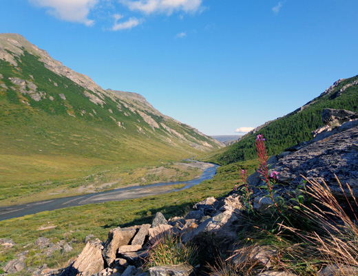
View downstream near the trailheads on the east
side of the river
Hike #1 was 4+ miles roundtrip on the mountain slopes east of the river. According to a photo
caption on the park website, this is the far west end of Healy Ridge.
I didn't realize it stretched this far to the west. I've already hiked on
the eastern portion of this ridge near the park entrance.
This is a view to the northeast from the day use area on the far side of
the river where we parked the truck. I marked my
approximate route on Hike #1 from the trailhead on the other side of the river:
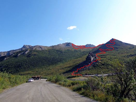
Per my Garmin GPS, elevations ranged from 2,643feet at the river to 4,435feet at the
higher of two saddles I reached.
I had about a one-third mile walk from the truck across the long
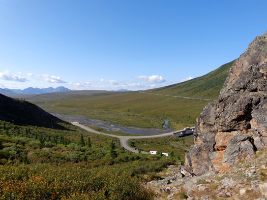
vehicular bridge to the trailhead for the Savage Alpine Trail. It is a
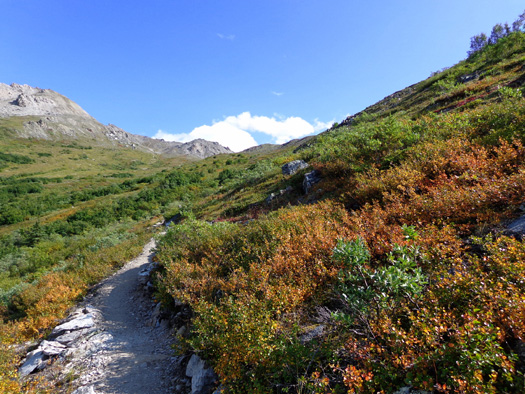
fairly steep but maintained trail for the first 1Ľ mile through and
beyond Savage Rock, with increasingly more expansive views down to the
riverbed and beyond:
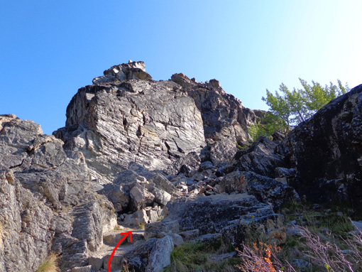
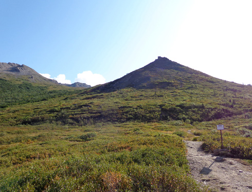
In the saddle at the top of Savage Rock there is a sign that explains
that the Alpine Trail is open to hiking but still "under construction:"
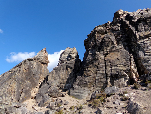
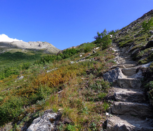
The Alpine Trail switch-backs 800 feet in elevation in the next 3/4 mile through
several more interesting rock formations.
It is fairly smooth just past the sign and a few places higher up:
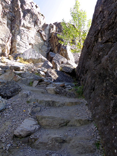
It also winds through quite a bit of rock, some rather rough.
Construction crews put a lot of work into all the steps through the
rocky areas. Here are a couple examples:
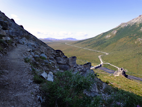
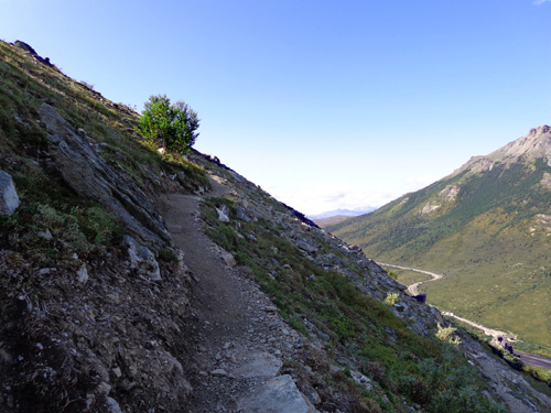
In some places the trail is also narrow above steep slopes. Acrophobics, beware:
Ascent continued on the
next page: scenes from the rocky spine of
the mountain and the tundra
Happy trails,
Sue
"Runtrails & Company" - Sue Norwood, Jim O'Neil,
and Cody the ultra Lab
Previous
Next
© 2012 Sue Norwood and Jim O'Neil
