Since the weather was nearly perfect this morning, we drove down to
Bandelier to hike one of the scenic trails that is new to us.
Although we read about most of the trails on the park website, we
weren't sure which one we'd hike today until we talked with a ranger in
the visitor center after we got there. She highly recommended the Falls
Trail to us for various reasons. It was a good choice.
In a previous trip to Bandelier we hiked two of the heavily visited
trails around the cliff dwellings. Those trails focus on archeological
sites inhabited by Ancestral Pueblo people descended from hunters and
gatherers who came into the region over 10,000 years ago.
You can see photos of some of the cliff dwellings and a village built
on the Frijoles Canyon floor in a journal
entry I wrote in 2009. Here is one:
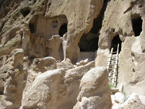
The trails to the cliff dwellings are very interesting -- and
something every visitor to Bandelier should see at least once --
but today we wanted something more challenging and farther from the
madding crowd. On the Falls Trail we saw only ten people in our 2˝-hour
hike from the Visitor Center down to the Rio Grande and back up.
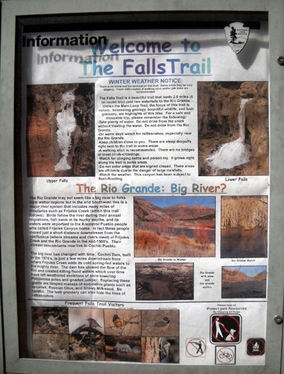
FALLING, FALLING . . .
The
Falls Trail descends 700 feet in 2˝
miles through Frijoles Canyon from the Visitor Center
to the Rio Grande. It passes two waterfalls
(Upper and Lower) and crosses Frijoles Creek several times. The
round-trip hike is about five miles.
This is a diagram of the trail from one of
the interpretive signs at the trailhead:
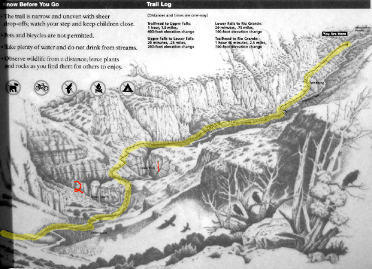
I highlighted the trail in yellow and marked the upper (1) and lower
falls (2) in red.
You can see a .pdf map of the park and
the location of trails on any page on the Bandelier
website. Just click the little box near the top that says
"View Map."
I recommend purchasing the inexpensive
guide to Falls Trail at the visitor center the first time you hike this
trail. It contains
information about the native plants, animals, and interesting geology
that will enhance your enjoyment of the hike -- identification of the various colorful rocks,
including "tent rocks," that you'll see, how the rock layers and shapes
were formed over the millennia, descriptions of the various
eco-systems along the way and the wide variety of animals and plants that
thrive in those environments, the effects of fires and floods, the
history of the river, and more.
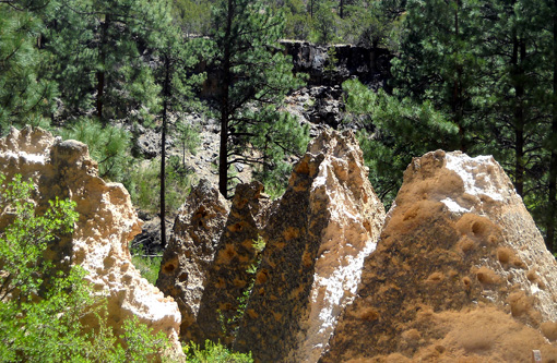
Tent rocks rock!
The photos that follow are in order going down the trail to the river and coming back up to the
visitor center.
Because I'm including so many pictures
-- for reasons
I'll explain in another entry -- this "virtual tour" of the trail
will have several pages. I enjoyed the trail so much that I took 250
pictures in about five miles! I whittled those down to about 200 while
editing them, and will show about 85 of them in this short series. [See
entry posted later re: the devastation wrought at Bandelier by
the huge Las Conchas wildfire in July.]
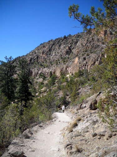
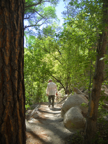
About a mile down the Falls Trail
Note:
Since dogs aren't allowed on any of the trails at Bandelier (and many
other national parks) we left Cody at home in the camper. Bikes aren't
allowed, either -- just foot traffic.
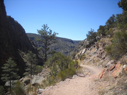
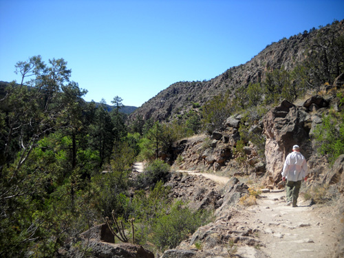
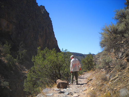
TRAILHEAD TO UPPER FALLS
The Falls Trail is very scenic and varied. It's moderately easy to
hike or run.
The descent to the river is mostly gradual with no steep grades;
switchbacks are used when the trail drops significantly near the falls.
There are a few rock steps to climb in that area, too. Surfaces range
from soft and sandy to uneven and rocky.
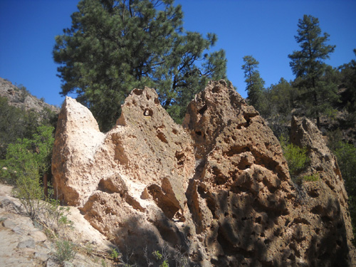
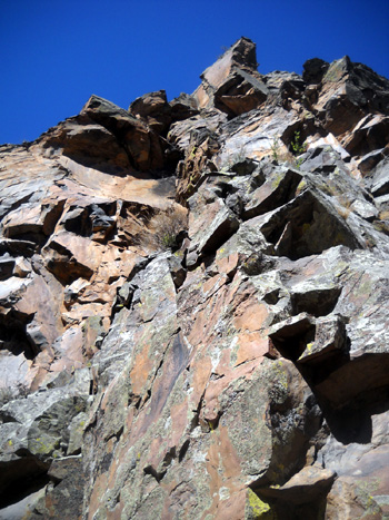
First view of tent rocks, eroded
remnants of volcanic tuff
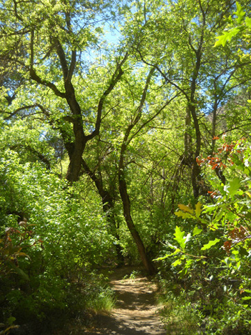
Frijoles Creek flows through the canyon down to the Rio Grande.
The creek is narrow but runs all year long. It was pretty shallow today.
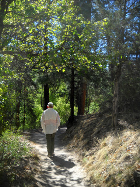
When the trail dips down close to the creek it is often shaded by trees and
shrubs:
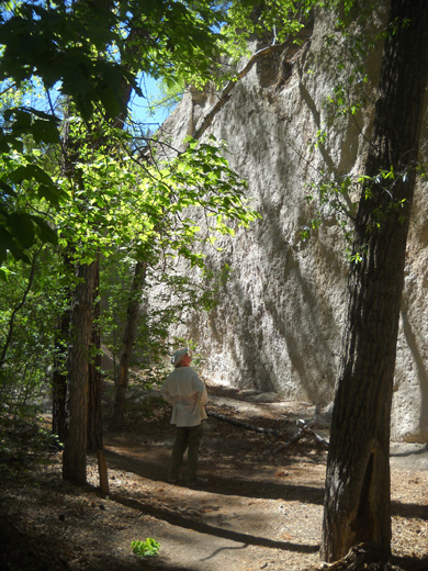
Jim inspects an almost-white rock wall.
We crossed the creek several
times on wooden foot bridges, then on rocks farther down where flash
floods have washed out previous bridges.
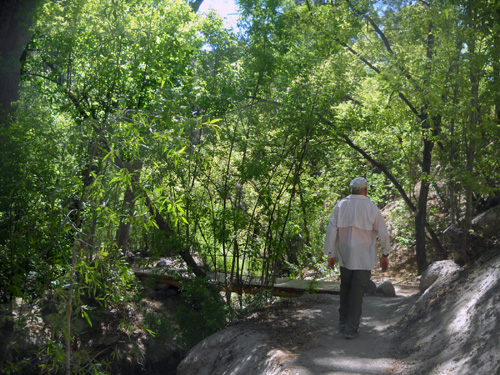
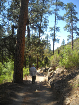
I'd estimate that about one-third of the trail is shaded and two-thirds
is exposed. Treed and/or lush green areas are interspersed with rocky,
exposed canyon areas all the way down to the river.
We felt plenty warm with temperatures reaching the upper 60s by the time
we finished our hike. I don't think I'd want to hike in this high desert
terrain when temperatures soar during the summer but it's pleasant
during spring and fall. (The website warns of icy conditions along the
Falls Trail in the winter.)
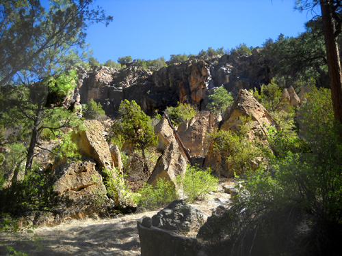
Another group of tent rocks
I really enjoyed the wide variety of colorful rocks and interesting
rock formations. As you'll see, I took a lot of pictures of rocks!
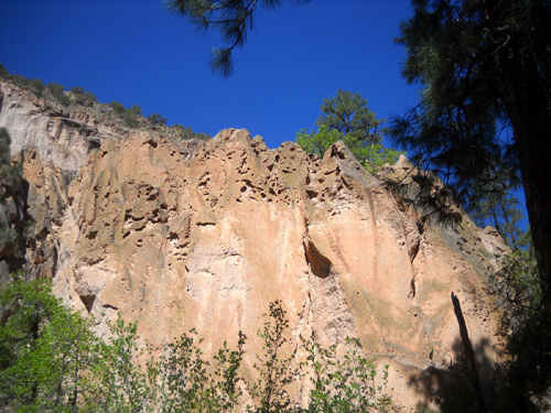
Porous pink volcanic tuff
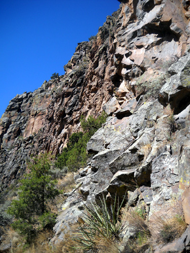
The darker rocks are hard, dense
basalt.
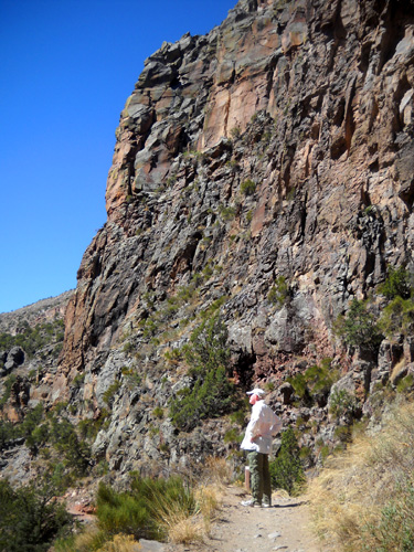
Jim looks into the canyon as the
creek is farther and farther below us.
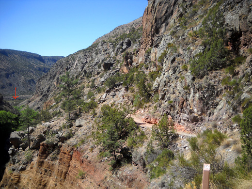
Before reaching Upper Falls we had some distant views of
the Rio Grande. In the next photo I marked the river with a red arrow because it's hard
to see the water in this little picture:
Upper and lower falls continued on the
next page . . .
Happy trails,
Sue
"Runtrails & Company" - Sue Norwood, Jim O'Neil,
and Cody the Ultra Lab
Previous
Next
© 2011 Sue Norwood and Jim O'Neil
