Caprock Canyons State Park has about 25 miles of sandy multi-use trails
within its boundaries, and another 64 miles along the adjacent Trailway, a
rails-to-trails conversion that is part of the state park system.
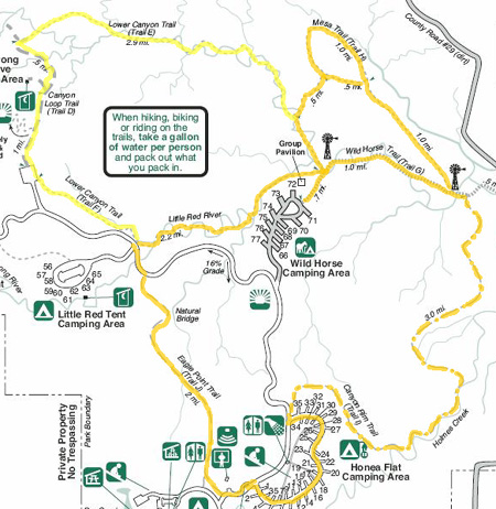
Here's a little map of the park that shows the general configuration of
trails and roads:
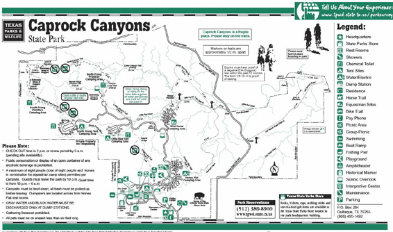
Click on this
link for a larger pdf. version you can read.
Last May we explored some of the dirt trails within the park but we
didn't have time to do all we wanted to. Nor did we do any of the Trailway.
Between the two of us, we've now been on almost all of the trail
system within the park and have seen five miles of the Trailway.
Jim doesn't like to carry a digital camera so almost all of the photos in
this trail series are ones I took on the trails I hiked and rode this
week. There
are a few miles that Jim covered that I didn't. The trails showcase a
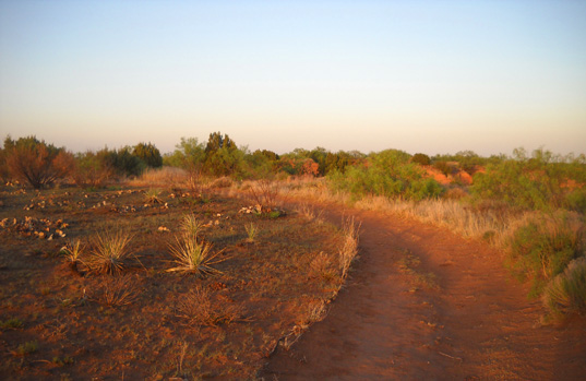
wide variety of terrain and plants:
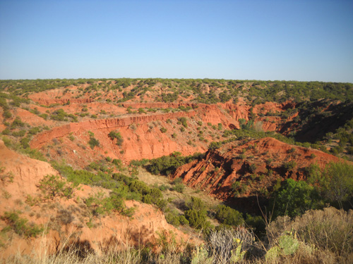
the prairie along the escarpment, the exposed red Permian Age
Quartermaster sandstone and siltstone formations in the canyons, and the
lush green riparian ecosystems in the bottomlands where streams flow at
least part of the time:
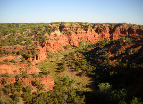
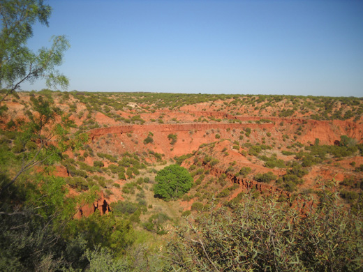
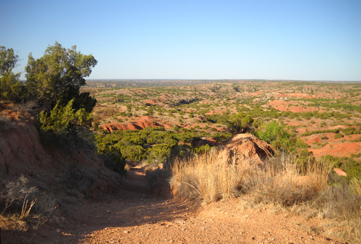
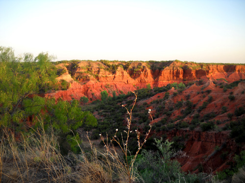
A view from the Canyon Rim Trail to Holmes Creek
While we've been here Jim has done three runs of 10, 12, and 13 miles
on the rim and through the canyons, as well as some shorter evening
walks near the campground with Cody and me. He has felt stronger on each
of those runs and has gained some confidence in his ability to finish
the Jemez 50K race comfortably next weekend.
Cody and I have done three hikes of 5, 6, and 8 miles,
plus some shorter walks, on the rim and in the canyons.
Today I challenged
myself with two sections on the Upper Canyon Trail marked "extremely steep
and rugged" that are at the highest elevations in the park (3,100 feet)
and came back in one piece. If you look at the online map at the link
above, they are in the upper left corner of the park. That was fun! Jim hasn't been on that trail yet. I'll describe it in a
subsequent entry.
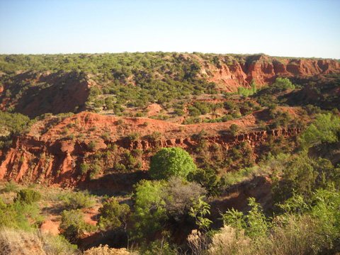
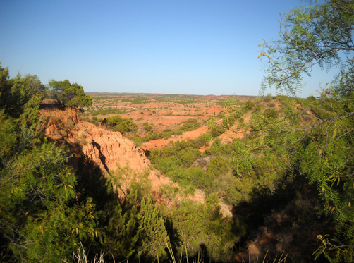
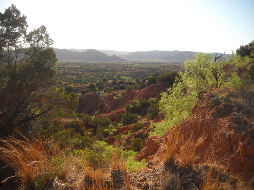
One of the canyons visible from Canyon Rim Trail
Jim and I rode our bikes together for ten miles (total, out and back) on the stretch
of the Trailway that includes the unique Clarity Tunnel, renowned for
its colony of Brazilian free-tailed bats. That's coming up in a separate
entry, too. I also did some solo rides on the park roads and Canyon Rim
Trail.
The photos and descriptions in this entry focus on
the Canyon Rim Trail. You can also reference an
entry I wrote about this trail last May. I rode and hiked farther along
it this time.
THE CANYON RIM TRAIL (TRAIL I)
Of all the trails in the park, this is the flattest and easiest for
folks who want convenient access from the campground and/or don't want to do any climbing.
That is, if you don't go beyond two miles from the trailhead --
after
that, it takes a decided dive down into the canyons and ends at the Wild
Horse Trail (Trail G) in another mile.
Here's a map section that shows the Canyon Rim Trail
highlighted in gold:
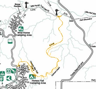
The trail begins at the far end of Honey Flat CG (mis-labeled "Honea"
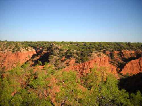
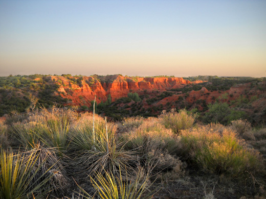
Flat in the map section above) and follows the cap rock rim above Holmes Creek, with scenic views to the south and east
across the canyon to the other rim:
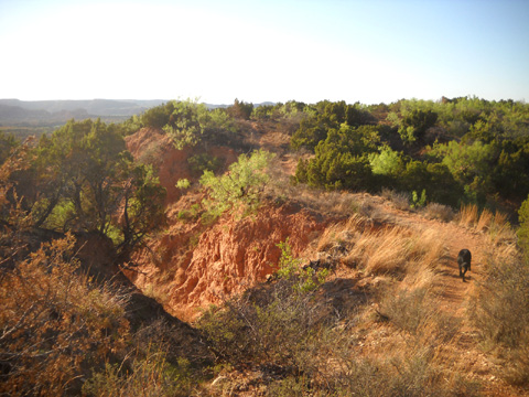
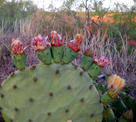
This is one of the trails in the park where the rangers
did a controlled burn on one side and not the other, giving a schizoid feel to our runs,
hikes, and rides along the rim:
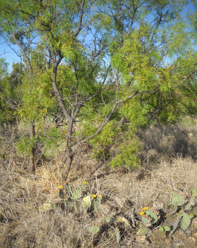
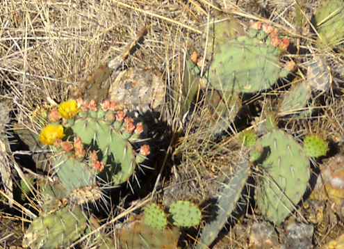
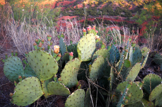
The side of the trail toward the rim was not
burned. That's where the trees looked the best (for now) and there were
some prickly pear blooms:
As the trail winds for two miles along the rim of the canyon walls
there are many little side paths that people have made to get closer to
the edge so they can get a better view of the changing scenery:
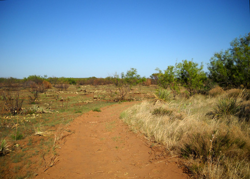
This is a nice, smooth single-track trail to run, hike, or ride a horse. Deep sand
in some places made riding a challenge on my cyclo-cross bike, however.
Knobby-tired mountain bikes would be easier to ride on any of the trails
in this park, including this one.
Despite that,
I rode my bike and walked out-and-back several times on Canyon Rim Trail
but never dropped down into the canyon on this particular
trail.
I did explore about 1/4 mile on a side trail to the end of the
bluff overlooking the canyon where the trail starts its descent:
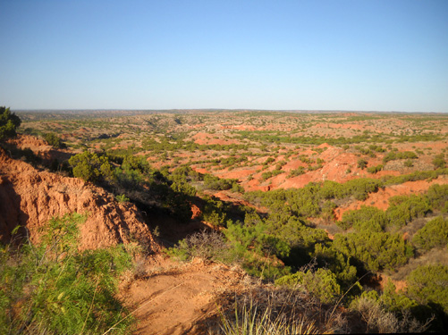
There are some great views of the surrounding canyons along this
little path
(shown below) and out to the point of the bluff, although it was hard to take pictures
to the southwest in the direction of Eagle Point because I was shooting
into the sun:
There was a steep, narrow trail going down into the canyon from the
end of the bluff; it's not on the park map.
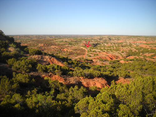
This photo shows the Canyon Rim Trail (red arrow) as it continues in
the canyon the third mile to its intersection with the Horse Creek Trail:
Jim did all three miles of the trail in both directions as part of
his various long loops. There are three photos he took on the lower part
of the trail with his camera phone last year at this
link.
Canyon Rim Trail connects with all the other trails in the park. By
just walking out the door of your RV you can come up with all kinds of
distances for interesting trail runs, hikes, or bike rides. This map
shows some of the trails Jim ran in various configurations this week to
total from 10-13 miles each:
And that's just the eastern half of the park!
I took the remaining photos on the Canyon Rim Trail at sunrise and sunset. Although it is
harder for me to photograph the canyons with a simple digital camera
when the sun is very low, in person the lighting is softer yet somehow
more dramatic:
Next entry: photos from Eagle Point Trail
Happy trails,
Sue
"Runtrails & Company" - Sue Norwood, Jim O'Neil,
and Cody the Ultra Lab
Previous
Next
© 2011 Sue Norwood and Jim O'Neil
