Some of those steep climbs and descents are also a challenge to
well-conditioned runners and hikers, not just cyclists and equestrians! The
flattest trail is the Caprock Canyons Trailway, built on an old railroad bed. I
think every trail within the confines of the state park is significantly hillier than
that.Neither Jim nor I got on the 64+-mile long trailway, which can be
accessed at multiple trailheads outside the park, but we had several runs/hikes
on the 25-mile system of trails within the park boundaries and got to sample a good
representation of them.
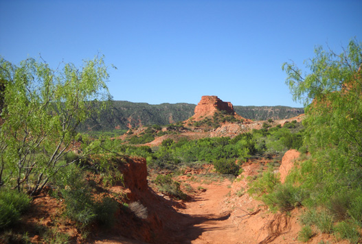
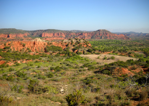
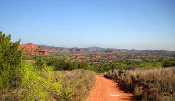
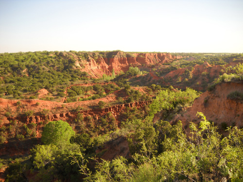
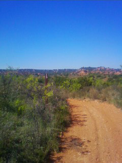
Along the Upper Canyon Trail
(Trail C)
In the next three entries I'll describe each trail we used and show photos
from the sections I hiked. I'll provide some information about the Trailway at
the end of the series.
The second page has the most photos (39, I think) and will take a little
longer to load than the first and third pages. I hope you enjoy the photos!
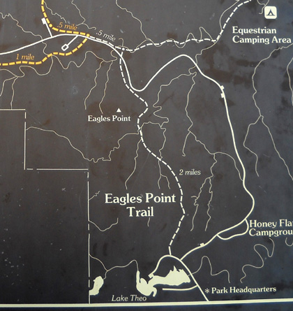
GENERAL CAPROCK TRAIL INFORMATION
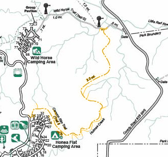
In addition to the official park
map, this sign is another representation of
some of the multi-use trails within the park:
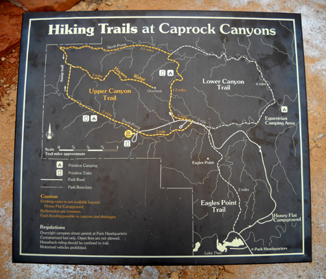
Hikers and runners may use all these trails, including equestrian trails not shown
on this map.
Cyclists and equestrians may not use the gold-colored trails in the western (left) part of
the park because they are either too fragile or too gnarly. Bikes can go on the
Eagle Point Trail (white dotted line in lower right quadrant of map) but not horses.
Equestrians are limited to the Lower Canyon
Loop (upper right dotted line on map) and several other trails that aren't shown on the map above:
the Canyon Rim Trail, Mesa Trail, Wild Horse Trail, and Old Ranch
Road, all in the north and east sections of the park. Those trails are shown on
the map at the web link above.
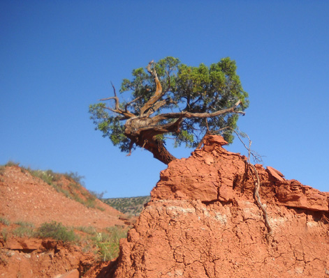
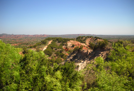
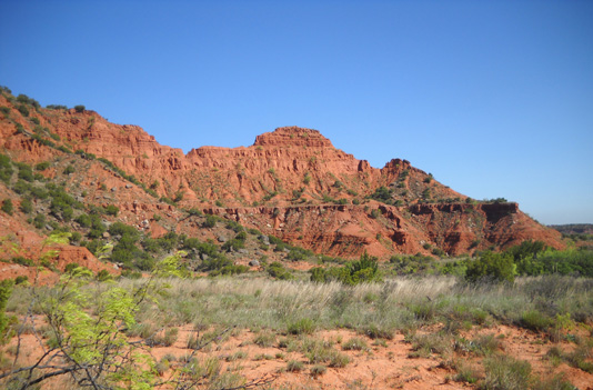
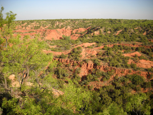
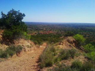
Ya gotta be tough to survive in this environment! (Canyon
Loop / Trail D)
Trail users are advised to consider the rugged terrain, potentially harsh weather,
scarcity of water, and presence of
rattlesnakes before embarking on any adventures in the canyons and on high
ridges.
Flash floods
or lightning may occur whenever it rains. The sun is direct all year and feels hot even
on cool days. Sunscreen, a map, and lots of water are necessities. Normal rules apply re: staying on trails,
packing out all trash, and keeping pets on a leash.
Most times of the year Caprock Canyons is very dry and there isn't any or
much water flowing through the ravines or streams, even the Little Red River.
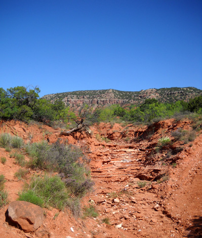
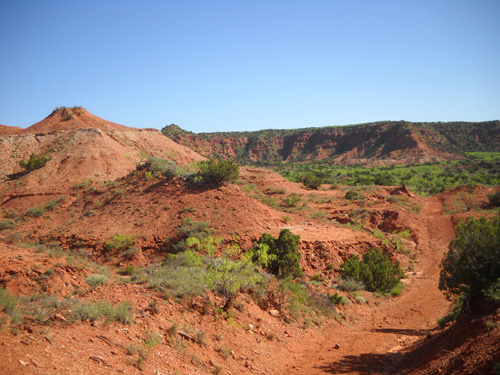
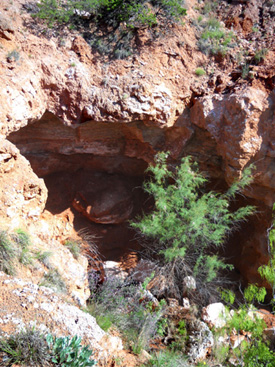
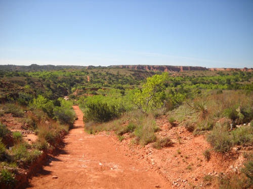
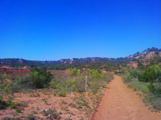
Typical dry streambed (Upper Canyon / Trail C)
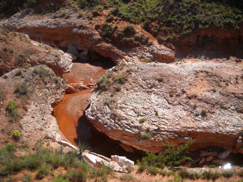
Cody was able to get a smidgen of water at a couple of the Little Red
River's tributaries
along the Eagle Point Trail, including this section (below) near the Natural Bridge,
but I didn't see any water sources on the other trails we hiked. They
were all bone dry, even in the spring.
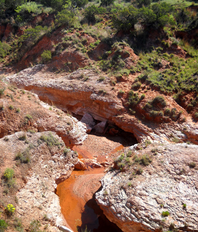
I was standing about thirty feet above the stream when I
took this picture.
Nor is water available at any of the trailheads beyond Honey Flat Campground. There are signs everywhere that
warn trail users to carry adequate water for themselves and their animals,
including this trail marker at the intersection of the Lower and Upper Canyon
Trails:
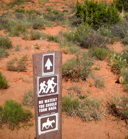
No water, no entree
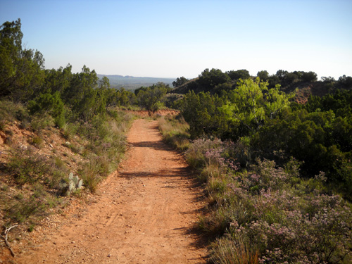
Just looking at trail maps, Jim and I expected the trails to be mostly
single-track. They aren't. Most that we saw looked recently graded and six to
eight feet wide, which makes sense on multi-use trails:
A nice, smooth section of Eagle Point Trail (Trail J) down in the
canyons
The Eagle Point and Canyon Rim Trails are more narrow and
grassy on the rim . . .
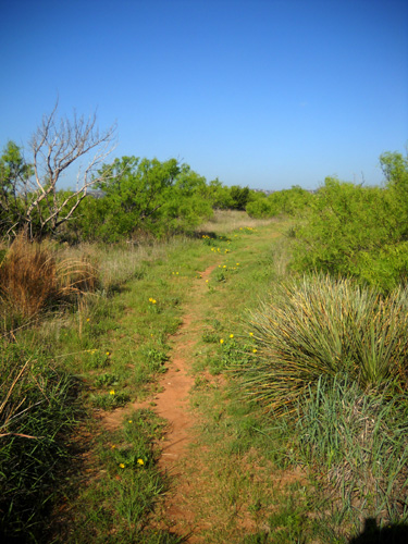
Upper section of Eagle Point Trail near
the interpretive center
. . . before descending into the canyons but most are reddish dirt, smooth in
some places and rocky in others. There aren't many flat places to run inside
the park; the trails constantly wind up and down through the ravines and cliffs.
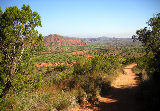
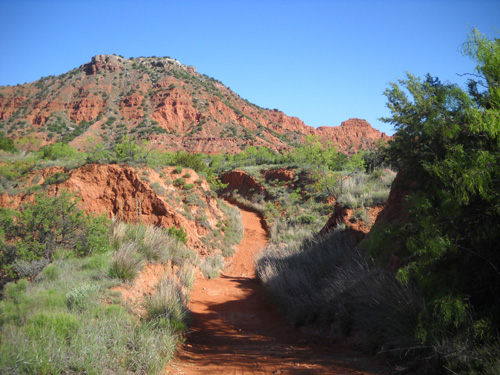
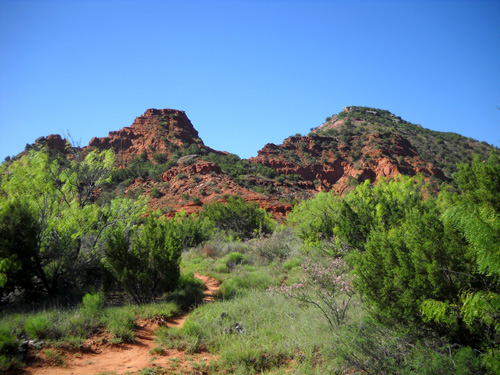
The Upper Canyon Trail (C)
roller-coasters through the canyons.
We really enjoyed the trails at Caprock Canyons. Come along while I show
some of them to you!
EAGLE POINT TRAIL (TRAIL J)
This two-mile trail, which is open to pedestrians and mountain bikers, goes
point-to-point in a mostly north-south direction from Lake Theo or the interpretive center on the escarpment rim and
generally
descends through the canyons to the Eagle Point formation near the Little Red
Tent Camping Area:
The first half mile of the trail (below) follows a narrow path through
mesquite, shrubs, grasses, cacti, and wildflowers on the canyon rim, affording
great views of the canyon below:
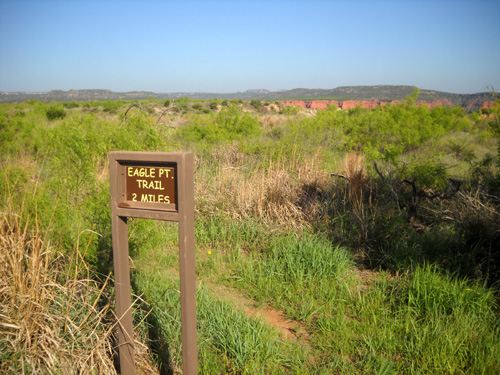
Eagle Point trailhead near interpretive center
I took these photos "outbound."
The trail widens to 6-8 feet when it intersects with a trail from Lake Theo and
it begins its long, rolling descent into the canyon and through the ravines:
Gotta get over these two hills first.
All the tire tracks in the sand and silt indicate cyclists like this trail.
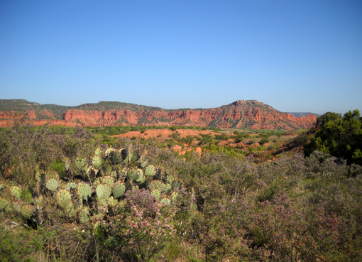
Cacti, junipers, wildflowers, and flowering shrubs soften
the harsh desert landscape.
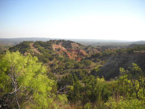
Great views to the west and north parts of the park
In and out of ravines
Getting closer to Eagle Point
The next three photos are in the Natural Bridge area as I neared the far
trailhead:
This is the view of Eagle Point from the other side; there is a wayside on the
park road about a quarter mile beyond the trailhead at that end of Eagle Point
Trail:
The next two photos are coming back on the same trail:
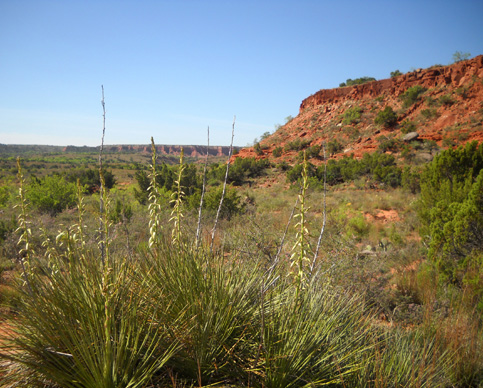
Yuccas in bloom
Long view back to my start.
Jim and I enjoyed this trail. It is very runnable and the views are scenic,
particularly going north.
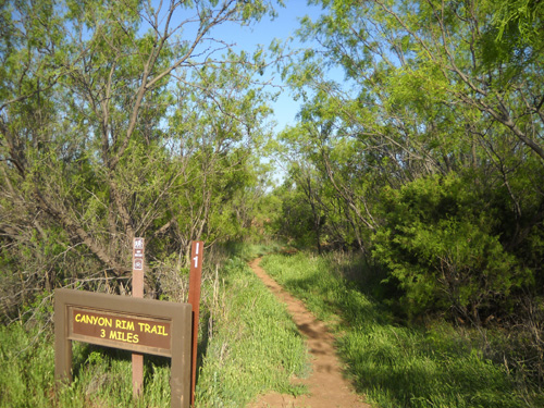
CANYON RIM TRAIL (TRAIL I)
The
Canyon Rim Trail is a three-mile point-to-point trail that starts up on the
canyon rim at one end of Honey Flat Camping area and dips down into the canyons
before it intersects with the Wild Horse Trail. I took a section of the
official park
map (below) and colored the Canyon Rim Trail orange:
Jim ran this as an out-and-back run, exploring a little of the Wild Horse Trail
in either direction, for a total of about seven miles.
The most convenient trailhead to start is at the north end of Honey Flats CG:
The trail is fairly flat for the first mile and a half. Single-track trail
through the mesquites soon morphs into a wider track through prairie, where I
sighted several mule deer (not shown here).
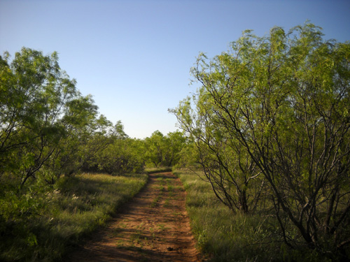
Then I popped out into more open terrain with cacti, shorter grasses, and lower
shrubs.
The trail hugs the rim of one of the park's eastern canyons for about half a
mile.
I took these larger photos when I did a short out-and-back on the trail
Monday evening; the cloudless sky was still obscured with some of the dust from that afternoon's
windstorm.
Jim took a few photos along this trail with his cell phone. This is as large as
they can be without getting pixel-y:
Jim reported that after about 1˝ miles the trail
turns more toward the north and takes a steep dive into the canyons. It travels
up and down through ravines with dry creeks that channel water into the Little Red River in
the eastern part of the park and soon intersects the Wild Horse Trail.
You can easily make this a run or hike of up to 25 miles (or up to about
16 miles on a mountain bike) if you continue west on Wild Horse and add in
various parts of the Mesa (Trail H), Lower Canyon (Trails E and F), Canyon Loop
(Trail D), Upper Canyon (Trails A and C), and/or Eagle Point (Trail J) trails.
Next entry: exploring two of the Upper Canyon trails
Happy trails,
Sue
"Runtrails & Company" - Sue Norwood, Jim O'Neil,
and Cody the Ultra Lab
Previous
Next
© 2010 Sue Norwood and Jim O'Neil
