This entry is the second of three trail pages.
CANYON LOOP TRAIL (D) + UPPER CANYON TRAIL (C)
Canyon "Loop" Trail is a misnomer. This 1˝-mile
section of trail is mostly a connector trail between the Lower and Upper Canyon
trails, the middle vertical part of the large figure-8 lying on its side
below:
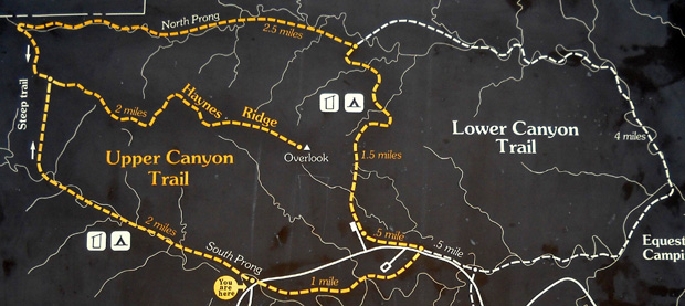
Its southern end is in a parking lot that serves as a trailhead for the Canyon
Loop Trail (D) going north and the Lower Canyon Trail (F) going east. The
entire Upper
Canyon loop is about ten miles long, the Lower Canyon loop about six miles.
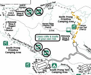
Here's another map section showing the Canyon Loop Trail (D) in orange:
Click
here to see it in context with the entire
park.
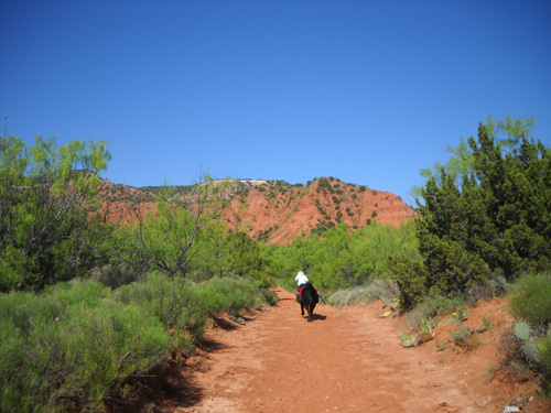
Jim and I both used this connector trail on Tuesday when we did an out-and-back run/hike
on the northern part of the Upper Canyon Trail from the trailhead parking lot
at the bottom of the orange dotted line. At the top of the orange line we went
left, then turned around after another mile (me) and two miles (Jim) and
retraced our steps to the parking lot.
I'll show photos of both trails from both directions in this section, then talk
about the southern trailhead of the Upper Canyon Trail separately.
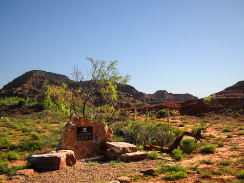
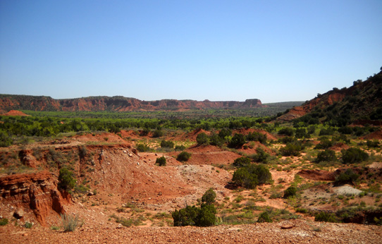
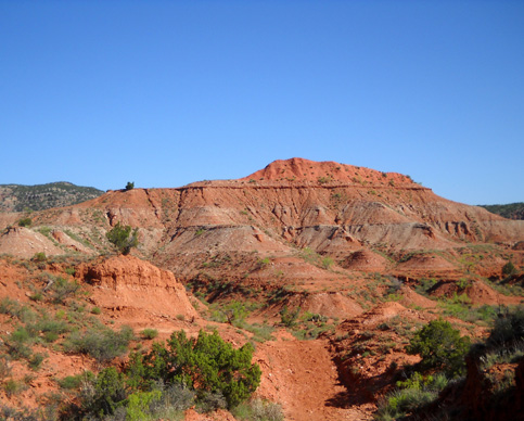
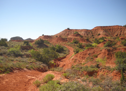
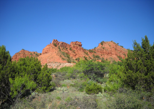
Views of the surrounding hills are scenic even from the large parking area.
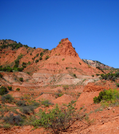
Here are two perspectives of the nearby cliffs to the west:
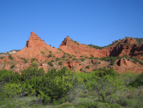
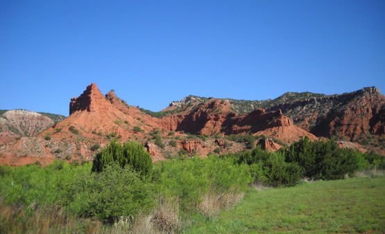
This view
looks north from the parking area:
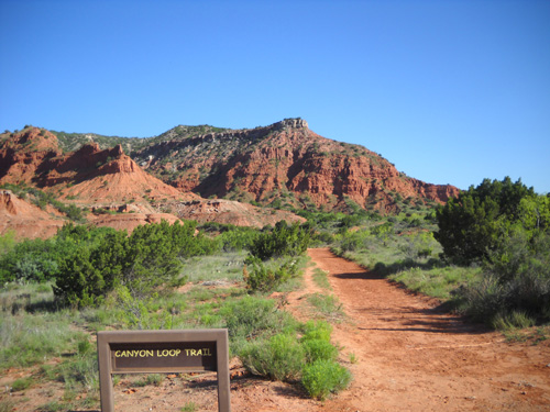
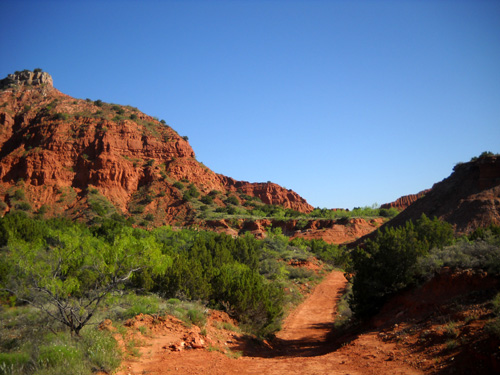
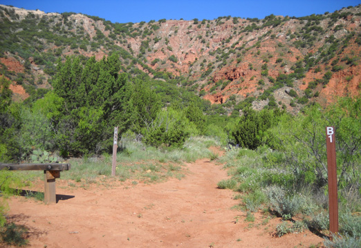
And this is the beginning of the trail:
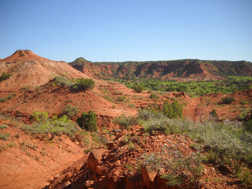
The loop trail stayed fairly wide, smooth, and hilly as far back as we went
but according to the park map, the Upper Canyon Trail (C) gets "extremely steep
and rugged" in two places in the far northwest corner of the park, which is
where the highest elevations are located (3,180 feet).
Bikes and horses are
allowed on the 1˝-mile Canyon Loop Trail (D) but
not past the intersection where the Upper Canyon Trail (C) begins --
probably because of the gnarly mountainous terrain in that corner of the loop.
We didn't see any bikes or horses on the Loop Trail on Tuesday.
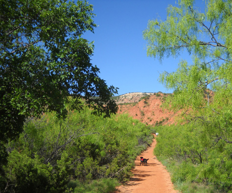
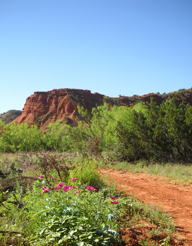
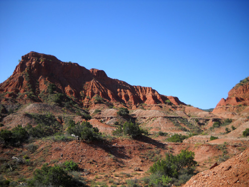
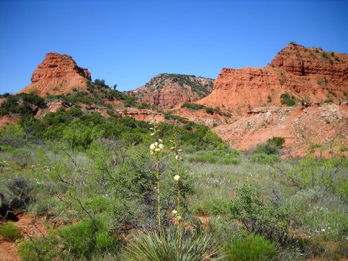
The next photos are going outbound (north). I
loved the views and took tons of photos! I've already shown some photos from
this trail (including pictures of the numerous flowers and flowering shrubs) in
the previous Caprock entries and will try to put only new ones here.
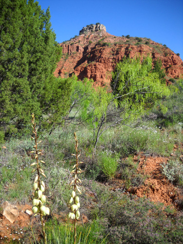
About a third of a mile from the trailhead the trail climbs up
and through a "portal." You can't see the next views until you reach the top of
that climb. I love surprises like that on a trail!
Soon I came to this eastern trailhead for the Haynes Ridge
Overlook Trail (Trail B):
I had planned to hike and back on that trail instead of going any
further on the loop trail but after a couple hundred yards it got very
rocky and went straight up! I'm talking about a 60% angle, at
least, for as far as I could see.
Yep, that's another one of those sections marked "extremely steep and
rugged" on the park
map!
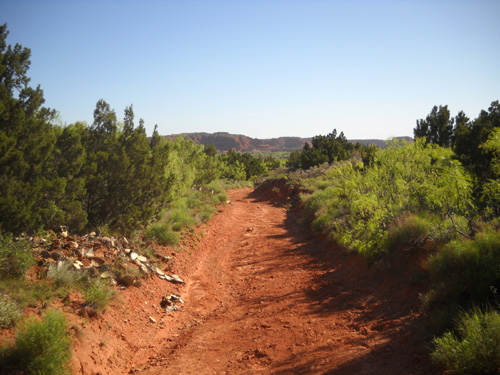
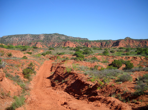
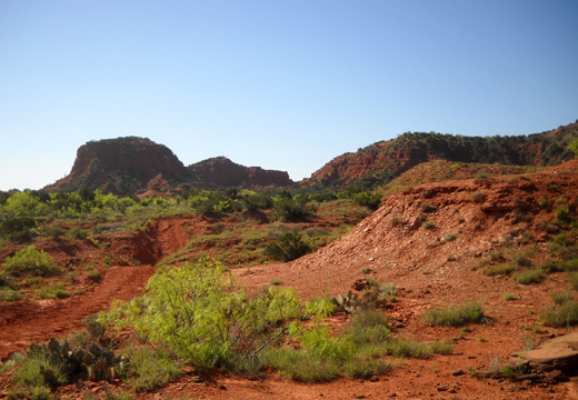
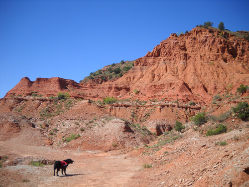
So I went back down to the Canyon Loop Trail and continued north:
About one mile from the trailhead I came to a path leading to the North Prong
Primitive Camping Area:
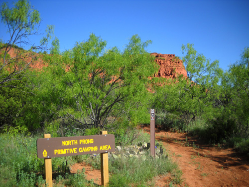
It looks like a nice camping area for backpackers. I came back
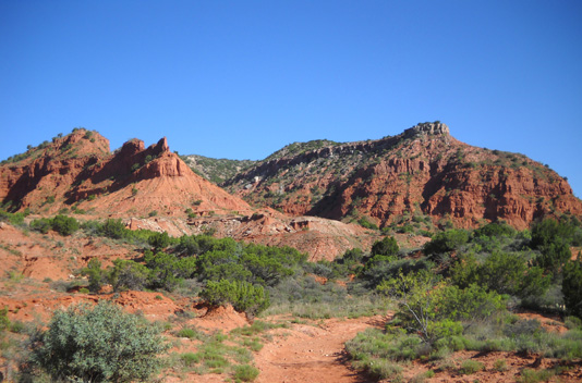
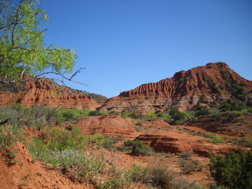
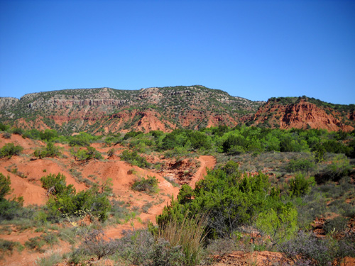
to the main trail and continued north and west through the scenic, rolling
landscape:
Jim caught up to Cody and me a little before we came to the intersection of
the Upper and Lower Canyon Trails.
That morning Jim had started out from our campground on the Eagle Point and
Lower Canyon Trails, about a 3˝-mile run to
the Canyon Loop trailhead where I parked our truck.
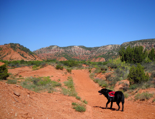
Cody wasn't sure who he was running with at that point!
Cody knew who was carrying his dog bones and water, however, so he stuck with
me! Smart dog.
In another quarter mile we came to the intersection with the Lower Canyon
Trail (C) going east and the Upper Canyon Trail (C) going west. We both
followed the Upper Canyon Trail. Jim went on another couple miles before
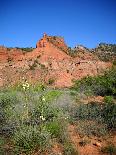
turning around. Cody and I went for only one more mile, enjoying the hilly
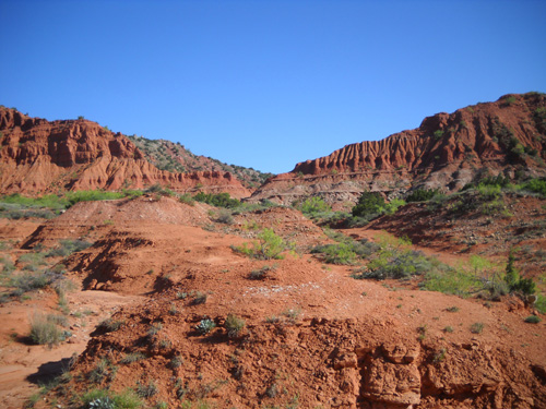
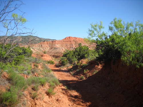
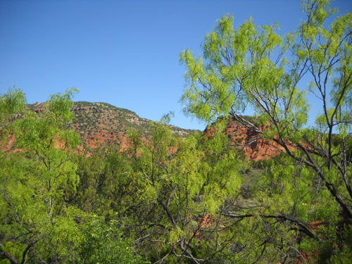
terrain that was alternately stark vs. verdant:
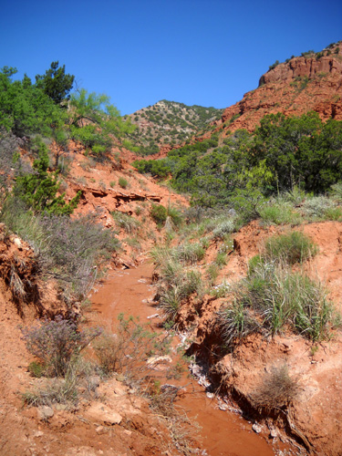
I turned around at a dry creek bed and retraced my steps back
to the truck on the main trails (no side trips as on the outbound). The
remaining photos in this section are some views going east and south.
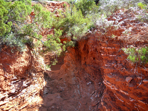
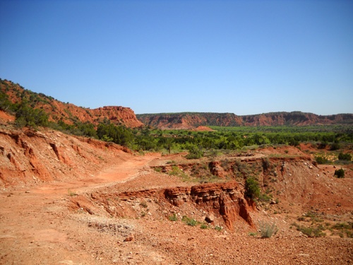
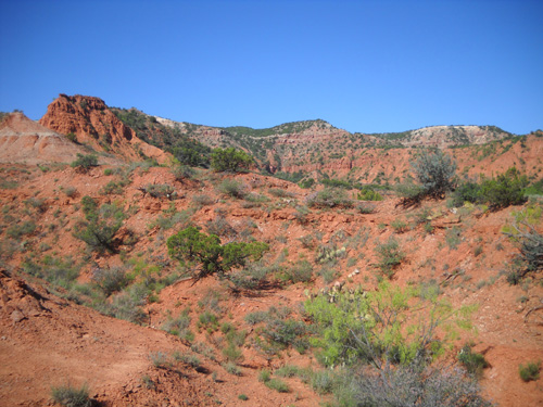
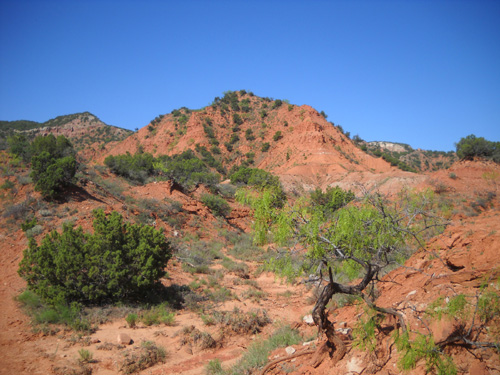
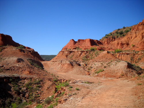
Small slot canyon
The next three pictures are approaching what I call the high
"portal" that is about a third of a mile from the trailhead:
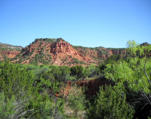
Cody's glad to be about done; I'm
admiring the erosion sculptures on the hills.
Now we're almost back to the truck:
I guess you can tell I liked that trail! That was a lot of
photos, but only a third of the ones I took that day.
Next entry: Let's go look at the other trailhead for the Upper Canyon
Loop, and I'll also tell you about the Caprock Canyons State Park Trailway.
Happy trails,
Sue
"Runtrails & Company" - Sue Norwood, Jim O'Neil,
and Cody the Ultra Lab
Previous
Next
© 2010 Sue Norwood and Jim O'Neil
