This entry is the third of three trail pages.
UPPER CANYON TRAIL (TRAIL A)
There is another trailhead for the 10-mile upper canyon loop
that begins in the parking area for the South Prong Tent Camping Area. It is at
the end of the park road and about a mile from the trailhead Jim and I used for
the last run/hike I detailed.
Here are the relevant map sections again. This time I
highlighted the beginning of the trail going clockwise on the official
TPWD map:
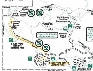
It joins the other Upper Canyon Trail (Trail B) in the upper
left corner of the park property and continues on around to the North Prong
Trailhead. Per this map, to do a complete loop and end up back at the South
Prong trailhead where you started, you'd have to run or walk about a mile on the paved park road.
The next map, from a sign at the South Prong trailhead, shows a
trail going directly from this camping area to the Little Red Tent Camping
Area, then connecting to the Lower Canyon Loop -- an option that is over
a mile longer to
make a complete loop (i.e., end up back where you parked your vehicle), but
it indicates that it's all trail:
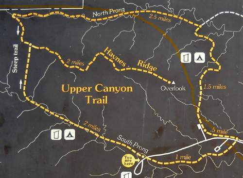
See it in the lower right corner? I don't know which map is
correct. We weren't looking for a trailhead going east from the "You are
here" circle and neither of us remembers seeing one there.
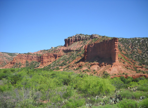
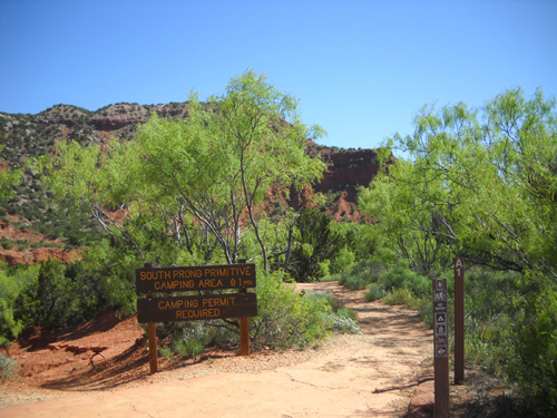
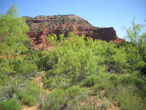
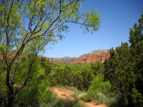
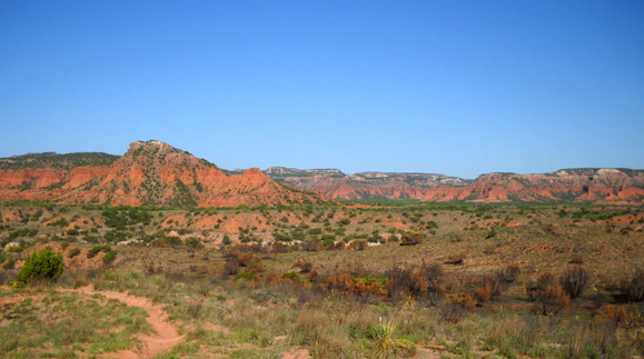
I've already shown some photos of the canyon from the covered
pavilion at this parking area. Here are a few more pictures from the trailhead
going west. I
went out only about a quarter of a mile and back -- just no time to go
farther during this visit.
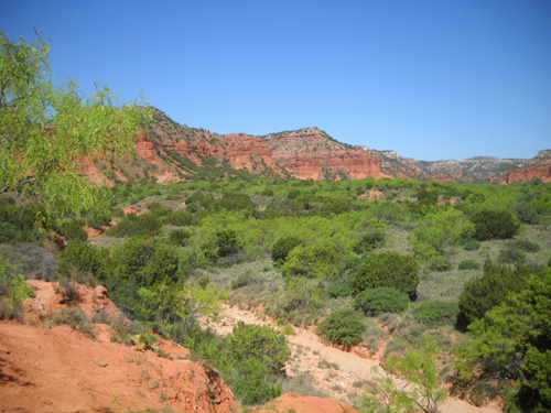
Above and below: views from trailhead
That trail's definitely on my list to hike the next time we
visit Caprock Canyons, at least up to the part that is "extremely steep and
rugged."
After all, my knees aren't 35 any more . . .
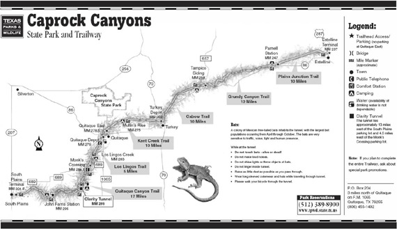
THE CAPROCK CANYONS TRAILWAY
Although physically separated from Caprock Canyons State Park, the Trailway
is also owned and maintained by the state. It is a second unit of the state
park and is included in the official 15,313+ total acres.
You can see its physical relationship to the state park in the
map at this link, which also shows trailheads
to the various sections of the trailway.
According to the park's printed visitor's guide to the trailway,
interpretive
guide and other website pages, in 1992 the
Texas Parks and Wildlife Department (TPWD) acquired 64.25 miles of a
Burlington Northern Railroad's right-of-way between the towns of Estelline in
the Red River Valley at the northeastern end and South Plains atop the Caprock
Escarpment at the southwestern end after a branch of the line was closed.
The transaction between the railroad salvage company and the state was
facilitated by the Rails-to-Trails Conservancy, which has helped communities
convert thousands of miles of abandoned railroad corridors into multi-purpose
recreational trails. The land, tunnels, trestles, and other structures were
donated to TPWD. Funding for visitor information materials and interpretation
along the trailway was provided by a federal transportation enhancement grant.
The trailway was opened to the public in 1993 for recreational use by
hikers, runners, cyclists, and equestrians. It is composed of six trail segments
that vary in length from five to seventeen miles. Numerous original railroad
trestles remain over creeks and ravines, including one bridge that spans more
than 200 feet over the often-dry Los Lingos Creek.
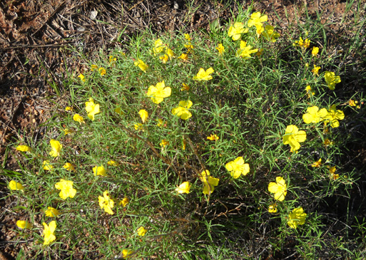
Spring buttercups
The 742-foot Clarity Tunnel is one of the most interesting features of the
trailway and is included in the National Register of Historic Places. Thousands
of Mexican free-tailed bats raise their young inside the tunnel each summer.
What's particularly fascinating to visitors is watching the adult bats fly out
of the tunnel each evening from April to October in search of food, just like
the bats at Carlsbad Caverns do (only there aren't as many as at the caverns).
The mile markers along the trailway are the original ones used by the
railroad, so instead of ranging from 1 to 64 they are numbered in the 200s. Day
or overnight visitors using the trailway should pick up a copy of the visitor's
guide and map at the state park headquarters. The visitor's guide has a wealth
of information about the terrain, geology, wildlife, plant life, and history at
various mile markers along the trail.
Overnight visitors must obtain a permit to camp. Day users can obtain
permits for trail use from trailhead fee collection boxes.
CLOSING THOUGHTS ABOUT CAPROCK CANYONS STATE PARK
I've included a lot of information about this park, considering
we visited it for only a few days!
There are two reasons for this: I was pleasantly surprised
with the beauty of the place and I hope other folks will want to go see it, too. Caprock Canyons doesn't get near as many visitors
as Palo Duro Canyon SP. One big reason is its more remote location;
it's not as close to a large metropolitan area or freeway.
My opinion is that Caprock Canyons State Park is well worth a visit,
either as a destination in itself or en route to other places. I definitely want to
return. After we visit Palo Duro I'll
compare the two parks and let you know which I prefer.
Next entry: introduction to Palo Duro Canyon State Park
Happy trails,
Sue
"Runtrails & Company" - Sue Norwood, Jim O'Neil,
and Cody the Ultra Lab
Previous
Next
© 2010 Sue Norwood and Jim O'Neil
