After seeing the HRH trail marking group off this morning, we went for our first Jeep
ride in the San Juan Mountains east of Silverton.
That’s fun!! Now we want a Jeep, too.
No wonder so many "Jeepers" come to the San Juans to ride. It's a
popular summer and fall destination for Jeep clubs and individual Jeep
owners from around the country -- especially Texans looking to
escape the summer heat within a day's drive. We see a lot of Texas
license plates when we visit Silverton.
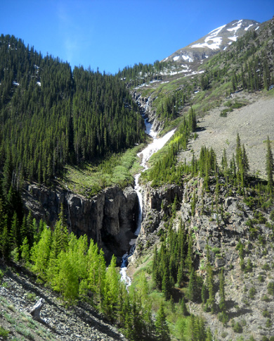
Much of the scenery in the San Juans is
inaccessible except by foot, on horseback, or
via an ATV, Jeep, or 4WD truck. This partly-frozen
waterfall is on FSR 588 to Maggie Gulch.
For folks who don't own a Jeep there are businesses in Silverton, Ouray,
Lake City, Telluride, Durango, and other nearby towns that rent them out
for self-tours or guided tours.
So far we've been too
frugal to rent one of the things.
Today we got an opportunity to
join
two of the couples we know in our campground who tow Jeeps behind
their motor homes. They needed an excuse to go play in the mountains and
we helped give them one.
We rode with Roy and Laura, our ham radio friends, in their vehicle. Their
friends, Bob and Lalani, followed us in theirs. Both couples
are members of the Hemet Jeep Club in their California hometown.
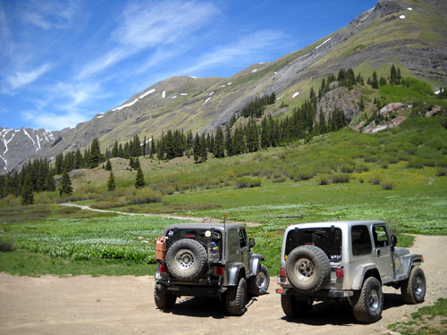
Our friends' Jeeps at Cunningham Gulch
Roy and Laura have been
vacationing with a Jeep in the San Juans for fifteen years but it’s Bob's and
Lalani's first time here. Roy is happy to play tour guide for them --
and others they meet -- while they're in the area.
There are hundreds of miles of little forest service roads like this to
explore and they prefer doing it with friends instead of alone.
Sometimes we'll see groups of ten or twelve Jeeps in caravans on a
beautiful summer day like this.
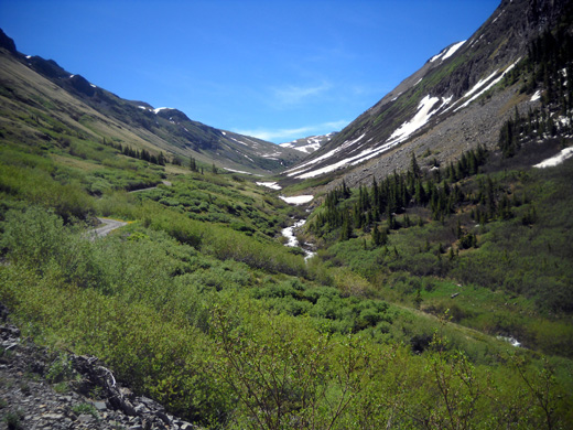
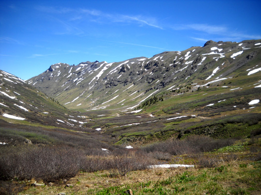
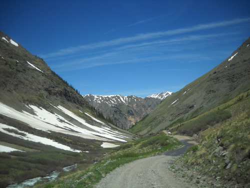
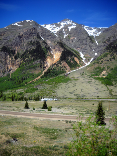
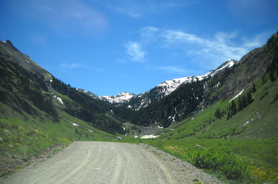
View up into Maggie Gulch
Jim’s and my main goal today was to see what the road through Maggie Gulch
looks like, in case we work the radio and/or timing at that aid
station during the Hardrock race. We've never driven up there.
After seeing the road
today
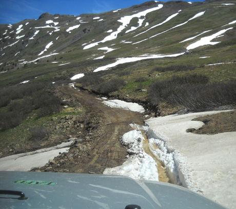
we don’t think we want to take our 2WD truck there, mainly because FSR 588
is so darn narrow most of the 3+ miles through the gulch. It was
hard enough to squeeze by other vehicles we met in the little Jeep; our
truck is significantly bigger.
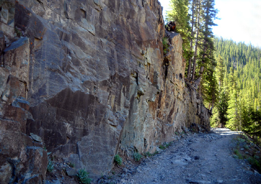
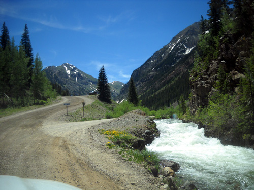
Skinny section of the road to Maggie Gulch between
a rock wall and a cliff.
Some of the road surface is pretty rough, too. Even rocks like
those in the photo above were enough to jolt the Jeep around.
Farther up we ran into some mud and snow:
We’ll have to talk with Shauna, communications director for HRH, before
we know for sure if we’ll be working out there during the race.
If that's where she wants us, we'll probably ride out with someone else.
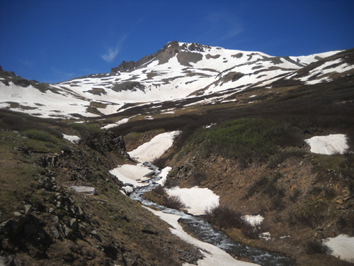
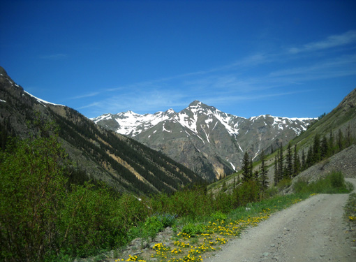
Canby Mtn. (elev. 13,478') is in the background;
the Hardrock course is up there somewhere.
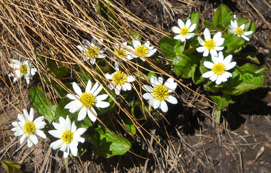
Marsh marigolds start blooming in late spring/early
summer as soon as the snow melts.
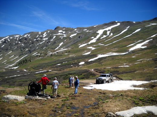
We parked at the end of the road through the gulch for about 15 minutes
to enjoy the scenery and look at relics from an old mine:

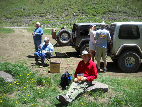
L-R: Roy, Jim, and Bob inspect some old
mining equipment. There are relics
like this all over the San Juans (mining equipment,
not retired RVers!!).
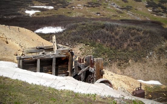
I think where we parked is the location of the Maggie Gulch aid station during the race. The elevation
is 11,800+ feet, higher than the Cunningham Gulch aid station
where we've worked several times previously.
After seeing the location of the Maggie Gulch aid station Jim and I are
less interested in working there than at Cunningham. Maggie is pretty
exposed (i.e., doggone cold overnight during the race) there above tree
line and we wouldn't be able to take Cody with us if we're riding with
someone else.
We'd also miss seeing our friends who are crewing for runners; they are
discouraged from driving up to Maggie Gulch
during the race. Every crew will be at Cunningham because it's
easier to access and it's the first aid station in this year's
counterclockwise direction. If we work Cunningham we can see a lot more
people.
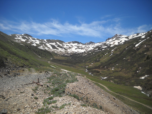
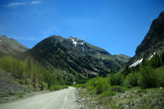
Nice view looking back (NW) where we came up through
Maggie Gulch.
On the way out of the gulch Roy drove up a little side road to see the
remains of another old mine.
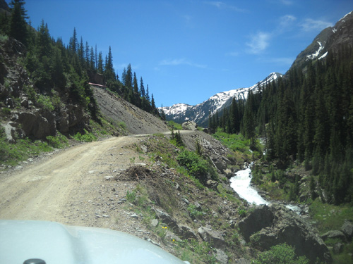
We had a good view back toward the high end
of the gulch (to the SE) where we'd just been -- opposite direction
from the picture above:
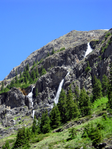
We could see another series of waterfalls coming down from Galena
Mountain:
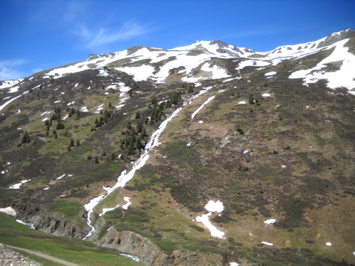
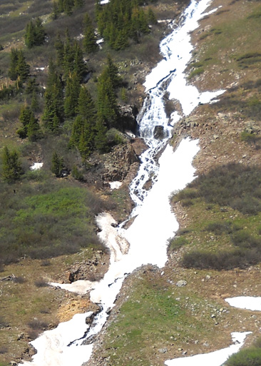
Although there is still some ice and snow over that stream the
water is flowing beneath it.
We scared off about twenty marmots in the rocky area where we turned
around at this location.
We saw lots of marmots today. This furry fella was along the road in
Cunningham Gulch; it's unusual to be able to get this
close to one:
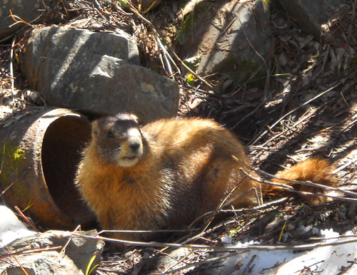
Ready to
escape into his drainage pipe when necessary
I love seeing marmots. Folks who've returned to their vehicles at
trailheads and discovered chewed brake lines, etc. aren't so fond of
them, though.
Here are two more photos I took on the way back down out of Maggie Gulch to CO 110:
When we got back down to CO 110 (AKA Alpine Loop, the road that goes
northeast to Eureka and beyond, or southwest to Silverton) we checked out a
dispersed camping area across the road:
Several RVs are parked between CO 110 and the Animas River; Dome
Mtn.
looms overhead. Folks have camped on this side of the road, too. See the
campfire?
Roy thinks this is BLM land that doesn’t get as crowded as the dispersed
camping area farther up the road at Eureka, where lots of folks camp
with their noisy ATVs. There are some private in-holdings along this road,
however, and it's difficult to tell what's public land and what isn't.
We’re interested in alternatives if the Forest Service tells us to leave
South Mineral Creek after two weeks.
Roy arrived a day earlier than we did. He's gotten notes on his RV in
previous years when he's been there a couple of months but he’s never
actually been run out or gotten a citation. Word is that the rangers are
more hard-nosed this year.
CUNNINGHAM GULCH
After checking out the dispersed camping area we drove back west on CO
110 to FSR 589, which runs several miles south through Cunningham Gulch.
Near the beginning of
the road at the former mining town of Howardsville the road splits and
rejoins about a mile later. The upper road leads to the famous Old
Hundred mine; Roy took the lower road along Cunningham Creek into the
gulch and returned on the higher road.
High road left, low road right
Jim and I know these roads very well because we've driven them
numerous times.
Both the high and low roads are OK for 2WD vehicles to the location of
the Cunningham Gulch aid station (about three miles). Crews are used to
driving back this road to the AS during the race. It's rough enough that
we've never wanted to take our camper back there, however. Plenty of
other people do, though.
I took the next three
pictures out the windshield as Roy drove toward the aid station site:
About 2˝
miles back the road we stopped to eat lunch at the horse
corrals right before the Cunningham AS location.
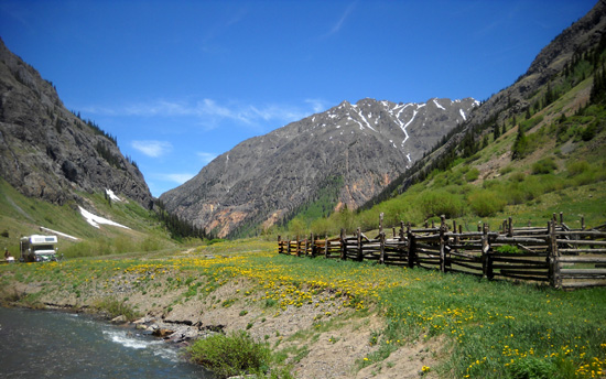
A truck camper was parked just
downstream in a great place to camp for free; most of this is
National Forest land back here:
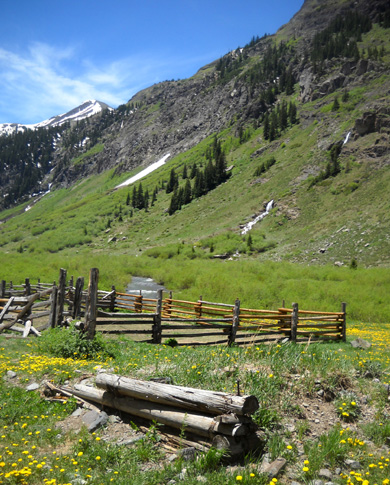
I spent more time taking pictures than eating. The waterfalls on either
side of the road are spectacular this week! Note all the dandelions,
too. <smile>
The Hardrock course is to the
right of these falls on Little Giant Mtn.
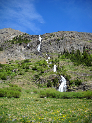
This long series of falls is on the other side of
the road, coming off Green Mtn.
That's enough photos for this page . . .
Hit "next" for pictures from the high end of the canyon and verbiage
about the obstacles we encountered on our way up into the mountains.
Even Jeeps can't go everywhere!
Happy trails,
Sue
"Runtrails & Company" - Sue Norwood, Jim O'Neil,
and Cody the Ultra Lab
Previous
Next
© 2011 Sue Norwood and Jim O'Neil
