In the past decade Jim and I have participated in quite a few course
marking and trail work groups in the two weeks leading up to the Hardrock Hundred
(HRH) footrace through the San Juan Mountains.
Participants include runners in each year's race, crews, pacers,
spectators, and volunteers. Group size varies from day to day and
those involved can choose how many of the hikes/work days they want to
attend -- all, some, or none.
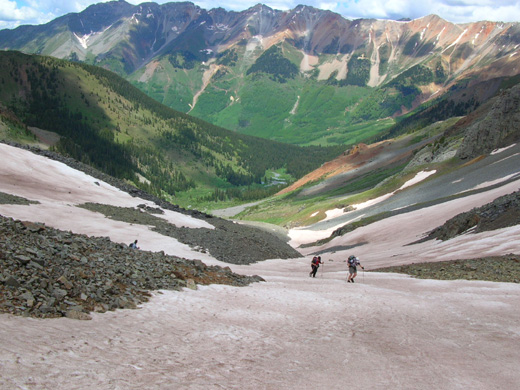
Jim took this photo during trail
marking from Chapman to KT on June 27, 2009. Oscar's Pass
is in the
background; the runners are climbing up to Grant-Swamp Pass (12,600' at the
top).
All they have to do is show up at Charlie's house by a certain time
each morning that a course marking or work day is scheduled, listen to a brief
description of that day's task, and carpool to the start and/or finish
of that day's hike.
I say "hike because the marking days go at a very
slow pace with lots of stops and on trail work days, everyone has to
carry tools and supplies to the work site -- which is very likely
to be uphill and over 12,000 feet in elevation.
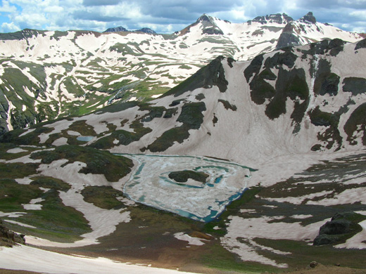
Iced-over Island Lake (center
foreground) and the
snowy Upper Ice Lake Basin; Jim took
this photo on the same trail marking day in
2009 just below 12,600-foot Grant-Swamp Pass.
Most of the trail marking days are very popular:
- For runners entered in the race it's a great chance to acclimate to elevations
up to and over 14,000 feet, to learn about interesting local history from Charlie, to
socialize with others in the group, and to see parts of the course before race
weekend.
- For race organizers it's an opportunity to scout out current
conditions in the mountains and get help carrying dozens of markers.
- For the rest of us -- crews, pacers, volunteers, interested
onlookers -- it's
a slow-moving party with old and new friends and an opportunity to enjoy
some of the most awesome scenery in the world.
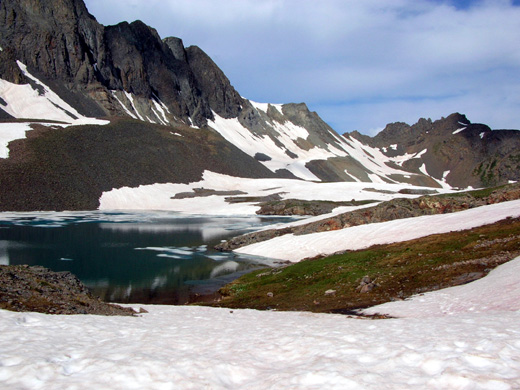
Alpine lake high up on Handie's Peak
(14,000+ feet);
Jim took this picture during a
trail work day on July 7, 2007.
Work days are tougher and are usually done by runners seeking extra
credit to increase their odds of making the lottery in the next year's
race. I think the odds this year for a runner with no extra credits or
five previous finishes to get into the race was only about one in eight,
maybe less.
This is an increasingly popular event and only 135-140 people are
permitted to start. Neither Jim nor I have qualified to enter it in the
last decade but we enjoy working the race, seeing our friends, and
running/hiking in these beautiful mountains.
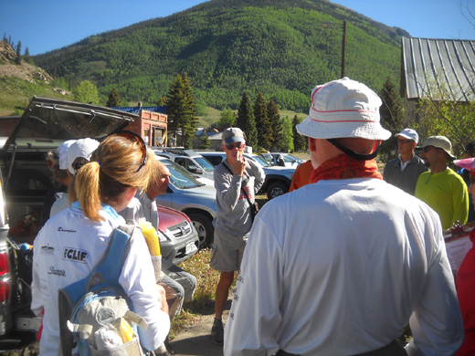
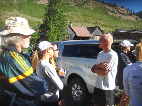
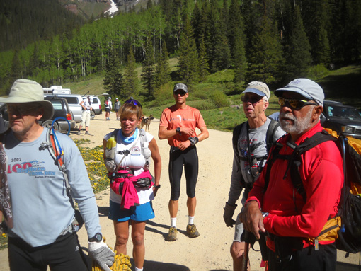
Charlie (facing camera) tells
today's trail marking group about plans for the day.
Because each course marking or trail work day is an all-day affair
over rugged terrain, Jim and I both opted out of today's course marking.
Jim's knee still hurts and I'm not acclimated to 12,000 feet yet. Both
of us have done course marking on this section previously so it wouldn't
introduce us to a new section of the course; otherwise, I
probably would have gone.
We did want to visit with friends who have already arrived in town to
run or work the race, however, so we showed up at Charlie's house in
Silverton a little before 9 this morning to see who was participating.
As usual, it was like a homecoming to see folks we often see at this
race -- Charlie Thorn and Andi Crohn, Deb and Steve Pero, Kathy
Lang and Jim Ballard, Beth and Larry Hall, Phil Wiley, Jean Jacques
d'Aquin, Mark and Margaret Heaphy, Chris Rios, Jennifer and Jerry Roach, and
at least a dozen other people.
It was great to see them all again!
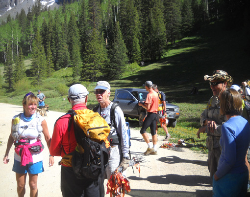
At the trailhead: Charlie
holds a bunch of flags to mark the course. Other folks also carried
flags.
Today the group planned to mark approximately ten miles of the
Hardrock course from the Kamm Traverse (KT) aid station on South Mineral
Creek Road to the outskirts of Silverton.
Each year the Hardrock course
reverses the direction of its loop; since the race goes in the
counter-clockwise direction this year (Silveton-Ouray-Telluride-Silverton)
each segment will be marked in that direction so runners will be able to
see the markers better.
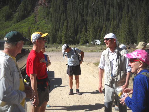
L-R: Jim, Phil, Leah
(behind Phil), unknown, Ballard, Kathy
Because most sections are marked point-to-point, and some of the
trailheads/aid station locations on the course require long drives
and/or 4WD vehicles to negotiate rough roads, course marking organizers
have to get creative and use various ways to get participants to the
beginning and retrieve them at the end.
Today the group used a variety of methods to mark not only KT to
Silverton, but also KT to the Ice Lake Trail, a total of about 13 miles.
This section also required the trail markers to add over a mile of
walking before reaching the course at KT and another couple miles at the
end.
Everyone initially started this morning from the Ice Lake trailhead parking area I described
yesterday, about four miles back South Mineral Creek Road from US 550
north of Silverton. There is room
for about one vehicle at the KT aid station so all 25-30 volunteers had
to walk back the road to that location before placing course markers
anywhere.
The main group had a major diversion at the end -- detouring to a bridge
over Mineral Creek instead of fording it at the usual place next to US
550 below Nute's Chute.
Although Rodger Wrublik and friends already fixed a rope across
Mineral Creek where the trail crosses the creek a couple miles from the
finish in Silverton, the creek was deemed to
be running too high and fast today for the folks marking the course to
use the rope. Unfortunately, I don't have a current picture of the creek
at this location.
This is the same creek that I've been showing you at our campground
-- except that another mile downstream where the Hardrock runners
go across it's even higher and deeper from more feeder streams. The
folks marking trail today stayed on the west side of the creek and used horse trails
for a mile or more to reach
town, then went back to mark Nute's Chute and the rest of the trail on the other side of the creek.
Hopefully Mineral Creek will be lower on race day!
Runners who cross it in the morning or early afternoon will have less
trouble then those going across in the evening or during the night when
it runs higher from the day's snowmelt. This crossing is
near the end of the race so runners will be spread out over about a
24-hour period of time (there is a 48-hour time limit on this race
because of its difficulty). Note that there are quite a few stream
crossings in this event, and Mineral Creek may not be the worst this
time.
Meanwhile, the second smaller group that marked the trail from KT to the Ice Lake
Trail had to come down two miles or more to the parking lot from that
intersection at the end of their day. I believe they were part of the
large group and did this extra section after they finished marking the
first ten miles.
All these variations today required ferrying trail marking volunteers
to and fro.
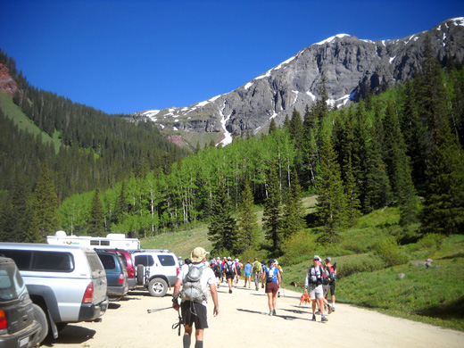
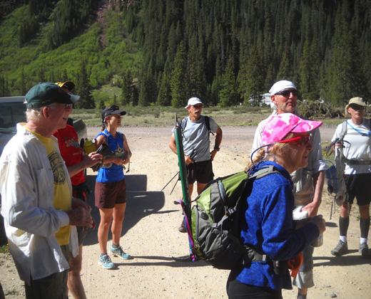
Today's trail marking group heads
out for KT and a fun day in the San Juans.
Some folks left their vehicles at Charlie's house and hitched a ride
with someone else to the Ice Lake trailhead. Some drove their vehicles
out to the trailhead and left them there, with promises of friends or
family to pick them up at the end of the day.
Jim and I could see there were more people than vehicles to transport
volunteers to the trailhead. Since it was sort of "on our way" home anyway, we
offered to take Phil Wiley and his friend Leah out there. Both live in
Durango and drove up to Silverton for the day. That gave us time to see
what Phil's been up to since we saw him at the Bighorn race last week
(he's running two tough 100-milers three weeks apart).
We talked more with friends as they got ready to start their hike to
KT, then drove back to our campground.
DEJA VU ALL OVER AGAIN
This morning I kept thinking about the day I helped mark this section two years
ago in the same direction.
Kathy and I hung together the first few hours that day. Here's a
picture I took from Bear Mountain looking back toward the Ice Lake
basins and Grant-Swamp Pass:
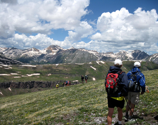
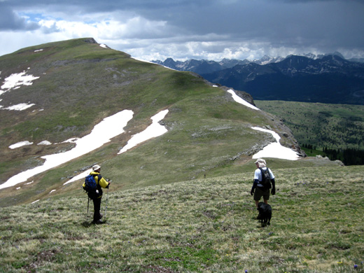
Trail marking group on Bear
Mountain (12,000+ feet elev.). Photo taken June 28, 2009.
There were some snow patches on Bear Mountain that day, but not many.
My Jim and Jim Ballard (Kathy's husband) came up from the other
direction with Cody and joined us on the descent to Mineral Creek, which
was high but manageable that day.
Jim took this picture of me crossing
the creek:
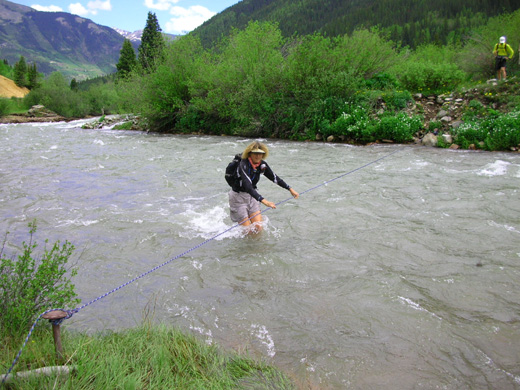
This is fun! (June 28,
2009) The creek was too high and swift today to
safely cross.
I'm sure there's a lot more snow this year at the higher elevations
on Bear Mountain but at least a storm didn't blow in on the group today like it did that
day in 2009:
We barely missed a nasty t-storm
on the ridges of Bear Mountain that day (June 28, 2009); all we
got was some sleet. Jim and Cody are on the right,
near the top of the descent to Mineral Creek.
Ahhh . . . those are some good memories.
This morning when we got back to our campsite
we got ready to go on our first-ever Jeep ride in the San Juans. We spent several hours exploring Maggie Gulch, the abandoned mining
area known as Eureka, and Cunningham Gulch with our ham radio friends,
trying to decide where we want to work communications on race weekend.
There will be aid stations at both Cunningham and Maggie gulches.
Photos from those areas are the subject of the next entry.
Happy trails,
Sue
"Runtrails & Company" - Sue Norwood, Jim O'Neil,
and Cody the Ultra Lab
Previous
Next
© 2011 Sue Norwood and Jim O'Neil
