This area of southeastern Texas is one of those "convergence zones" where
different regions merge and provide an intriguing mix of
terrain and habitats for a wide variety of plants and animals.
If you're into learning about a different environment, it makes a great classroom for children and adults alike.
If you just want to relax and have fun without taxing your brain
too much, Brazos Bend is a great place to do that, too!
The entire park is a nature preserve for over 800 kinds of
plants, 300+ kinds of native and migratory birds, 23 species of mammals, and
21 species of reptiles. There are numerous species of fish,
insects, and
amphibians, too.
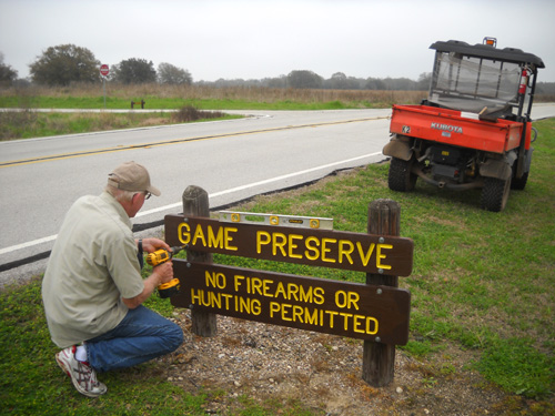
Jim reattaches two of the signs we painted
near the entrance to the park.
In this entry I'll give you a synopsis of the terrain and bio-diversity in the
park. My information is from the park
website, interpretive
guide, various brochures
available in the park office, and exhibits throughout the park.
NATURAL PHYSICAL FEATURES
Except for deep channels cut by the Brazos River and Big Creek,
Brazos Bend State Park is quite flat.
The average elevation is 104 feet. The park lies in a region of Texas called the Gulf Coastal
Plain. Park property includes mostly Brazos River floodplain, or
"bottomland," and some areas of flat upland coastal prairie.
Fortunately, we've found a few hills to relieve muscle monotony
on our walks, runs, and bike rides.
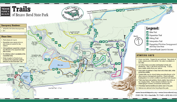
Below is a teeny version of the park trails map to give you an
idea of the location of the Brazos River, Big Creek, the lakes,
and trails. You can see a larger pdf. version of this map
here and a close-up version of
the campgrounds, lakes, picnic areas, and facilities at
this link.
Look on the right side of the map above. That's where the eastern side of the park borders the wide Brazos River for
over three miles.
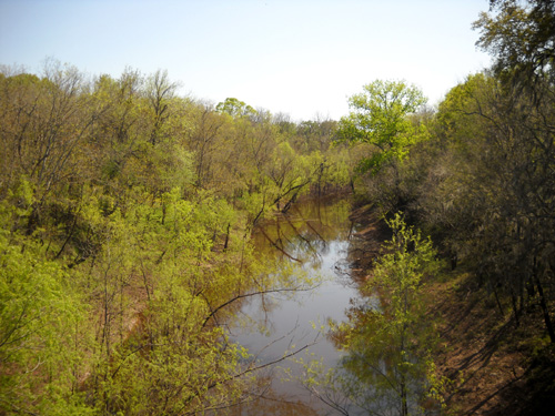
I took the next photo in early March when both the river and Big
Creek were quite high and full of sediment from upstream:
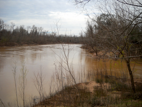
Big Creek (R) flows into the Brazos River
in the southeast corner of the park.
This is also the point of lowest
elevation in the park.
(3-5-10)
After talking with rangers
I soon learned that the river and creek can get much
higher. Southern Texas got so much rain in January and February
that both streams were reportedly fifteen to twenty feet higher
than this! It was so high that I couldn't have taken that photo
a month ago -- a low spot in the trail leading to the
overlook was
flooded.
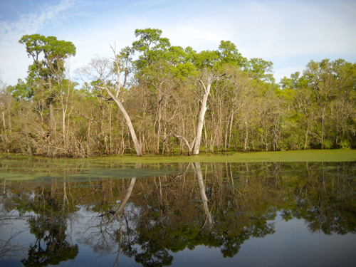
I took the next photo the same day as the one above:
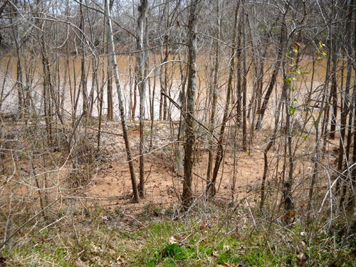
We have seen the water level drop during March but many trees
along the banks are still in the water.
The other major water course is Big Creek, which is aptly named.
I've seen rivers that are smaller than Big Creek! I took
the next picture of the creek today from the bridge that crosses
it near the campground. Even though the water level has dropped
considerably since we got here, some trees are still in the
water:
Many miles of Big Creek meander diagonally through the park,
forming sloughs, bayous, and several cutoff meanders (oxbow
lakes) along the way. I think you can see some of these features
in the map above, even though it is small.
Sloughs and bayous (both rhyme with "stews") are low-lying
depressions with very slow-moving or stagnant-looking water. They are
common in swampy wetlands.
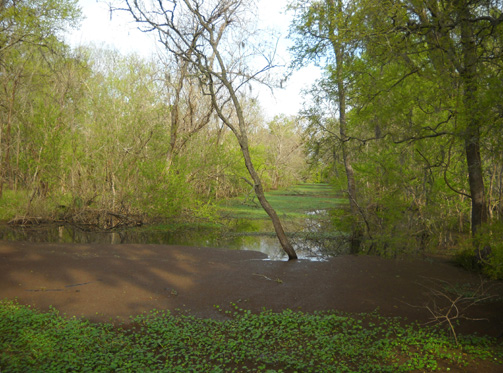
The next photo shows Pilant Slough in
one spot along the trail of the same name. The trail didn't open
to foot traffic until just a few days ago because it has been
under water this winter.
In some parts of Pilant Slough the water is more open, as in the
photo above; the current is apparently moving moving a
little bit more in that spot, although the surface looked
perfectly still when I stood still and watched it for a couple
of minutes.
Other places in the slough appeared more stagnant, like below,
with more green and reddish brown plant life growing on top:
Dave Heinicke, the ranger who is the most experienced naturalist
in the park, explained during his "Pond Life" nature talk that
wetlands don't percolate well and can dry out during a drought.
Sloughs stay wet because of their slow-moving water. Even if you
can't tell the water is moving on the surface, it's moving
slowly below.
Meanders, also known as oxbow or horseshoe lakes because of
their U-shape, are interesting. The next photo shows one of the two lakes named Horseshoe
at Brazos Bend SP:
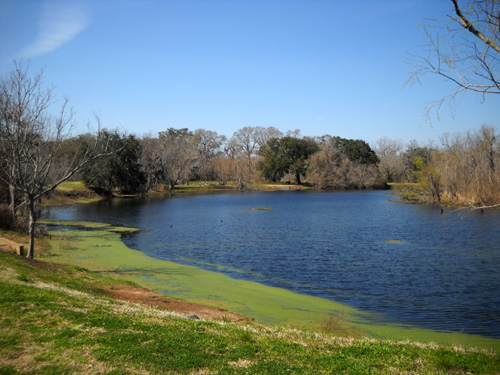
New Horseshoe Lake; there's an Old Horseshoe
Lake to the left (see next photo).
A nearby exhibit explains how the horseshoe shape is formed by a
meandering stream. I know you can't read the text in this small
picture but you can see how the lakes form in the diagram to the
left:
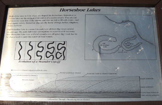
Two of the meanders at Brazos Bend form natural oxbow lakes. Two
other oxbows are man-made by the channeling of Big Creek in
order to prevent flooding. You can see an example of that in the
photo above, where the creek now goes in a more straight line to
the right of New Horseshoe Lake.
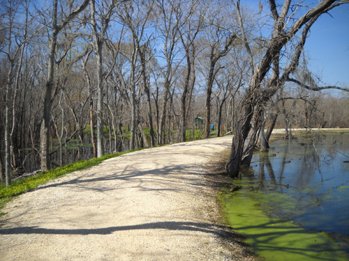
Other lakes in the park, such as Elm and 40-Acre, were created
by levees that dissected the main channel of the ancient Brazos
River. The levees make nice, broad multi-use trails around both
of those lakes.
The levee/path below is at the SW corner of Elm Lake near the
Spillway Trail, which connects to 40-Acre Lake. Elm Lake is to
the right. Many acres of swamp (Pilant Slough) are on the left:
Pilant Lake is a shallow freshwater marsh west of Elm Lake on
the map above and just north of 40-Acre Lake. You can get great
views of it from the trail at ground level
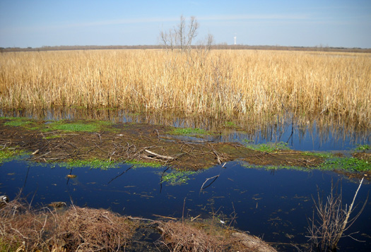
Marsh between Pilant Lake and 40-Acre Lake.
The tower in the background is on private property.
and from an observation tower at the NE corner of 40-Acre Lake:
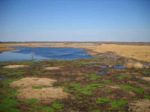
View of Pilant Lake and marsh area
looking north from
the observation tower
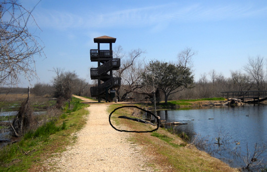
Observation tower and alligator (circled)
between Pilant Lake and marsh
on the left and Elm Lake on the right. The
Spillway Trail is in the background left.
I took the last four photos on March 3 before the grass and
trees really greened up.
I like this dramatic shot I took over the marsh on March 20, a morning when we got drenched during a run (Jim) and
walk (Cody and me):
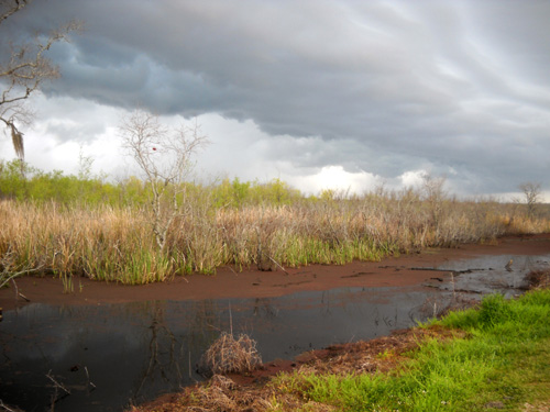
Happily for us, there were only three or four days of rain or gray
skies while we were at Brazos Bend. The rest of the time it was
sunny and in the 60s to almost 80 every afternoon.
Elm and 40-Acre lakes are the largest of the seven named lakes
in the park. The trails, which are levees, are the widest and smoothest around
these lakes and they are both easily accessed by two of the
picnic/parking areas.
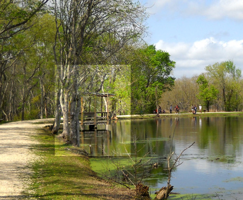
Elm Lake also has several fishing piers
around its perimeter. The next picture, taken near the end of
March, shows one of the shady covered piers at Elm Lake
(I lightened it so it's easier to spot):
All those features, combined with the near-guarantee of seeing
lots of alligators and birds, make these the most popular lakes
in the park (i.e., the most heavily traveled by foot or
bicycle).
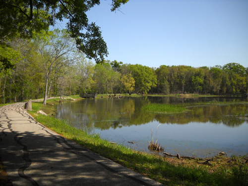
Another lake that sees a lot of visitors is scenic Creekfield
Lake, close to the Nature Center and campgrounds. It has two
fishing piers and is another
good place to view birds and alligators. It also has a half-mile
wheel-chair accessible paved trail around its perimeter:
I'll show more lake photos in sections featuring plant life,
wildlife, trails, and popular park activities like fishing and
birding.
Next entry: the diverse plant zones and a story about
literally draining the swamp!
Happy trails,
Sue
"Runtrails & Company" - Sue Norwood, Jim O'Neil,
and Cody the Ultra Lab
Previous
Next
© 2010 Sue Norwood and Jim O'Neil
