We finally found the sun, warmth, green leaves, and colorful flowers
we'd been craving when we got the bright idea to head farther south in
Texas to Brazos Bend State Park (BBSP) at the beginning of March. It's a
veritable tropical paradise in early spring.What
a wonderful contrast to the wet, wintry weather we'd been experiencing farther north!
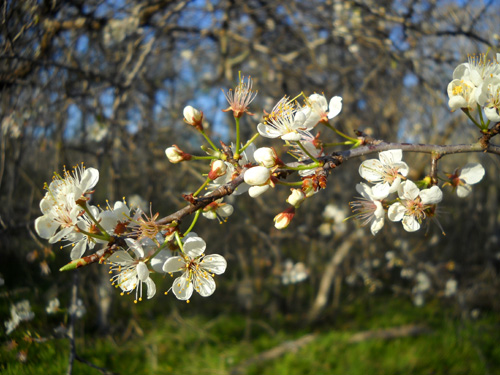
Pretty apple blossoms in the
campground in early March
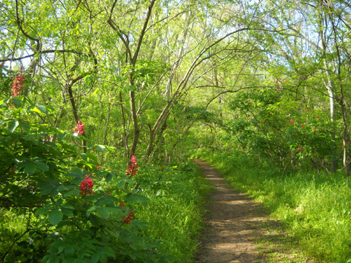
Red buckeye blooms, lush green
grass, and many tree leaves in late March
Brazos Bend wasn't on our radar until
we attended a nature talk about alligators at Huntsville State Park in
late February. We were intrigued about the large population of 'gators
reported to live at BBSP and started reading about the park. The description of the
various ecosystems, abundant wildlife, and plentiful trails sounded
great. We figured there must be some very good reasons why this is one
of the most heavily visited of Texas' hundred-odd state parks.
There are good reasons. Come along and I'll show you.
SETTLING IN
We were initially able to make campground reservations for only three
days in the middle of the first week of March; the weekend was
already booked. But when we checked in on Tuesday afternoon Ranger
Susan used her judgment to extend our reservation right on through the
weekend. She knew from experience that a few people always cancel or simply
do not show up.
She was right -- there were several campground vacancies that
weekend, even with perfect weather for outdoor activities.
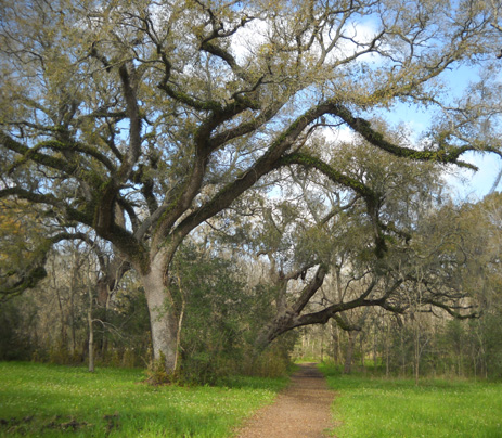
Live oak trees along one of the trails near our campground
We loved the park at first sight!
- We passed ancient coastal live oak trees
growing along the road near the entrance gate and park
headquarters, their massive moss-covered limbs touching the
ground in some places.
- Perky yellow flowers danced above the
bright green grass on either side of what we dubbed "The Longest
Mile," the main park road guiding visitors through a large
swampy area to the Nature Center, lakes, picnic areas, and
campgrounds.
- We could see herons and egrets feeding in the
wetlands, which were at "high tide" after all the rain
southern
Texas has gotten this winter. (More about draining the swamp
later.)
- Deer grazed on the grounds near the George Observatory;
we would see a herd of them in that area almost every morning
and afternoon when they were feeding.
We didn't see any alligators yet, but Susan promised us we'd see
dozens of them around the lakes on sunny days! She was right
about that, too. I counted at least thirty different 'gators on
my walk the
next day.
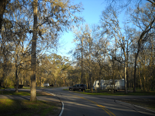
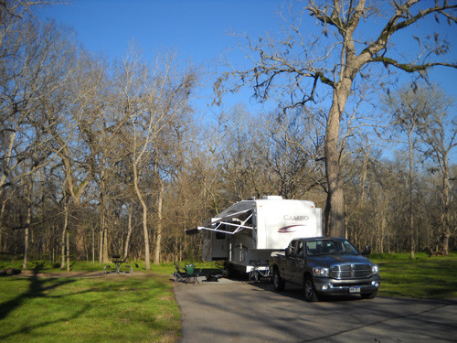
We drove into the 100 Loop, the shady campground (above) that
would become home to us. Unlike some state park
campgrounds, the two loops at Brazos Bend feature spacious sites
with long paved driveways. Larger RVs can fit into almost all
of them, not just a few of them.
Most of the forty-one sites in our loop were empty that day, typical
even for popular Brazos Bend during weekdays in the winter and early
spring. Well, except for Spring Break Week. Whew!! That was a
busy week when it seemed like every kid in southern Texas was in
the park!
Although Susan assigned us to a particular site she
encouraged us to drive through the entire 100 Loop to see if we
preferred a different spot. We did choose another one at the far
end of the loop that had a bit more room and sunshine:
Our first campsite in the 100 Loop was long and
wide.
After we settled in, we began exploring our new environs. That
was fun!
CAN WE JUST LIVE HERE ALL SPRING??
Long story short, we didn't have to leave on March 7 when our
reservation ended. We're still here at the end of
the month!
Better
yet, we had to pay for only the first six days ($20 X 6 days
minus a half-price coupon for one night = $110), then got three
weeks *free* by unexpectedly becoming campground hosts.
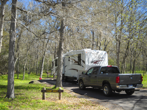
Our camp host site for three weeks
We were
happy to move into an empty host site in the 100 Loop because the host
sites are the only ones in the park with sewers; visitor
sites have just water and electricity.
Having a sewer meant we could use our own bathroom in the Cameo
and not have to move it periodically to dump black or gray water
at the dump station. It's at least a two-hour job to get the
camper ready to move, dump the tanks, and get set up again. It
was nice not to have to do that.
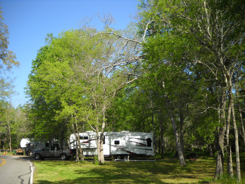
Another view of our host site after more
leaves came out. Cody had lots of woods to play in
behind our site. The camper beyond
ours belongs to the other CG host couple in our loop.
By volunteering some of our time and energy we saved $25/night
for full hookups for 21 days = $525, a big pile of money!
Even
if we could have stayed an additional three weeks at $20/night
in a standard site with no sewer, it would have cost us a bunch.
Brazos Bend has the normal two-week time limit and it's not as
easy to extend the time as it is at Huntsville because even in the winter the weekends
are usually booked at BBSP. And they don't have a weekly rate
from December to February like Huntsville.
So work camping really did pay off for us in several ways. I
talked about our experience as campground hosts in a
previous entry. Since I've got
so much more to share about the park itself, I won't repeat that
information.
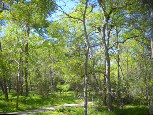
By March 21 the view from my computer desk
was almost summery. The path leads to the
restroom in our loop; we didn't need it
since we had a sewer connection in the camp host site.
JOIN US FOR A TOUR OF THE PARK
We've really enjoyed our month at Brazos Bend. Can you tell??
In order to
entice even more visitors to this popular park, I'll
include information about things you can see and do in the park,
illustrated with lots of photos that I took of the lakes, trails, and wildlife
-- including alligators -- in a series
of journal entries so each one is not too terribly long (I know,
I know . . .) or too hard to load.
Boy, do I have pictures!
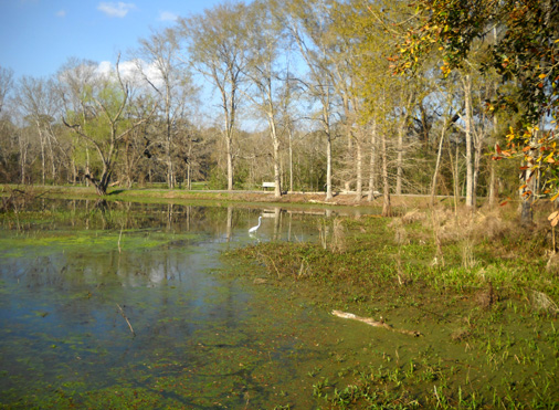
An egret wades in Creekfield
Lake.
Brazos Bend is a gorgeous place in the spring; I never
went out on a walk, bike ride, or work detail without my camera.
On my first long walk around Elm, 40
Acre, and Creekfield Lakes I took over 250 pictures!!!
It's not that I'm so easily impressed, it's that this place is
so beautiful and varied.
A VIDEO INTRODUCTION TO BRAZOS BEND STATE PARK
You can learn a lot about the park by watching a three-minute
video on the Texas Parks &
Wildlife Department's web page for
Brazos Bend.
If you have a slow connection and the video won't load, click on
the text and just read that.
We got to know David Heinicke, one of the narrators in
the video,
while we were campground hosts. He's been at the park about 25
years as a ranger. He's also the primary park naturalist, a
terrific speaker, and the sole police officer in the park. Yeah,
he's a busy guy but it's obvious that he clearly loves his job(s).
He's great with people of all ages and has lots of interesting
stories to tell about the park.
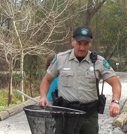
Ranger Dave carries a net full of tiny swamp life
for his hand's-on talk about pond life.
Another good source of information is the
interpretive guide to the park,
one of many links to further information that you can find on
the park web site. The interpretive guide is in the form of a
colorful brochure in the park office. Visitors can pick it up
along with detailed paper
park and
trail maps.
Brazos Bend is located about 50 miles southwest of downtown
Houston in the Gulf Coast Region of Texas. It is about the same
distance west of Galveston. That accounts for the balmy March
weather we've been enjoying! We've had quite a few days in the
mid- to upper 70s already, which is a little above average for
this time of year. It sure felt good.
Considering it's only about 90 miles south of Huntsville SP as
the crow flies, we
were surprised by how much milder the weather was at
Brazos Bend during the winter and how much more spring
growth there was:.
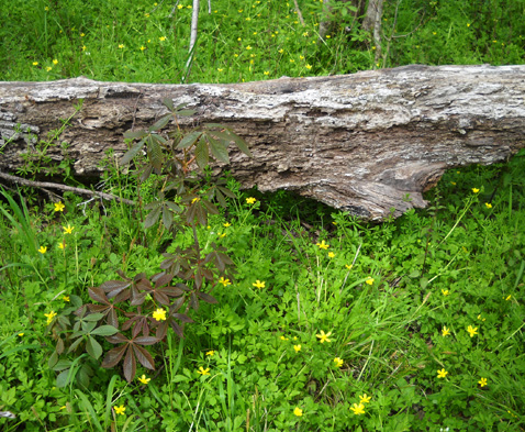
Buttercups carpeted the ground all over the
park in early March.
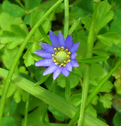
This looks like it's in the daisy or aster
family but I can't identify it.
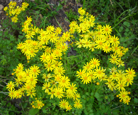
This type of yellow daisy was all over the
park during March.
The day we drove from Huntsville to Brazos Bend we felt like we
traveled in a time capsule from winter to spring.
Even though there weren't a lot of leaves on the trees until a
couple weeks later, all the green grass and numerous flowers,
particularly the bright yellow buttercups and daisies, that were
already in bloom on March 2 spelled S-P-R-I-N-G!
2,300 YEARS IN A NUTSHELL
Nearly 5,000 acres of land was purchased by the state for the
park in 1976-7. It was developed and opened to the public in
1984. In just twenty-six years it has become one of the "crown
jewels" in the Texas state park system.
The park property is a diverse mix of upland coastal prairie,
bottom land forest, and wetlands.
One of the first things we noticed about the park is all the
different kinds of water -- marshes, bogs, swamps,
sloughs, lots of lakes, creeks of every size, and a big ole
brown river swollen with water from upstream. I'll talk more
about the park's natural features in the next entry.
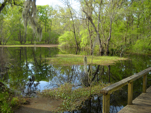
Water, water everywhere . . . a tropical
view from the Pilant Slough Trail
The land now included in the state park has an interesting history:
- According to
the park
web site, prehistoric peoples appear to have visited or
lived in the area as early as 300 BC.
- In early historic times a
band of the Karankawa Indian tribe that lived around Galveston
Bay is thought to have traveled as far inland as Brazos Bend.
- In more recent times, Stephen F. Austin's first colonial land
grant from Mexico included current park land in the early 1800s.
- In 1827 what is now park land was granted to Abner Harris and
William Barrett.
- By 1845 (after the Texas Revolution) part of the park property and
about half a mile of river frontage belonged to cotton brokers who probably had a river
landing and used the Brazos River to ship their product to market.
- In the 20th century private landowners used the property for
cattle grazing, pecan harvesting, and as a hunting preserve.
The most visible remnant in the park today from any of
the people who lived here or used this land is an old cistern, shown below, that is
located just behind the Nature Center.
The cistern was built by slaves with clay-fired bricks in the first half of
the 19th century. It extends about fifteen feet into the ground:
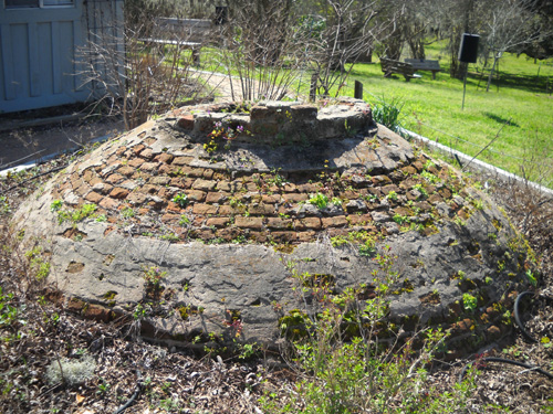
There is also some debris from a brick kiln and part of an old wagon road. It isn't known who owned
the property at the time or
how many people lived in the community.
Next entry: the diverse ecosystems within Brazos Bend State Park
Happy trails,
Sue
"Runtrails & Company" - Sue Norwood, Jim O'Neil,
and Cody the Ultra Lab
Previous
Next
© 2010 Sue Norwood and Jim O'Neil
