One of my favorite Colorado Trail (CT) segments is #25 from Molas Pass
to Rolling Mountain Pass and beyond.
It's just gorgeous, one of the best trails in the San Juans for
hiking and running. Every time we visit Silverton I
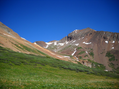
like to get up into the beautiful hanging alpine gardens and the basins
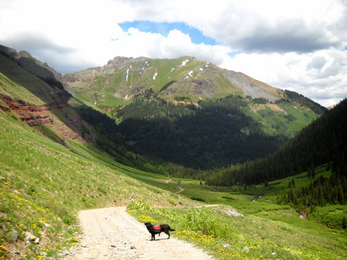
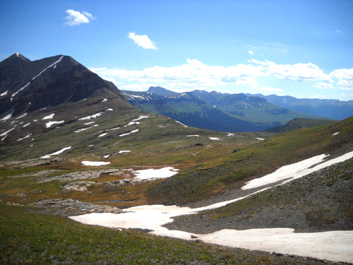
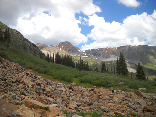
formed between the Twin Sisters peaks (elev. 13,432 feet), Jura Knob
(elev. 12,614 feet), and Rolling Mountain (elev. 13,693 feet).
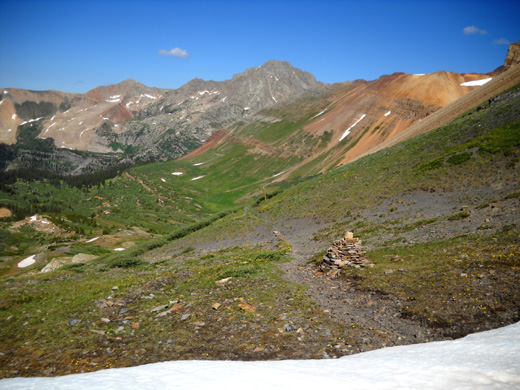
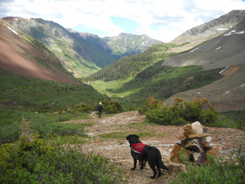
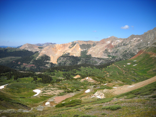
View southwest from Rolling Mountain Pass
That's an 11Ľ-mile run or hike from Molas Pass, however (Molas Pass is
south of Silverton on Hwy. 550). I used to be able to run that 22˝ miles
out and back in a decent time but now that I'm just hiking, it'd be a
full day to complete the round trip at my average mountain pace of 28-30 minutes
per mile (considering the altitude, elevation gain and loss, and various
stops).
That's if I was even in shape to do 22+ miles right now. I'm not.
So
. . . where there's a will, there's a way, right?
A VIABLE ALTERNATIVE
Several years ago we found a faster way to get up to the pass and this
lovely basin: just drive to the end of South Mineral Creek Road
and hike up the Mineral Creek Trail, which I think I've mistakenly
called the Rico-Silverton Trail in previous years' entries. It's a steeper
trail than the CT but less than three miles up to the pass from the
trailhead instead of
eleven. That distance doesn't include exploring the large basin, which
is east of the pass.
Nor does it include the part of S. Mineral Creek Road that we now
must hike/run instead of drive = bonus miles.
When we had a 4WD truck we could
negotiate the rocks on this road all the way back past the old Bandora
Mine to the South Fork Mineral Creek crossing where the road ends. Not with the 2WD Ram, however.
We did a test drive to see
how far back the road we could reasonably negotiate and discovered that we'd have
to park in a little pull-off 1.7 miles from the creek
crossing and trailhead. So now that out-and-back hike has been extended by 3.4
miles. Still, that's more doable for me than walking to Rolling Pass from Molas Pass.
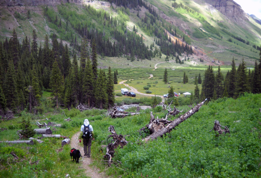
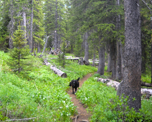
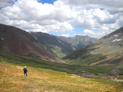
Cody heads back South Mineral
Creek Rd. to the trailhead.
Beattie Peak (elev. 13,342 feet)
is in the background.
This morning Jim, Cody, and I drove to that pull-off, hiked 1.7
miles up the road, and climbed up Mineral Creek Trail through South Park
to the pass. Then Cody and I wandered on and off the Colorado Trail
through the alpine basin area for about an hour while Jim waited for us.
When we got back to the intersection with the Mineral Creek trail we headed
down to the truck. Because the trail is so rocky in places Jim decided
to hike most of the way instead of running. I walked all of it.
(Doctor's orders.)
Here's a section of a map from the Colorado Trail guidebook that
shows where we went today:
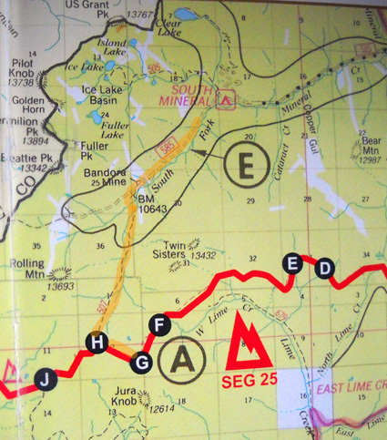
The red line is the CT. Segment 25 starts at Molas Pass
("A") which is off the map to the right. "G" is the intersection with
the Engineer Mountain Trail. "H" is the Mineral Creek Trail
intersection. The segment continues another ten miles south and west to
Bolas Pass.
Jim and I followed the route I highlighted in light
orange, first on the road, then the trail, then into the basin between G
and H. Rolling Mountain Pass is left of H a little bit. You can see
where Rolling Mountain, Jura Knob, and the Twin Sisters are located, as
well as the Ice Lake Basin, Island Lake, and Clear Lake. Since these
marvelous trails are close to our campground on South Mineral Creek
Road, we use them frequently! The Hardrock 100 course runs through here,
too.
Cody watches Jim descend into
South Park
I had a total of 10˝ miles today, Jim about 8˝. We both got in a good workout and I got to enjoy one of my favorite
places in the San Juans.
We lucked out with the weather, too. Sometimes we've been caught up
in this basin in rain, sleet, snow, and thunder-lightning storms. Today
was perfect, despite a forecast of 30-40% chance of rain. That was for
Silverton, though. The chance of a storm at 12,500 feet in the San Juans
is more like 95% every afternoon!
That's why we got an early start this morning. It took us about six
hours to complete the hike, including all our stops. We began at 7:30
and ended at 1:30. That got us off the exposed part above tree
line well before noon.
Increasing clouds as we descended
toward the forested section of the trail
As you'll see from the photos in this entry, the sky was bright blue
with nary a cloud early in the morning but by the time we were coming
back down an increasing number of clouds, including gray ones, were
coming in. While we were driving back to our campground (5-6 miles down
the same road) we got a few sprinkles. We could use more rain in this valley
to tame the dust on the road.
Once again I went crazy taking photos of the beauty surrounding me!
Since I'm including 80+ pictures in this entry, I'll split it into two
parts. This entry will show the road and trail up to the pass; the next
one will focus on the alpine basins.
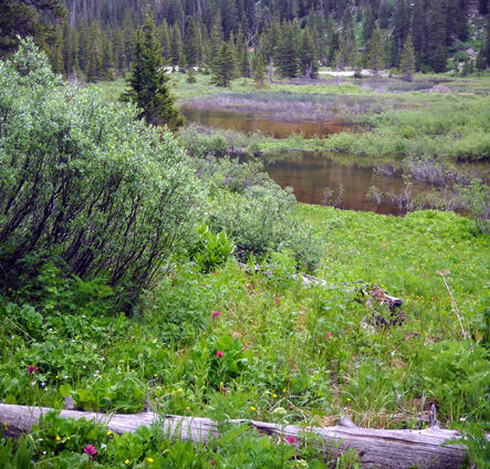
OUT AND BACK ON SOUTH MINERAL CREEK ROAD
This morning we parked at the pull-off I mentioned on South Mineral
Creek Road. Jim's original intention was to go a different direction than Cody
and me: he planned to go up the nearby Ice Lake Trail to
Grant-Swamp Pass, which is on the Hardrock course. He changed his mind,
however, and caught up to me after I'd gone about three miles.
The elevation where we parked off the road was 10,262 feet on Jim's
GPS. We walked west for 1.7 miles to the trailhead, which begins at S.
Mineral Creek. The elevation there is about 10,700 feet.
I'm not wild about hiking on this road. It isn't devoid of scenery, it's just not as remote as the
trail part of this run/hike and on weekends there is considerable traffic
stirring up dust. This afternoon we met only one vehicle on our way back
to our truck, and none outbound in the morning. The creek and
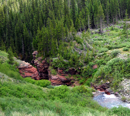
surrounding mountains are quite scenic. Although I've been back this
road many times, today was the first I noticed this little canyon
Mineral Creek has cut through the rocks:
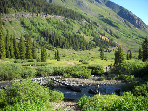
Along the road we passed the location for the KT aid station during
the Hardrock Hundred race, the trail a quarter mile farther up the road
where the runners will cross the creek, and the location of the old
Bandora mine.
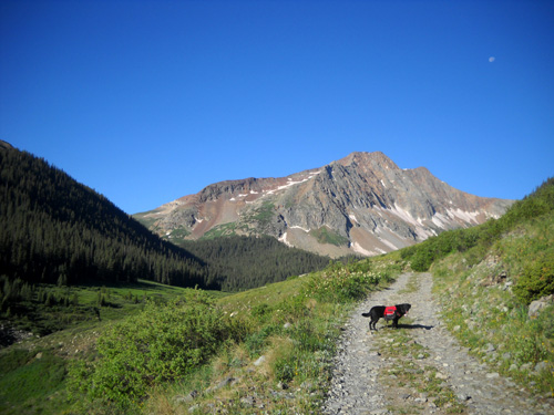
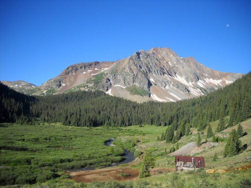
In the next photo we're passing the mine area and approaching the end
of the valley. Beattie Peak (elev. 13,342 feet) is in the background. We'll be making an arc
to the left as we ascend the gulch called South Park between Beattie and
Rolling Mountain on the right and the Twin Sisters on the left:
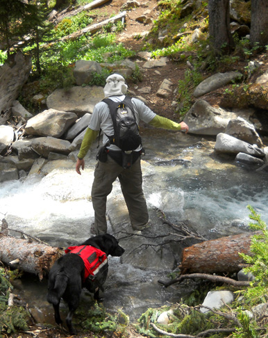
First we have to ford several shallow creeks. The next picture shows Jim
and Cody walking through one of them on the way back to the truck:
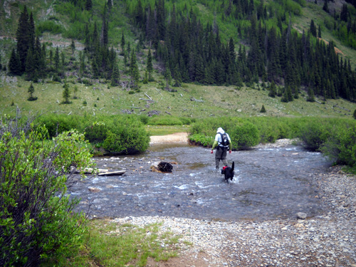
If you drive back here you'll need a vehicle with high enough clearance
for these streams, which are undoubtedly higher earlier in the season
when there is more snowmelt.
The trailhead sign is just before the South Fork of Mineral Creek
crossing. This one's deeper, although it was only calf deep today. Right
now there are two channels. You can see the larger one in the photo
below, which I took this morning on the other side of the creek, looking back to
the road
through the valley:
In the photo above you can see where part of the old
Bandora mine was located (brown tailings in upper right quadrant).
I took the next picture on our way back to the creek
this afternoon. Notice that now there are some folks camped near the
creek. This is national forest land with free dispersed camping. The
only problem is getting a rig back that bumpy road without destroying
it!
The next two pictures are on our return to the truck this afternoon.
Check out all those dandelions! We've seen tons of them in the San Juans
and continue to joke about being in the Dandelion Time Warp:
Now we're almost back to the truck. The mountain that is prominent
ahead of us is the unnamed 13er with the road we run/hike up to Clear Lake:
OK, on the outbound hike we're across South Mineral Creek and ready
to begin our ascent to the high alpine area below Rolling Mountain Pass.
OUT AND BACK THROUGH THE FOREST
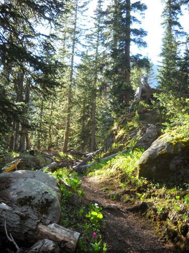
Ah . . . now we're on some nice single-track trail for about a
mile through a rather thick pine forest with just enough sun filtering
through to allow some flowers to grow. Although there are some rocks and
roots the trail is smoother here than it is in the next section. The
Forest Service keeps the trail in pretty good shape. We had to bypass
only one blow-down today.
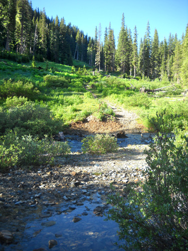
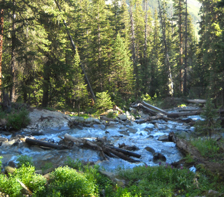
The trail crosses several small creeks and one larger one that all
flow into South Mineral Creek.
The creek in the next set of photos runs quite fast because the trail
crossing is right below a set of waterfalls. Fording it can be a major challenge when
the water is
higher than it was today. One year Jim was running on this trail alone
and barely made it across because it was so treacherous.
Downstream
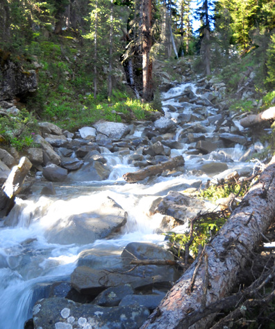
Upstream
As you can see in the next photo, finding the right rocks to
step on is crucial; even when the creek is this low, the
rocks are slick. I find it a lot easier to stay upright through
creeks when I've got both my trekking poles, as I did today.
Trail crossing
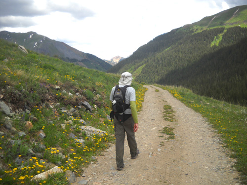
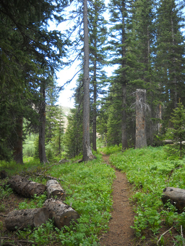
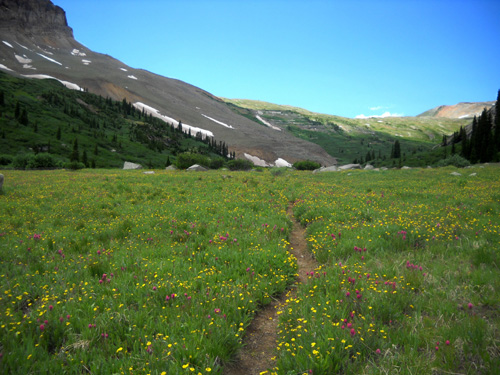
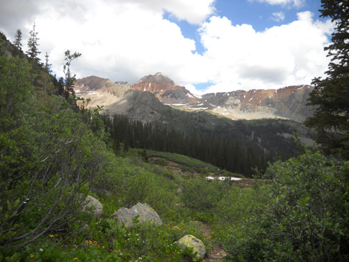
ASCENDING TO THE PASS
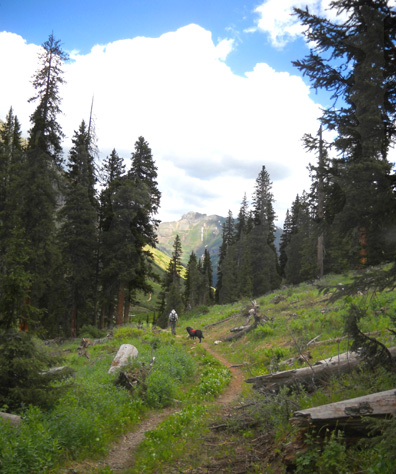
I always love to pop out of the forest and get above timberline
so I can see wide-open vistas. On this trail, you can spot
the basin and Rolling Mountain Pass soon after you leave the woods and
enter the marshy area full of low shrubs and flowers. From here
to the pass is about 1˝ miles of
mostly rocky single-track trail.
I'll mostly show photos in this
section going up, then down.
This looks like a great place to
spot moose but we've never seen any here:
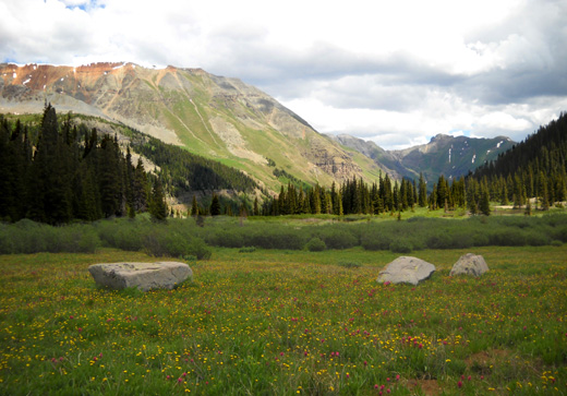
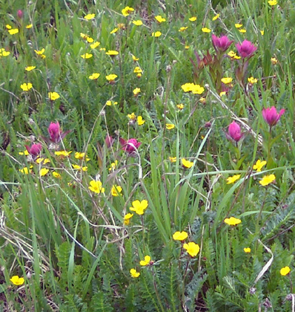
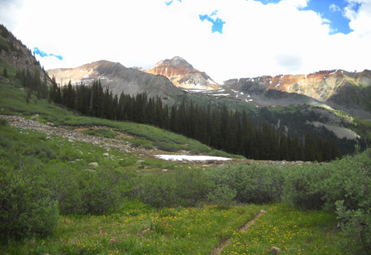
There are numerous flowers blooming in the sunny meadows between
11,000 and 12,000 feet, particularly yellow mountain avens and
colorful pink, red, orange, and cream Indian paintbrush:
Twin Sisters, 13ers with two peaks very
close together, are to the left as you ascend to Rolling Mtn.
Pass.
Mountain (alpine) avens and Indian
paintbrush
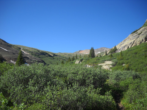
The trail winds through several sections of
thick, low shrubbery. Jura Knob is in the center background.
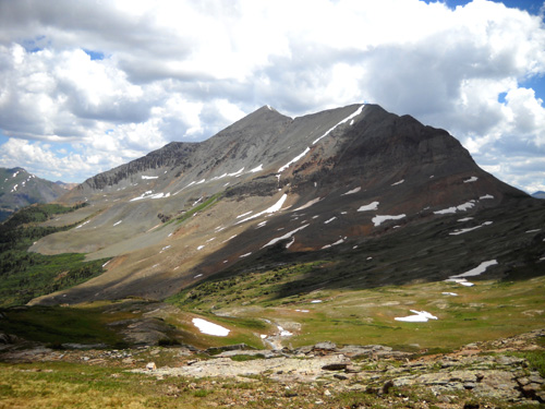
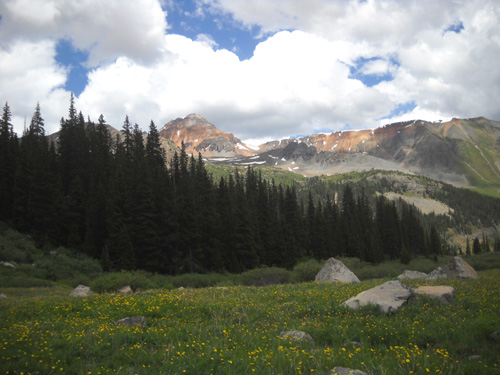
On the way up the trail colorful, hulking Rolling Mountain is to
your right (west) and the Twin Sisters peaks are on the left (east). Ahead
(south) is Jura Knob and the pass between it and Rolling
Mountain. We'll get better views of all these mountains as we
climb higher.
Rolling Mountain
Cody was happy to find some snow to play in as we ascended
through the drainage area:
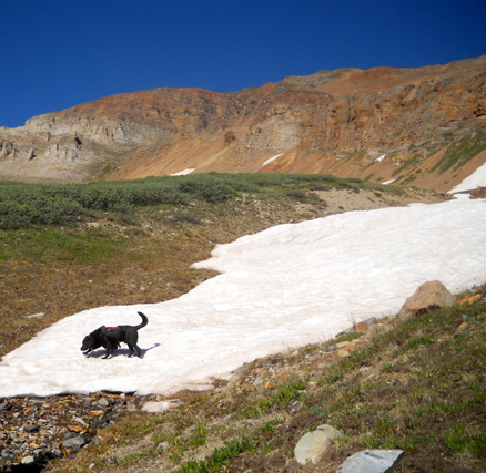
He'd have a lot more snow to roll around in when we got up to basin and pass.
This is a good trail for dogs, with all the water available. He
really didn't need any water from his pack today so we emptied
his bottles on the way
up the mountain to reduce his load.
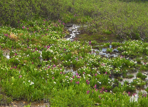
As we get into the 12,000-foot elevation level there is less
(and shorter) shrubbery and more tundra plants like the marsh
marigolds and Parry's primrose growing in this wet area:
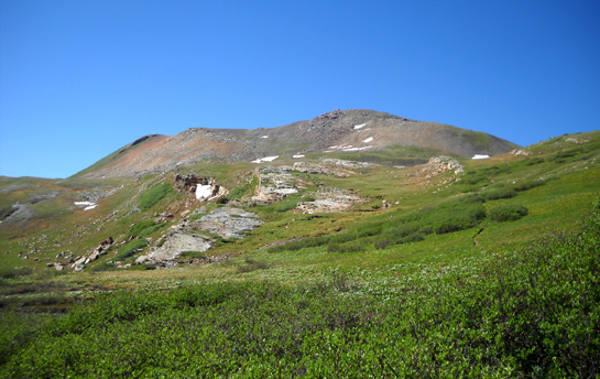
When you reach the basin, the trail gets flatter and you can
easily spot the intersection with the Colorado Trail:
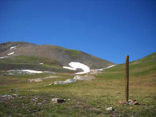
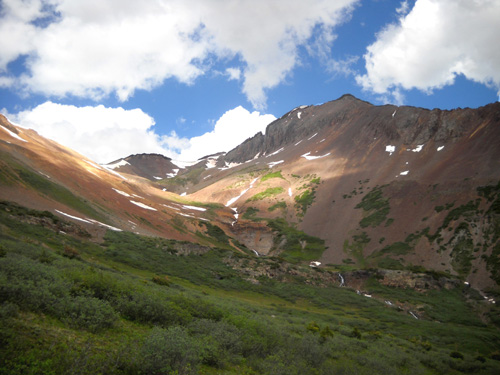
Jura Knob is ahead and on the left. Rolling Mountain
Pass Pass is just to the right of it.
The elevation here is about 12,350 feet. To reach the pass, go
right on the CT and follow the switchbacking trail that ascends
another couple hundred feet in a quarter mile.
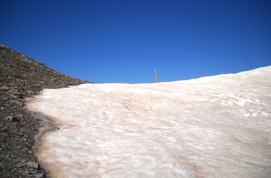
Half the times
I've been up here, the pass has still had some snow on it. Today
we could skirt around to the left of the snow in the rocks. If
there is too much snow to make that feasible, just follow the
footprints and aim
for the CT post at the saddle:
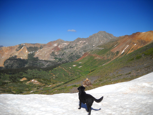
The views from the pass are some of the best along the entire
Colorado Trail.
Below, Cody surveys the valley to the south
where the CT descends toward Cascade Creek. I love the colorful
mountainsides and valley but we didn't go down there today:
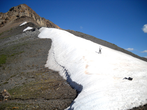
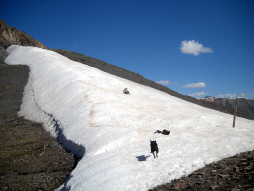
Although there is still a snow cornice at the pass at the end of
June this year, the snow was deeper here last year and would
have been more problematic for hikers to continue down the
switchbacks on the south side. You can get a good sense of the
depth of the snow in the photo below when you consider that Jim
is about six feet tall:
Last year when I was up here there was a good 20-foot drop down
to the trail unless hikers detoured quite a ways up Jura Knob
and tried to reach the lower part of the trail via rocks. Right
now hikers can just walk in the rocks in the foreground
right and get around the snow to reach the trail and cairn in
the lower left of that picture -- much easier.
The trail gently switchbacks down into the valley on the other
side. When I did this entire segment (#25) in 2006 I was able to
run down the trail all the way to Cascade Creek, stopping only
to take photos of the great views and myriad of flowers.
Today we lingered at the pass for 10-15 minutes so Cody could
get a good snow-fix:
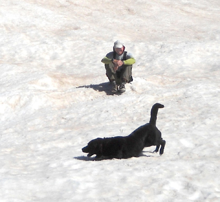
Even Jim had fun in the snow!
It didn't take Jim long to decide
to climb most of the way up the cornice, then slide down on his
butt. When Cody saw what he was doing, he made a beeline up the
mountain, ears flying:
(The black thing in the snow above Cody is Jim's pack.)
After we played a while we descended back down to the intersection with the Mineral
Creek Trail. In the next photo Rolling Mountain is on the left,
the gulch (South Park) that we came up is ahead of him, and the side of one of the
Twin Peaks is on the right:
The next view shows the basin
and is looking northeast. Now you can see the Twin Sisters
peaks.
That's where we went next this morning, but the remaining photos
in this entry will be the descent from Rolling Mountain Pass.
I'll feature pictures from the basin area in the next entry.
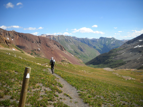
DESCENDING FROM THE PASS TO TREE LINE
After we explored the basin for over an hour we began our
descent on the Mineral Creek Trail. Jim started out running,
then walked (and waited for me) when the trail got rougher.
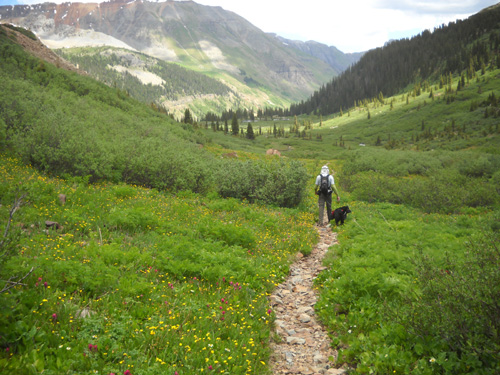
Jim starting his descent through the scenic
gulch (South Park)
Twin Sisters peaks
Waterfalls on Rolling Mountain
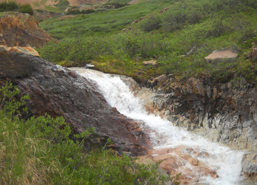
Little falls along the trail; there are
several small streams in the tundra area above timberline.
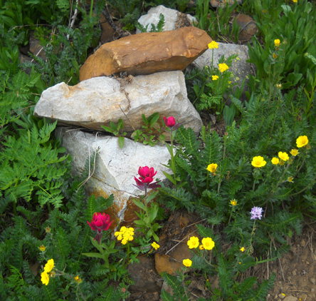
Neat little floral vignette
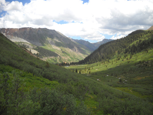
About halfway down to tree line
Rockier trail
Short rock field to cross; colorful
mountains surrounding Ice Lake Basin in the background
Meadow full of flowers near tree line
That's what you'll see in June or July if you go up to the pass
and back down to South Mineral Creek Road. To see what the basin
typically looks like in early summer, check out
Part 2.
Happy trails,
Sue
"Runtrails & Company" - Sue Norwood, Jim O'Neil,
and Cody the Ultra Lab
Previous
Next
© 2010 Sue Norwood and Jim O'Neil
