Note that that trail description is going CCW and the Hardrock course
goes CW this year (it alternates directions on the loop each year). I
just wanted to emphasize that part of the "trail" Jim was marking today
with a dozen other folks wasn't a real hiking/running trail, but often
follows animal trails -- or no trail at all:
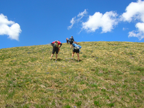
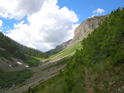
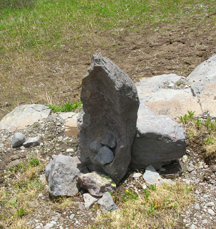
Trail? What trail??
And that's part of the
intrigue and challenge of the Hardrock Hundred race!
Jim and I did completely separate hikes in the San Juan
Mountains near Silverton today but we ended up finishing at the
same trailhead on South Mineral Creek Road.
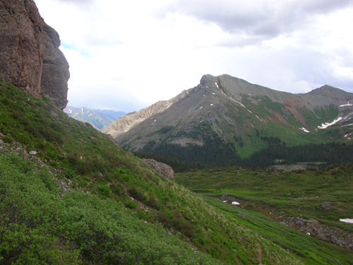
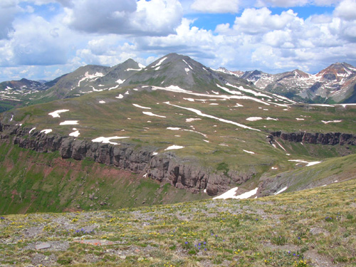
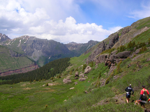
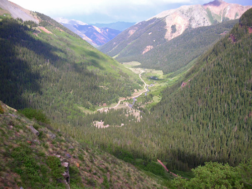
Even more
interesting to me is how close we were to each other, at least
as the crow flies. You can see the mountain peaks surrounding
the upper Ice Lake Basin that I was enjoying so much (see the
last four entries in this journal) in the background of some of
his photos, including the next one. See the distinctive colorful
peaks and the jagged ridge between Pilot Knob and Grant Peak in
the middle right background? Ice Lake Basin is in there!
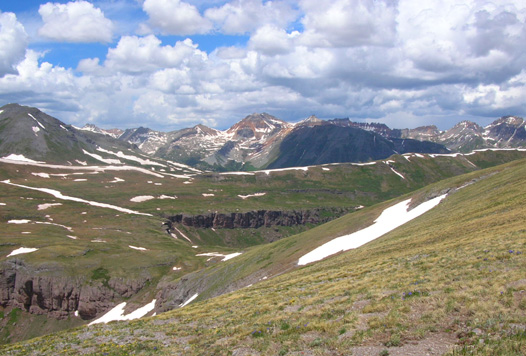
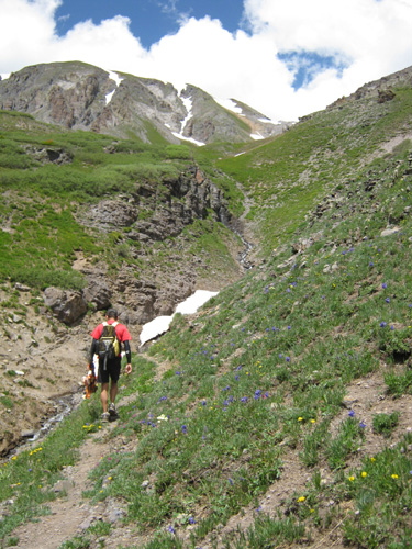
One of Jim's trail marking pictures today,
taken from a high ridge above the Colorado Trail
I didn't realize that until I downloaded his photos and had this
surprised, "Hey! That's where I was today!" reaction.
Cool.
When you look at the map section below, you'll see how close we
were.
THE JOY OF TRAIL MARKING
This is the fourth year we've come to the Silverton area at
least two weeks before the race so we could enjoy our own runs
and hikes in the mountains and help do some trail marking and
trail work for the race. Both jobs help runners acclimate to the
high altitudes in the race and become familiar with the course.
They are also a great opportunity to socialize with other race
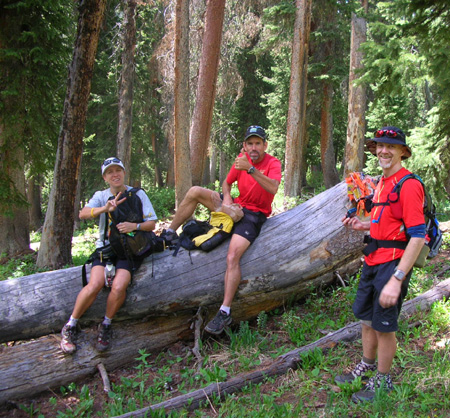
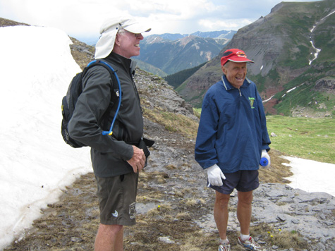
participants, crews, and volunteers. Jim got this shot of two of
our buddies engrossed in a conversation about mathematics
at about 12,000 feet up:
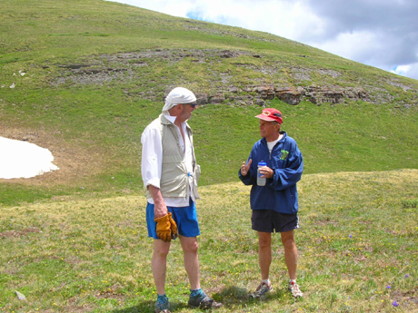
Jim Ballard (L) and Bill Heldenbrand
Although the pace can be tediously slow during trail marking and
I knew I could probably keep up with the group today,
I also knew from helping mark this part of the course in the other
direction last year that there are some devilishly steep
downhill sections that wouldn't be advisable for me to hike with
bad knees. So I struck out on my own today. Sure, I had a lot of elevation gain and loss on the
nearby Ice Lake Trail, but it's not as grueling as the HRH
course. I'm glad I chose the route I took.
Jim had fun with the group today. He knows most of the folks
(Jim Ballard and Kathy Lang, Marcy and John Beard, Deb and Steve
Pero, Bill Heldenbrand, Liz and Rick Hodges, Jim Sweatt, Marty Fritzhand,
Andy Hewatt) and he also made a couple of new friends.
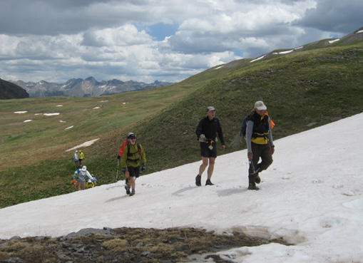
The group heads up a snow bank, led by
Rick, Steve, and Andy. (Photo by Marcy Beard)
Usually Charlie Thorn, one of the members of the HRH race
committee, is in charge of trail marking. This year, however, he
is unable to be in Silverton until right before the race. So
race veterans Jim Ballard and Steve Pero volunteered to manage all the trail
marking ventures this year, with lots of help from other Hardrock
veterans familiar with the course and some new folks running the
race for the first time.
While Ballard and Steve are quite the story-tellers, no one is in Charlie's
league in this regard. The downside for newbies was fewer stories
about the local mining, geological, and social history;
Charlie is renowned for his detailed descriptions of life in the
San Juan Mountains when mining was in its heyday -- those
were the original hardrockers, you know.
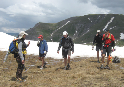
Marcy, John, and Andy take a break during trail
marking. (Photo by Jim)
The upside was that course marking, although still fairly slow
and sprinkled with some breaks (above), went faster
today than when Charlie is leading the group and
frequently stopping to relate tales of life in the 1800s. (No,
he's not that old, just a history buff!!)
In addition, the course will be more thoroughly marked this year
than most. Charlie also has a reputation of being rather skimpy
with the markers:
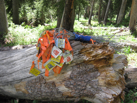
Marcy took this picture of a stack of
markers, reflective flags on sturdy metal posts.
Folks carrying the flags today made sure they are close enough
so that each one is visible from the last. Even though they are reflective, it's
sometimes been difficult on some sections of the course in
previous years to find the markers, especially at night. As long
as these same folks keep marking the other sections as well as
this one, runners shouldn't have that problem this year.
Of course, that assumes they don't run out of the flags and the
elk stop eating them! (Seriously.)
TODAY'S MARKING ROUTE
The section of trail Jim helped mark today is near the beginning
of the race in a clockwise year like this one. The goal was to
mark from the Mineral Creek Crossing in mile 2 to the location
of the first aid station, KT (Kamm Traverse), at mile 12. Then
they'd run back a couple miles on S. Mineral Creek Road to the
vehicles they left at the parking area for the Ice Lake Trail.
The group marked the trail so fast, they ended up continuing to
mark for another couple miles to the Ice Lake Trail!
OK, here's a map for reference. This larger section is harder to
read than the ones in the last entries about Ice Lake because it
covers more ground. I made it as large as I could without
affecting the size of this page.
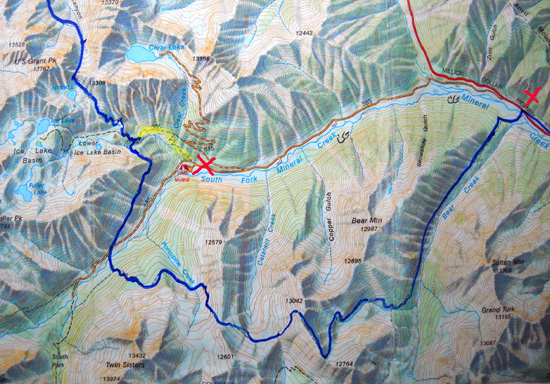
The dark blue line is the HRH course. Jim's group marked about
14 miles from the red X on the right of the map to the
intersection marked in yellow near the center. That's the Ice
Lake Trail. The Hardrock course continues north to Grant-Swamp
Pass and the Chapman Aid Station. That section will be marked
tomorrow.
The trail marking group still got a couple bonus miles today at
the end. When they finished marking the course to the Ice Lake
Trail, they turned right and ran down to the trailhead at the
second red X.
That was the same trail I was on and our truck was in the
parking lot there. Jim came down about an hour after I did and I
got to listen to some of the group's trail marking stories.
FIXING THE ROPE
During the race, runners start out in Silverton, run up a hill past the Shrine of
the Mines, and roughly parallel US 550 north of Silverton
through some woods and over Nute's Chute. Then they cross the
highway and drop down to Mineral Creek, which is a little over a
mile from the start:
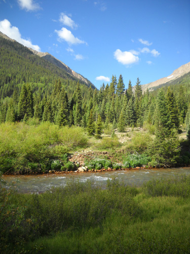
A beautiful morning to mark trails! Jim
will be going up that valley.
This is the same creek that goes by our campground, only it is
wider, deeper, and faster moving at this point because other branches
have poured into it by now. Fortunately, the race crosses the
creek just upstream from the confluence with Bear Creek, which
swells Mineral Creek even more.
Some years Mineral Creek has run so high before
and during the race that it's up to the waist or chest of
the shorter runners. When I crossed it last year at the end of my
course-marking day, it was up to my thighs on the far side and
running very fast. I am rather tall (5'9") and some of the
shorter female runners needed assistance getting across that day. Jim got
this picture of me on the shallower side where the water was only up to
my knees:
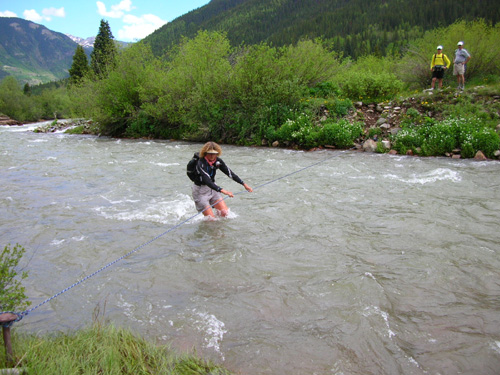
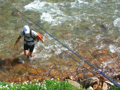
Me (Sue) crossing Mineral Creek in 2009
You can see that I had to flex and brace even on the more
shallow side of the creek to prevent getting swept off my feet.
I was rather proud of myself for getting across the creek pretty
easily when others had difficulty. I can guarantee you that that
crossing was a piece of cake compared to the four flooded
streams in Maine I crossed on Day 141 during my Appalachian
Trail Adventure Run!! That day will be forever seared in my
memory. (See
2005 journal.)
This year, fortunately, the Mineral Creek crossing is about the lowest
we've ever seen it. Most of the snow has already melted and there
hasn't been a lot of rain recently. That's a Good Thing for the
runners.
Marcy Beard's expression pretty well says it all: Who
needs a rope??
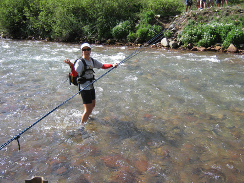
Marcy Beard crossing a lower, gentler
Mineral Creek today (photo by John Beard)
Her husband John took that photo of her crossing the creek this
morning. Marcy's several
inches shorter than me and was standing about in the same place
in the creek as I was in the photo above. You can even see the
rocks this year!
There is always a rope across the creek during the race, even in
CW years when the creek is in the second mile of the race and
runners are alert (in CCW years, they cross the creek at 99+
miles, often in the dark -- by then, most of the
remaining runners are zombies).
This year a rope was already in place when we arrived in
Silverton. It's easy to spot when we drive past it to town;
the crossing is only about twenty-five feet from the highway.
That
rope was not deemed sturdy enough to be suitable for the extra
use runners would give it during the race, however, so the first
order of business for the trail markers today was to reinforce the
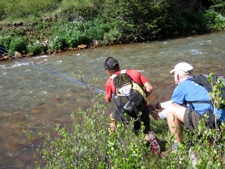
rope and the posts that anchored it on either side.
Sue, Bill, Jim, and the location for the
roped crossing of Mineral Creek
(photo by Marcy Beard; I added the arrow to
show the location of the rope)
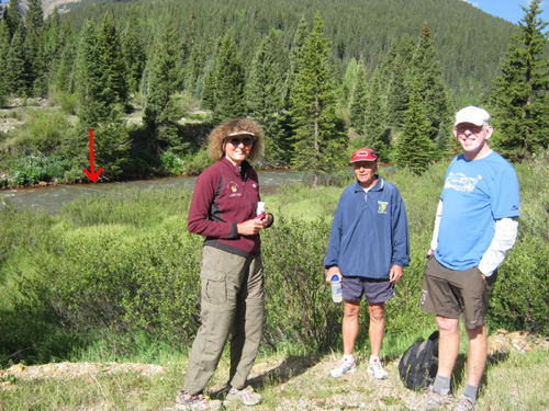
I dropped Jim, Bill Heldenbrand, and the Beards off at Mineral
Creek a little before 9 this morning and hung around for a few
minutes to say hi to the first half of the group that arrived
early. Marcy took this picture of Bill, Jim, and me. I added the
red arrow to show the single rope that had been stretched across
the creek for local runners and hikers to use.
I left before everyone arrived and work began in earnest to
reinforce both the roping and the mooring. (I had my own agenda:
exploring the Ice Lake basins.)
Marcy took these photos of Jim and John getting the rope taut on
the near side of the creek while Jim Ballard and another runner
worked the other side:
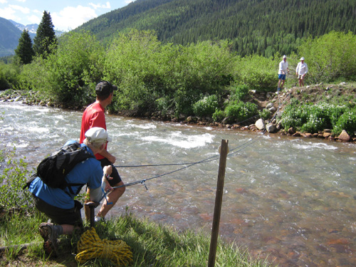
After securing three strands of the rope to the guys'
satisfaction, everyone in the group tested it. They had to get
to the other side of the creek anyway!
Marcy took this shot of Jim as he crossed:
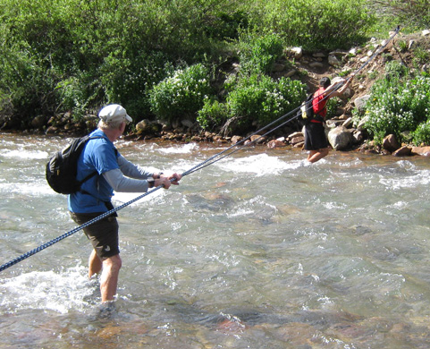
Jim: "Piece of cake!"
When he got to the other side he snapped a few pictures of the
runners crossing behind him:
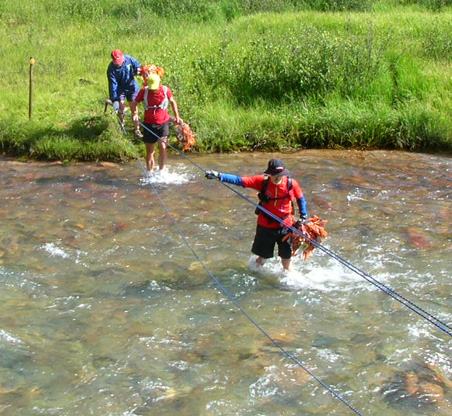
Andy (front), Marty, and Bill step into the
bracing mountain water . . .
Marcy, who's as much of an adventure racer
as an ultra runner, showed everyone
how to do it without holding onto the rope
the last few feet! You go, girl.
Now on to the trail marking . . .
GETTIN' ER DONE
The elevation at Mineral Creek is about 9,395 feet. Next the
group headed up the Silverton Bear Creek drainage to Putnam
Basin and the first high pass on the course this year at 12,600
feet. It's a 3,200-foot climb in about 5˝
miles.
At least there's a trail part of the way! Here are some of the
photos Jim took on the way up this valley to the bench and pass:
Early morning shadows patially obscure the trail (R)
and Bear Creek (L).
There's
another Bear Creek the course follows near Ouray.
The narrow trail crosses several scree
fields.
Looking back toward the east; the trail is
barely discernable to the left.
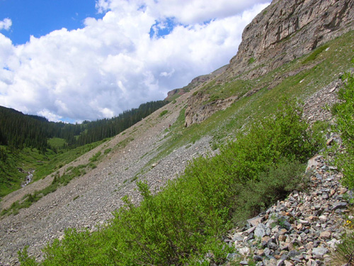
More rocks
Rick got creative with these rocks and made
an interesting cairn.
One of Marcy's photos shows John about to
enter the lower part of the
basin from which Bear Creek originates. The climb
gets steeper now.
Jim takes another look back at
the valley. See the narrow trail in the foreground?
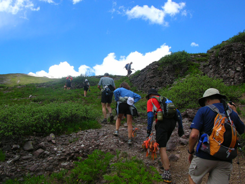
The line of trail markers trudges up the
first steep section. Deb is third from the right
(blue shirt) and hubby Steve is in front of
her (gray shirt).
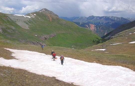
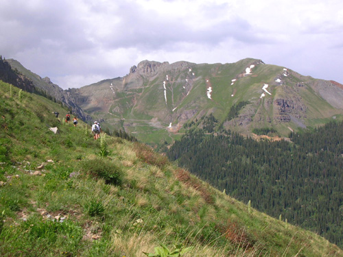
For much of this section the runners were above tree line like
this.
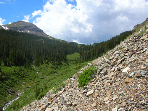
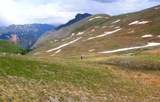
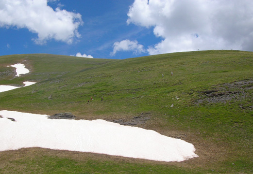
HIGH POINTS
Jim's GPS registered 12,745 feet elevation at the highest point
today. At elevations above 12,000 feet on the way through the
Putnam-Lime Creek saddle, Porcupine-Cataract saddle, and various
ridges and other passes between Bear Mountain and the Twin
Sisters, there were patches of snow that may well be melted by
the time the race starts in two weeks. When I compare photos we
took at this time last year it's obvious that there is less snow
in the mountains this summer.
That bodes well for the race. Trail conditions should be better
than average.
Here are some more photos (mostly in order) that Jim took of the
trail marking group and the fabulous scenery through which they
passed today. Note the changing sky, with storms in the distance
and varying cloud conditions throughout the day. Jim said he got
into only a few sprinkles and a little bit of sleet, the same as
me.
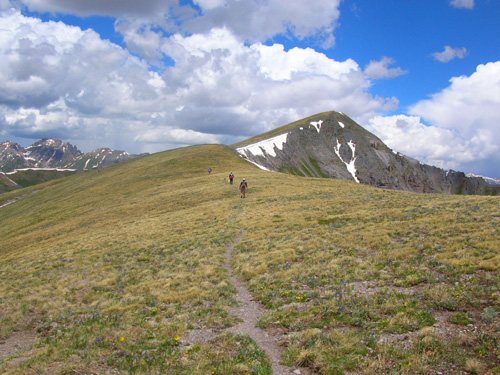
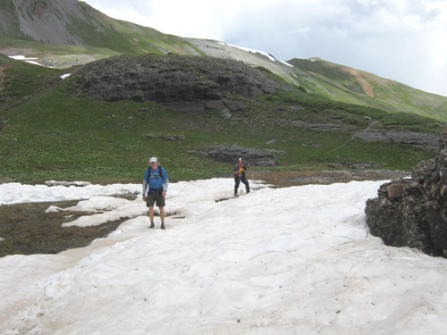
Wow! A real trail!
Segment 25 of the Colorado Trail is down to
the left of this red ridge.
I remember the slow trudge UP this ridge
last year when I helped mark the course
in the other direction; this year runners come down it.
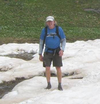
Most of the other trail markers were busy taking photos, too.
Marcy got these (and other) shots of Jim in this section:
Jim's in the snow and he's actually
smiling??? That's because he likes Marcy, not the snow!
(I took the liberty of cropping her photo
for the close-up.)
More snow, but less than there could have
been
Jim and Bill share a laugh. They've got
their jackets on after one of today's little sleet episodes.
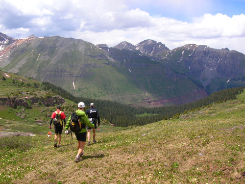
Several of the runners (Jim's in the
middle) relax after climbing yet another ridge.
Thanks for sharing your photos with us, Marcy and John!
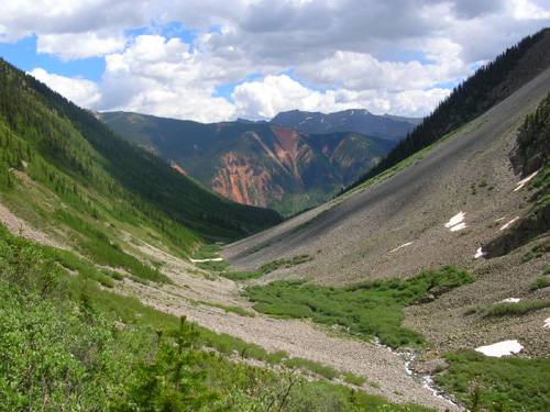
PORCUPINE GULCH
After several miles in the tundra, the group gradually dropped
down through Porcupine Gulch and the flank of Twin Sisters to
South Mineral Creek Road (FSR 585, also called the Bandora Mine
Road). Jim took these pictures of the colorful mountains to the
north on the way down:
Ice Lake Basin is in the background (left
half) behind Fuller Peak. Grant-Swamp Pass and
Island Lake are in the background center,
also hidden by Fuller. Kamm Traverse,
on the HRH course, is above the red rocks
in the right center of the photo.
South Mineral Creek Road is still hidden by
trees and the side of Twin Sisters.
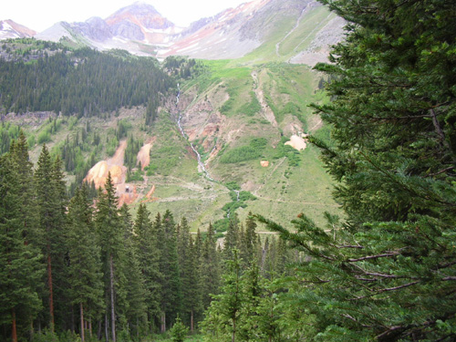
The view toward the abandoned Bandora Mine
(left center)
looks like a pastel drawing but it's a
photo!
A couple hundred feet before reaching the road, the course
crosses the South Fork of Mineral Creek, the largest branch that
flows into the creek farther downstream where Jim's group
crossed via rope this morning. I've only been across the branch
at this location one time, when I helped mark this section last
year. It was higher then but still didn't require a rope. I
understand that in at least one previous race the creek was so
high here that runners had to form human chains to cross safely.
They won't have to do that this year.
Neither Jim nor Marcy got a picture of the creek this year but
Marcy took this shot of John (foreground), Jim (blue shirt), the
Peros, and another trail marker after they got on the road.
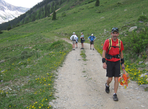
Jim looks ready to call it a day but he kept on going!
KT TO THE ICE LAKE TRAIL
The Hardrock course follows the road for about a quarter of a
mile before reaching the
location of the KT (Kamm Traverse) aid station on a wide spot
that used to be a jeep trail to an old mine. That was the
original stopping point for today's marking crew but since they
did their jobs so efficiently, Ballard decided to continue
marking along the traverse, over Ice Lake Creek, and up to the
Ice Lake Trail -- a little under two more miles.
In this photo of the trail along the traverse, you can see the
unnamed mountain (elev. 13,156 feet) ahead where the road goes up to Clear Lake, which I've
written about previously:
We realized later that about the
same time Jim was on the traverse, I was going down the Ice Lake
Trail on the other side of the mountain.
Jim took the next photo from the traverse, looking east and down
to S. Mineral Creek Road:
He could see our truck in the parking lot at the trail head but
he still had over three miles to hike and run before reaching
it!
If you look at the course map above, you can see that the
Hardrock trail
traverses the southern flank of Fuller Mountain without gaining
much altitude until it winds around the eastern shoulder. The Hardrock
handbook warns runners about acrophobia and exposure on this
narrow trail along the steep hillside but there are
significantly more dangerous places on the HRH than this --
and one of them is a short distance through the woods and around
that corner!
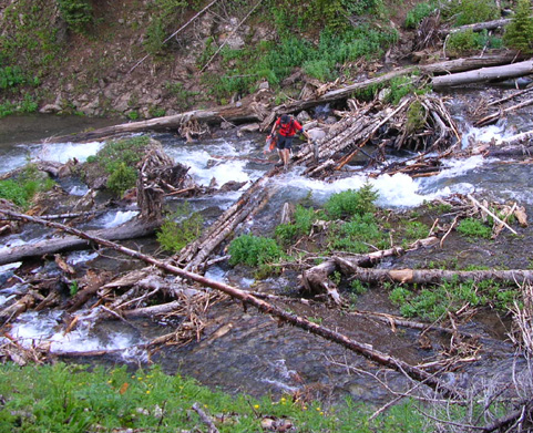
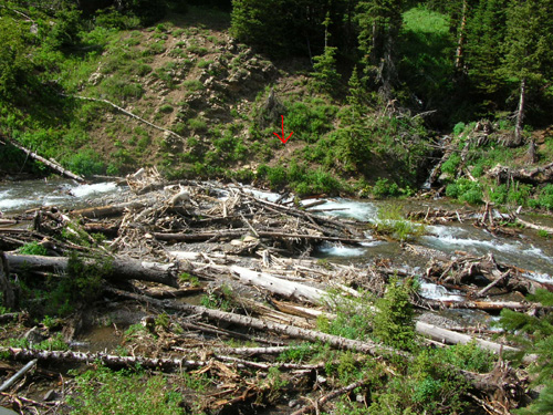
John carefully crosses Ice Lake Creek
today.
It's Ice Lake Creek.
The runners' handbook has some colorful language to describe
this crossing:
"If you go too far left (in a CCW year), you will run into
some spectacular water falls . . . and unless you have wings, it
is very difficult to cross there."
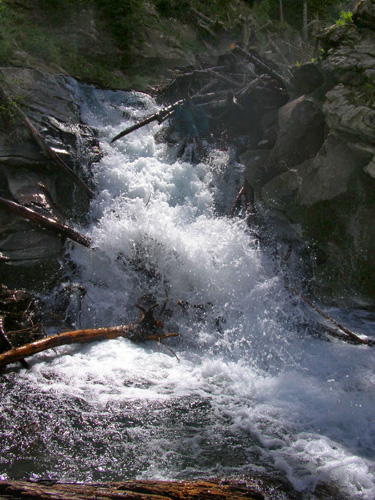
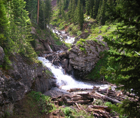
There are also falls on the left of the recommended crossing in
a CW year (next photo). In fact, this mountainside is so steep
that Ice Lake Creek is pretty much one big series of waterfalls
until it reaches South Mineral Creek.
The handbook continues,
"At the crossing place, there are a series of big trees that
have been washed down by the stream into a small, almost level
bowl. Cross the stream, either by wading or working your way
carefully across on the logs."
Carefully, indeed.
The objective is to get across 25-30 feet of
rocks, logs, and rushing water to the trail on the other side
(arrow below). Good luck with that!
I crossed this vicious creek ONCE with Jim a few years ago on a
training run and I vowed to never get near the place again. I've
stuck to that vow. Since I'll never run Hardrock there isn't any
reason for me to do this short section of trail.
I've mentioned before how uncoordinated I am balancing on logs
across creeks. I'd rather wade through the water than fall off a
log. This creek runs so fast, however (even in a "low"
year like this)
that it's treacherous for someone like me to wade through the
water (even with two trekking poles). Other people can obviously do it just fine. An additional
problem for me is the necessity of climbing or crawling over some of
those big logs in the process; I'm not as limber as I
used to be.
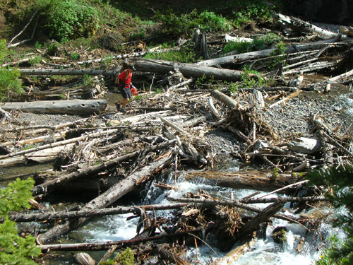
John starting to cross Ice Lake Creek
Jim got across before Jim and Marcy arrived so I don't have any
pictures of him negotiating the creek. He took all of these
creek photos from one side or the other.
Once safely across the creek, runners scramble up a short but
steep, narrow trail to its juncture with the Ice Lake Trail.
That's where the marking ended today and will resume tomorrow.
Then the group ran about two miles down the much nicer Ice Lake
Trail to the trailhead.
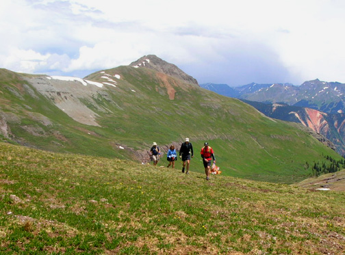
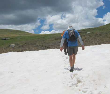
When I could see Jim pop out of the
woods near the parking area, I told Cody to go see him:
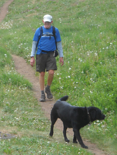
Cody (almost) always makes Jim smile, even
after a long day on the trail.
We stood around the parking lot talking with the other members
of the group until most were back and we were sure
everyone had rides into town.
Jim and I spent most of the evening talking about our respective
run/hikes. It was a lot of fun to share our different trail
experiences. We both had a great day in the San Juans!
Happy trails,
Sue
"Runtrails & Company" - Sue Norwood, Jim O'Neil,
and Cody the Ultra Lab
Previous
Next
© 2010 Sue Norwood and Jim O'Neil
