|
2010 RUNNING & TRAVEL ADVENTURES
| ||

|
Runtrails' Web Journal
SATURDAY, JUNE 26 Hardrockers get to enjoy a half a mile or more of it in the section
between Ice Lake Creek and Grant-Swamp Pass (where the blue and orange
lines coincide) but most of the runners never take the
trail through the Lower Ice Lake Basin or the upper basins during their
training runs.
I encourage them -- and anyone else who loves alpine
basins -- to keep going as far as possible on the Ice
Lake Trail sometime. I think it's even more splendid than Island Lake,
Grant-Swamp Pass, and the view across Swamp Canyon to
Oscar's Pass.
Heresy? I don't think so. Check it out for yourself on a
pretty day like I had today and compare the two routes. The
lower basin is very runnable and getting to the upper basins is
a great workout at 11,000+ to 13,000+ feet in altitude,
depending on how far you venture.
THE LURE OF THE BASINS
Jim and I have used the Ice Lake Trail half a dozen times or
more to reach Grant-Swamp Pass, which is on the Hardrock Hundred
(HRH) race course.
If you look at the photo header on this and every page of
this year's journal entries, you'll see Jim and Cody on the
trail going up to the pass -- with one of the upper Ice
Lake basins in the background! I took that photo on July 24,
2009.
One time in July, 2007 I explored the Lower
Ice Lake Basin and the falls in the next photo on my own while Jim went up to the pass, but it wasn't until last July that we
both continued on up to Ice Lake, which is in
the next higher basin.
That's part of the missing
six weeks in last year's journal, which I hope to eventually
upload. Some of the photos from that run/hike are on our Picasa
site (click on "More Photos" at the top left of each web page).
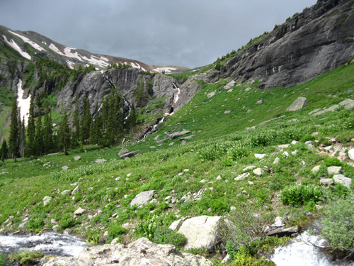
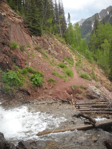
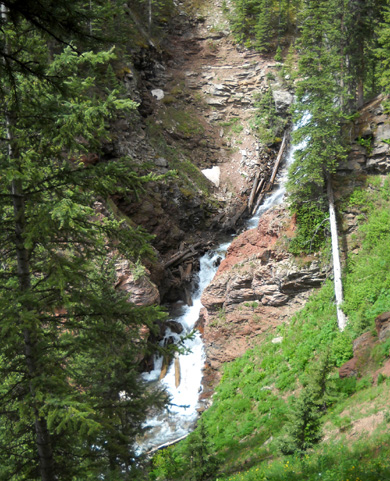
We almost didn't make it to Ice Lake last year. A storm
was approaching from the west when we got to the serious climb
that begins at the series of waterfalls full of run-off from the lakes in the
high basins (photo above). We reluctantly and briefly turned around.
The storm soon passed, however, and the sky was bright blue
again in a few minutes. We retraced our steps to the
waterfalls and continued
up another mile-plus into the next higher basin to
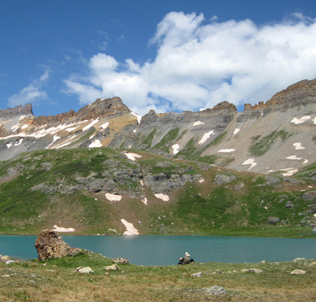
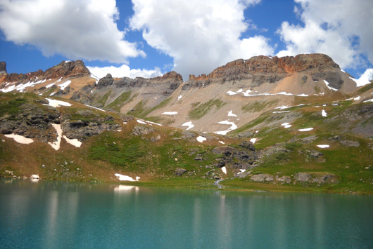
Ice Lake, which sparkled like a turquoise gem in the sunshine. Jim plopped down
on the soft tundra lichens and moss above the lake (next photo) to take a nap at about 12,200 feet while Cody and I explored a bit higher.
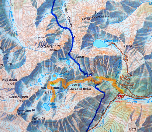
I knew there were even higher basins and more lakes above
Ice Lake -- and I was determined to explore more of them
someday. You can see them on the map above. I marked Ice Lake
with an orange dot. Just look at all the other lakes and ponds below
Pilot Knob, Vermillion Peak, and Fuller Peak!
And that's not all of them. Some are too small to include on the
map. It's a watery world up there.
LET'S DO IT!
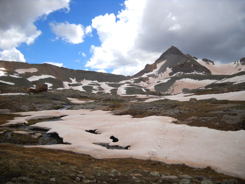
Today Cody and I went more than a mile farther up into the basin
below Fuller and Vermillion Peaks until incoming gray clouds forced me to turn
around. I still didn't get as far up into the basins as I
wanted, but I'm happy with the new territory I got to see.
I knew there was a 30% chance of thunderstorms in the Silverton
area today and I got a much later start than usual -- it
was about 10 AM when I left the trailhead. I took Jim to meet
the HRH trail marking group north of Silverton, watched them
cross Mineral Creek, then drove back South Mineral Creek Road to
the main Ice Lake trailhead.
It was after 1 PM when I turned around in the upper basins
because of the storm clouds. Typical summer day in the San Juans!
Even without the approaching storm (which passed over with no
lightning and very little rain and sleet, fortunately) it would have been
increasingly difficult to continue much farther today. There is
still some snow on the ground and the turf is very wet at this elevation, which I estimate to be about
13,000 feet. I didn't have the GPS with me today. Jim was wearing our Garmin 305 while he helped mark
the HRH course from the major Mineral Creek Crossing at
Hwy. 550 to the Ice Lake Trail. More about that in a subsequent
entry.
I'm going to divide my Ice Lake hike into several journal
entries because the trail sections are so distinct and the pages will be
easier to open with fewer photos on each one. This was a 350-picture day
(!!) but I won't bore you with quite that many
shots.
I was overwhelmed with scenery today and had no idea I took that
many pictures until I downloaded them on my computer. I thought
perhaps half that number. When I was downloading the
photos Jim took today, I asked him how many he thought he
took. He guessed 30; it was 58 (which is a lot for him).
Our skewed perceptions were similar!
I'm not sure if digital cameras are a blessing or a curse
for a photo-nut like me. I enjoy composing the shots and
reminiscing later. And I get enough positive feedback from
readers to continue sharing the pictures. Jim jokes, however,
"Don't encourage her!" It does slow me down and
takes more time to edit them later.
Fortunately, Cody doesn't mind how many times I stop to take
pictures. Good boy. With all our stops and breaks and photos and
wandering around today, it took me about 5˝
hours to go about eleven miles.
And you know what? I had a
fantastic day!
I hiked strongly uphill, playing
leap-frog with most of the people ahead of me (there was a good
crowd out today, but folks were spread out along the trail). I'm
starting to feel pretty well-acclimated to the altitude now. The
only reason most hikers passed me was my frequent photo stops;
I out-hiked all but the fastest young men. < grin >
TRAILHEAD(S) TO THE LOWER ICE LAKE BASIN
The Ice Lake Trail is out and back; folks can choose any distance
up to about ten miles round trip -- or farther if they go off
on a few of the side trails, explore the upper basins, or include
parts of the Hardrock course that intersect the Ice Lake Trail
(Grant-Swamp Pass and the Kamm Traverse).
Without the GPS I estimate Cody and I covered at least
eleven miles today.
The main trailhead for the Ice Lake Trail is at the large
parking area across from the South Mineral NFS campground four
miles back South Mineral Creek Road. The elevation here is about
9,800 feet.
There is a secondary trailhead about a mile up the road to Clear
Lake. You can see it going out to the left (west) from the first
serious switchback on FSR 815 on the map above. The advantage
(?) of
starting there is two-fold: you eliminate about a mile of
switch-backing trail and several hundred feet of elevation gain.
From both trailheads you may get your feet wet, however;
Clear Creek crosses both trails.
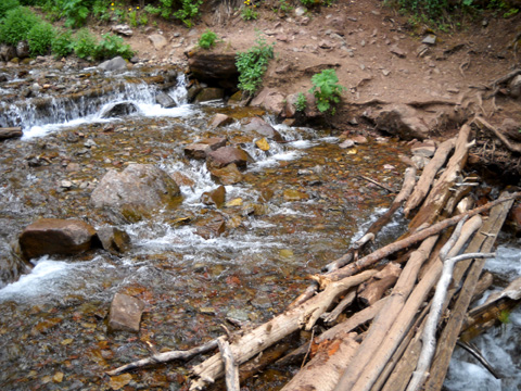
Within about half a mile from the trailhead, the longer, lower route from S. Mineral Creek Road -- the
way I usually go -- crosses the creek below a couple of
pretty waterfalls. The water crossing is about fifteen feet
across. There are several skinny logs across it that some folks use
to try to keep their feet dry:
Since I'm not the most
coordinated person in the world I just plow through the
ankle-deep water so I don't slip off the logs.
For me, it's safer and the water feels good on my feet.
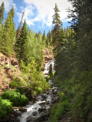
The view of the waterfalls above the creek crossing is
nice:
The creek crossing on the short, upper spur trail coming from Clear
Lake Road is more of an adventure.
The trail crosses the water
right at the bottom of a pretty good-sized waterfall and the
"trail" has become more eroded with each passing year.
The rocks and logs are slick. It's hard
to pass next to this falls without getting your feet wet in the
creek and the rest of you wet from the water spray:
If you're on this short trail, you'll join the lower Ice Lake
trail less than a hundred feet after the waterfall. Keep going
straight and slightly up.
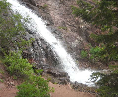
If you're coming up from the lower trail, you'll take a sharp
left to continue on the Ice Lake Trail to the basins. For an
additional treat, however, briefly follow the trail to the right
so you can see the upper falls that hikers/runners go through
from the secondary trailhead:
See why they're likely to get wet?
Enjoy the water, then turn around to the trail intersection, go
straight, and continue up toward the basins.
"Up" is the key word here!
TRAIL DESCRIPTION
The Ice Lake Trail has some plateaus on its way up to the lower
basin but it's mostly relentlessly uphill, sometimes rather
steeply. There are quite a few switchbacks which help make the
grade moderate overall.
In this section, the main thing making the trail strenuous is
the altitude. If you are acclimated to high elevations and used
to hiking in mountains, this is not a difficult trail.
Most of the trail from South Mineral Creek Road to the Lower Ice
Lake Basin, a distance of about 2˝
miles, is very runnable downhill. Strong, acclimated
runners can run some or most of the ascent, too.
The trail surface alternates between very smooth grit to
rocks and/or roots. Some parts can be treacherous coming back
down where there are loose rocks/grit or if it's been raining.
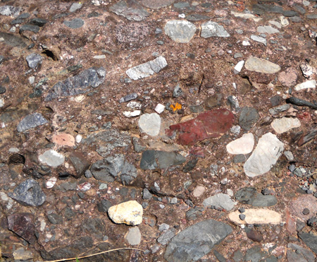
In the previous photo you can see some examples of the
conglomerate rocks that are so common in the San Juan Mountains.
They are a mosaic of various kinds of rocks that adhered
together eons ago during one of the upheavals that formed the
mountain range. Here is a close-up of one of the rock formations
along this trail:
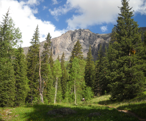
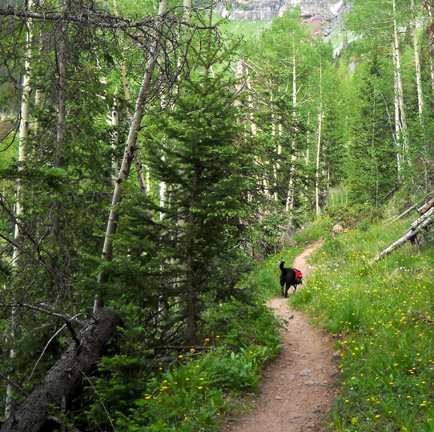
The lower section of the Ice Lake Trail passes through both pine
forests and aspen groves, giving way to mostly pines and shrubs
as it climbs over 10,500 feet. Even in mid-day there is quite a
bit of shade in the first two miles of the trail:
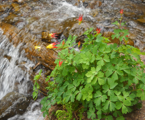
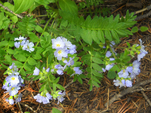
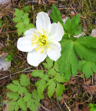
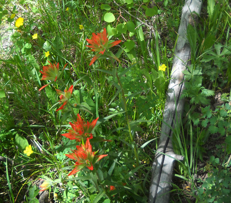
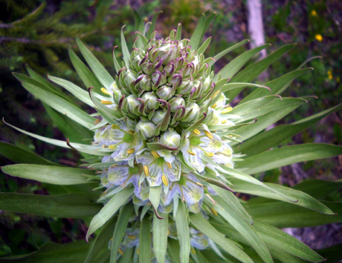
Many kinds of flowers enjoy the shady spots; these are
but a few of them:
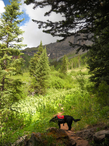
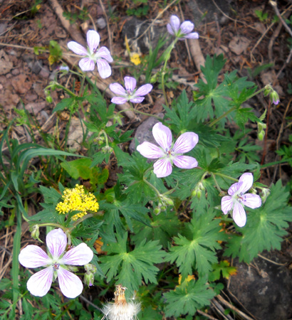
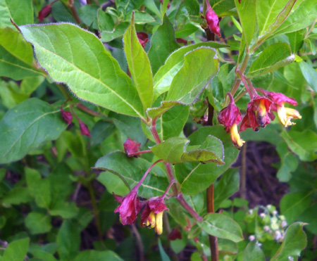
Forested sections are periodically broken up by sunny meadows
full of other kinds of flowers this time of year:
The next photo shows a view of Ice Lake Creek from the Ice Lake
Trail. This is a little bit below the spot
where Hardrock runners cross it on an intersecting trail coming
from the Kamm Traverse. The creek is wider than it looks here, and runs quite
fast. I crossed it once and will never go back! Thank goodness
the Ice Lake Trail does not cross it:
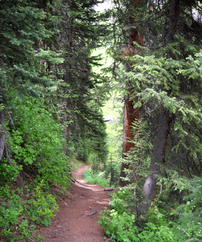
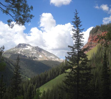
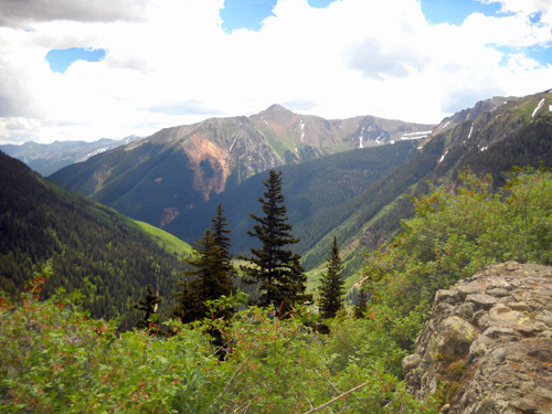
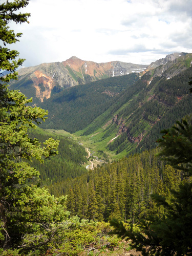
The views back down toward the main trailhead on South Mineral Creek
Road are scenic as you climb higher and higher:
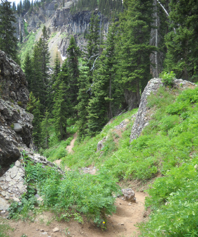
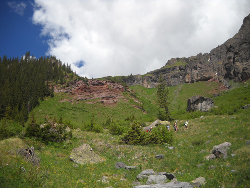
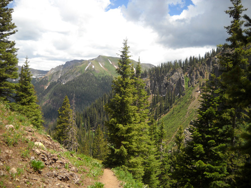
The Hardrock course follows the Ice Lake Trail for half a
mile or more. This is part of it, looking back down the trail:
Shortly after that the trail makes a wide right turn and the vista
opens up as you reach the Lower Ice Lake Basin. We are now at
about 11,200 feet in elevation.
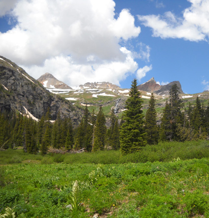
This view is
toward the west end of the lower basin and into the upper
basins. Peaks in the distance include Fuller, Vermillion, Golden
Horn, and Pilot Knob:
At this point, the Ice Lake Trail forks to the left and a cairn
marks the less-obvious trail to the right that Hardrockers follow up to
Grant-Swamp Pass.
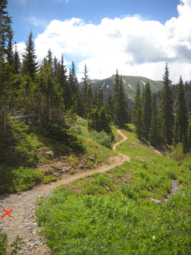
I turned around at the juncture to take the next picture. I'm
looking back down the Ice Lake Trail that I've just climbed.
Hardrock runners will turn onto the trail where the red X is
located to get up to Grant-Swamp Pass. That's a right turn in
clockwise loop years like 2010:
In counter-clockwise years the runners reach this juncture and
turn left to go down the Ice Lake Trail for less than a
mile before heading down to the Ice Lake Creek crossing.
Today I stayed on the Ice Lake Trail and entered the
beautiful world of the Lower Ice Lake Basin. Pictures from the
lower basin are featured in the
next part of this series . .
.
Happy trails,
Sue
© 2010 Sue Norwood and Jim O'Neil |
|||