Or a woman can lose herself! Figuratively, of course. More
about getting literally lost later in this entry.
One of the most convenient runs and hikes for us is right out our
door when we camp along South Mineral Creek Road: the dirt forest
service road itself.
FSR 585 is a good 2WD road for the first four miles to the
National Forest Service's South Mineral Campground and the Ice Lake trailhead.
The road climbs gently from about 9,500
feet at our dispersed campground near the eastern end of the road to about
9,900 feet at South Mineral CG, a nice uphill run/hike with an
average of only 100
feet rise per mile and an even nicer, faster run back home.
If you're the adventurous type you can continue west for approximately
another mile with a 2WD vehicle but the road narrows and rises more
sharply just after the NFS campground and trailhead parking area. It
also gets significantly rougher the farther back the road you go.
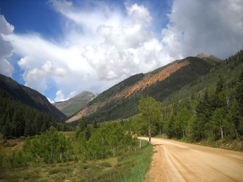
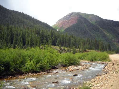
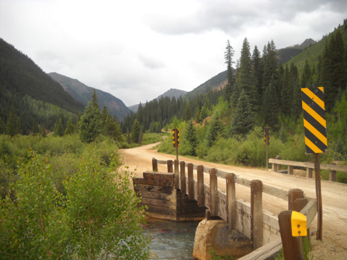
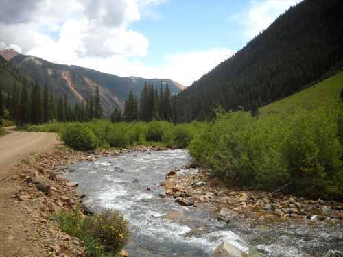
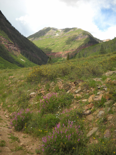
This picture from the road going up to Clear Lake shows a good
portion of the valley through which both South Mineral Creek and its
namesake road run. The creek is down and to the left of the road:
One day we planned to drive farther up this road than
we did but
we gave up and backed down a hundred yards until we could park the
truck at a little pull-off; we had trouble with traction on a
steep section with loose, sharp rocks and it wasn't worth messing up our tires
or transmission to keep going.
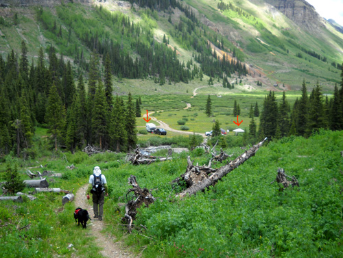
Cody and Jim (hidden by flowers) head back to the
truck the day we parked it about five miles in on
South Mineral Creek Rd. The road to Clear Lake traverses the
mountain in the background.
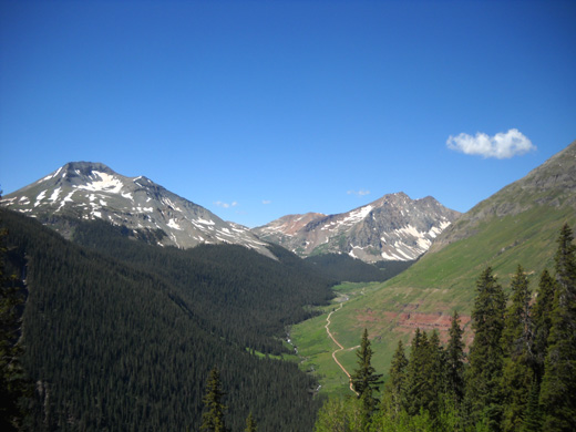
It's no big deal with a 4WD vehicle to continue on this rough road another three
or four
miles beyond the campground/trailhead. Some people even take smaller,
older travel trailers to the end of the
valley at the base of Rolling Mountain, Fuller Peak, and South Park (not
to be confused with the HUGE South Park valley west of Kenosha Pass):
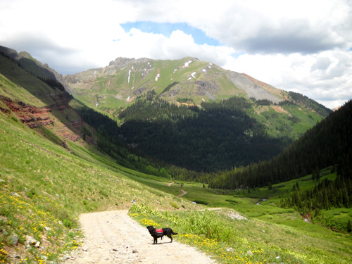
Jim and Cody head down the Rico-Silverton Trail
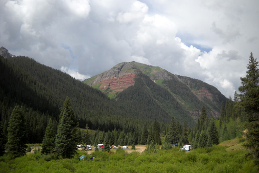
toward South Mineral Creek and road.
I marked a 5th-wheel camper and tent/canopy in the
dispersed camping area with red arrows.
On the way there you'll pass the location of the Kamm Traverse (KT) aid station during the
Hardrock Hundred race, then some old mine remnants, and ford a couple of
streams (one is below) before reaching a large dispersed camping area
and the trailheads to Lake Hope and Rolling Pass (Rico-Silverton Trail).
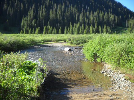
This little creek is always more shallow than the
South Fork of Mineral Creek.
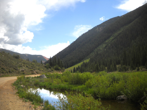
During this trip to Silverton Jim and I both ran/hiked on the
smoother section of South Mineral Creek Road several times. It's right
out our door, good for speed work, and a way to add some distance when
we're using it to connect to other roads and trails.
One other time we hiked the rough western portion of the road when we climbed up
to Rolling Mountain Pass and explored the high basin below Jura
Mountain. I'll show photos from that hike in another entry (the last
three pictures above are from that hike, and the next one).
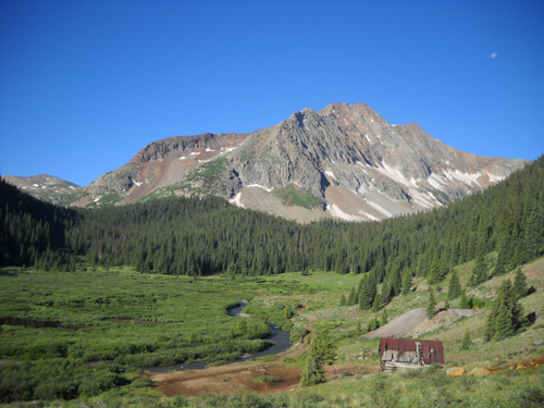
An old mine building sits above the South Fork of
Mineral Creek near the end of the road.
Most of the remaining photos in this entry are from one of my hikes on South Mineral
Creek Road this week. I went out just three miles to the road that goes up to
Clear Lake, then back. I would have gone further that day if a storm
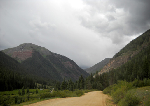
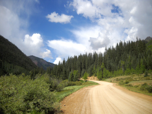
hadn't been approaching. The blue-sky/white-cloud photos are outbound;
the pictures with gray clouds are ones I took on the way back.
I wonder if I can walk two more miles without
getting wet . . .
Mountain weather -- it can change at any minute. Both Jim and I
got into some sleet and rain that day.
TIPS FOR RUNNING, HIKING, OR CYCLING THIS ROAD
The road surface and general terrain along South Mineral Creek
Road is excellent the first four
miles for foot or bike travel. If you like rougher roads,
continue the whole seven or eight miles until the road
dead-ends.
When it's dry, vehicular traffic can stir up a lot of annoying
dust. If it hasn't rained recently, we try to get out early in
the morning before traffic picks up.
Even without the dust factor, we try to avoid South Mineral
Creek Road on Fridays, weekends, and holidays because there is so much ATV,
motor bike, motorcycle, car, truck, and RV traffic on the road.
The road is narrow and curvy, and some drivers just aren't very
considerate of pedestrians or cyclists.
I have ambivalent feelings about walking/running with a dog on
this road. On the one hand, the rocks can be tough on a dog's
feet if it isn't used to running on this type of surface. A dog
also needs to be on a leash the whole time so it doesn't get run
over by speeding traffic (35 MPH is speeding on this road).
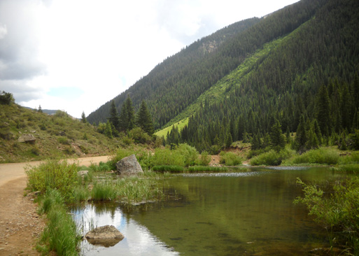
The good thing is that there is plenty of water in the creek and
beaver ponds along the first four miles of the road and at the
end of it. The road is farther from the creek in the last three
miles.
Above and below: Two of the beaver ponds along S. Mineral
Cr. Road
DID YOU SAY FREE CAMPING??
Since I'm giving you a little scenic tour along South Mineral
Creek Road, let me show you some of the free camping spots in
the first three miles. I mentioned them in the last
entry but didn't show pictures of the ones past our campground.
Folks
can camp in everything from a tent to a big Class A motorhome.
There are two large dispersed camping areas, one smaller area,
and lots of "onesies."
We are hunkered down in the first and largest dispersed
campground on this road. It is about 6/10ths of a mile off US 550 north of
Silverton. As I explained in the last entry, it's the only one
on this road (in fact, the only one anywhere around Silverton)
where we can use our Verizon cell phones to make calls and get online.
I can't speak for other service providers. It's also the most convenient
of the SMC campgrounds to town, with less dirt road to
navigate.
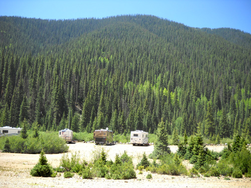
A few of the RVs parked near S. Mineral
Creek in our campground this week
Our camping area has a pit toilet; its cleanliness and
t.p. supply vary, depending on how many people are using it and
how considerate they are. Right now it's fine, with few people
here. On the upcoming holiday weekend -- when this place
will be jam-packed -- we'll probably start using the
toilet in our Cameo.
A little past our campground
there is a bridge across the Middle Fork of Mineral Creek:
There are several dispersed sites to the right on either side of
this creek. It's a pretty location but there is no pit toilet.
Another mile or so down the road and on the left is the
second-largest dispersed site with frontage on the South Fork of
Mineral Creek. The easiest way to spot it (if there aren't a
bunch of campers visible from the road) is to look for the
distinctive red
cliffs on the mountainside on the west side of Copper Gulch:
We've stayed in this camping area two or three times before.
It's nice but we can't get a Verizon phone signal there. It has a pit
toilet and is large enough to maneuver a big RV into position.
The Forest Service has placed boulders near the creek so you
can't park a camper as close to Mineral Creek as you can in the
campground where we are but you can still fish and walk along
the creek.
All along the first three miles of South Mineral Creek Road are other little
pull-offs where
one or two vehicles can park. Usually people will leave their
cars or trucks by the road and set up their tents closer to the
creek, as in the photo below.
I marked a red X where people often erect tents down near the
creek at this location:
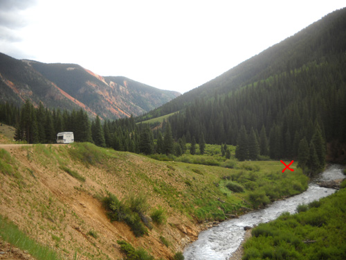
In those places the creek is usually downhill a hundred feet or
more,
away from the noise and dust of the road -- like the
location shown above.
When the dispersed sites are full, RVs sometimes park in the
pull-offs right next to the road but that isn't our idea of a
pleasant experience. There's just too much traffic. It's better
to find a spot like the one below where a small camper can be
backed in:

GOT CORSAR? OF COURSE!
One of the first things we do every summer when we get to
Silverton is to obtain our
CORSAR cards in case we require a
rescue when we're out on remote San Juan trails. I suppose we
should have gotten them when we were in Colorado Springs but we
didn't think of it then; we've always gotten them in
Silverton.
These CORSAR cards are a great idea, both for outdoor
adventurers of all types and for the state of Colorado. Having
one can save you thousands of dollars if you require a search
and/or rescue. Search & Rescue obviously benefits, too. If they
weren't making some money off this, or at least recovering their
costs, they'd raise the very reasonable fee for the cards.
CORSAR stands for Colorado Outdoor Recreation Search & Rescue.
You can buy a one-year card for $3 (per person) or a five-year
card for $12. We never know for sure if we'll be back multiple
consecutive years so we just buy them one year at a time. Two
dollars go to the Search & Rescue Fund and the vendor gets $1
for its time and effort. (You pay the fee, fill out a card with
your name, address, phone number, date of purchase, and DOB,
sign it, and keep the copy. The vendor sends the original to
CORSAR.)
Fortunately, we've never needed either a search or a rescue
during any of our wilderness adventures -- even when I
had my bike wreck last year. No one needed to hunt for me or
evacuate me by land or air. Silverton Ambulance transported me
to the hospital in Durango, which was covered by my medical
insurance, not CORSAR.
We carry our CORSAR cards with our other ID when we're out on
trails in Colorado, with the hope that we'll never need to use
them. They are cheap insurance when you consider what a
search/rescue effort can cost.
I wonder if other states have a similar program? Misadventures
can happen anywhere, even with the best pre-planning.
NO DEJA VU
Family, friends, and folks who read last year's journal may
remember that this is the road where I had my $10,000 bike wreck
early last
August (those were the medical bills, not the
damage to Jim's bike or replacement of my helmet).
Here's where I crashed, just above the steep, rocky slope down
to the creek:
That doesn't show the perspective as well as one of the pictures
I took last year (in the entry link above) with Jim standing on
the road. The slope is about 50 feet high.
This spot is about a mile from our campsite. Every time I've
passed it since the wreck, I have a detached sort of
perspective. I tell people, including myself, the story about my
crash but it's like I'm talking about someone else. In the 10+
months since it occurred, I've had no further recollection of
what happened nor any dreams or nightmares that could have shed
light on how it happened. I still have a 20- to 30-minute gap in
time that I simply don't remember.
This is typical of head traumas and the resultant amnesia.
As I said after the accident, I wish I knew how it
happened and what was going on immediately afterwards, but I'm
just as happy to not remember the crash itself. Considering the
damage to my face and body, it had to have been painful!
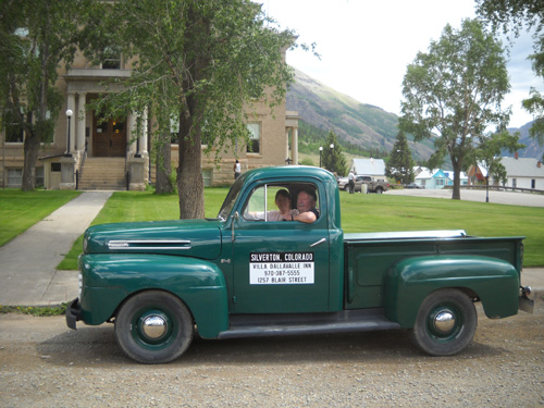
One day when I was walking through Silverton during this visit I
saw an old green truck with the Villa Dallavalle logo on it,
parked in the shade near the courthouse (photo above).
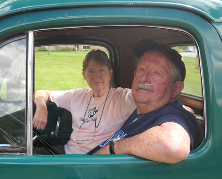
Nancy and Gerald
Swanson, owners of this B&B and the folks who called Jim and 911
after my crash last summer, were sitting in the truck (next
photo). I
recognized them from their pictures on the Villa Dallavalle
website.
I walked over, introduced myself, and thanked them for being my
guardian angels last summer when I wrecked my bike. Although I
talked to them on the phone the day after the accident, I never
saw them in person before we left Silverton. They are part of
that blank spot in my mind; I don't remember them or
anyone else who was on the scene afterwards except Jim. I don't
remember giving them Jim's name and phone number. I wasn't aware
of anything or anyone until I was being loaded into the
ambulance, and even then the only face I remember is Jim's.
Needless to say, I surprised the heck out of the Swansons! They
seemed genuinely happy to see me. They remembered the incident
very clearly but didn't recognize me without blood all over my
face!
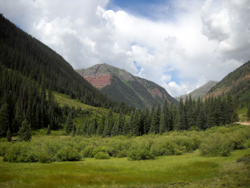
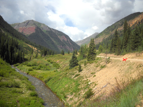
View toward the eastern end of Fuller
Mountain from S. Mineral Cr. Road
They had all kinds of questions. In my phone conversation with
them after the accident I let them know I'd been released from
the hospital the same evening and told them that the brain and
spinal CT scans showed no damage. But they were still concerned
almost a year later about all the abrasions and gashes I'd
gotten on my face, arms, and legs and wondered if I had any
problems later from the head trauma.
They were pleased to see I'd healed up just fine (in fact, that
occurred rather fast) and don't have any apparent spinal or
brain damage (although some people might argue with the
latter!). They've known other folks who've experienced amnesia,
so they weren't dismayed about the memory gap.
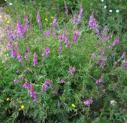
A type of vetch growing along
South Mineral Creek Road and the Ice Lake Trail
I had a few questions, too. I wanted more clarification about
the woman who either found me first or arrived just as the
Swansons did. I thought they told me last year that she was on
the scene and "freaking out" when they arrived. I've
wondered if maybe she came around the corner and I swerved to
miss her. She told Nancy
and Gerald that she didn't see me fall and she didn't move me.
She apparently just didn't have a clue what to do next.
The Swansons gave me another bit of information I didn't know
last year. They said that when they came on the scene I was sitting next to my bike
with
one leg dangling over the edge of the cliff, my helmet was half
off, and I had blood all over me. I knew I was close to the edge
but I don't remember them saying one leg was dangling over! My
blood stains were a couple feet into the roadway; there's
even a photo of that in the entry linked above!
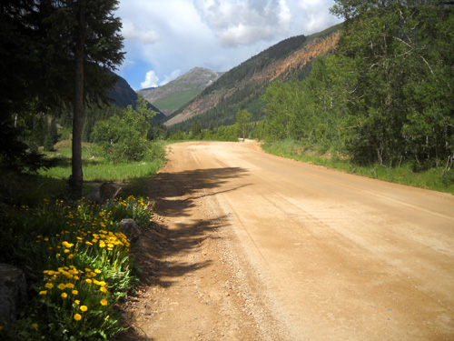
Even dandelions are attractive in a setting like this!
I really didn't learn much of anything new to fill in my memory gap.
I still felt like I was talking about someone else's accident.
Maybe that's a good thing, some sort of protective mechanism our
minds have.
I was touched when Nancy told me she still has the sincere
thank-you note I wrote to her and her husband before leaving
town last year.
A few days later when Jim was with me and we were leisurely
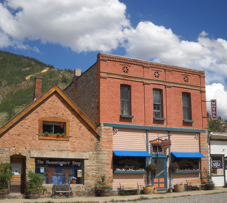
walking through town, we stopped at Villa Dallavalle (above) to say hi
and see what the place looks like. Unfortunately, the Swansons
were out of town then and for the remainder of the time we were
in Silverton. I'm glad I caught them when I did. I think it gave
them and me some closure.
And no, I don't have any problems with running, walking,
cycling, or driving past the scene of the wreck. I can't cycle
on the road this trip, however. We just brought my Terry road bike
this time and I can ride only on pavement. If we had Jim's
mountain bike, I'd be out there riding it again.
When you fall off the horse, just get back on it again or you'll
end up being too terrified to do anything.
Next entry: another favorite run/hike: nearby
Clear Lake
Happy trails,
Sue
"Runtrails & Company" - Sue Norwood, Jim O'Neil,
and Cody the Ultra Lab
Previous
Next
© 2010 Sue Norwood and Jim O'Neil
