I laughed out loud when I found that quote! It fits me well. Problem
is, it's also fun to keep going back to our favorite places.
As much as we love the Bighorn Mountains, we're excited about
returning to the Silverton, CO area and some even bigger
mountains. The San Juan Range is one of our favorite places to stay and
play for a few weeks.
We had some concerns about whether we'd be able to get the Cameo out
of our soggy site at the Foothills Campground yesterday morning. We were
deluged with rain on Sunday afternoon. The dirt and grass under the
camper tires were still soaked. Fortunately, the truck tires were on more
solid gravel and could "get a grip." Even though we don't have 4WD any more, Jim was able to
extricate the camper from the mire and we were on our merry way by about
9:30 AM.
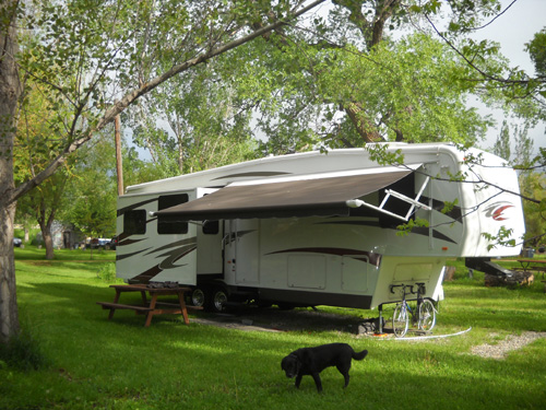
Photo taken of our campsite at
Foothills two weeks ago; no flooding then
Once again, we weren't in a big hurry to reach our destination.
We didn't have a specific date or time we needed to arrive in
Silverton since we can't make reservations for dispersed national forest
camping. Our goal was simply to get here before the hoards begin
arriving for the Fourth of July weekend. We're under more pressure
getting from Point A to Point B when we have a reservation somewhere. Of
course, not having a reservation can be stressful sometimes, too
. . .
We've also learned that it's more fun to travel if we allow plenty
of time to get somewhere with the camper in tow. We're starting to allow
more days in transit, taking more breaks along the way, starting later
in the morning, and
stopping earlier.
Is that age, experience, or both?
Since we got the Cameo in January we're also keeping our speed lower
most of the time. This puppy is heavier than the HitchHiker. At 60-62 MPH we get better fuel mileage and have more
control over the rig. You'd be amazed how long it takes to slow down or
stop a 15,000-pound camper, even with the best of brake systems.
OUR ROUTE
If you look at maps of Wyoming and Colorado, you'll see that there
are numerous choices of routes between Dayton, in northern Wyoming, and
Silverton, in southwestern Colorado. Even though we weren't in a big
hurry, we did want to get to our destination in this lifetime, so that
limited our choices somewhat. It made more sense to us to use a
combination of freeways and two-lane highways instead of only "blue
highways" that meander through the mountains of both states.
Eastern approach to the
Eisenhower Tunnel
For various reasons, including the number of high passes we'd have to
cross, we chose the following route: south on I-90 and I-25 through Casper and Cheyenne to the metro Denver
area, west on I-470 and I-70 to Grand Junction, then south on US 50 and
550 to Silverton.
We've used all these roads before and know they are fine for travel with
an RV in the summer.
It took us parts of two days to travel with the usual
stops and no long delays for road construction or traffic accidents.
MILES AND MILES BEFORE WE SLEEP
Yesterday we drove from Dayton, WY to the Sam's Club in Loveland, CO.
We had great weather through Wyoming as we traveled along I-90 and I-25. Even
through the small cities of Casper and Cheyenne there was minimal traffic on a Monday.
That's one of the nice things about driving through states like Wyoming
and Montana -- even though they are summer vacation destinations, traffic
is usually light and you can enjoy the scenery without semis blowing you
off the road.
The rangelands are very green and somewhat flooded right now,
after all the recent rain. We saw numerous antelope in the first hundred
miles. It was still early enough in
the day for them to be out grazing. We love seeing antelope. Cody even
perks up sometimes when he sees them out the window.
We fueled up at the Conoco station in Douglas, WY for 18˘
less per gallon for diesel than at the Flying J that drives us nuts in
Casper. I've written about that particular Flying J before -- no
RV lanes and fuel prices 10˘ higher in the truck lanes than in the
crowded car lanes. In our experience this particular Conoco is less expensive
than any other service station for many miles in either direction and it has plenty of room for
large RVs.
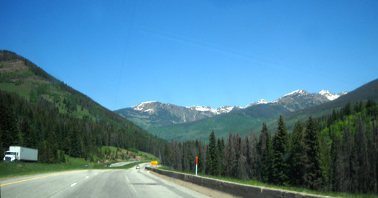
I didn't take any "windshield
shots" in Wyoming yesterday;
this one is from today on I-70
west of Denver.
This was the third or fourth time we've
spent the night at the Loveland, CO Sam's
Club in recent years. The parking lot is big, relatively quiet, has some shade next to
trees, and is convenient for shopping. We had great cell phone, internet
broadband, and TV reception. Jim also found spotty WiFi from two nearby
businesses, including Home Depot.
This Sam's Club has gasoline pumps but not diesel.
We needed some gas for the generator so Jim got it there for a good
price. He walked over to Home Depot
for some supplies while I loaded up on groceries and other
items at Sam's Club -- another "free" night at Sam's Club that
cost us about $90!
We also shopped at the nearby Wal-Mart on
our way back to the freeway this morning; Sam's is two or three
miles west of the freeway but worth the detour for us, especially since
there's a Super Wal-Mart on the same road. We won't be near
a Wal-Mart store for about three weeks unless we go down to Durango or
up to Montrose while we're in Silverton -- at least an hour's
drive either direction. The nearest Sam's Club is even farther away
(Grand Junction). The little grocery store in Silverton is expensive and
has a meager selection of items, especially produce, so we try to load
up as much as possible before we go there. Ditto for gas and diesel,
which are 20-40˘ more per gallon than other areas.
Can you say "tourist trap?"
<sigh> We still love to visit the area.
OVER THE MOUNTAINS AND
THROUGH THE WOODS . . .
This morning we left the Loveland, CO
area about 9:15 so we could avoid rush hour between there and Denver on
I-25. Traffic was heavy in the Front Range and the metro area but moving
well in the clear, warm weather. The high in Denver was predicted to
reach 93° today. We haven't been in 90+ F. temps for a while, so we were glad to
be in an air-conditioned truck, headed for higher, cooler climes in
Silverton!
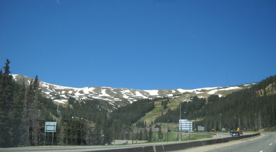
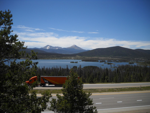
We took I-470 west to I-70 and began the
long ascent out of Denver into the mountains, climbing from about 5,200
feet to just over 11,000 feet in elevation. There is still plenty of
snow on top of Mt. Evans and the other peaks along the Continental
Divide:
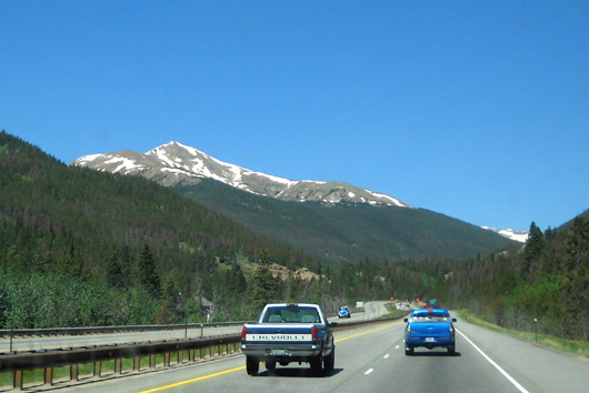
The truck hauled Cammie up to the Eisenhower Tunnel, our highest pass
today, just fine:
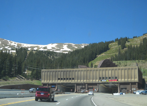
The
long grade going westbound is an easier climb than
going eastbound.
Of course, since we were going westbound that meant we had to use lower gears and exhaust brakes going
down the steeper side. Jim's very good at keeping the brakes cool on
long descents, as he proved going down the even steeper and longer Pike's Peak Highway recently.
Still, he though it would be a good idea to take our first break at
the rest area above the Dillon Reservoir after several miles of
serious downhill driving:
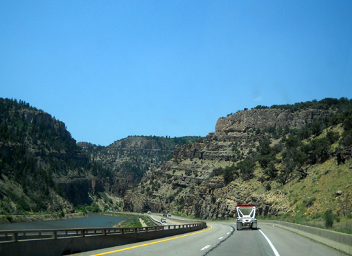
We
went through a total of six tunnels along I-70 today. Both the
Eisenhower Tunnel and one of the other tunnels are about a mile long. Cool!
After the Eisenhower Tunnel the freeway undulates up and down on its
long descent to the
west. The scenery is great, with lots of rock formations (below), open
rangeland, and verdant Colorado River valleys.
We saw several of these earthen
ramps along I-70 but aren't sure what they are for.
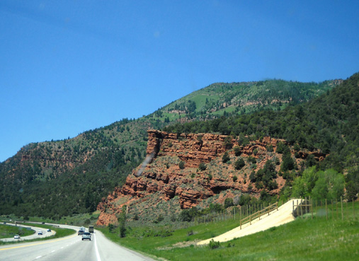
I especially love the scenery and terrain through the Glenwood Canyon
area east of Glenwood Springs (approximately exits 116 to 133).
There are several rest areas along here. Most looked too small for
our camper to park or turn around so we didn't stop at any of them. We
could see cyclists, runners, and walkers on the bike trails and rafters
on the river where it wasn't too rough.
Glenwood Canyon area
We didn't stop for lunch until exit 90 near Rifle, CO. There is a
large wooded rest area with plenty of room for RVs and a free dump station with
easy access.
Despite all the road construction along the part of I-70 we traveled, we made good time to Grand
Junction. We took exit 37 on the eastern edge of town, a convenient
tangent to reach US 50 south. This highway is a fast four-lane conduit to
Montrose.
Several times in the past we've gotten good service and prices at a
propane place called Hometown which is between the little towns of Delta
and Olathe. We wanted to stop there to top off both propane tanks
We discovered the old "Mom and Pop" business was
recently bought by a large local corporation (AmeriGas) after "Pop" got
cancer. Their price is still good, about $19 for 8.3 gallons,
including tax. That's cheaper than we'll find it in Silverton.
The price was also good for diesel at the Western service station
in Delta ($2.86/gal. compared to $3.29 in Ouray and Silverton) so
we filled the truck tank again there.
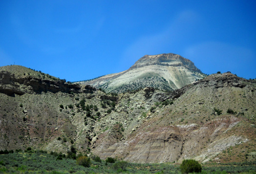
I like all the colors of rocks in these hills in
the Glenwood Canyon area.
As we pulled out of the gas station, our credit card company
called to verify it was us that had made that purchase and all the
others in the last couple days! I had notified the company
when we left Virginia two months ago that we'd be traveling all
over the West this summer but the woman who called me didn't see
that on the computer. She apologized several times for any
inconvenience (none we know of; no transactions were
denied) and "reset" the card. I told her we'd be in
several more states before returning to VA. She asked that we call again when
we get there.
We're glad the company is somewhat cautious but we're wondering
why it took them two months to figure out there were charges
several times a week all over the West? I wondered at first if
it was a legitimate
call, but the woman asked for no personal information.
If she had, I wouldn't have given it to her since I wasn't the
one who initiated the call. We are diligent about checking online almost daily for any
unauthorized or incorrect charges to the account. We'd know
before the card company if someone else was using our card.
EDGY
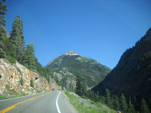
In Montrose we headed south on two-lane US 550 through Ridgway
and Ouray to Silverton. The views of the San Juan Mountains are
dramatic along this road:
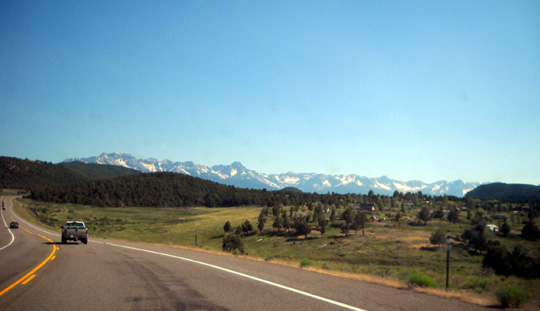
The northern edge of the San Juan Range is
prominent from the road south of Montrose.
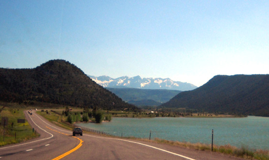
Passing the lake at Ridgway State Park
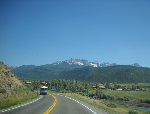
Traffic hummed along nicely as the road became more winding and
hilly on the approach to Ouray:
Then comes the fun part.
As much as I love to visit the San Juans, I increasingly dread
the ride just south of Ouray in the first few miles of the
"Million Dollar Highway."
The road begins benignly enough as it switchbacks up the first
mountain at the southern end of Ouray and begins its traverse of the canyon:
That's not so bad, even though it's several hundred feet into
the canyon (to the right in the picture above). There's enough of a shoulder that I
can't really see down into the chasm.
I'm not afraid of
heights, just skinny highways with huge drop-offs that I can
see down on
my side of the road!
I'm not just talking about curves with no guardrails; there are
very few guardrails along this stretch of road. What's worse are
the
places where the cliff has eroded right up to the
pavement, like where I've drawn the arrow in the photo below:
Yeah, I'm a wee bit paranoid about places like that!! They make me wonder whether the earth and rocks will
give way just when we're driving a heavy RV over a weak spot
under the road
. . .
It wouldn't be much better if I was driving instead of Jim. I
trust his driving abilities. I just don't trust everybody else,
especially big motorhomes that are driven by people who aren't used to
driving in the mountains and folks who are driving anything
fast and might come over into our lane on
one of the sharp, blind curves.
I would never want to be on this road, even in just our truck,
on a rainy day. Summer weekends are no picnic either, with all the extra
traffic.
Every year I get more nervous about this section of roadway. I
think it's an aging thing. Or maybe it has to do with my bike
wreck last August. I don't feel nearly as invincible as I used
to. I just have to not look down into the canyon directly to my
right when we're headed south on this road. It's much better
going northbound, when I'm next to the mountain instead of the
yawning chasm.
Anyway, I survived the edge of the Million Dollar Highway today
and I hope I don't have to do it again for another year!
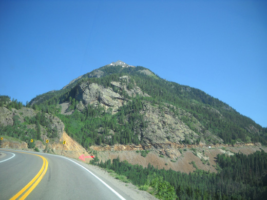
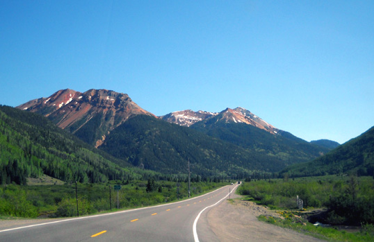
Fortunately the road is not at all scary for most of its way to
Silverton. The scenery just keeps getting better and better as you get
deeper into the San Juans:
UTILITARIAN MATTERS
We deliberately drove right by the road we take north of
Silverton to get to our destination campground at South Mineral
Creek and went into town to the visitor's center first. Campers can
get water from a spigot on one side of the building and dump
trash in one of several dumpsters. Donations are requested but not
required. We couldn't pay today because the visitor's center was
closed by the time we got there.
We filled up our fresh water tank before heading back to the
campground. In order to keep the camper weight down, we usually
travel with only 1/3 tank or less of fresh water and as little gray and black
water as possible.
The Cameo holds 10-12 gallons of water in
the hot water tank, about 75 gallons in the fresh water tank, and 62
gallons in each of the gray and black water tanks. Multiply all
those
potential gallons by 8.3+ pounds per gallon and you're talking
serious extra weight if you haul all that water and waste down
the road.
Part of the Million Dollar Highway:
looking down into the valley where the road will take us next.
This tank will hold us for a few days before we need to start
replenishing it with our three six-gallon containers. We'll take the empty tanks with
us any time we're heading into town and fill them up, trying not
to let the camper tank get completely empty. Tank gauges in RVs are
notoriously inaccurate so we partly use our experience as a
guide to know how much water is in the fresh, gray, and black
tanks.
Earlier on this trip Jim discovered an easier way to get fresh
water from the little tanks into the camper tank. Instead of
holding each heavy six-gallon tank high enough to let gravity do its thing, he can
set the tanks on an empty 5-gallon bucket and use the Cameo's
water pump to siphon it in. That sure is a lot easier on Jim.
Our other alternative is to haul the camper into town every few
days to put water directly into the tank with our hose. No way! That's too
much of a hassle with a 5er or travel trailer. It's more easily done with a motorhome
that doesn't have to be hitched and unhitched, but still a
hassle even then to put everything away, close the slides,
prepare to move, then get settled in again.
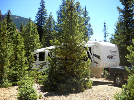
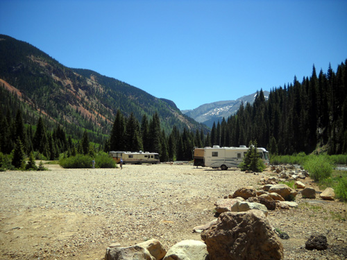
Our current campsite
There still isn't a dump station in Silverton except the ones in
the private campgrounds. I don't think we've ever used one of
those; they charge a hefty fee for folks who aren't
staying in their campground. Because so many people dry camp/"boondock" (camp
without hookups) in the surrounding area in the national
forests, I think the town could bring in some extra revenue if
they built a dump station and charged a reasonable $5 fee for boondocking RVers to dump their gray and black water. We
always
dump before we get there and primarily use the pit toilet in the
campground so we don't build up much black waste. We can go a
month or more that way without having to empty the black water.
Gray water is a different matter. This is water from the kitchen
sink, bathroom sink, and shower.
To the best of our knowledge there are no rules against dumping
gray water at South Mineral Creek or many other national
forest campgrounds we've used in the western states.
Nonetheless, we use fresh water sparingly when we boondock
because 1) it's time-consuming to fill our small containers
frequently and transfer the water to the camper tank and 2) it's
not always convenient or permissible to empty the gray water. If
regulations say not to dump gray water, we don't.
Either way, when we don't have a sewer hookup we take
"Navy showers," use small amounts of water to wash the dishes,
and
sometimes use paper plates/bowls. We've learned how to go quite a while
without having to dump gray water.
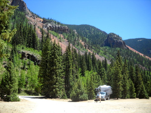
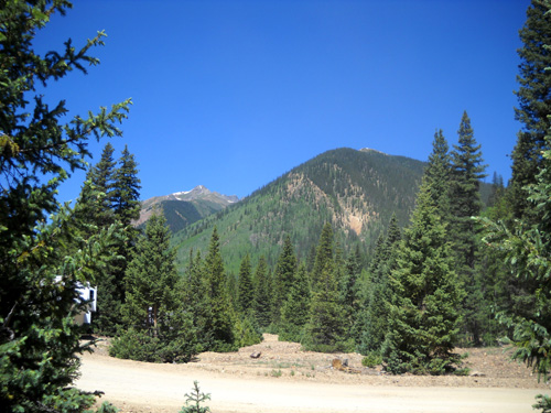
OUR NEW NEST
We picked out the same site near the entrance of one of the campgrounds on South Mineral Creek Road
that we used the second time we were there last summer (photos
above and below):
We were in an adjacent site at first, but moved when we realized
someone might crowd right next to us or block us in. No one can
do that in the site above; it's a "onesy."
This campground, which is about 6/10ths of
a mile off Hwy. 550, gets very crowded over the
4th of July holiday but it is the only dispersed campground in
the Silverton area
where we can get a Verizon signal for our phones and internet
broadband service. There is no TV reception here without cable
or satellite service (we have neither) and we have to go into
town if we want WiFi. There is one pit toilet that is kept
fairly clean by the Forest Service; there are no trash
bins so we have to take our garbage to the visitor's center.
Because of bears, we have to keep our trash inside the camper
basement until we can take it into town.
But it's free, has great views and a lovely creek, and is
convenient to town.
Did I mention that it's free?? We like our tax dollars to
work for us like this!
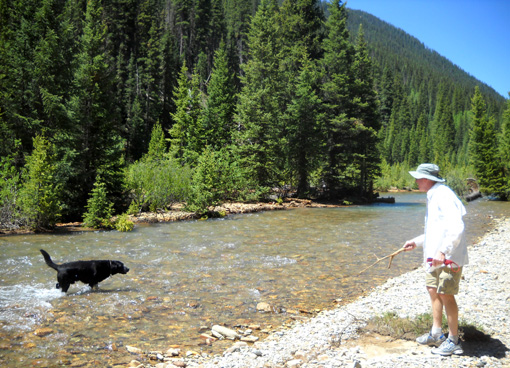
Jim and Cody play fetch the stick in South
Mineral Creek.
There is a lot more dispersed (free) camping farther along South
Mineral Creek Road -- two other campgrounds that are smaller
than ours, also along creeks, and numerous pull-offs by the
road. The pull-offs are great for folks with tents because they
can erect their tents about anywhere in the woods or along the
creek.
There is also a paid Forest Service campground about
five miles back this road. It has water spigots, pit toilets, and trash
bins but no hookups or dump station. You can make reservations at that
campground; I don't know the cost. Half of it is closed
right now because of recent storm
damage.
There are three private campgrounds with full or partial hookups in
the town of Silverton. We've
never stayed in them but we've decided which one we'd use if we
want hook-ups sometime. Because the only Laundromat in town is such a dump
(dirty, expensive, half the machines broken), Jim was delighted
to discover that we are welcomed to do our laundry at the AB RV
Resort at the east end of town even though we aren't staying
there. We appreciate that.
Gorgeous view upstream; this is why so many
people want to park next to the creek!
Our campground has plenty of available spots right now, although
it is more crowded than when we got here last year on June 24.
Our first choice is a back-in spot near the creek but we've
never gotten that one; it's always been
occupied (last summer by our friends Laura and Roy).
We can see that several RVs near us are not occupied;
people are obviously staking out spots for the weekend, a
practice we haven't seen here before. That's not kosher but the
Forest Service doesn't have enough staff to enforce the rule
about occupying your camper every night.
Although there are still good spots next to the creek (above) we
decided not to camp there this time because it gets so crowded
in early July. I'll take some pictures next week to show you the
difference between now and then. We've parked there two previous
times in mid to late June and liked the location until it got packed.
Another advantage to the spot we have next to the entrance is
that we can see who's coming and going from the campground. That
can get distracting but we like being unofficial "gatekeepers."
(That's a joke, like when we've "supervised" construction
projects at Huntsville State Park and Los Alamos from our
camper.)
Knowing who's coming and going from the "neighborhood"
can be a good
thing, though. Campers tend to watch out for each other.
The view from my desk; that's the entrance
road to the campground in the foreground.
Someone drove a motorhome into the campground after we arrived,
stopped just past our site, and asked Jim if he was the
campground host! Jim told him no but answered all his questions.
We joked later that he should have said "Yes, that'll be $20
a night to camp here!"
Just like when we stayed at Foothills the last two weeks, we've
been in this campground enough times that it feels like home to us.
We hope
we can stay under the radar for three weeks without getting run out. There are other
places to go but we like it here the best. The two-week limit in
the dispersed campgrounds hasn't been enforced for several
years. A man named Jim who remembers us from previous years is
camped across from us. He was in the area all summer in 2009 and
the Forest Service did make him move periodically but he was
able to stay at least three weeks in each spot. This summer he's
relocating on his own about every three weeks and no one has
hassled him.
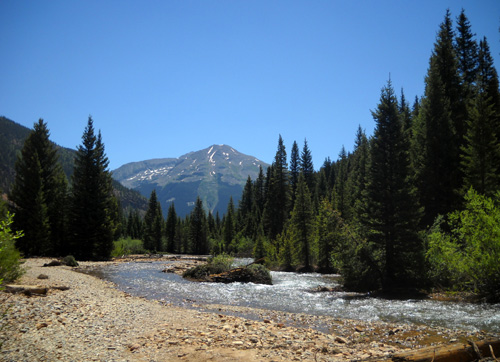
Nice views downstream, too
We also ran into Roy and Laura, ham radio operators from
California who we met last year in this campground. They just got
here, too, and are staying for only three weeks this time
instead of most of the summer like they managed to do last year. They
didn't get run out like the other guy did.
We enjoyed visiting
with Roy and Laura for about an hour this evening. They'll
probably be working communications at a different aid station than us during
the Hardrock race
but we can see them in the campground as often as we
want. We're also looking forward to hanging out with ultra
running friends Marcy and John Beard and Bill Heldenbrand when
they arrive here to camp soon.
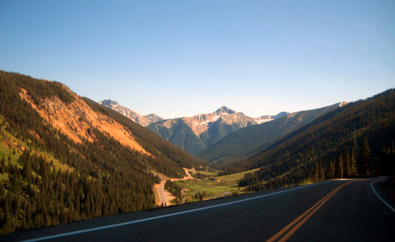
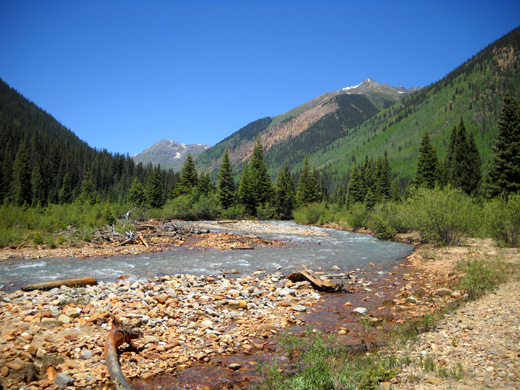
We noted on our way to Silverton that there is very little snow visible
in the San Juan Mountains. That's a good sign for our training runs/hikes
and for the Hardrock race. Jim and I are both ready to hit the trails
tomorrow.
Next entries: exploring new trails and revisiting old
favorites
Happy trails,
Sue
"Runtrails & Company" - Sue Norwood, Jim O'Neil,
and Cody the Ultra Lab
Previous
Next
© 2010 Sue Norwood and Jim O'Neil
