I was so enamored with this park when I visited three years ago that
I posted a total of seven pages of entries full of information and
photos in the 2016 web journal. This entry has just two pages of
photos.
I was alone on my
first visit and took over
500 pictures on a beautiful sunny day in early April, 2016 when I explored the
whole park and hiked several trails. A few days
later
I took Jim back with me to hike two of the trails with Casey and Cody and show
him around the rest of the park.
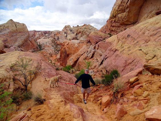
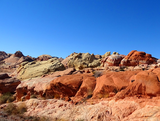
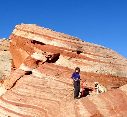
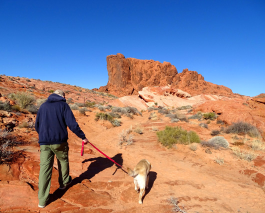
Jim and Casey hike down the "chute"
on the very colorful White Domes loop trail. (4-9-16)
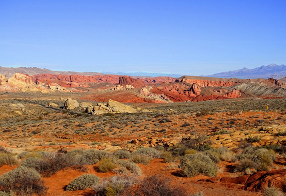
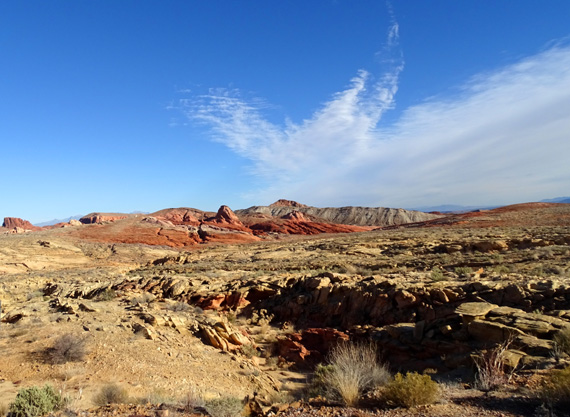
More hiking and sight-seeing at Valley of Fire was my main reason for wanting to come back
to the Las Vegas area this winter. I was determined to spend a couple of
sunny days at the park to try to re-live the excitement I felt the first time.
Well, one thing we've learned after fifteen years of extensive RV
travel is that repeat visits to most places haven't usually been as
exciting as the first time or two. That was true once again.
At least the weather was more comfortable today -- sunny and temps in the 40s to
low 60s F., which is perfect for hiking in a potentially hot desert.
That was an improvement over the upper 80s F. we had in April three years ago.
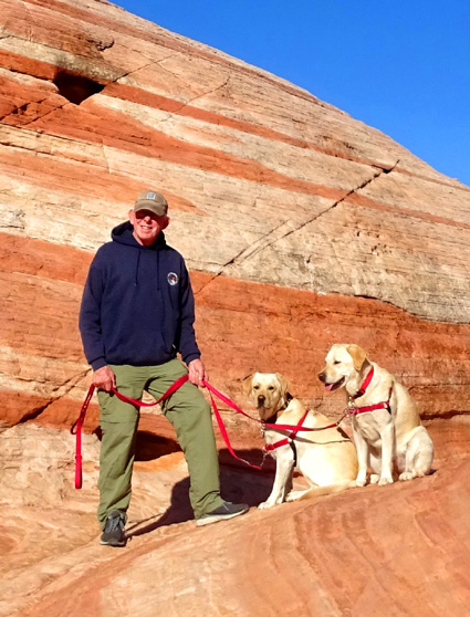
We took Casey and Holly with us today so I wasn't able to take as many
pictures as I could when I was here the very first time and hiking solo.
That wasn't a problem either -- everything still looks the same:
absolutely stunning!
The problem was not being able to hike the most important trail
I wanted to do today, the White Domes Loop.
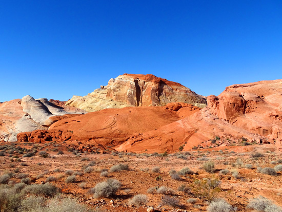
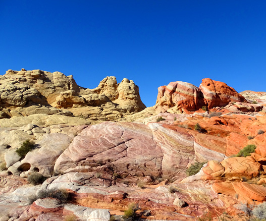
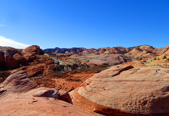
If you look at the
photos I took on my first hike there in 2016 you'll see why --
that trail is a fantasy of colors and shapes. When I took Jim to see it three days
later, the lower end was flooded and he didn't see the whole loop. I wanted
to show all of it to him today.
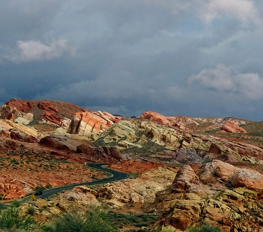
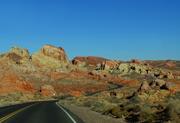
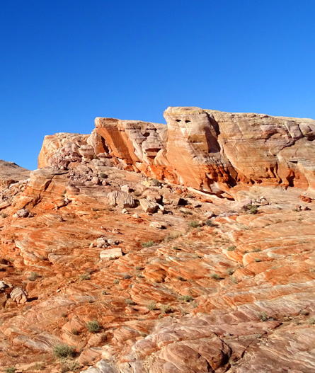
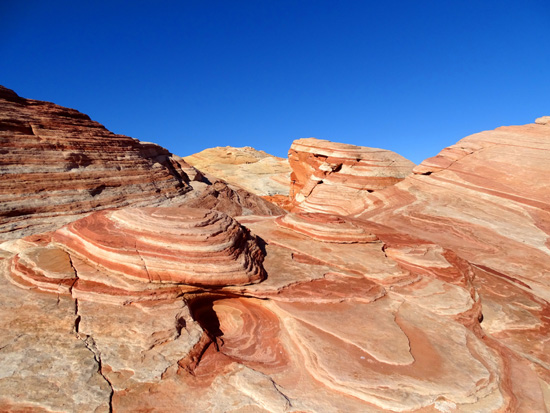
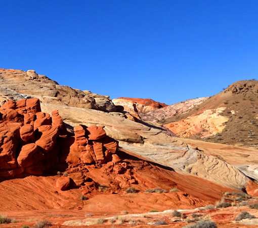
Awesome colors along White Domes
Rd. on a cloudy day three years ago (4-9-16)
Unfortunately, Jim still hasn't seen all of the White Domes Trail!
As soon as we got to the entrance station the attendant told us White
Domes Road was closed just past the Fire Wave Trail and we couldn't
drive back the remaining mile to the trail that I so badly wanted to hike again.
<sigh> At least we could hike to Fire Wave, which Jim hasn't seen
before, and anywhere else in the park we wanted to go. That was worth
our $10 entrance fee.
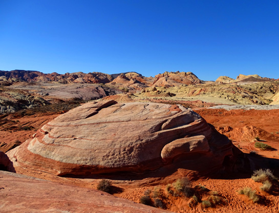
Part of the unusual Fire Wave formation
(1-9-19)
Once we knew what the problem was, we understood why visitors weren't
allowed all the way back this road. A friendly ranger at the road block, set up next
to the Fire Wave parking area, explained that a hiker was missing and
only Search & Rescue folks were allowed in that part of the park until
the guy was located.
Well, that's a definite bummer
for the guy who was missing/lost. We wondered what happened.
Later that evening we heard on the news -- and I found more
online -- that a 57-year-old "endangered man who may be
emotionally distressed" was last seen four days previously at the White
Domes Trail parking area and was still missing. Sounded to us like maybe he *wanted* to
disappear??
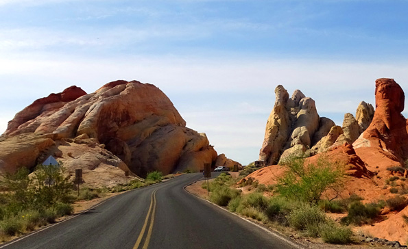
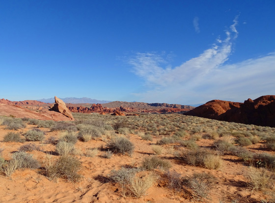
Picture of White Domes parking
area from three years ago (4-6-16)
They were still looking for
him on this date and the road was closed for several more days after we were there,
too. I called the park a few times because I wanted to go back another day and
hike the White Domes Trail.
We never did go back up there
because rangers said that even if the road was open when I called, it
could still be closed without notice at any time until
the man was found. We weren't able to learn if he'd ever been located.
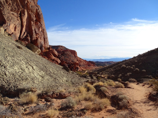
On this visit the only hikes we did were on Fire Wave Trail and the Petroglyph
Trail. We took the dogs on both trails. This entry has photos from these
trails and other areas of the park.
We drove into the park from the west on Valley of
Fire Road and went out the east gate several hours later to Lake Mead Recreation Area, which
I'll talk about in another entry. Here's a
map showing the park
roads:
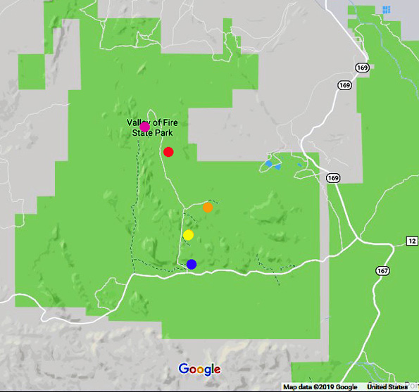
I added the colored dots. Blue = visitor center. White
Domes Rd. is the narrow white line going north from there. Yellow =
Petroglyph Canyon AKA Mouse's Tank. Orange = Fire Canyon. Red = Fire
Wave Trail. Purple = end of the road at White Domes Trail.
Valley of Fire State Park extends farther north than
this map section shows. Lake Mead Natl. Recreation Area is the green area to the
right (east) of the state park.
I wrote a whole lot more
about the geology and history of this park in
April, 2016.
If you start at that link and follow the next seven pages you can access all that
information and see dozens more photos from other trails, landmarks,
campgrounds, the AtlAtl petroglyph wall, etc.
It's a fabulous park!
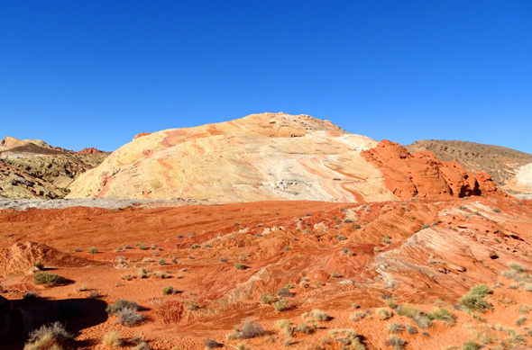
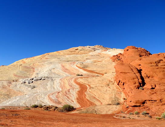
MORE SCENES ALONG WHITE DOMES ROAD
If you have limited time in the park and think maybe you'll just
drive the main east-west road through it, I'd encourage you to take at
least an extra half hour to drive out and back on the White Domes Road
while you're there. It's only 5.5 miles long (11 miles total) but
there is even more outstanding scenery along this road than the 10.5-mile
long Valley of Fire Road.
Here are some more photos I took along White Domes Road on this visit
while Jim was driving; there are more in the 2016 journal
referenced above.
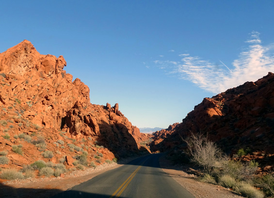
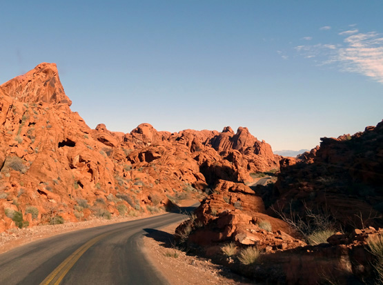
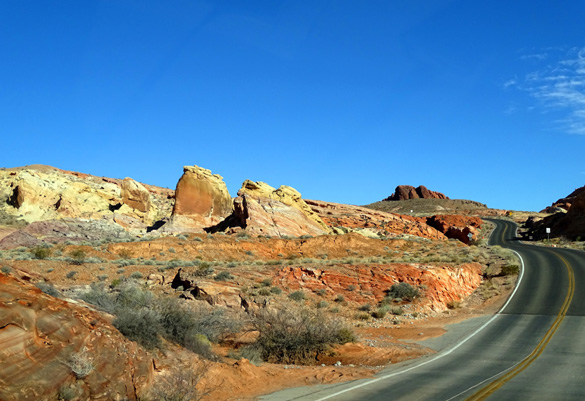
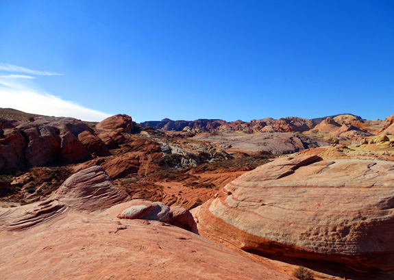
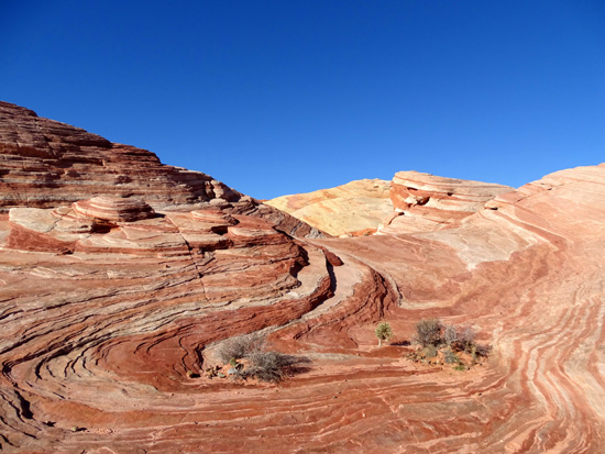
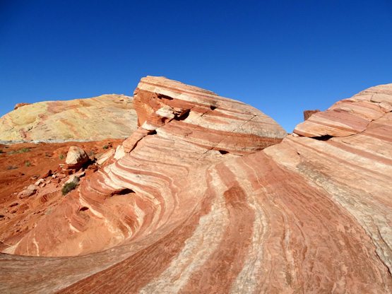
Pretty kaleidoscope of colors
Interesting layers of swirled
rock
See why I love this road so much??
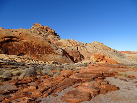
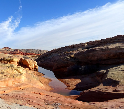
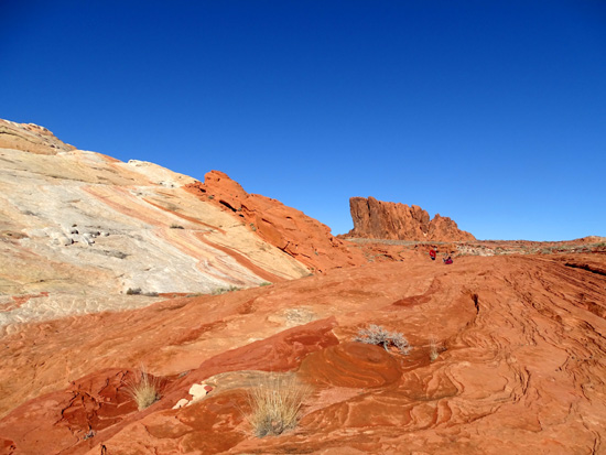
FIRE WAVE TRAIL
After the White Domes Trail, this is my second favorite trail in the
park. It's 1.6 miles total out and back to the main Fire Wave
formation, and more if you wander around the rocks and small canyons once
you get there.
Soft, deep sand at the beginning
of the trail
We drove to this trailhead first for several reasons -- the trail is
completely exposed to the sun, it gets hot quickly, and it's also very popular.
Four other people were leaving the main wave formation when we got there at 9:30 AM
and we had it to ourselves for admiring the colorful rocks and taking photos.
Good timing! More people came in while we were hiking out. On a
warmer day, I recommend getting there as soon after the park gate opens
as possible so it isn't too hot to enjoy the awesome scenery.
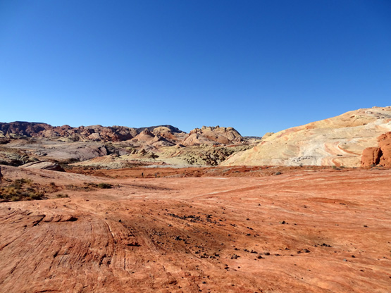
Part of the large expanse of
bedrock before you reach the Fire Wave formation
A cairn marks where they want
folks to walk.
I'd rate this trail as moderate. It isn't long or steep but there are
some large and small rocks to negotiate, some deep sand in places, some loose sand on
the bedrock when it's dry, and slick bedrock when it's wet.
Today was dry, but we had to be extra careful of those obstacles because we
had our two exuberant Labs on-leash and they were pretty excited about all
the new sensory experiences.
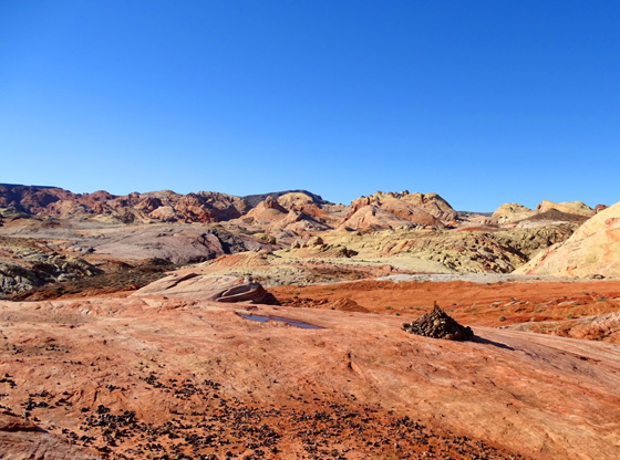
Once we got to the main Fire Wave formation Jim handled the dogs
so I could take pictures more easily. We spent about 10 minutes in the
area before hiking back out. I already showed a couple photos from the
Fire Wave area above; here are some more:
Above and below: The colors
visible in the distance from here are gorgeous!!
So are the colorful stripes and swirls right at your
feet:
Since we couldn't drive any farther up White Domes Road due to the
missing person investigation, we headed back toward the main road, drove
back a spur road to Fire Canyon to see some different rock formations and
canyons, looked at ancient rock art in Petroglyph Canyon, and watched a
bunch of desert bighorn sheep near the visitor center.
Photos continue on the next page . . .
Happy trails,
Sue
"Runtrails & Company" - Sue Norwood, Jim O'Neil,
Casey-Girl, and Holly-Pup
Previous
Next
© 2019 Sue Norwood and Jim O'Neil