Continued from the previous page.
After hiking to the Fire Wave,
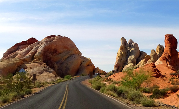
I drove another mile to the end of White Domes Rd. and hiked the
1.25-mile White Domes loop trail.
It was good timing there, too, with only half a dozen vehicles in the
parking lot when I arrived and left. It's a more strenuous hike so fewer
people are probably interested in it. It was my favorite of the hikes I
did today, though, because of the large variety of colors in the rocks.
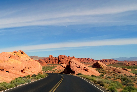
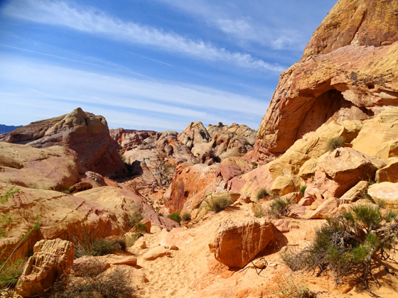
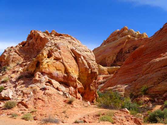
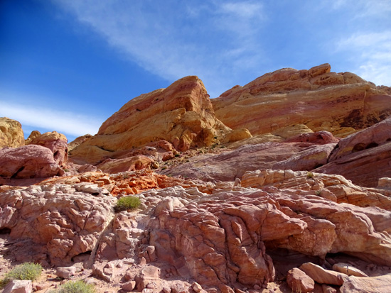
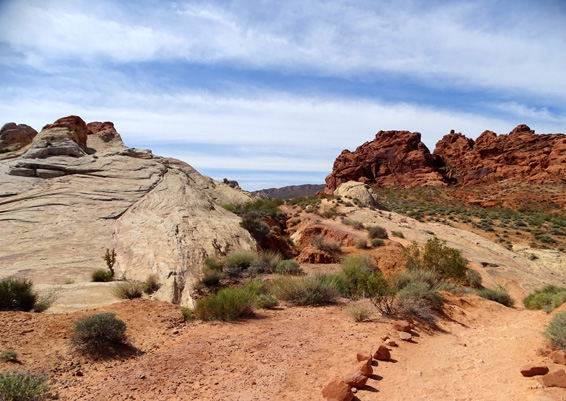
Above and below: road approaching White Domes Trail parking area
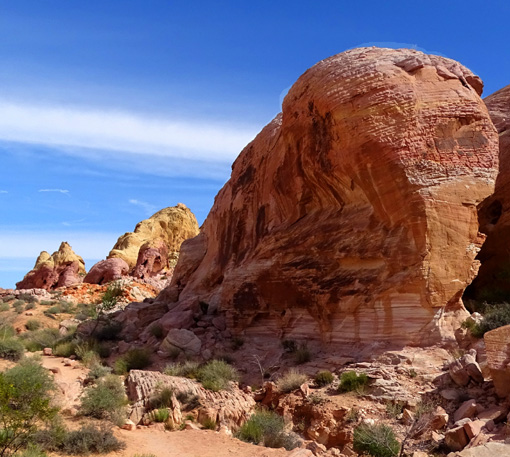
I hiked clockwise from the far end of the parking area, which I decided
afterwards is the more interesting direction because of the awesome
views from the high point near the beginning of the loop.
Here's a somewhat
blurry diagram (sorry!) of the trail loop from an interpretive panel:
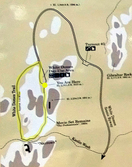
I used a yellow dot to indicate the start/finish
and yellow highlighting on the trail.
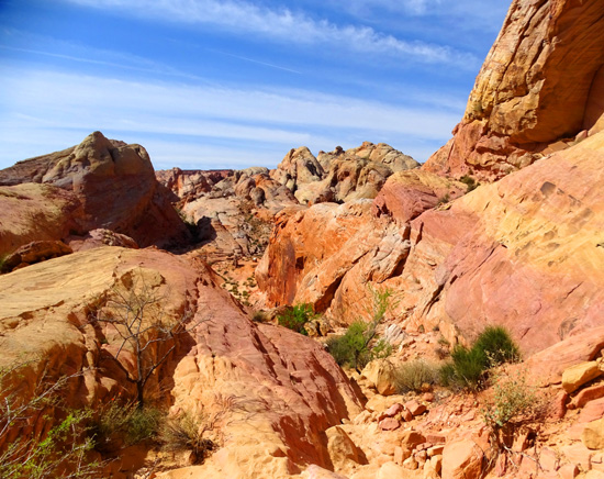
After a brief incline there is a long, steep drop down through a narrow, rocky
canyon in this direction. I marked that with a #1 on the map above. Number 2 is a wash
through a really narrow slot canyon at the low point of the loop.
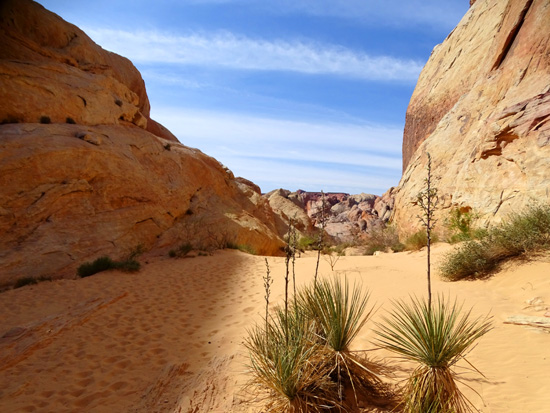
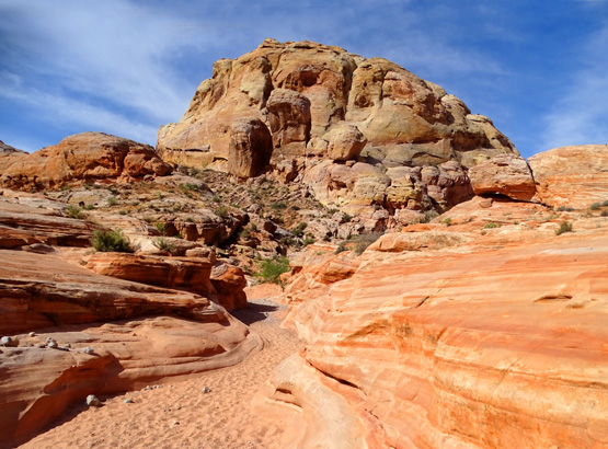
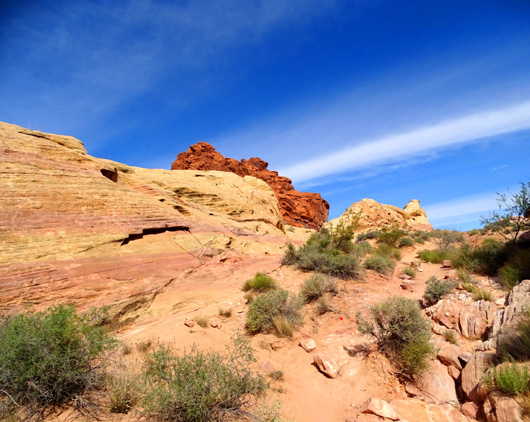
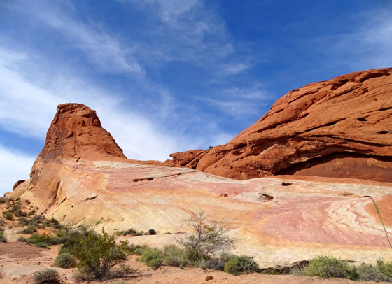
Yuccas and soft, fine sand at the top of the canyon
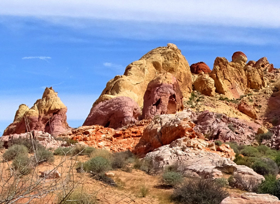
Above and below: OMG, what a view from up
here!!! And the parfait colors are gorgeous.
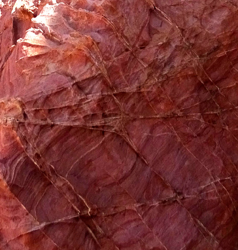
The long stretch of rocks and steps was manageable as I descended using one trekking
pole but I had to be careful not to slide on smooth or sandy rocks. The
smooth rocks might be slick when wet.
I went down slowly, not just for safety's sake but also to be able to
savor the distant views and the little details close up. I stopped every
few feet to examine the color on nearby rocks and to take lots of photos
in both directions:
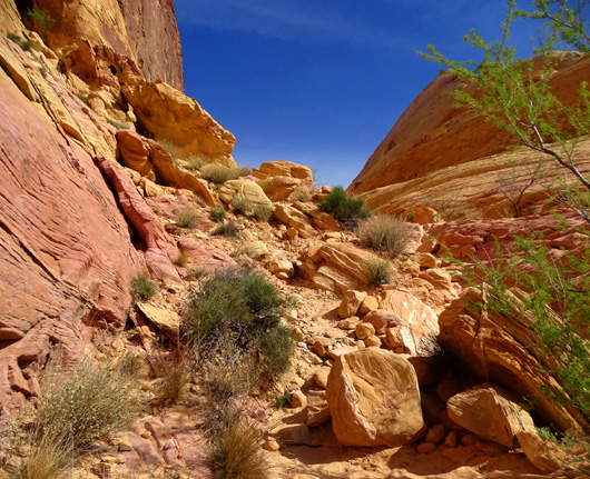
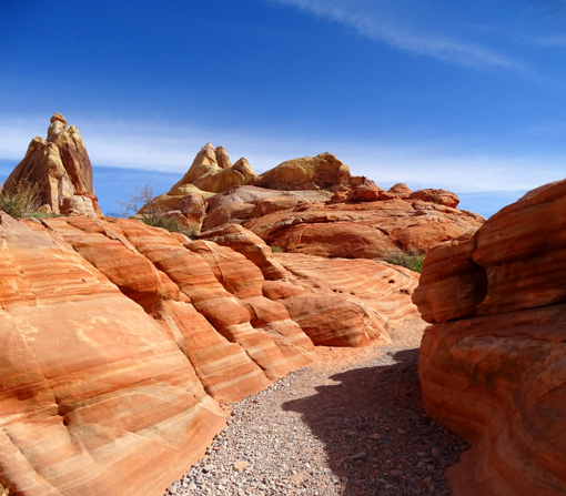
Plenty of loose rocks and sand as I descended this
part of the trail
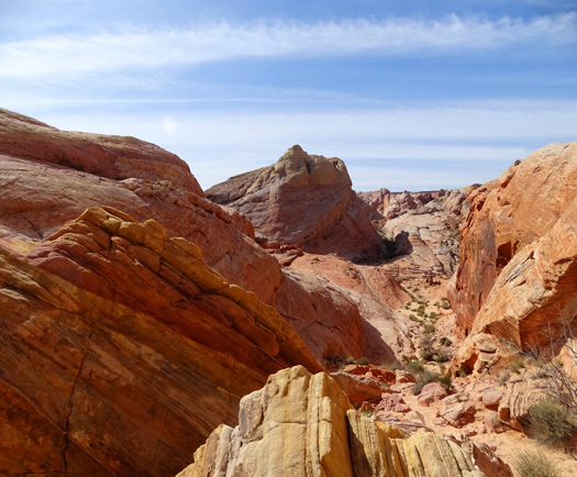
Part way down the chute
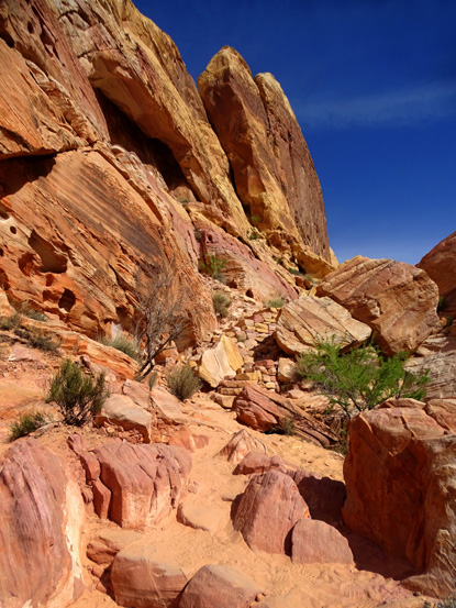
Pretty colors!
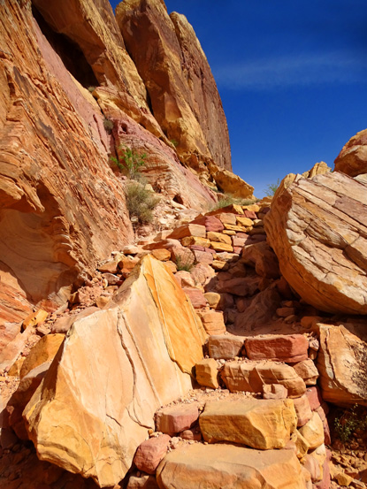
Close-up of rock steps and a retaining wall in a
patchwork of pink and gold
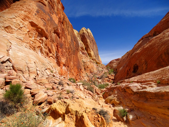

The canyon chute opens up a bit at the bottom, just before the low point
in the trail loop:
What looks like a
part of an old ruin lies just ahead.
It's not. It's a remnant from a
structure built for a 1965 movie, "The Professionals." A number of
movies, TV shows, and commercials have been shot here because of the
picturesque geologic formations.
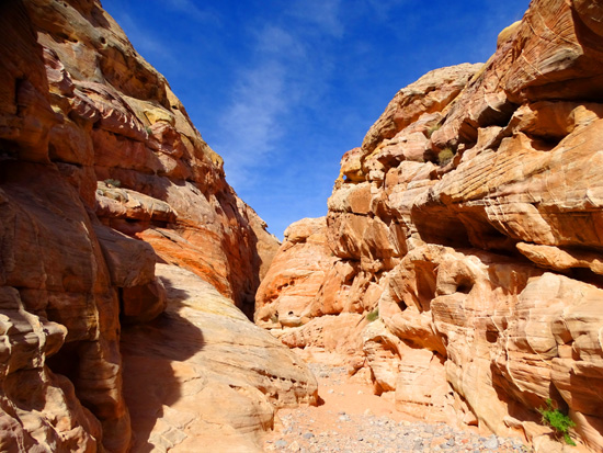
The loop turns right
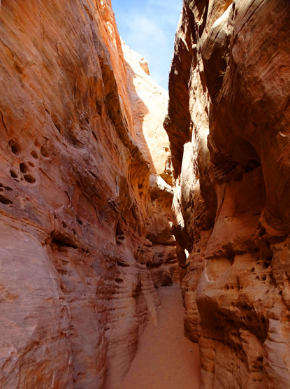
(west) just past the modern "ruin" and follows a wash through a narrow
slot canyon.
The colorful walls
are low at first, then quite tall, providing a cool respite from the sun:
Looking back
Approaching the high, narrow slot
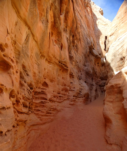
Above and below: the erosion in this part of the
slot looks cave-like
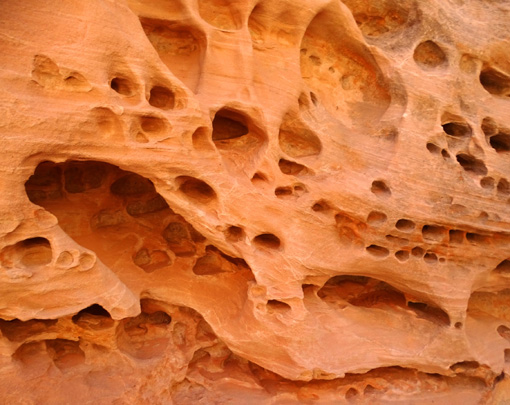
Claustrophobics might not like this section!
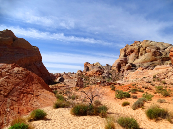
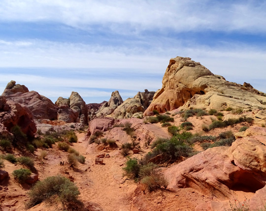
The vista opens up at the end of the slot canyon and the trail turns
right again, heading north.
I'm glad I got to go
through this part of the trail today. During the next three days this
part of Nevada got almost as much rain as the annual average. When I
showed the trail to Jim on Saturday, the wash and slot
canyon were under enough water that we thought it prudent to turn around
at the bottom of the chute and hike back up to the parking lot.
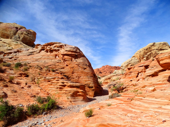
There is a more gradual slope on the west side of the loop than the canyon
chute I went down in the clockwise direction.
There are many pretty rock colors on this side of the loop, too:
The raised design on this boulder reminds me
of the "boxwork" erosion at Wind Cave in South
Dakota.
The last half of the hike I was following a
young man with an English Springer spaniel. He kept posing it for photos in the
numerous niches and windows in the rocks, which was cute.
Dogs are allowed on the trails in the park; that's good, because
Jim and I could take Casey and Cody hiking with us when we returned to
the park a few days later. I saw only two dogs on trails today, though.
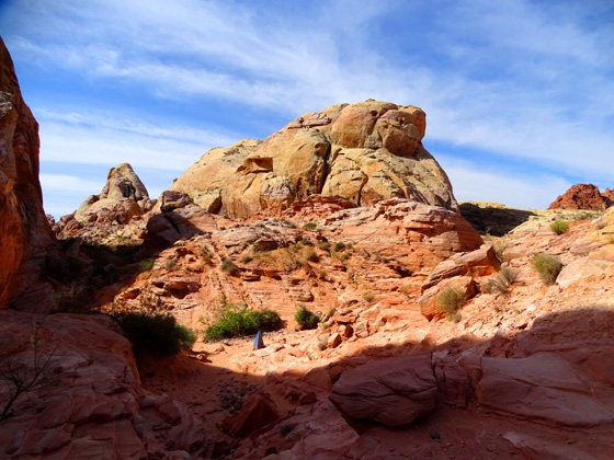
Looking back (south)
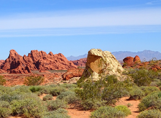
Near the top end of the loop the trail turns to the right (east) again,
going CW, and ends up back at the parking area.
There's a lot to see on this relatively short hike so I recommend going
slowly to take it all in.
I frequently stopped to look in all directions and took more photos than
I usually do in such a short distance. My GPS registered 1.25 miles
on this trail, with a total elevation gain/loss of 360 feet.
Continued on the next page: photos from Petroglyph
Canyon AKA Mouse's Tank, the visitor center, Elephant Rock, old stone
CCC cabins, and Seven Sisters
Happy trails,
Sue
"Runtrails & Company" - Sue Norwood, Jim O'Neil,
Cody the ultra Lab, and Casey-pup
Previous
Next
© 2016 Sue Norwood and Jim O'Neil
