Despite my scary adventure on the southern end of the island in January,
when I inadvertently got stuck in knee-deep mud, I was eager to go back to do
more hiking a few days before we left nearby Kings Bay Sub Base in late March.
I just stayed out of the South End for the second hike!
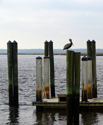
Pelican at St. Mary's harbor
It was another great-weather day to go over to the island, a sunny, breezy, and
warm Wednesday with temps from about 60 to 80 F. I walked over 14 miles
on the island and in the small seaport town of St. Mary's, and at least another mile with the dogs
near our campground that day.
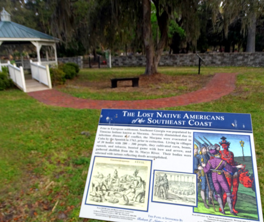
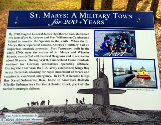
After checking in with the National Park Service in St. Mary's and getting my ferry
ticket at 9 AM, I walked several blocks to the new History Loop between
the cemetery and waterfront park. There area a couple dozen interpretive
signs about the area from the earliest inhabitants to
contemporary cultures:
Somehow I lost my ferry ticket during that time but the NPS staff believed me
and issued me another one. Whew! After paying $26 (senior rate) to the
ferry concessionaire for the ride, I may not have gone if they'd said I
had to pay again.
The Park Service charges an additional fee for the national seashore but
I got in free with my NPS senior pass.
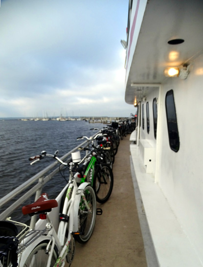
The ferry was packed, the most full I've ever seen. It was a different
one, too -- the Cumberland Lady, not the Cumberland Queen I or
II. At least three ferries are used, maybe four. There were at least two
dozen bicycles on board, and lots of camping equipment. More folks are
taking advantage of the opportunity to take their own bikes to the
island now.
The Ice House dock remains closed from last year's Hurricane Matthew so
all passengers get on and off at Sea Camp.
[Addendum in September, 2017: As I write this, the whole island
is closed to visitors after extensive damage from Hurricane Irma. I
assume everyone evacuated and there were no injuries. I hope all the
horses and other wildlife survived during the high winds and storm
surge.]
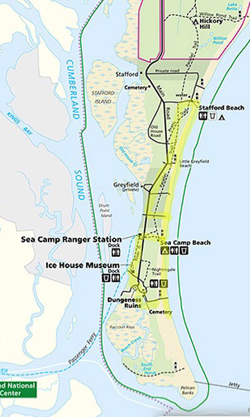
MY
ROUTE FOR THIS HIKE
I was one of the first off the ferry and headed down the River Trail
near the shore to the Ice House Museum and dock, then over to the
Dungeness ruins. I had seen two horses in that area from the ferry and
wanted to see if they were still there.
I had a general idea
of where I wanted to explore this time -- some old favorite areas and
some new places I haven't hiked -- but I made part of it up as I
went along. Here's my circuitous route:
Although I didn't see any of the
horses close up when I got to the expansive Dungeness grounds I did see
more of them in the distance in the marshes near the ruins
and the boardwalks over the wetlands.
Here are a few of the
pictures I took at Dungeness and from the dock the owners used decades
ago:
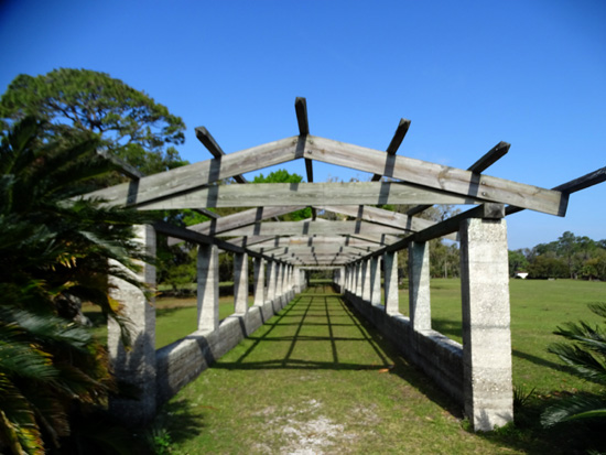
Shadows and symmetry at the pergola
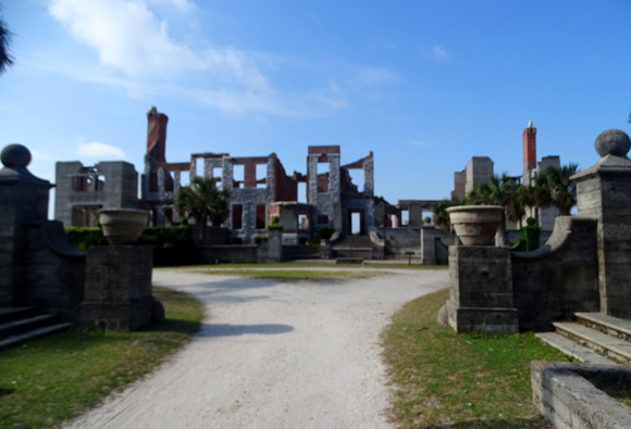
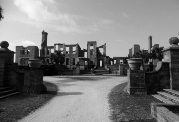
Above and below: front of the ruins of the
mansion in living color and black & white
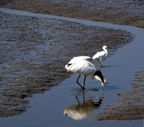
Birds by the old Dungeness dock
From Dungeness I hiked a forest trail past an old cemetery to the
photogenic boardwalks through the marsh.
Here are a couple pictures
from that area:
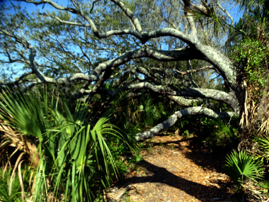
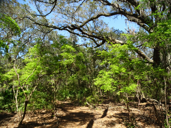
Live oaks and palmettos dominate the maritime
forests on Cumberland Island.
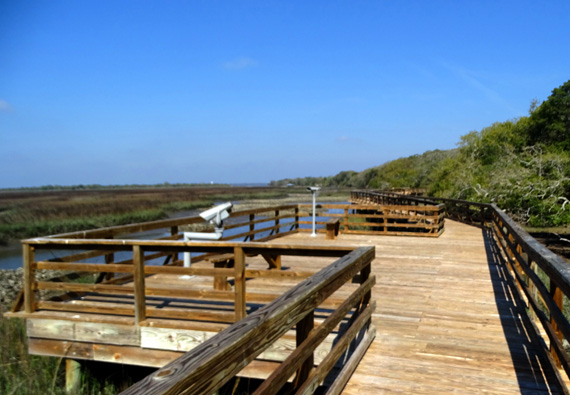
Viewing scopes for the marsh
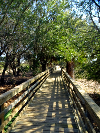
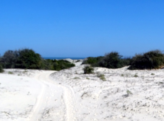
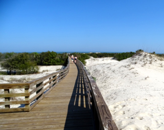
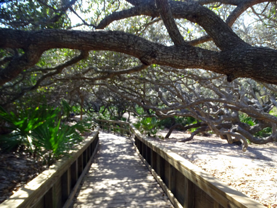
There are more boardwalks over the dunes and through the forest between the
marsh and Atlantic beach side of the island:
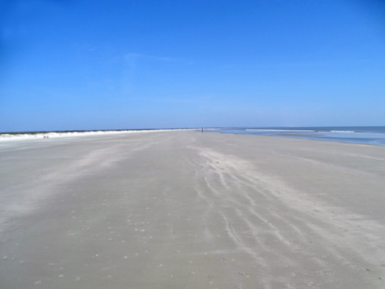
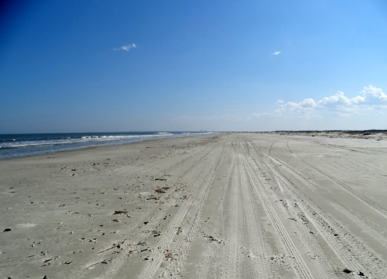
When I got to the beach I started walking south for a bit, hunting for
shells, then decided to just go north for about five miles. It's the farthest
I've hiked up the beach in that direction by a couple miles.
The beach is very
wide when the tide is lower:
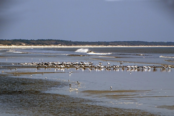
There weren't a lot of people on the beach in the morning and I saw very
few on the trails or roads, either. I'm not sure where everyone went! So
few are allowed on the island each day that crowds have never been a
problem for me.
There were plenty of
shore birds, though, and I had fun walking close to them as I hiked up
the beach:
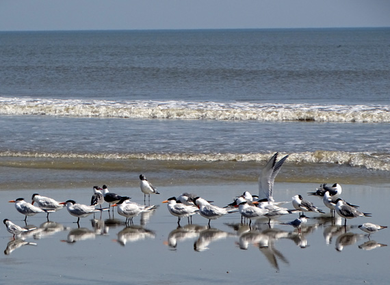
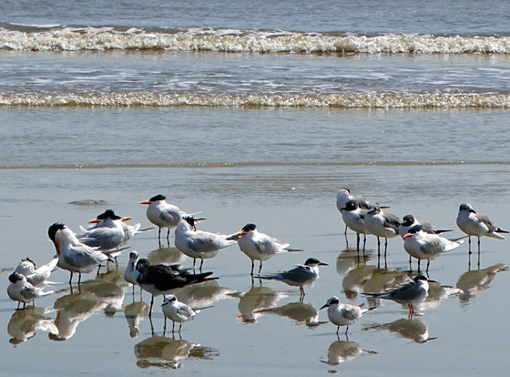
Above and below: I love the mirror-like
reflections in the shallow water
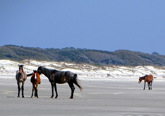
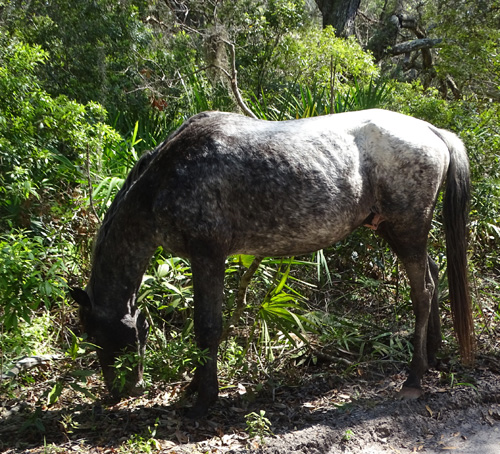
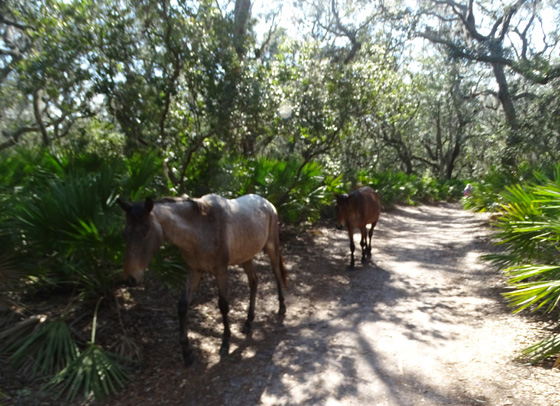
I also saw lots of horses again on this hike -- in the marshes, along the roads
and trails, in the Sea Camp Campground area, and on the beach.
They're everywhere and constantly moving around so I never know where to
expect them. I like the surprise factor!
Some horses were either partially hidden by foliage or too far away to get
good pictures. Others were right next to me and easy to photograph, so that
was fun:
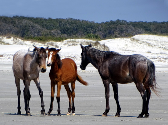
Dappled gray and black horse along the main island
road
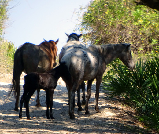
Above and below: several horses and a colt on
the trail to Little Greyfield Beach
I saw only a couple armadillos but could hear several rooting around in the
forest.
OTHER OBSERVATIONS
Somewhere between the Little Greyfield Beach Trail and the Stafford Beach Trail I
saw this large rusted ball that has washed up near the sand dunes. It's about three
feet in diameter:
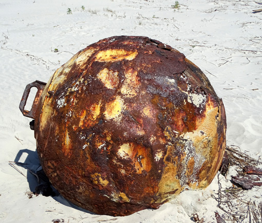
I wasn't sure what it is. Jim says it looks like a buoy but I think it's metal
so I'm not sure it would have floated unless it's hollow. Maybe it's an
anchor? I didn't try to move it so I have no idea how heavy it is.
Whatever it is, I was surprised to see it there.
I always find lots of living and dead sea creatures washed up on the
beach as I'm walking along:
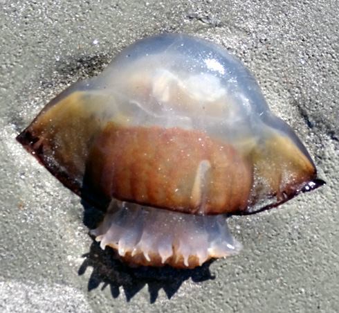
I don't mess with any of the jellyfish lying on the
beach
because they might still be able to sting.
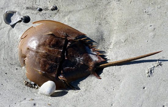
Horseshoe crabs can get pretty big.
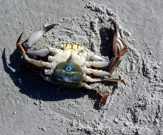
Crab legs, anyone?? Looks like the birds got
here first, by the looks of the disturbed sand.
I picked up lots of shells as
the tide was going out (AM) and coming back in (PM). I found a small but
perfect sand dollar and put it in my pocket instead of the bag with the
heavier shells, hoping it would stay intact till I got home.
Not
-- it crumbled into tiny pieces. Phooey.
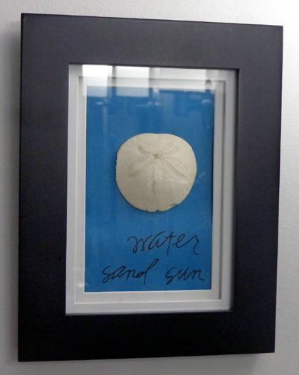
However, I already had several other nice sand dollars from previous trips to Cumberland
Island. I mounted one in a framed box, added beach-y words from my
scrapbook collection of rub-ons, and hung it
in the coastal-themed master bathroom in our new house:
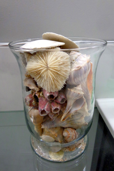
I also have a large glass container filled with some of the Cumberland Island shells and sand dollars
I've collected over the years:
You know what I've never found on the beaches at Cumberland?
Shark's teeth. There are a bunch on display in the ranger station. I
sure looked hard for them this winter but still don't have any.
PRIVATE VS. PUBLIC PROPERTY
When I was nearing the Stafford Beach Trail, where I turned inland from
the beach, I talked to a grandpa, mom, and teenage girl who were riding by in a golf
cart and ATV with their dogs. Since visitors can't take dogs on the
island, I assumed they own property there.
I already knew that a
small percentage of the land on the island is still in private ownership;
some roads to houses are closed to visitors and are marked as private.
During our conversation the woman
in the golf cart told me she's the fifth
generation in her family to own that property and when she dies, it will
revert to the Park Service.
Trail inland from Stafford Beach
This is the first family I've met that owns property on Cumberland
Island. The woman lives in Asheville, NC and was staying on the island
with her daughter during Spring Break. Her dad lives near Jacksonville.
This is just a vacation spot for the family, not a year-round home any
more.
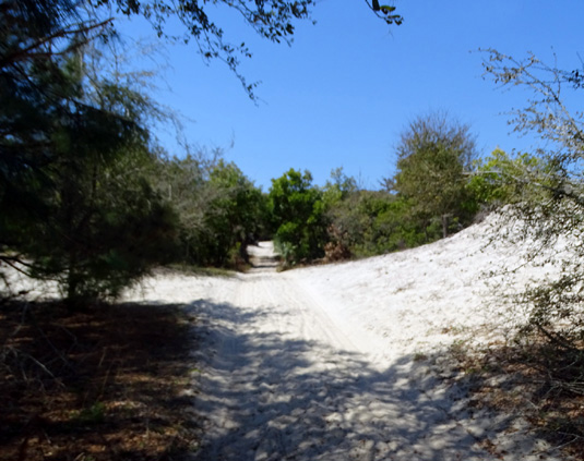
I wandered south on the narrow Pratt
and Parallel Trails to the Little Greyfield Trail, which took me back
out to the beach again:
A different kind of under story tree along the
Parallel Trail
Trail to Little Greyfield Beach
Still a lot of hard-packed sand here, but less as the tide
was coming back in again
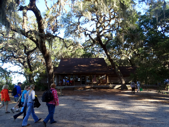
When I got down to the Sea Camp Trail I turned back inland and walked over the long boardwalk,
through the popular tent camping area, and along the path to the ranger station at the Sea
Camp dock to wait for the ferry to return:
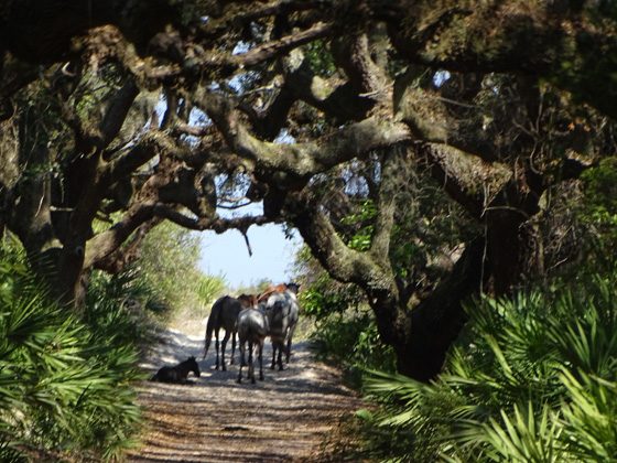
Three feral horses sauntered right by several of us hiking on the trail
as they headed toward the campground:
It's a little over a mile from the beach to the dock on the Sea Camp Trail.
This is where you'll see the most people on Cumberland Island because of
the popularity of the campground and the shortest, most direct route
from the ferry to the ocean.
I got back to the campground about 6 PM that day and was mighty happy to take a shower.
Although I didn't get mired in mud like the last time, I was still
sweaty and dusty. The roads and trails were very dry.
Cumberland Island is a great place to visit for folks of all ages.
Read all about it on the park website so you'll be adequately prepared
to be self-sufficient while you're there. It's well worth all the effort!
Next entry: camping at Uchee Creek Recreation Area for
Fort Benning, GA
Happy trails,
Sue
"Runtrails & Company" - Sue Norwood, Jim O'Neil,
Cody, Casey, and Holly-pup
Previous
Next
© 2017 Sue Norwood and Jim O'Neil
