This park is named for the distinctive, multi-armed mature Joshua
trees that are so prevalent in this part of the Mojave Desert. They are
closely related to yuccas and are classified in the agave/lily family:
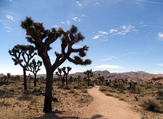
Joshua trees along the southern part of the Boy
Scout Trail (3-25-16)
The southwestern growing limit for the tree is in this park, where they thrive in
the cooler, more moist atmosphere above 3,000 feet elevation. You can
find Joshua trees in other parts of the Mojave Desert outside of the
national park, too.
We were fortunate to visit the park when some of the Joshua trees and yuccas were
in bloom:
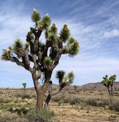
Above and below: good
example of a Joshua tree in bloom in the park this date
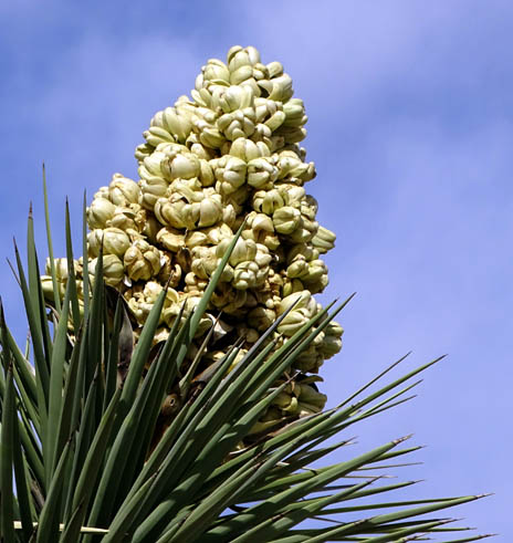
Above and below: yuccas in
bloom (3-22-16)
This entry describes our initial introduction to the northern and
western part of the huge park. Most of the photos are from this date.
When we first visited the park in
January on a quick scouting trip, we drove in the southern
entrance and exited the northern entrance without stopping to see very
much along the way. You can see some representative photos from along
that road at the link above. We didn't go back that direction in March
because there was so much else to do closer to where we were staying.
Cholla Cactus Garden in southern
end of park in January, 2016
On this Monday we explored the more popular areas of the park in the
northwestern section where most of the interesting trails and rock
formations are found.
I'll have a lot more photos from those trails in subsequent entries.
ABOUT THE PARK
I'll be pretty general here because I can't possibly describe
everything about this park in one entry. Check the official
park
link for detailed information and maps.
Joshua Tree National Park is quite large (about 800,000 acres, mostly
designated wilderness) and includes two distinct desert ecosystems with
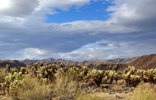
a transition zone between them. The eastern half, below 3,000 feet, is Colorado
Desert, part of the much larger Sonoran Desert. The western half of the park,
at elevations above 3,000 feet, is Mojave Desert habitat.
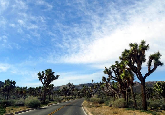
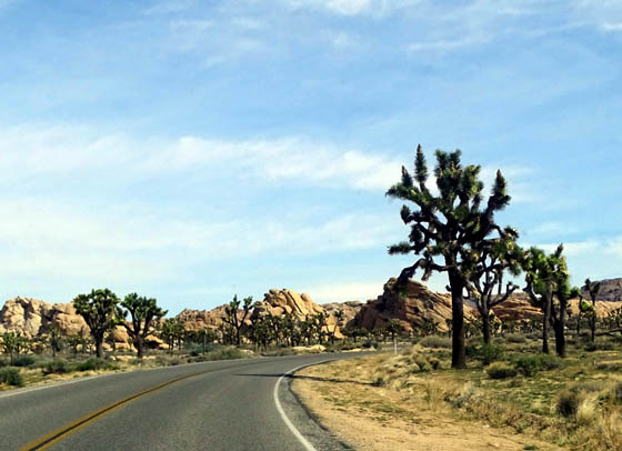
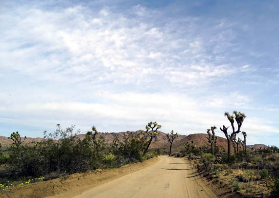
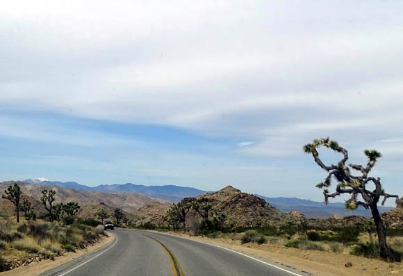
Numerous Joshua trees along the
main road in the higher, western part of the park
Different types of plants and animals thrive in these two distinct
habitats -- Joshua trees, Mojave yuccas, prickly pear cacti,
pinyon pines, scrub oaks, and junipers like the cooler temperatures in
the high desert regions in the western part of the park, creosote,
ocotillo, palo verde, jumping (Teddy bear) cholla, and
brittlebush the lower eastern regions.
Plants flourish at Joshua Tree year-round, with a total of 730
different species. The spring wildflower show -- if there has
been adequate rainfall during the winter -- is what draws so many
people, including us, to the park this time of year.
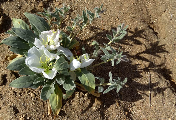
Dune evening primrose casts an
interesting shadow on the sand.
It's hard to predict when and where the wildflowers and other plants
will bloom each year because of varying weather patterns and the
different elevations in the park. Visitors can see updated wildflower
reports on the park
website, with an interactive
iNaturalist app, or in the visitor centers.
Wildlife includes bighorn sheep, kit fox, black-tailed jackrabbits,
antelope ground squirrels, lizards and iguanas, desert tortoise,
rattlesnakes, rodents, and a large number of birds and insects.
Joshua tree and jumbled rocks in
the park's Indian Cove Campground
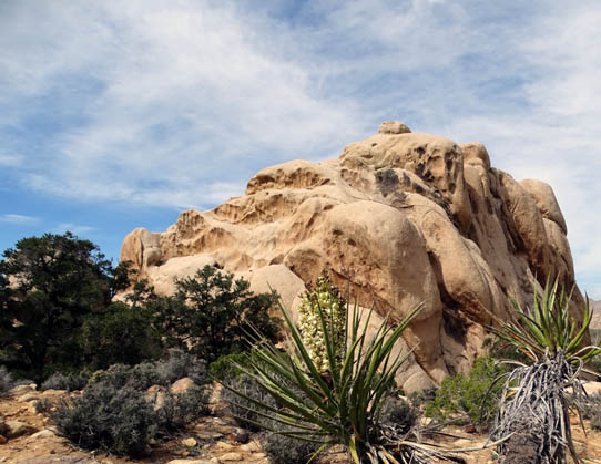
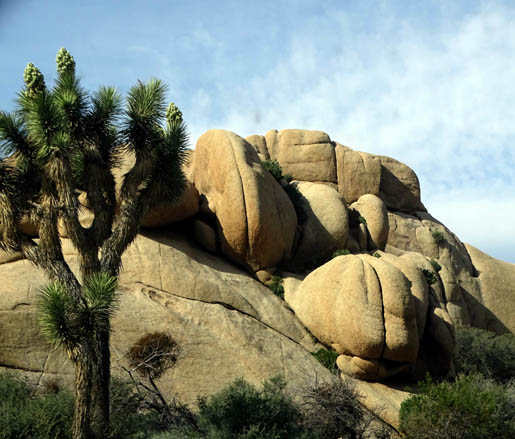
Three of the most distinctive features of the park are the Joshua trees,
which are more prevalent here than in more developed parts of the Mojave
Desert, the large palm trees in the Fortynine Palms Oasis, and the smooth,
jumbled rock formations found throughout the park.
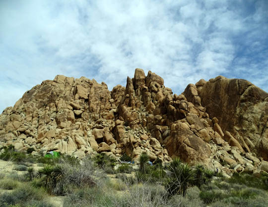
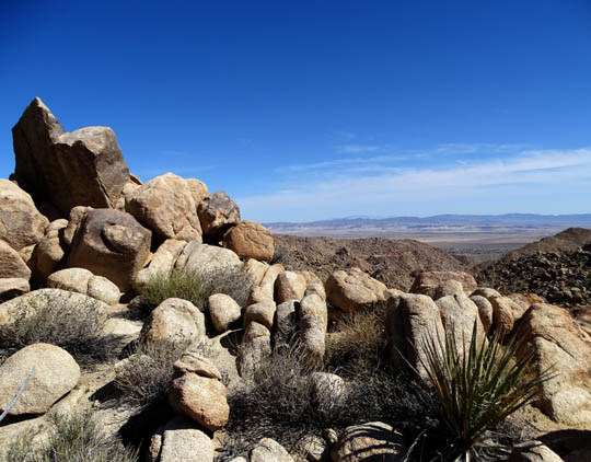
WHO PILED UP ALL THOSE ROCKS?
I was totally fascinated with those jumbled stacks of boulders everywhere
I went and took many photos of them during the week we explored the park.
"Kids" of all ages, from 2 to 92, love to climb on them and/or take pictures of them. Certain
areas of the park are known for their climbing opportunities (equipment is required
in some places) but visitors are allowed to climb at their own risk just about
everywhere in the park, including the campgrounds.
Make that especially the campgrounds. Each campground we walked or
drove through seemed to be located in an area full of interesting rock formations.
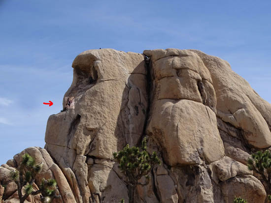
I highlighted and marked a climber most of
the way up the side of this very large rock formation.
The head of a climber who has
made it to the top and is facing the other direction is barely visible.
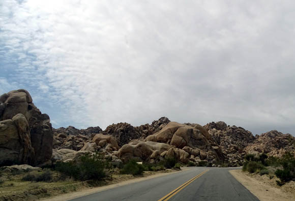
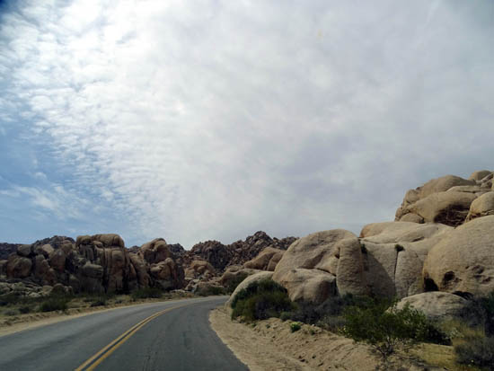
You can see the rock jumbles from the roads and get
right next to them on all of the hiking trails. Some of the formations are
quite tall, like the one in the picture above.
The rock piles began to form about 245 million years ago as a result
of volcanic activity in the area. The park lies along one of the world's
most active tectonic boundaries, the San Andreas Fault.
Magma, in this case a molten form of monzo-granite, uplifted from deep
within the earth, oozed through the Pinto gneiss rock crust that was
fractured by the eruptions, and formed horizontal and vertical cracks as it
hardened in big globs beneath the surface of the earth.
Some of the rock formations are
relatively smooth, others more jagged.
This is the entrance to the
Indian Cove Campground.
Weathering over many years by groundwater under the earth's surface
widened the cracks and rounded the edges of the angular granite blocks.
After the surface soil
eventually eroded away, the heaps of monzo-granite scattered around the
area became visible and were further shaped by erosion from rainwater
during the last Ice Age, resulting in the cool, light-colored rock piles
that we see today. (Glaciers never came this far south.)
The rock looks a lot like sandstone, but it's granite:
The only gneiss that is still visible is on exposed mountain tops. It
is a much darker color.
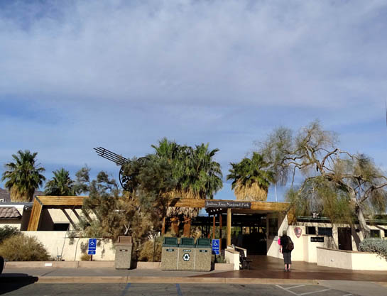
PARK FACILITIES & ACTIVITIES
The park is open year-round, although not all facilities and activities are.
We have been in all three of the visitor centers: Cottonwood
near the south entrance when we blitzed through in January, and Oasis
(north entrance) and Joshua Tree (west entrance) on this trip.
The next four pictures are from today's visit to the Oasis of Mara
Visitor Center, which is located between the town of Twentynine Palms and
the park's northern entrance.
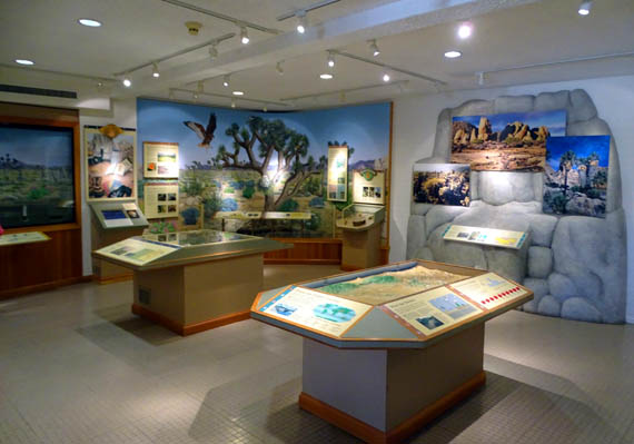
You can get a wealth of information from the exhibits, printed materials, and
rangers at the three visitor centers that will enhance your knowledge and
enjoyment of the park, especially the first time(s) you're there. Ranger-guided
activities are offered year-round and Desert Institute classes every season
but summer, when temperatures can be in the 100s F.
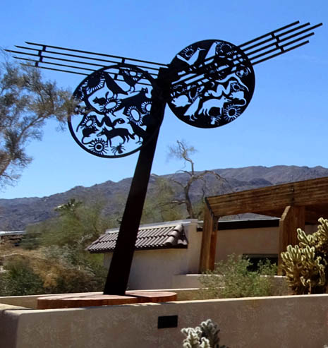
Interesting symbol outside the visitor center
entrance
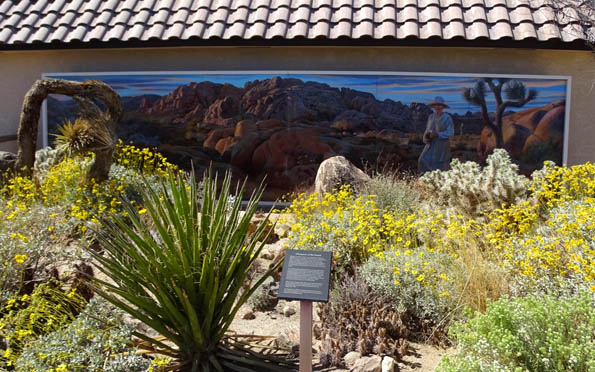
Mural commemorating the efforts of Minerva Hamilton
Hoyt to make
Joshua Tree a national monument in 1936
(subsequently a national park in 1994)
About the weather -- this is harsh desert country with little rain,
occasional flash floods, and high temperatures much of the year. People have
died here from heatstroke, thirst, and preventable accidents like slipping
from those enticing rocks.
During our visit in late March we were happy to
find cooler temperatures and less wind up in the northwestern part of the park,
where elevations are above 3,000 feet -- 40s and 50s F. in the morning,
60s and 70s F. in the afternoons -- while it was hotter and more windy
down at 29 Palms and the Marine base 1,000-2,000 feet lower.
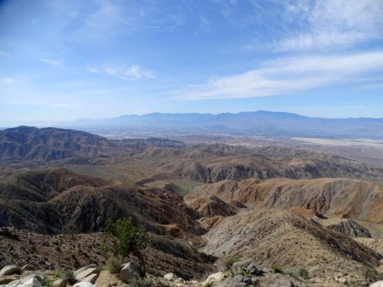
Elevations in the park range from 506 feet to 5,814 feet (Quail Mountain). Visitors
can drive to the top of Keys View (5,185 feet) to view the nearby mountains and
Coachella Valley. On a clear day you can see even higher mountains in the distance,
two with snow still on their peaks right now:
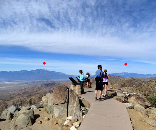
Mount San Jacinto (under L. dot) is 10,831
feet high;
San Gorgonio Mtn. (R. dot) is 11,485 feet high.
This park has no lodge or restaurants but there is a variety of overnight
accommodations and food in nearby towns along Hwy. 62 between the north and west entrances.
There are several campgrounds in the park for tents and RVs plus
group sites, equestrian sites, and back-country camping with registration.
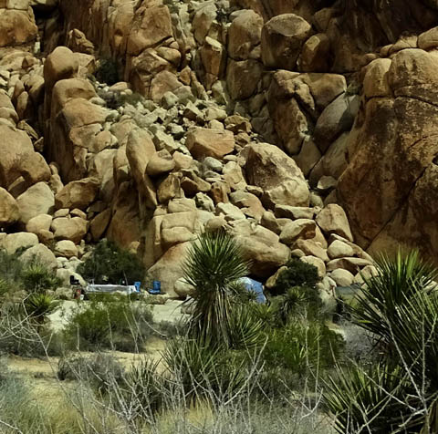
Above and below: an awesome tent site
at the base of a
large fractured rock formation at Indian Cove Campground
Most of the park campgrounds don't have water, which is a challenge for anyone staying
for more than a short period of time. There are a few private campgrounds with water,
electrical, and/or sewer hookups along Hwy. 62.
Other park activities besides camping include sight-seeing, nature/wildlife and
scenic photography, wildflower viewing, star-gazing, birding, picnicking, cycling and
driving on the main paved park roads and backcountry dirt roads through several canyons,
nature walks, hiking on trails ranging in difficulty from wheelchair-accessible to
strenuous, rock-climbing, horseback riding, and participating in ranger-led activities and classes.
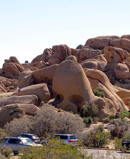
Visitors love Skull Rock! Get there early
to avoid crowds. (3-24-16)
Some of the interesting things to see are the Cholla Cactus Garden and Ocotillo Patch
on the Wilson Canyon Rd. in the southern part of the park, and Lost Horse Mine,
Hidden Valley, Ryan Mountain, Skull Rock, Jumbo Rocks, Keys View (you can drive to
that one), Barker Dam, and Fortynine Palms Oasis in the northwest section of the park.
I'll have photos from those places and more in this and subsequent entries.
MONDAY'S FORAYS
We left our campground at the Marine base about 8:45 AM to explore
Joshua Tree NP by car, scouting out trailheads and dirt or paved roads
where Jim can ride his bike.
Dogs and bicycles aren't allowed on the hiking trails, only paved and
dirt roads where vehicles can drive. I never did take either Casey or
Cody to the park to hike because it wasn't practical. I was
able to plan out several interesting hikes for the remainder of the
week, however, and Jim is looking forward to one or more long rides on
his bike in the park.
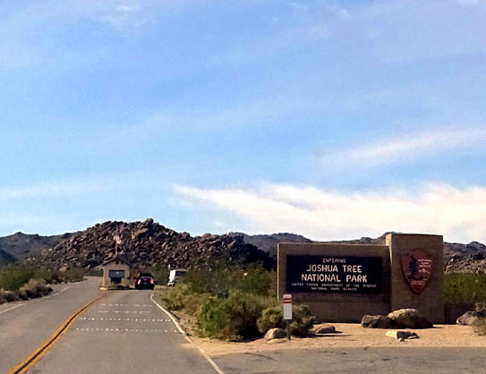
North entrance to the park
We entered the park from the north on Utah Trail after going into the
Oasis of Mara visitor center in the town of Twentynine Palms. We asked a
few questions and picked up a new spring park guide, a second park flyer,
and guidelines for pets in the park.
We drove through the northwestern portion of the park that has the most
trails and campgrounds. All the campgrounds are full this week with
spring breakers -- lots of kids of all ages out there now. The
visitor center was very busy at 9 AM; it opened at 8:30.
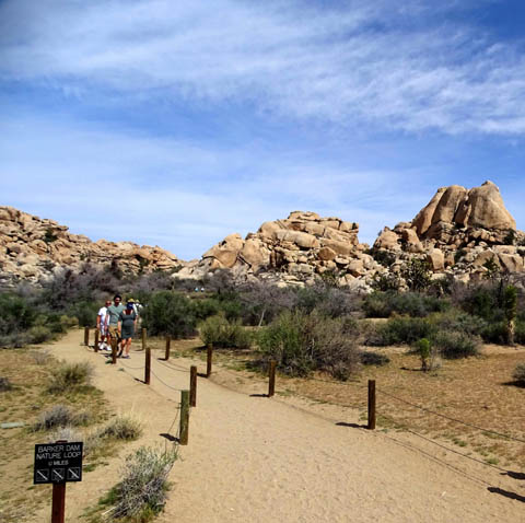
Trailhead for the Barker Dam loop
Parking areas at the most popular trailheads were also crowded by 9 or
10 AM so I knew I'd have to get out there plenty early when I hiked.
(The blazing sun was another good reason to start early!)
Be aware that this
park has one of the highest visitation rates of any unit in the entire
U.S. national park system, partly because of its accessibility and
proximity to large population centers in southern California and partly
because of its unique features. It is very popular with both foreign and
domestic tourists. Choose longer or more remote trails to hike if you
want some solitude.
We drove west on the main park road past lots of Joshua trees . . .
. . . through two campgrounds (Jumbo Rocks and Ryan) . . .
. . . went a couple miles out the narrow dirt Desert Queen Mine Rd. and back
. . .
. . . made a note of the parking area for the dirt Geology Tour
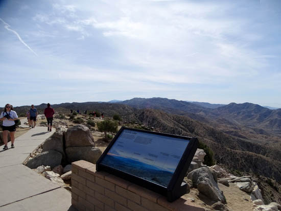
Road, and drove a paved road to Keys View and back.
At Keys View we
took a short walk on a paved loop to see two peaks with snow on top and
scenic Coachella Valley:
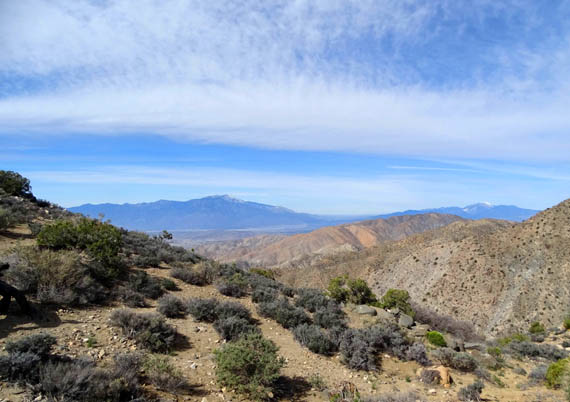
View toward
Santa Rosa Mountain Range from the road going up to Key's View
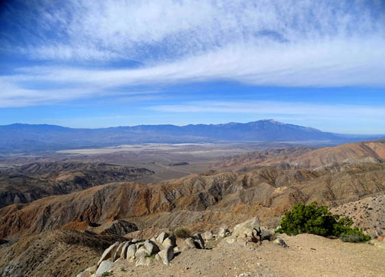
Palms
Springs, CA lies below Mt. San Jacinto in the distance, right.
We got up to 5,185 feet on Keys View; most of the park road in
the northwest section is above 4,000 feet, which was a lot more pleasant
for hiking and cycling this week than 2,000 feet lower in the valleys. It
was pretty hot and windy down there all week. I wouldn't want to be
visiting here much later than April.
Beginning the descent to the west gate
We drove out the west entrance and down to the visitor center in the town of Joshua Tree, then
east on US 62 to the Indian Cove entrance to the park. I got a detailed
map and more verbal trail information for a future hike at the ranger station there.
We drove back to the Indian Cove Campground and located the trailhead
for the Boy Scout Trail, one of many trails I knew I wanted to hike in the park.
View from a
high point on the Boy Scout Trail (3-25-16)
This trail goes through lots of boulder jumbles and the Wonderland area,
where a photographer from the base newspaper took pictures of
wildflowers last week. (See the March 25 entry for more Boy Scout Trail
pictures.)
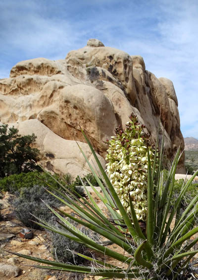
The large white clusters of flowers on the Joshua trees have mostly
peaked already but we saw a few still intact. I showed one tree full of
flowers near the top of this entry, as well as similar clusters on
yuccas.
Desert (or Hairy) sand verbena grows in clusters on
stalks.
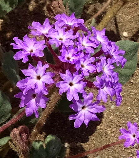
We also saw two kinds of pretty purple wildflowers, groups of yellow
buttercup-type flowers, a type of daisy, and some white dune evening
primrose on our Monday drive through the park.
I'll show more flower
photos in subsequent entries.
Next entry: Let's get out there and hike! First up,
the popular hike on Mt. Ryan.
Happy trails,
Sue
"Runtrails & Company" - Sue Norwood, Jim O'Neil,
Cody the ultra Lab, and Casey-pup
Previous
Next
© 2016 Sue Norwood and Jim O'Neil
