Whew! This was a rather epic "day trip," covering a 533-mile loop in
southern California that took us over 14 hours to drive, research, and
observe on this date.
And we didn't decide for sure to do it until the day before.
Our
original plan was to drive up to Quartzszite, AZ for the annual gem and
mineral show. But we'd been having so much trouble deciding where to go
this spring after leaving the Yuma area that we wanted a first-hand look
at some of the camping options and places to sightsee, hike, and ride our bikes
that were on our long list of possibilities.

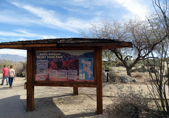
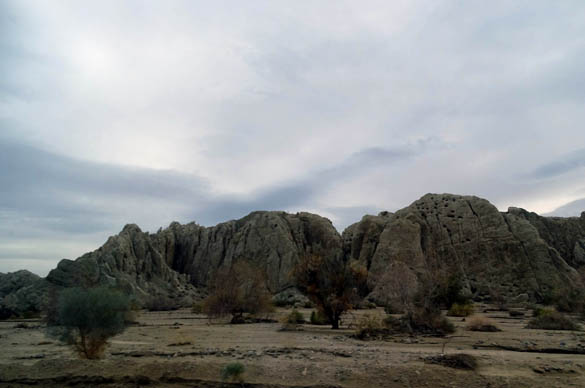
Scenic view from the Anza-Borrego Desert
State Park visitor center
Sometimes we just gotta check out our options first to avoid
disappointment. And since reservations were required nearly everywhere
we ended up going this spring, we didn't want to forfeit very much money in
reservations that we might decide later to shorten or cancel for some
reason.
This year we plan a nice mix of old places we love to visit in Utah
and Colorado and some parks and other areas that are new to us. Since we
were already in the far western part of the country, we decided we'd
better go see some potential memorable destinations in southern
California while we were relatively close by.
LET'S GO!
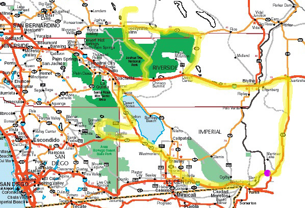
Here's a map section of southern California that shows our route, in
yellow, for
this large loop.
I list the roads in the text below since you can't read the numbers
and town names unless you're using a large computer screen like I am.
Our RV park at Yuma Proving Ground (YPG) is approximately where I put the
purple dot:
That dot was our start-finish, in the runner lingo with which we are
familiar.
We left in the dark (7 AM) and returned in the dark (9:15 PM), covering
533 miles on a large loop in southeastern California. Our purpose was to determine
if we want to spend time in March at the very large Anza-Borrego Desert
State Park and/or Joshua Tree National Park and where we might stay if
we do.
We accomplished that goal but it
was a very looooong day! Jim did all the driving because he didn't want
to be a passenger; he preferred that I navigate since we had a
lot of turns. Even though we were in the Pacific Time Zone most of
the day, we kept our watches on Mountain Time.
We drove down to Yuma via S24 through the farming district on the
California side of the Colorado River and were
amazed that crops were being harvested in the dark! Who knew?? There are
bright lights on the arms of the harvesting machines and other
equipment. Cool.
There sure was a lot of activity in the fields this week. I'm guessing
they mostly harvest at night during the summer when it's so hot.
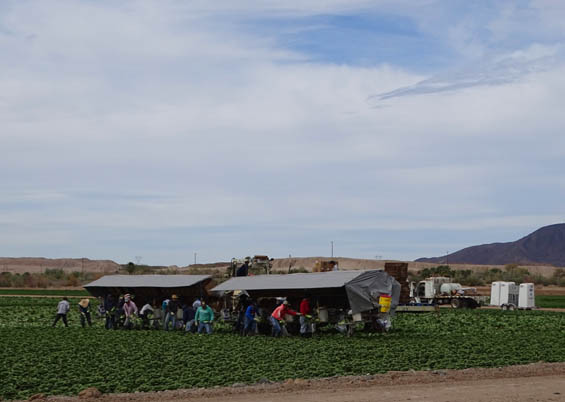
I took this picture along the same road the
day before, when workers were harvesting a crop in daylight.
The weather was good in the morning -- mostly sunny, 50s-70s F. Clouds
increased during the afternoon. We got up to 3,600 feet elevation at
Joshua Tree and it felt rather chilly there.
While we were at 29 Palms Marine Corps Base it started raining lightly.
It rained the first couple hours from there to the Arizona border on the way
back to YPG. It was dark the whole way home. Starting and ending in the dark
made it seem like an even longer day than it was.
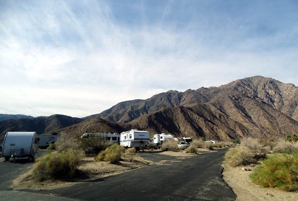
PALM OASIS RV PARK
We headed west of Yuma on I-8 past two of the smaller Long Term Visitor Areas to exit 114 at El
Centro, CA and drove west another three miles on a road paralleling the
freeway so we could see more of the area. We never did see downtown El
Centro, just rural areas between there and the El Centro Naval Air
Facility.
It was easy to find the Palm Oasis RV park on base. Several folks have
told us they like staying there but we didn't care for any of the three
sections. The sites are
smaller and more crowded than most other military parks where we've
stayed and the place is NOISY.
The Blue Angels train at El Centro from November to February and in
Pensacola, FL the remainder of the year. We have seen them training in
March at the Naval Air Station in Pensacola two different years when
we've stayed in Battleship Row RV Park at the Blue Angel Recreation
Area. The rec. area is a quiet place to camp because it's about ten
miles from the air station -- most of the noise is over there.
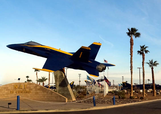
We saw the Blue Angel jets on the ground today at El Centro but heard plenty of other
jets flying around at 7 AM their time. The RV park is close enough to the flight
line to be very noisy; some other retirees have warned us about
the constant racket. I doubt we'll ever stay there.
OK, seeing/hearing the place
answered one of our questions re: where to go next -- not
here!
In addition, El Centro is not really close enough to Anza-Borrego to use
it as a base to explore the state park. That's the main reason we
considered it.
LEAPIN' LIZARD AND METAL ELEPHANTS
Our next goal was to check out our camping options in and
near Anza-Borrego. We noted that gas on base cost $2.70/gallon this date. It was
$1.98 at YPG and $1.87 at Sam's Club in Yuma. California usually has the third highest
gas prices in the U.S., after Alaska and Hawaii.
It's one of many reasons we haven't spent much time traveling in
California in our RV!
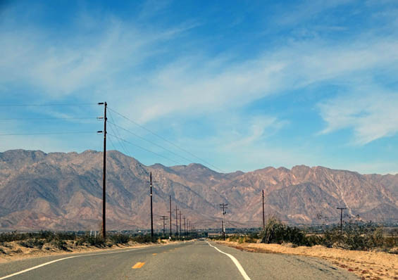
Lots of desert terrain as we head north and west toward the Santa Rosa
Mountains
We drove north on S30 and CA 86 past lots of produce farms and turned
left (west) on CA 78 toward Anza-Borrego State Park. Before we reached the park we
went past the Ocatillo Wells State Vehicular Recreation Area for ATVs, dune
buggies, etc.
In that area we visited the Leapin' Lizard RV Park, which
is nice but also located too far from Borrego Springs to really interest us. Debra,
the owner, showed us around the whole place (sites, restrooms, pool, dog
park, trails leading to the desert, etc.) and we picked out a good-sized
shaded site we might want in early March if we decided to come back.
Nearing Borrego Springs
It was at least a 20-minute drive from there to the town of Borrego
Springs on good paved roads with wide shoulders. We saw several cyclists
on Borrego Springs Rd., S2, and later S22.
We weren't that impressed with what we could see of the park itself from
those roads. I'm sure it's more interesting close up on the trails, dirt
roads, and another paved road going out of the park on the west side
that we didn't see.
The most interesting thing we saw were some large metal sculptures of
mammoths along the road south of town:
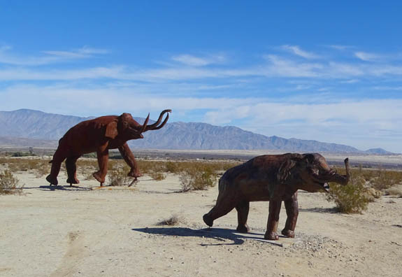
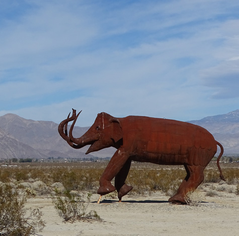
Cool, eh?
There are numerous other similar sculptures in the desert that
we didn't see. This
website describes the 130 life-sized
metal animals inspired by creatures that roamed this area millions of
years ago. I believe all of them were designed and welded by artist
Ricardo Breceda.
I'd really like to go
back someday and find all of them! There is a map of the location of at
least some of them at the link above, as well as more photos of
different sculptures.
I had already done some online research re: RV parks in the area and
noted that most are very expensive. We went into one that has very small
sites for a bunch of money and would never consider staying there.
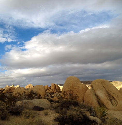
ANZA-BORREGO DESERT STATE PARK
We decided that the best bet here is the campground inside the park near
the
visitor center. There are some sites that are long enough for all three
of our vehicles:
Unfortunately, they are full in March because it's the most popular time
to visit Anza-Borrego. That's when the flowers are out if there's been
enough rain to encourage them to bloom.
After we got back to YPG Jim looked online to check availability and the
best he could find was a three-day period for one of the long sites.
They do have full hookups, which is rare for any state park. The cost is
$33/day plus $8/day for the car (we have a 5th-wheel, truck, and
minivan).
While there we went to the visitor center, which is surrounded by both
artfully landscaped and natural desert terrain:
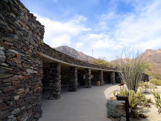
Above and
below: 6,666-foot Rabbit Peak is in the distance.
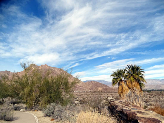
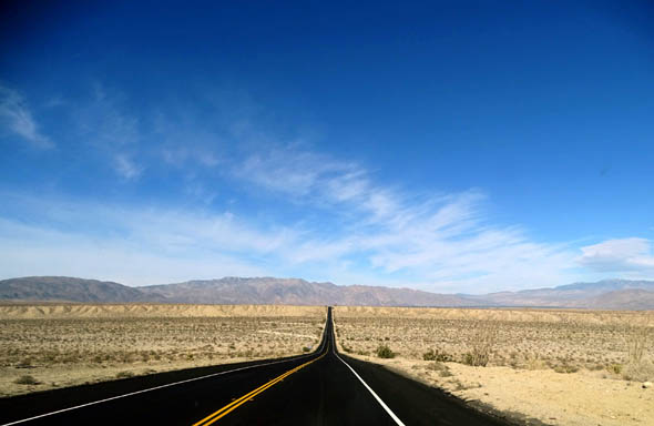
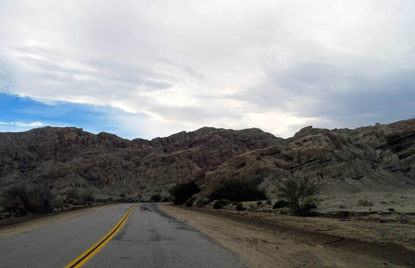
The drive east on S22 through the park to CA 86 was interesting, with
small canyons carved into the desert from mountain rain and snow runoff.
The park has several 5,000-6,666-foot mountains.
We pulled off onto one plateau near the eastern end of the road so I could get pictures
of the canyons and the Salton Sea to the east:
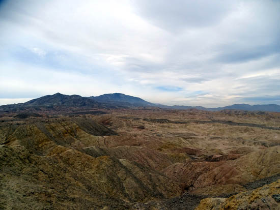
Multi-colored rock layers eroded over the eons
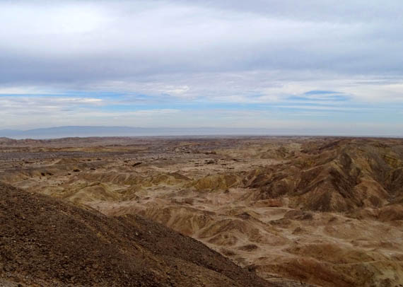
From
this far away, the Salton Sea is just a narrow band of white
between
the brown rocks and gray mountains at the horizon.
We also had views of the lake as we continued north on CA 86.
NORTH TO JOSHUA TREE
We passed many more produce farms, date and citrus groves, and vineyards on
four-lane CA 86, which was busy with a lot of big trucks going in
each direction.
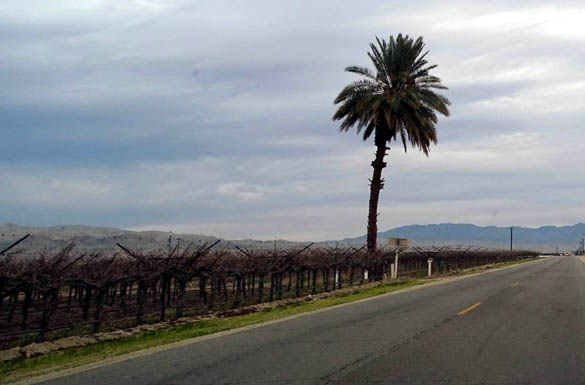
One of the vineyards
I was surprised to see numerous large greenhouses covered in white fabric, as
well as rows covered in fabric:
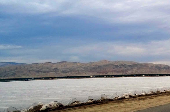
Apparently it gets down to or below freezing here in the winter; it is
at higher elevations and a little farther north than the farms and orchards
near Yuma and YPG.
We turned off CA 86 in Mecca. We got some very expensive gas and made
several turns until we found the tangent going NE to I-10 and the
southern entrance to Joshua Tree NP. I think it's CA 195 but it's not
marked on our AAA map. A sign at the edge of Mecca said it goes to the
park so we continued ahead.
It was a good choice
in our minivan but I'm not so sure it would be suitable for a large RV.
There was minimal traffic on this narrow, winding
two-lane road, which looks like it gets sandy every time it rains
or the wind blows:
You can see in the picture above and below how the sand has been plowed
to the side but some still covers the road.
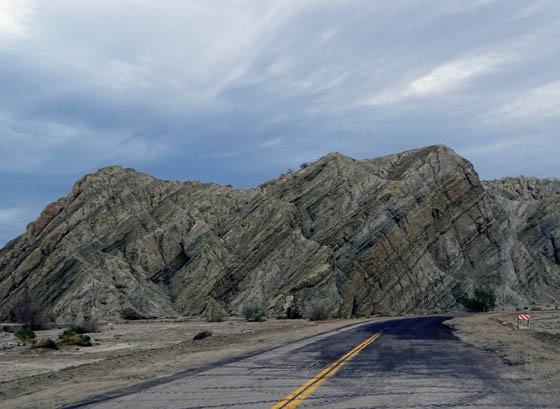
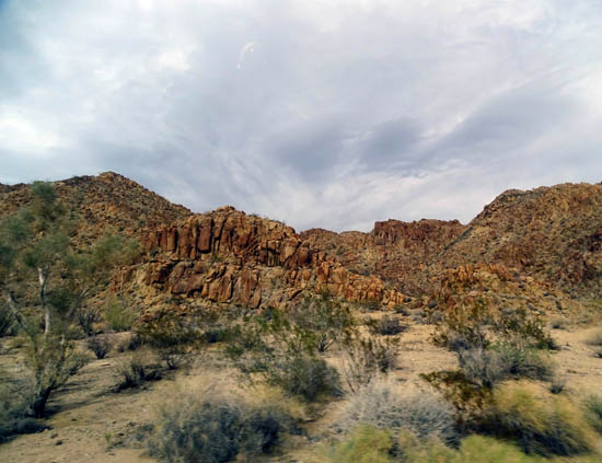
There are lots
of unusual rocky hills and washes on this road for 21 miles, partly through the
Oracopia Mountain Wilderness. The rock formations are sort of a prelude of what's
to come in Joshua Tree National Park.
JOSHUA TREE NP: WELCOME TO SURREALITY
Is "surreality" a word??
You might think so if you've ever been in or near this popular national
park and have seen the odd-shaped trees that are the park's namesake.
We crossed I-10 and continued straight into the southern end of the
park. Neither of us has ever been there before and we quickly decided we
wanted to come back for at least a week this spring so we could see more
of it up close.
The winding, hilly road bisects the park from south to north for 45
miles. There is another road going out the NW quadrant of the park that
we didn't see because it was getting later in the afternoon, and
overcast. Most of the trails and Jeep roads are in that section so we'd
definitely like to go back to see it.
We stopped at the Cottonwood Visitor Center at the southern end of the
park and rode through the nearby campground but wouldn't want to stay
down there because there aren't as many interesting land features or
trails in that area.
The "big rig" sites
look pretty small to us and a friend back at YPG who has camped there
previously later told us the sites aren't any larger at
the two campgrounds in the NW section, either.
Above and below: Scenes from the southern
part of the park
We got up to 3,600 feet elevation in the park and it felt chilly to us
in mid-January.
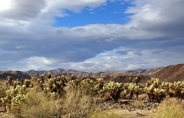
The most interesting part of the park that we passed today was the Cholla
Cactus Garden, with a gazillion Teddy bear chollas in a few acres:
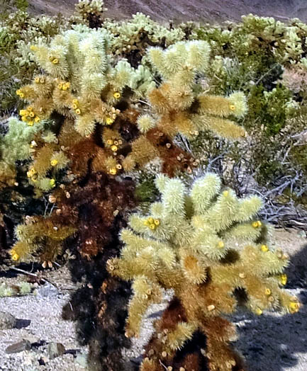
The "Teddy bear" part is a misnomer. You don't want to rub up against
one of these prickly beasts while hiking because the needles are very
sharp and they hurt. The little bundles also come off quite easily and
are difficult to remove from your skin, clothing, or dogs' paws due to
the barbed ends of the needles.
Ask me how I know! Take my word for it and keep your distance from these
interesting cacti while hiking.
We didn't get out to hike on this trail today but have seen chollas many
times on other trails in Arizona and California. They are especially
beautiful to photograph when the sun is shining through their branches.
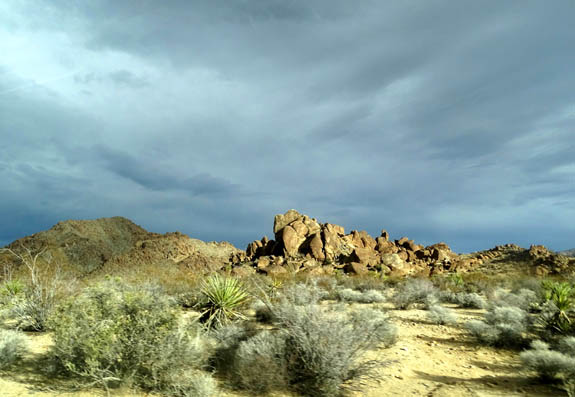
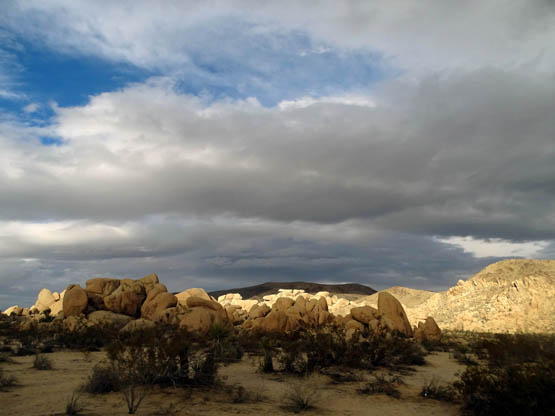
We passed lots of interesting rounded boulders farther north near the White Tank and Belle
campgrounds:
The road loses a lot of elevation past the north entrance station and Oasis
Visitor Center (we didn't go into that one) before reaching CA 62 and the
town of Twentynine Palms.
29 PALMS & TWILIGHT DUNES RV PARK
We drove north on four-lane Adobe Rd. to the Twentynine Palms Marine base
AKA "Marine Corps Air Ground Combat Center" to check out the RV park,
which appears to be our best place to stay when we visit Joshua Tree NP
in a couple of months.
We could see Twilight Dunes RV Park on our right behind the fence at the
main entrance gate but had to drive over two miles inside to reach it.
We liked the looks of the sites -- sandy but very large, with covered
carports, sheds, and paved driveways at each site:
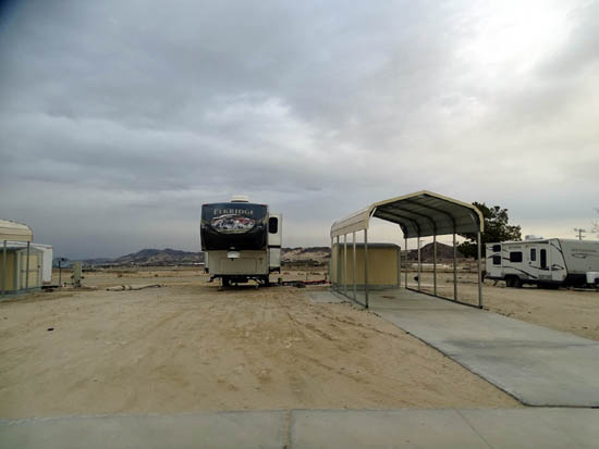
Later we learned that these sites used to be for mobile homes before the
area was turned into an RV park. That's why they are so large and have
the covered carports and sheds. We've never seen that at other military
travel camps.
We went to the campground office (at the inn) to confirm
that retirees can stay at Twilight Dunes.
We could have made a reservation right then but waited until the next
day so we could talk more about all of our options.
The 220-mile drive back to Yuma Proving Ground in the dark, and rain, took
3:35 hours. We took CA 62 east to CA 177 south to I-10 east, got
off in Quartzsite, and headed south on US 95 to Imperial Dam Rd. and YPG.
The whole trip lasted over 14 hours.
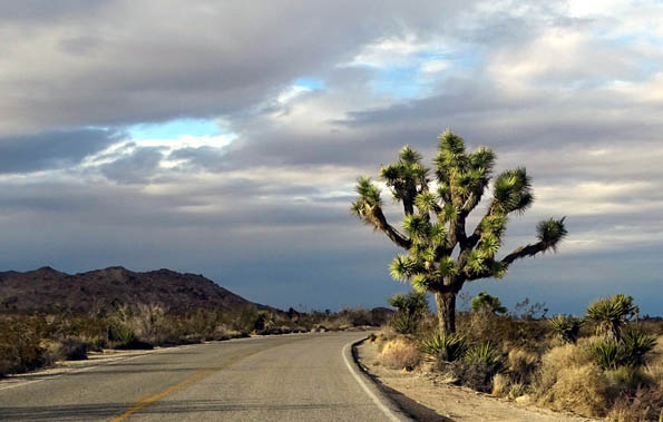
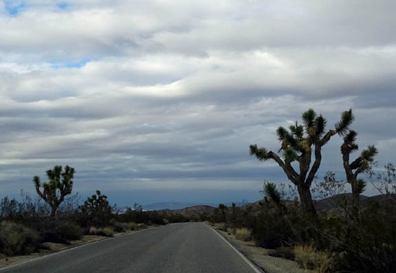
Another Joshua tree in the national park
Although we were very tired by the time we got home Jim got online to check
out campsite availability at Anza-Borrego State Park. We decided not to go there
in March because only one long site is available when we want it, and
for only three days. We'd prefer to spend more time there. Maybe we can
return another year when we can reserve a space earlier for the blooming
season.
All in all, this was a long but interesting and informative trip. Not
only did we decide when and where we want to stay to visit Joshua Tree
National Park in March, we also know more about Anza-Borrego if we ever
decide to go back there.
Next entry: another fact-finding day trip, this time to
Lake Havasu, AZ
Happy trails,
Sue
"Runtrails & Company" - Sue Norwood, Jim O'Neil,
Cody the ultra Lab, and Casey-pup
Previous
Next
© 2016 Sue Norwood and Jim O'Neil
