** Although we were able to hike many of the trails in Zion this
week, one we couldn't access was the iconic Narrows slot canyon where
the Virgin River flows through a narrow canyon for 16 miles through the park.
Spring rains and snowmelt put the kabosh on that. It's just too
dangerous when the water is deep, murky, and running fast in the spring.
Last fall seven experienced hikers drowned at Zion in another canyon
during a flash flood that caught them by surprise, so park officials
aren't taking any chances this spring. The Narrows slot canyon is closed
this week.
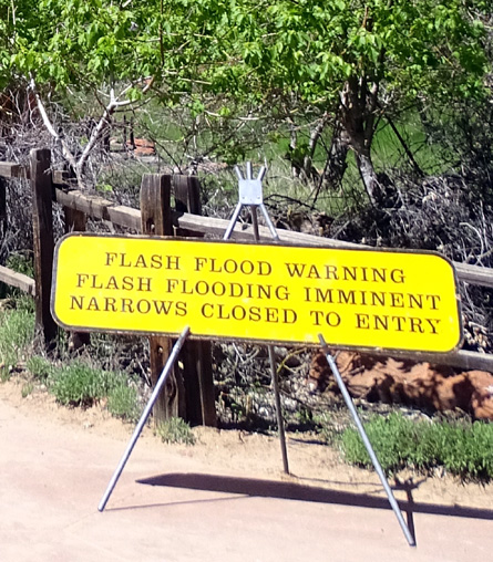
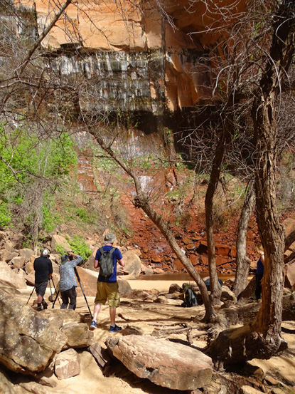
Entry to The Narrows; no one
is allowed past here this week.
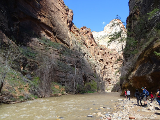
We did get to see the beginning of that famous canyon hike at the end
of the Riverwalk Trail, however, and we experienced most of the
second most popular hike at Zion, Angel's Landing.
In this entry I'll give some general information about the park --
a little history, things to see and do, peak seasons, parking,
entry, where you can and can't drive, shuttle bus system, hiking and
cycling opportunities, campgrounds, visitor center, museum, etc.
Subsequent entries will include photos and information about the
trails we hiked, the roadways and paths where we drove and/or cycled,
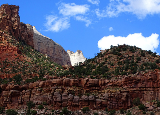
and a day trip up Kolob Terrace Road to Kolob Reservoir. I covered Kolob
Canyon in the northwest part of the park last
October.
WHY IS ZION NATIONAL PARK SO POPULAR?
There are lots of reasons! I'll talk first about the geological and
ecological diversity within the park.
Established in 1919, Zion was the first of five national parks in
Utah. It draws the most visitors of those five -- over four
million a year -- probably because it has so much to offer and it is
the easiest to access from a freeway running between two major cities, Salt
Lake and Las Vegas.
This map shows the location of the five national parks in southern
Utah, all south of I-80 and east of I-15 in what tourist guides call Canyon Country:
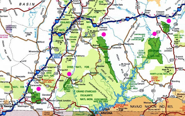
I marked each of the national parks with a purple dot. Since you probably
can't read the map even on a large computer screen, they are (L-R) Zion,
Bryce Canyon, Capitol Reef, Canyonlands, and Arches.
Jim and I revisited all of these parks this spring;
we've been to most of them before but spent more time to explore
them this time. I'll let you know in May which one was our very
favorite and why.
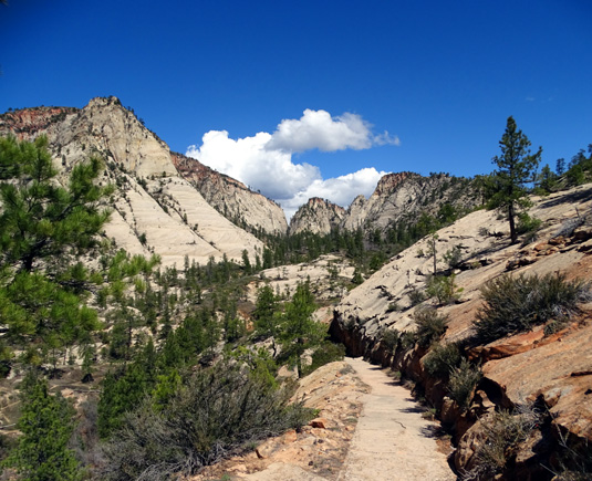
My favorite trail in my favorite
Utah national park (see 5-3-16 journal entry for location)
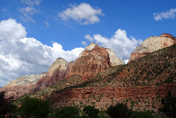
Zion is large -- 232 square miles -- and covers a range
of elevations from 3,666 to 8,726 feet. Because the park is
located at the junction of the Colorado Plateau, Mojave Desert, and
Great Basin regions, Zion has a wide variety of terrain and
ecosystemsthat support significant plant and animal diversity.
According to the park's website and newsletter, Zion is home to about 78
different species of mammals (including mountain lions and bighorn sheep), 291
birds (peregrine falcons and California condors are two favorites), 30 reptiles,
eight fish, and seven amphibians.
Conifers high up on the West Rim Trail at Zion NP
There are about a thousand different kinds of plants in the park, too, with
a mix of desert, riparian, pinyon-juniper, and conifer woodland communities. The terrain
is diverse, ranging from high sage-covered plateaus and colorful 2,000-foot
sandstone cliffs to deep canyons.
It's a pleasant surprise in this harsh
desert environment to also see lush green valleys with streams and the unique
hanging gardens that grow next to wet seeps, springs, and waterfalls.
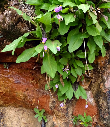
Shooting Stars flourish in a wet
niche in the rocks along the lower part of
Observation Point Trail, not far
from the even wetter Weeping Wall.
The amazing
geological features in Zion National
Park began forming over 250 million years ago when the area was covered
by sea water. Later a vast desert covered the region. Today's tall,
colorful cliffs were once sand dunes in that desert.
Zion is located near the "bottom" of what is called the Grand Staircase,
layers of colorful rock on the Colorado Plateau that extend from Bryce Canyon
National Park at the high end to the Grand Canyon at the low end.
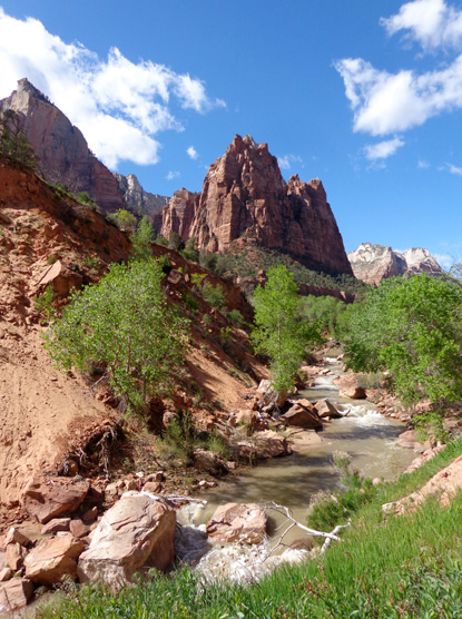
Busy little river, cutting through several thousand
feet of rock layers over the eons . . .
(view of the Virgin River from the Pa'rus Trail)
With such a variety of geological features and habitats , Zion is a fabulous
study in contrasts. It's perfect for folks like us who love to sight-see,
hike, ride our bikes, and/or do landscape and wildlife photography.
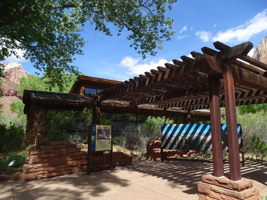
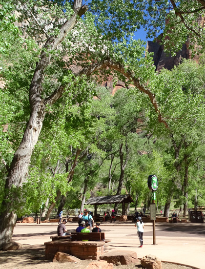
VISITOR CENTER
We almost always go to a park's visitor center the first time we're
there, even if we've already done some online research. There is always
more information to gain from the rangers, exhibits, maps, and brochures on-site.
Zion has steep cliffs, narrow canyons, and unpredictable weather
during every season so it's important to have current information about
road and trail closures and weather predictions that are as accurate as
possible if you plan to do any hiking.
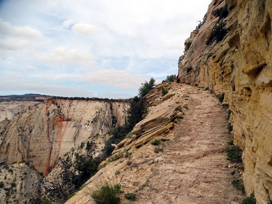
Avoid Observation Point Trail
(above, my favorite trail in Zion ) and West Rim Trail if the
weather is bad or you're
seriously acrophobic; both have narrow paths above steep drop-offs.
The park brochure emphasizes, however, that each visitor's own good
judgment, constant awareness, and adequate preparation are critical for
his/her safety and enjoyment.
Since we weren't able last fall to find a parking spot at
the visitor center when we came over here from Red Canyon, UT on a day
trip, we went in today after getting set up in our
campsite. The main visitor center is located just inside the west
(south) gate of the park at Springdale, only half a mile from the Zion Canyon
Campground and RV Park where we're staying.
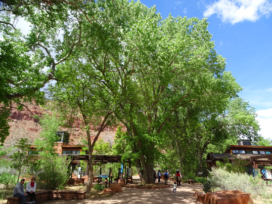
The visitor center and shady outdoor terrace area are spacious, nicely landscaped,
and designed to accommodate a lot of people during peak hours and
seasons:
After perusing the exhibits and bulletin boards I had two main
questions for the rangers -- the current condition of Kolob
Terrace Road, including possible snow (there was major construction on
that road when we visited in October), and the likelihood that The
Narrows will be open for hiking/wading later this week.
The good news is Kolob Terrace Road is open and clear so we were able
to explore that part of the park on Monday:
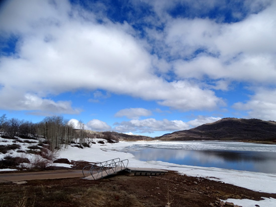
Kolob Reservoir is at the end of
Kolob Terrace Rd. It's at 8,000 feet elevation and still frozen.
The bad news was a next to zero chance of The Narrows opening up to
hiking for several more weeks. However, all the other trails in the park are good to go, even those
at higher elevations in the northwestern part of the park. The
information was helpful in planning our week at Zion.
After we were done in the visitor center we caught a free shuttle bus
to the human history museum so we could learn more about the shuttle
system. We found that it works efficiently and comfortably to move people around the
very narrow and busy Zion Canyon Scenic Drive, which runs next to the
Virgin River.
HUMAN HISTORY MUSEUM
Human history in the area has been traced back to native peoples who lived here about 12,000
years ago. Over the millennia, humans have adapted to all the variations
in climate change and eco-zones in the region. In more recent
centuries, the lush Virgin River Valley has been the easiest place for native
hunter-gatherers and incoming settlers to find and grow foods and hunt animals
for sustenance.
A good place to learn about human history in the park is the (ta-da!)
Zion Human History Museum, located less
than a mile north of the visitor center on Zion Canyon Scenic Drive.
This is one of the shuttle stops. You can drive a personal vehicle here
but not any farther north on this busy road.
Colorful cliffs across the road from the
museum parking area
Above and below: more
cliffs to the north of the museum
Exhibits inside the museum focus on the people who have lived in this
region and also the water that made it possible for them to survive. The
effects of water not only determined where people lived in the area, it
also helped form all the spectacular cliffs and canyons that draw
tourists to the area now. As the park website says, "Water creates
the scenery and sanctuary that makes Zion famous."
While we were at the museum we watched an informative 22-minute video
with an overview of the park. It is shown every half hour.
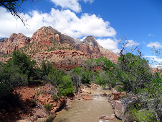
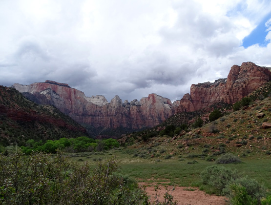
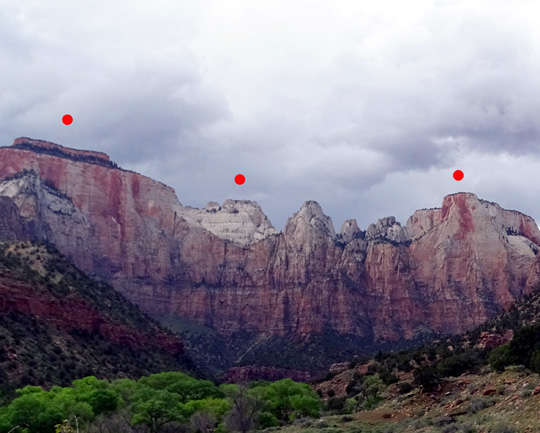
From the back terrace is one of the best views of the park's famous
scenery -- the West Temple formation:
To show some scale of size, these cliffs are about two
miles from my viewing point on the terrace. They rise above the canyon
floor about 3,800 feet.
I marked three named formations with red dots.
Left to right they are the West Temple (elev. 7,810 feet), the Sundial (elev.
7,590 feet), and the Altar of Sacrifice (elev. 7,505 feet):
WHAT TO SEE & DO IN THE PARK
There are sights and activities at Zion that are suitable for a
wide range of people, from those who are physically handicapped to those who
are very athletic.
I highly recommend researching things to see and do
in the park before arriving so you can maximize whatever time you
have, whether it's just part of a day or several weeks. That's good advice for
any national park or other bucket-list destination, especially one that
draws as many visitors as Zion.
The best place to research things to see
and do in the park is the
official park website. It will have the
most current information about road closures, etc. You can spend many hours
clicking on lots of links!
There are numerous other types of websites that will give
you information, too, from businesses like resorts, tour companies, and
sports outfitters to people's personal blogs.
Photographing the falls at the Upper
Emerald Pools
Sight-seeing is probably the most common activity, and even very sedentary
people can enjoy looking at the colorful cliffs and rock formations in their
own vehicle along all 12 miles of State Rt. 9 AKA Zion-Mt. Carmel Hwy. (the east-west
route through the park), Kolob Terrace Road up to the reservoir (about 25 miles one way),
and Kolob Canyon Road in the far northwest part of the park (five miles one way).
Free shuttle buses carry visitors the length of Zion Canyon Scenic Drive where
most vehicles aren't allowed (only park personnel and folks with reservations at
the lodge). You can get on and off at any of the stops or just stay on the bus to enjoy
the scenery.
Visitors wait at the Grotto shuttle stop,
where there are several trailheads.
More active people can add walking and running to places off the
road to view scenic wonders in the park, including the wilderness area.
Photography and observing wildlife are probably the next most common activities at Zion.
I took gobs of pictures of the landscape and nature, including flowers
and a few critters.
I was thrilled to hike close to a curious young bighorn ram on the way down from Observation Point.
He wasn't very fearful of the humans who passed within 30-40 feet of him on the trail:
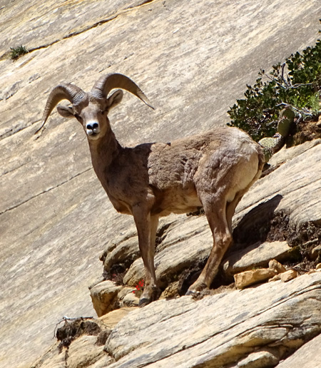
Sure-footed and well-camouflaged ram
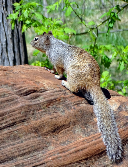
When I sat down on a bench along the Virgin River on the Riverside Trail one day, a hungry,
fearless squirrel jumped into my lap unexpectedly and nearly grabbed my Clif Bar snack!
I laughed, but if he'd bitten me it wouldn't have been so funny. I shooed him away. He's
definitely used to manipulating tourists. Most of the park's critters are more reclusive or
nocturnal than that so you may have to look hard to see them.
Other activities that don't require a lot of energy include looking at exhibits
at the visitor center, nature center, and human history museum; watching the free park
videos; shopping in the book stores/gift shops; eating at the lodge; having a picnic;
attending ranger talks and short walks; viewing sunsets and the night sky;
and staying in the campground.
There are also a lot of special kids' activities during the summer months.
More active things to do include hiking on trails that range from easy to
strenuous, cycling the Pa'rus Trail and paved roads in the park, horseback
riding with or without a guide, back-packing overnight in the wilderness
area, some types of rock climbing, river trips, and canyoneering.
The last four activities require special permits.
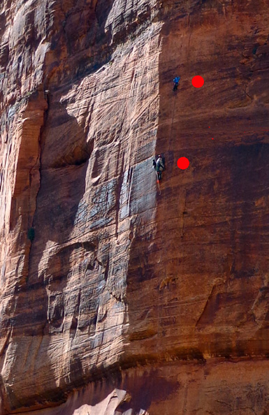
Two climbers (left of red dots)
scale a very high
vertical wall
above the Virgin River.
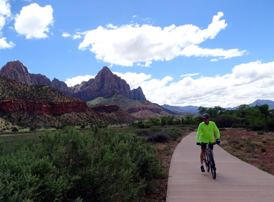
Jim riding on the Pa'rus Trail
I'll have several entries about our hikes and bike rides in the park. The
park website describes other trails we didn't do this
week, if you'd like to read about those, too.
We both rode our bikes out and back along the river on Zion Canyon Scenic Drive (about
10 miles one way) and enjoyed seeing things up closer than we could on the shuttle buses.
Cyclists have to pull off the narrow road when a bus approaches, but otherwise there is
minimal traffic since it's closed to almost every other vehicle.
View in Zion Canyon above the Virgin River;
picture taken on a bike ride.
This road is slightly uphill outbound
(upstream/north) but not strenuous if you're used to riding 20 miles. Shuttle buses
can each transport a couple of bikes if you want to hop on for part of the ride.
Note that pets other than legitimate service animals aren't allowed in most buildings,
the shuttle buses, or on any of the park trails except the paved Pa'rus Trail. Pets are
also allowed in the campgrounds and at pull-offs along Hwy. 9.
AVOIDING THE CROWDS
It's ironic that the name "Zion" means "peace and refuge."
That was a lot easier to find here many years ago than now.
While you can find peace and refuge far out on some of the trails, and in the
wilderness area where few people venture, I can't warn potential visitors enough about
the crowds that are possible in the more developed parts of this park.
Last
October we drove over in our car from Red Canyon (close to Bryce Canyon NP) to
scout out places where we could camp with our RV on this spring trip to Zion. We did make
a decision about that but we were already too late to reserve a suitable spot in
a park campground and we were unable to find a place to park at the visitor center so we
could go in to get some information.
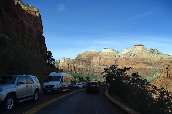
Solid line of cars on Rt. 9 in the eastern
part of Zion last October
At least I got better pictures of that part of the park on that day trip last fall
than I was able to get this week.
In recent years Zion has been the third
most-visited of the sixty designated "national parks"
in our country, per the
National Park Service website. Only the Great Smoky Mountains
and Grand Canyon national parks have drawn more visitors each year. (Some other parks in the system
like the Blue Ridge Parkway and Golden Gate National Recreation Area have higher numbers, but
they aren't designated as national parks.)
That means you'd better plan any trip to Zion well in advance and perhaps try to avoid
the busiest seasons so you can have a more pleasant experience.
This year is the National Park Service's 100th anniversary and it is advertising heavily
to get more people involved in visiting the 400+ units under its umbrella. It's good to get
more people outdoors and supporting the parks, but but more people also put more of a strain
on already-strained resources. Park maintenance and staffing have both suffered in recent
years from lack of funds.
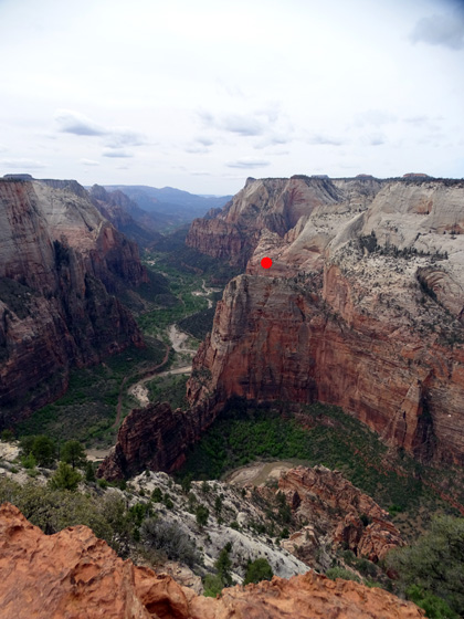
I took this picture from Observation Point
on the trail named after it. I can see
a couple miles of the Virgin River running through the canyon,
and I'm
looking down
on too-popular Angel's Landing (under the red dot). Cool, eh?
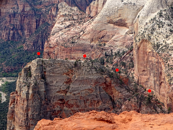
Steep and narrow trail (under
the dots) up to Angel's Landing,
zooming in from higher up on
Observation Point
Many of the visitors at Zion and nearby Bryce Canyon NP are from foreign countries.
Both parks offer unique landscapes and experiences for domestic and foreign
visitors. Both are also relatively easy to reach by tour buses and rental cars or
RVs from either Las Vegas or Salt Lake City.
It's amazing how many different languages you can overhear at visitor centers, on the
shuttle buses, and along the trails at both Zion and Bryce. I love the diversity and
I'm proud to share my country with them. A few times I was able to answer questions
and offer suggestions to other visitors (domestic as well as foreign)
about things to do and see while they are here. I like being helpful!
This week is not the busiest week this spring -- that
honor would go to the Easter and Memorial Day holidays, as well as several spring break
weeks in Utah and neighboring states -- but spring is a busy season
in general because the weather is temperate.
There's a
page on the park website that shows how many visitors
were here each month for the last ten years. That's useful for trip planning.
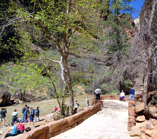
If The Narrows had been open this day,
there would have been
even more people here at the end of Riverwalk.
We were impacted by crowds in several ways but mostly learned real fast how to avoid
them as best we could:
- We left our vehicles at the campground and walked, rode our bikes,
or took the Springdale town shuttle buses into the park.
- We got into the park at 7 or 8 AM, before the park shuttle buses
got real busy (more about shuttles shortly).
- We planned out our itinerary each day, with some leeway for
flexibility when we found other things to add.
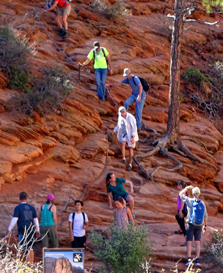
- We hiked the most popular trails like Angel's Landing early in
the day -- but even then, it was so crowded on the last (and most treacherous)
ascent/descent that we didn't go all the way up. It was too frustrating to have to wait for so
many people using the ropes in both directions at the same time:
- We spent one day last fall driving out and back on Kolob Canyon Road in the far northwest
part of the park. The entrance and visitor center are just off I-15 and only a few people were
there. The scenery is great, although not as spectacular as along Zion Canyon Scenic Road.
- We also did a day drive up to the reservoir at the end of Kolob Terrace Road this week. That
was also interesting and hardly anyone else was on the road. (There was still snow up there
and ice on the reservoir but the road was clear.)
We weren't usually near the park entrances during the day because we were out hiking, cycling, or
sight-seeing but we've seen pictures and heard horror stories of the long lines of vehicles
trying to get into the park after 9 or 10 AM.
And by then it's also nearly impossible to find a place to park inside Zion, too.
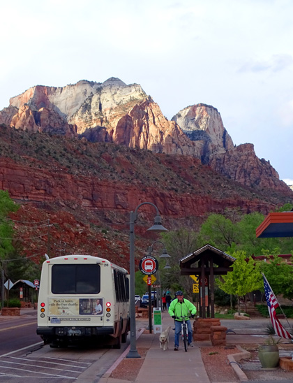
Jim and Casey go past one of the Springdale
shuttle buses on its way to the park.
Because parking is so scarce in the park, visitors coming in from the west (south) on Rt. 9 are
encouraged to park in Springdale and take the free town shuttle buses to the pedestrian entrance
of the park that leads to the visitor center. This is the busier of the two entrances to the
main part of the park because it's more accessible from I-15.
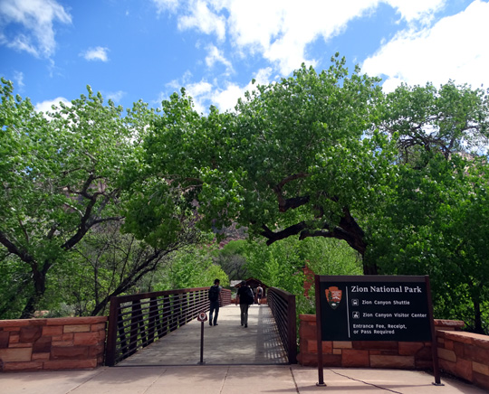
Pedestrian entrance to Zion NP
Be forewarned that parking spaces along the street in Springdale can
stretch for several miles -- and by 2018, more spots had meters where you have to
pay -- but the city's free shuttle buses go out fairly far to
pick up passengers.
Fewer people come into the park from the east so the lines aren't as long to get in at that gate.
That's the good news.
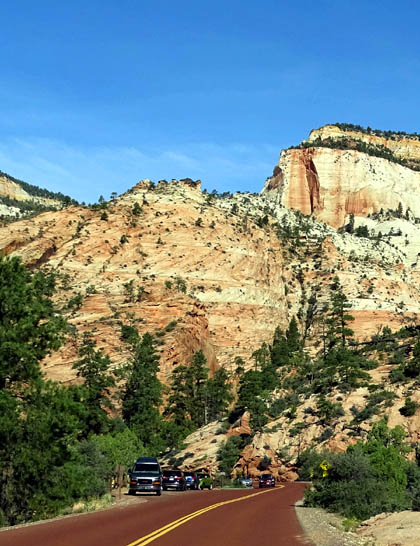
No room to park
The bad news is that the scenic pull-offs and trailhead parking areas along Rt. 9, such as the
one in the photo above, are very small and fill up fast. I had to take most photos of that
side of the park as we were driving on our day trip back in October and on another day
trip out and back through that part of the park this week because Jim was unable to find a
place to pull over for me to take pictures.
In addition, when coming in from the east you may be delayed at a 1.1-mile
long tunnel for a while if a large vehicle is being escorted through the center of it
where the ceiling is highest. Tall and/or wide vehicles like RVs get to pay $15 for that
privilege. Two lanes become one and the folks going the other direction have to wait till
they're all the way through.
Also be forewarned that in 2018 the National Park Service is considering limiting the
number of people allowed into Zion (and some other popular parks like Yosemite)
by requiring reservations to even get into the park during the busiest
times!! We'll see how that flies with the public.
PARK SHUTTLE SERVICE
For now, the way Zion limits crowding on the most popular road in the park, Zion
Canyon Scenic Drive, is to require the use of shuttle buses beyond the human history
museum for almost everyone except folks with reservations at the lodge, people
riding bicycles, and park personnel.
The park shuttle system, operating since 2000, is great! In 2016 approximately six
million people used the shuttles within the park (some like us, more than once;
total visitation was about four million people and not everyone rides the buses).
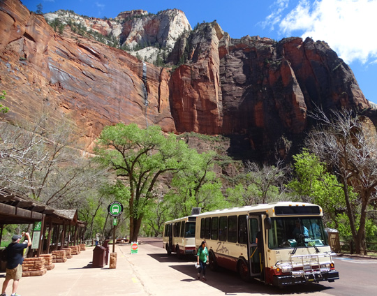
Two of the buses at the end of the line,
the Temple of Sinawava
The shuttle system is free and efficient. We used the buses several times this week.
They are clean and comfortable, they stop at nine different trailheads and scenic
overlooks over the ten-mile length of the canyon road, and you can get on and off for any
length of time at any of the stops -- during the times they run, of course. It's
not 24/7, but hours are generous between March and November. The drivers are courteous
and well-informed if you have questions.
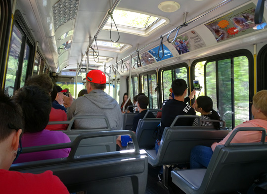
Inside one of the park's shuttle buses
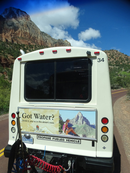
The buses are fueled by propane.
Shuttles run approximately every 7-10 minutes in the summer from the visitor center. We always got
there well before 9 AM so we could get on the next available bus. Times and frequencies vary
by season, depending on number of visitors.
The park
website and visitor center have a video, bus schedule, maps, and lots of information
about using the shuttle system.
CAMPING & LODGING IN THE PARK
Zion Lodge, located three miles north on Zion Canyon Scenic Drive, offers the only in-park
lodging unless you have an RV. It is managed by Xanterra and has a separate
website.
We haven't stayed or eaten there so can't make a recommendation re: value or quality
but it's definitely convenient! There are motel rooms, suites, and cabins. The lodge also houses
a restaurant, gift shop, and post office. I went in one day to see it, and bought a shirt in the
gift shop:
Zion Lodge
Zion has three
campgrounds within park boundaries. We haven't stayed at
any of those, either, but we drove through the two near the visitor center to see if any
sites were large enough for our RV, if we come back again. (Yes, a few, but they are tough to get!)
Lava Point CG is located far up Kolob Terrace Road
over an hour's drive from Springdale and the visitor center at almost
7,900 feet elevation. It is open only "as weather allows" from May to
September. There are just six primitive sites at Lava Point, first
come-first serve, pit toilets, no available water, and no vehicles or
combinations over 19 feet in length can travel that road.
Much more convenient are the two campgrounds inside the park along the Virgin River
near Springdale and the visitor center, South Campground and Watchman
Campground. Since these are located at about 4,000 feet elevation, they are open
year-round but have "reservation seasons" when reservations are
required if you want any chance of getting a site.
You can make reservations at either of these two campgrounds for up to two
weeks. Sites fill quickly during the times reservations are allowed. Visitors should
reserve them as far in advance as allowed (six months before arrival date) because the
sites are full every night during the busy seasons.
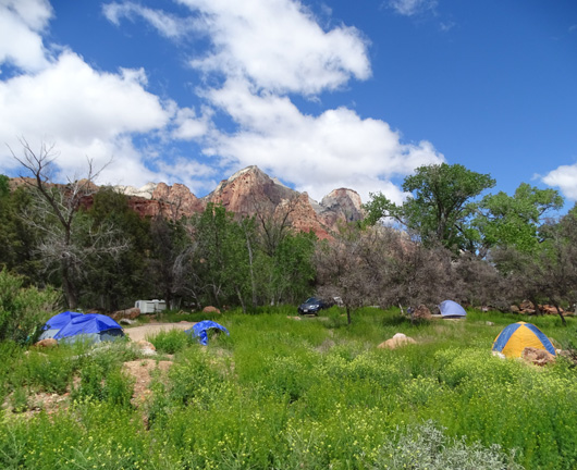
Tent and RV sites at South CG, as seen from
the Pa'rus Trail
South CG has 117 no-hookup sites. Potable
water is available at the restrooms. Generators are allowed for only two hours in the
morning and two hours in the evening. (That's typical for national parks.) There is a
dump station.
Watchman CG, with 178 individual sites and some group sites, has
some sites that are suitable for larger rigs. There are RV sites with electric hookups
and some tent sites without. Potable water and a dump station are available. No generators
are allowed in this campground since most sites have electricity.
Watchman CG is located across the river from the campground in Springdale where we are
parked; we can see some of the RVs from our campground:
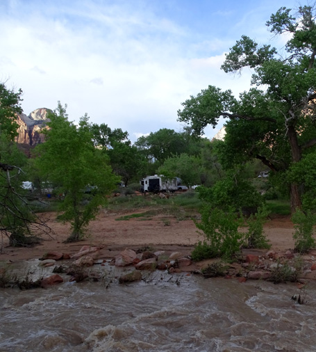
They are a little closer to the same Watchman cliff formation we get to enjoy.
Accommodations are limited at Zion so if you aren't able to get a reservation at one
of the campgrounds or the lodge/cabins inside the park, there are other options in
Springdale near the west (south) gate or farther east along Hwy. 9 over to Mt. Carmel
Junction.
WILL WE COME BACK?
We've enjoyed everything this week at Zion National Park except the crowds, which
we avoided to the best of our ability. We can see why this park is so popular but it's
not our favorite of all the national parks we've ever visited -- partly
because it's so crowded -- and there are other parks we want to explore
that are new to us.
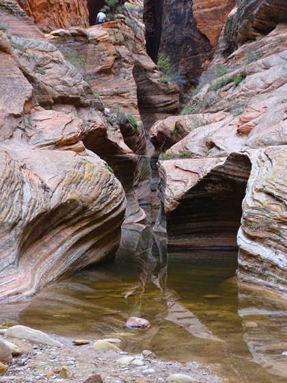
Very cool optical illusion in a beautiful slot canyon
about a mile up the Observation Point
Trail.
However, there are more trails at Zion that I want to hike. I
want Jim to go up to Observation Point, my favorite trail in the park, and we'd both like
to hike up The Narrows a mile or two when the water levels are low enough for it to be allowed.
So yes, we want to return to Zion again in the future. We're considering it as early as this
fall, although campsites within the park that will accommodate our 36-foot 5th-wheel are already
reserved for the week we're thinking about. We'd prefer to stay at the Watchman CG rather than
the private Zion Canyon RV Park we're in now. We'll see.
Next entry: the drive up to Kolob Reservoir on Kolob Terrace Road
Happy trails,
Sue
"Runtrails & Company" - Sue Norwood, Jim O'Neil,
Cody the ultra Lab, and Casey-pup
Previous
Next
© 2016 Sue Norwood and Jim O'Neil
