Continued from the previous page.
BACK ON THE GOLDEN WALL TRAIL
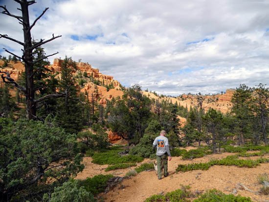
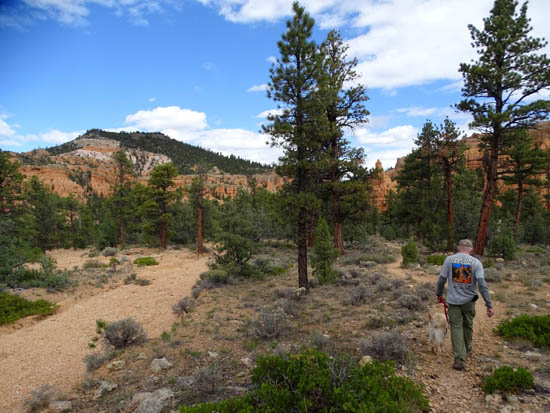
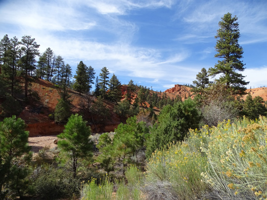
Down at the intersection with the Golden Wall Trail we turned right and
headed back to the trailhead, hiking a little above the wash and then
down in it for a couple hundred feet:
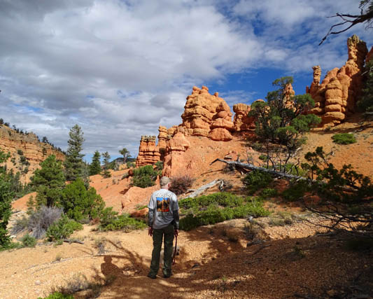
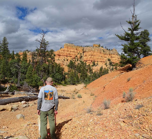
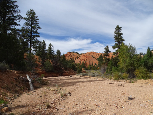
For a little while the trail goes right through the
wash.

Looking back from the wash
It was half a mile to the other end of the Castle Bridge Trail and
another 6/10ths mile repeating the "stick" part of the lollypop.
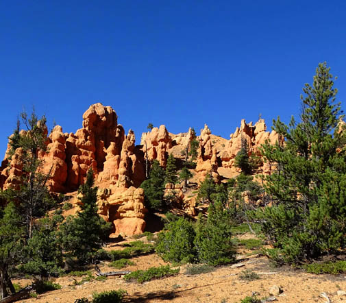
As with just about every trail in Red Canyon, you can do variations to
add distance and difficulty to this loop. The remainder of the Golden
Wall Trail is much hillier, as is the Buckhorn Trail.
If you want a longer
hike with more elevation gain and loss, start at either end of the
Golden Wall Trail and include the Castle Bridge Trail near the beginning
or end. If you do the two extensions out and back as shown on the map
below, walk through part of the campground, and return to your starting
point via the bike trail, the distance is an even five miles.
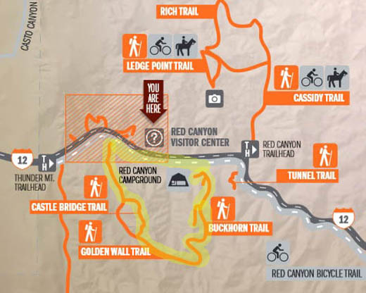
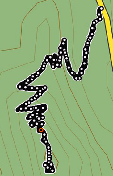
Here's the trail map
again, with the longest distance in yellow. You can shorten it by 3/4
mile if someone drops you off or picks you up or you spot a vehicle at
either end:
Note that the Golden
Wall Trail doesn't have its own trailhead on the eastern end.
Like Castle Bridge, it isn't "self-contained." It morphs into
the Buckhorn Trail at its other end. Buckhorn is just under a mile long
and begins/ends part way back into the Red Canyon NFS campground.
I hiked
only a mile of the Golden Wall Trail as of October, 2015. In May of 2016 I hiked
the rest of it, and Buckhorn. That's how I know the distance for the
longer hike. I'll show those photos in the 2016 journal (eventually).
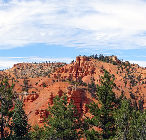
TUNNEL TRAIL
This is a short, fun trail that puts you at the top of a
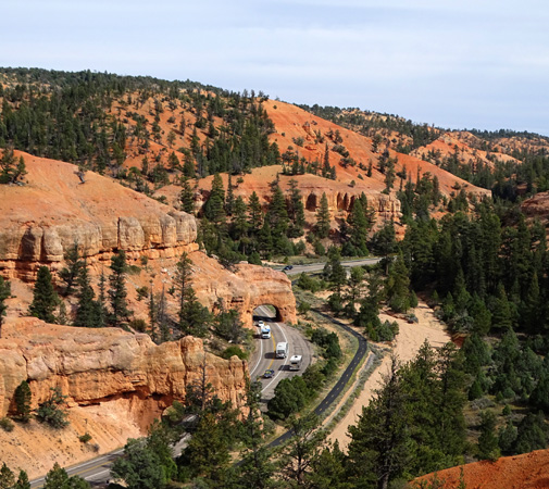
cliff with good views down to the two vehicle tunnels on Scenic Byway 12.
From the higher vantage points you can see traffic going
through both tunnels:
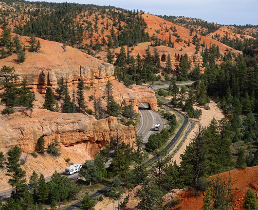
Here are some pictures of the tunnels from road level.
They were reportedly blasted out of the rock fins back in the 1920s to
impress dignitaries and other visitors to Bryce Canyon National Park,
which is about 15 miles up Scenic Byway 12:
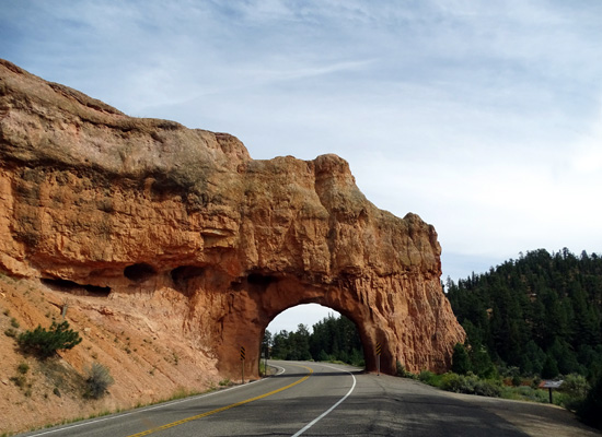
Tunnel #1 going eastbound toward
Bryce Canyon
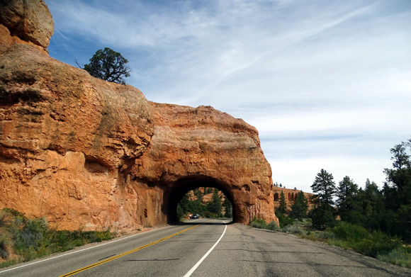
Tunnel #2 going east toward Bryce
Canyon
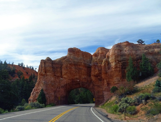
Other side of Tunnel #1
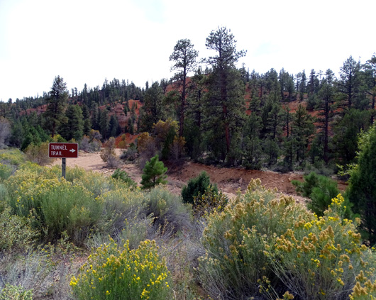
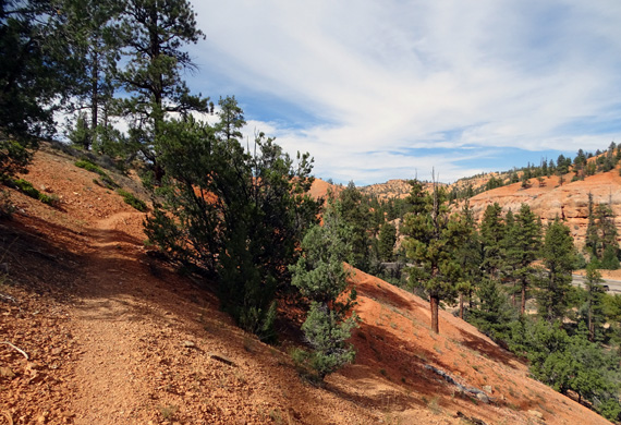
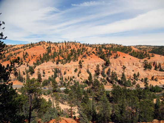
The Tunnel Trail starts at a pull-off about a quarter
mile west of the first tunnel, across the road from the trailhead
parking area for the Cassidy Trail.
Like the Golden Wall Trail, you cross the bike path and
the large, dry wash, then go up the trail on the bank on the other side:
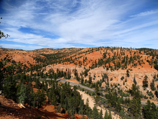
As you can see from my GPS track (I hiked this trail
only once on this trip) the trail switchbacks a bunch of times up the
slope. It's only about half a mile to the top:
The grade is one of the smoothest in Red Canyon and partly shaded all the way
up to the top of the hill. Because of all the switchbacks the grade is
very gradual.
Along the way are several benches with
views of the rock formations across the road and peeks down to
the two tunnels:
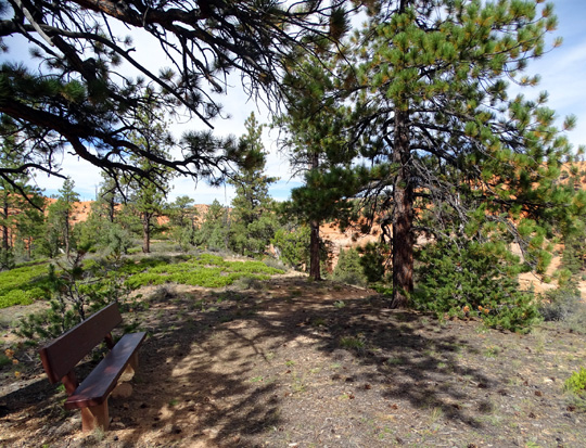
One of five benches along the
trail
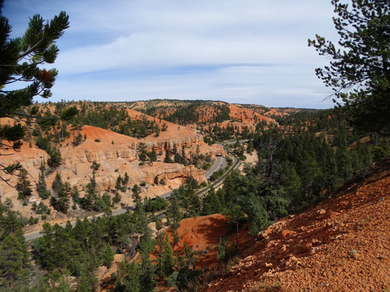
I had fun watching big RVs, tour buses, and trucks going
through the tunnels. You can see down to them when you're about halfway
up the hill but the higher you go, the better you can see both tunnels.
Some folks stop at the pull-offs just before each bridge
to take photos -- or make the determination that yes, our rig
will fit under it!
View of tunnels on one of the
switchbacks part way up the hill
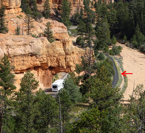
Arrow marks the bike path (I used
this photo in a previous entry)
Lots of RVs! Both tunnels are visible from
the top half of the trail.
When you're driving or hauling a large RV it's a good idea
(understatement!) to know the height of your vehicle and the height of
bridges/tunnels you're approaching.
These tunnels are tall enough for any but an over-sized vehicle to
pass under. It's a good idea for RVs to go through the middle of the
tunnel, though, if no one is coming the other way. The sides aren't as
tall as the middle.
Once at the top of the cliff you can watch the traffic going through
both tunnels -- more fun than you might think! -- and
continue walking around the rather flat, wide ledge to view the scenery in
all directions:

You can also continue east to another higher hill but I didn't do it
on this hike:
Up and back is a mile with a total of only 520 feet elevation gain
and loss. Elevations range from about 7,319 feet in the wash to 7,568
feet at the bench on top of the hill.
Next entry: another short, fun, but more challenging
hiking-only trail -- Arches. See who can count the most
"windows!"
Happy trails,
Sue
"Runtrails & Company" - Sue Norwood, Jim O'Neil,
Cody the ultra Lab, and Casey-pup
Previous
Next
© 2015 Sue Norwood and Jim O'Neil
