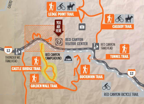
Another one of my favorite trail loops in Red Canyon is a lollypop-shaped
loop that packs a lot of scenery and 900 feet of total elevation gain and loss
in just under 2˝ miles -- the
Golden Wall-Castle Bridge Loop, highlighted in yellow on this Forest
Service trail map:
I hiked the loop on our second full day in Red Canyon, a
sunny Saturday, after doing the four trails on the other side of the highway
that I wrote about in the last entry.
I crossed the road near the Pink Ledges-Hoodoo trail
intersection just west of the visitor center and found the trailhead for
the Golden Wall Trail next to the bike path and a medium-sized parking
area on the south side of the road:
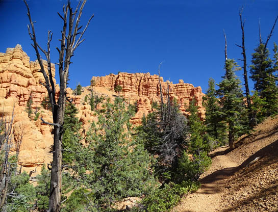
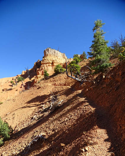
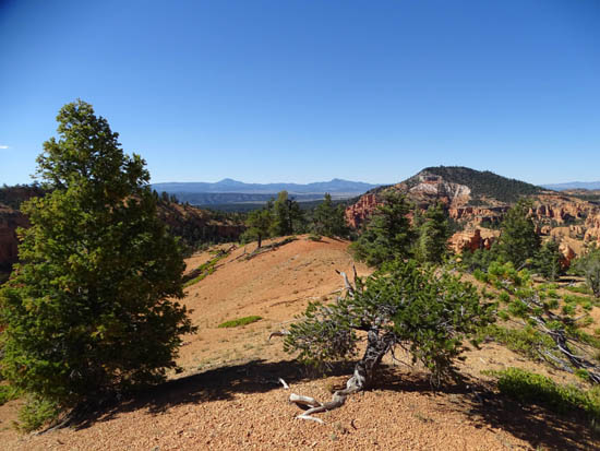
Hikers cross the bike path next to the parking
area, go across a wide, dry gravel wash
(I've never seen any water in it), and go up the
trail on the other side.
Although hundreds of cars, RVs, and tour buses were
traveling past these trailheads along Scenic Byway 12, and some were stopped
so the occupants could take photos of the rocks from the road, I saw only 15
people on these six trails -- on a gorgeous, warm Saturday when
there were several hundred thousand people at Bryce Canyon National Park
just 15 miles away!!
I talked Jim into hiking this
loop with me on a pretty Sunday in early October. That day we saw
no other hikers on this fascinating loop -- another warm,
sunny weekend day.
Is it any wonder I love the trails at Red Canyon so much??? What a
well-kept secret!
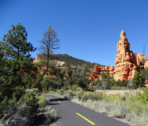
Bike path at trailhead for the
Golden Wall-Castle Bridge trails
These trails are spectacular, varied (distance, terrain, etc.),
dogs are allowed on all of them (they aren't allowed on trails at Bryce
Canyon), some are only for hiking (including the three trails described
in this entry) -- and, except for the Thunder Mountain Trail that is
so popular with cyclists, hardly anyone else apparently uses them!!
There's a third nearby trail I hiked only one time this
trip, the unique Tunnel Trail, which is located a little east of the visitor
center. Jim didn't see it until we returned in May,
2016. I'll describe it and show some photos of it in this entry, too.
You can see it to the right on the map above. I forgot to mark it in yellow.
I didn't see anyone else on that trail, either. People
just don't know what they're missing when they're in such a big hurry to
get to Bryce Canyon. I'm glad, actually -- more solitude
for me here.
GOLDEN WALL-CASTLE BRIDGE
LOOP
I will present the photos and trail descriptions in the order in which I
hiked the loop both times. The photos are from two different hikes, one
solo and one with Jim and Casey-pup.
If you look at the
map again you can see that this loop looks sort of like a lollypop,
going out and back on the "stick" part. That's because you can't
do the Castle Bridge Trail in isolation. Unless you have wings, it is a
half-circle that you can only reach via the Golden Wall Trail.
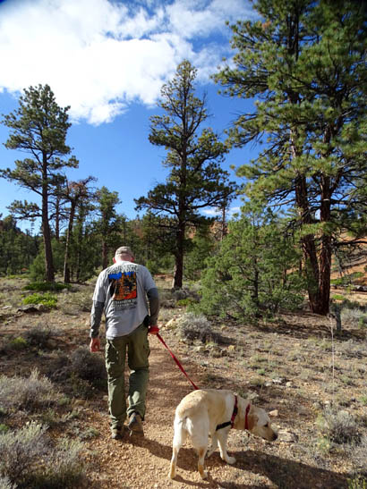
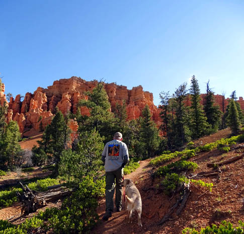
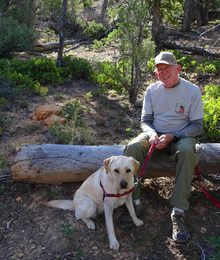
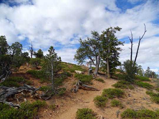
Jim and Casey on the first part of the Golden Wall
Trail
The shortest way see
the Castle Bridge rock formations is to start at the western end of the
Golden Wall Trail near the visitor center, as shown in these pictures.
This way the loop is just 2.4 miles long. You can do the loop part
either CW or CCW.
I'll talk about ways
to vary the distance and difficulty later.
Here are a few more photos on the Golden Wall Trail after we crossed the wide
gravel wash. It runs perpendicular to the road and roughly parallels
another smaller wash that flows toward the road:
It's easier to spot this "window"
in the rock wall when hiking than in this picture.
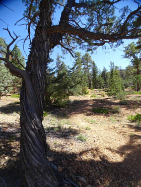
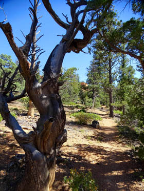
Interesting twisted trees along the path
Jim and Casey pose in a shady spot while I take
yet another picture.
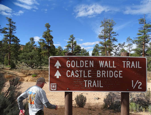
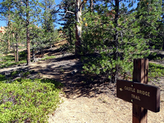
In about 6/10ths of a mile you come to the first intersection with the
Castle Bridge Trail:
You have two options if you're doing the lollypop loop -- go left here
like I did both times and hike clockwise around the loop, or continue
another half mile on the Golden Wall Trail and take a left when you get
to the intersection where the other end of the Castle Bridge Trail comes
out.
Either way, you'll end up back here before the end of the hike.
WHAT BRIDGE??
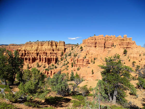
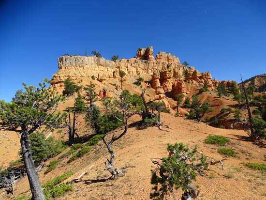
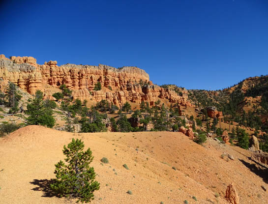
If you turn left at this first intersection like we did, you'll climb
one side of a narrow, steep canyon through tall trees on narrow,
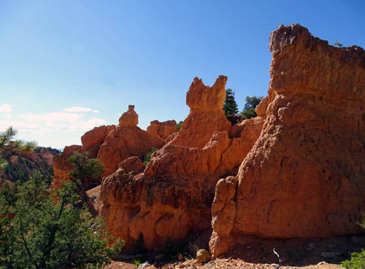
sometimes-steep switchbacks with fabulous views of a long castle-like
wall of red rocks:
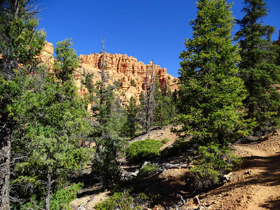
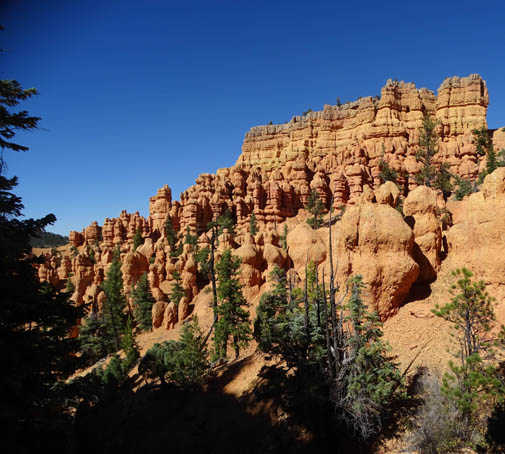
Cool, huh?
The steepest, most narrow part of the trail is in the
last couple hundred feet from the plateau where the trail tops out for a
little bit:
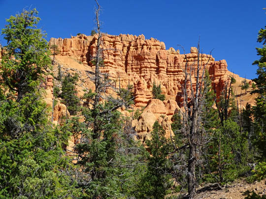
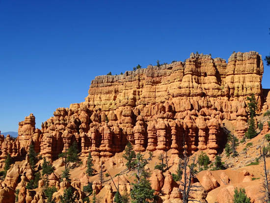
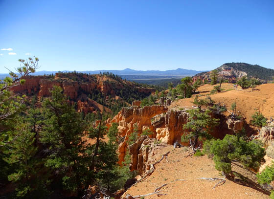
When you reach the first "landing" or ledge the views are spectacular in every
direction:
Above and below: looking back at the castle
walls
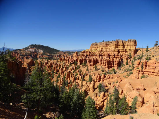
Looking west toward the Sevier River Valley
Neither one of us is sure where the castle "bridge" is located, unless
it's one small span (two photos down) that's not even in that long wall
of sculpted spires.
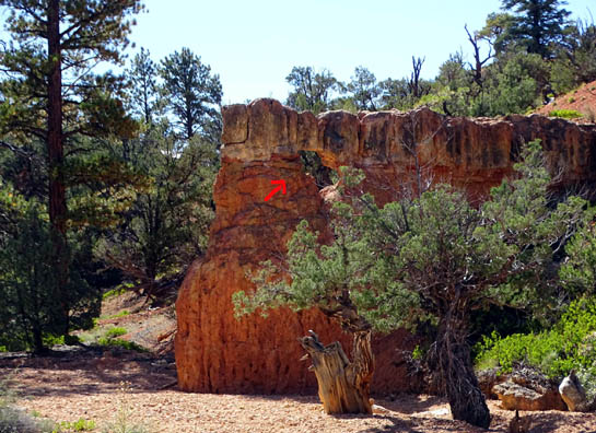
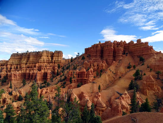
Perhaps it's somewhere in this second long wall to the east that is
visible for the next quarter mile of high trail:
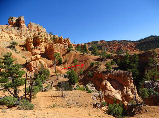
Arrow marks the trail; I was standing on a point
that jutted out away from the trail
to look more closely at a span of rock to the right
that looked sort of like a "bridge."
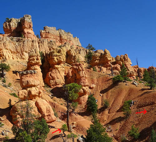
Although the wall to the east has some gold-colored rock in it, it's
not the "Golden Wall" for which the lower trail is named. It's on
the part of the Golden Wall Trail farther east that I didn't hike this
fall.
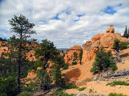
Somewhere up here is the high point on the loop at 7,569 feet. The low
point is the wash at the trailhead at 7,101 feet. Total elevation gain
and loss is about 900 feet on the 2.4-mile loop.
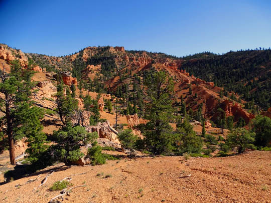
Here are some other views from the high part of the
trail before beginning the descent:
Above and below: views west over a canyon
toward the Sevier River Valley
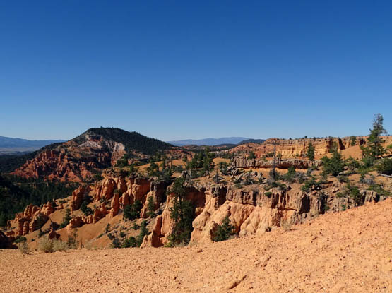
The wall to the east extends for several hundred feet.
After about a quarter mile of hiking in this high area the Castle Bridge
Trail drops down through a ravine to the Golden Wall Trail:
On two separate hikes my GPS recorded a distance of only 7/10ths of a
mile on the Castle Bridge Trail. For some reason the trail guide says
it's 1.8 miles, but that includes part of the Golden Wall Trail
-- and that distance doesn't even get you back to a trailhead!
Continued on the next page: the last mile of the loop on the
Golden Wall Trail plus photos from the Tunnel Trail
Happy trails,
Sue
"Runtrails & Company" - Sue Norwood, Jim O'Neil,
Cody the ultra Lab, and Casey-pup
Previous
Next
© 2015 Sue Norwood and Jim O'Neil
