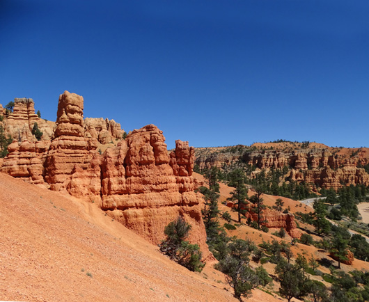
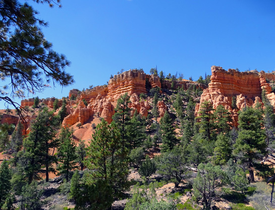
Even people just passing through Red Canyon on their way to Bryce Canyon
National Park should stop for at least a couple hours to enjoy this
spectacular canyon. That's enough time to look at the exhibits and displays
inside and outside the visitor center, pick up a free trail map, take photos
of the interesting rock formations visible from the road, and maybe hike one or
more of the four short foot-only trails behind and near the visitor
center.
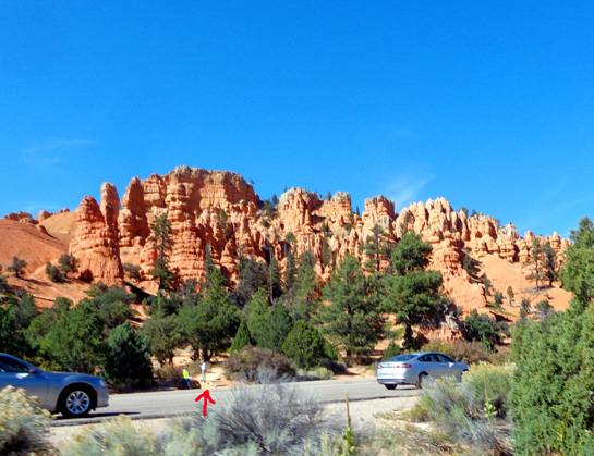
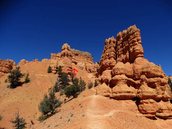
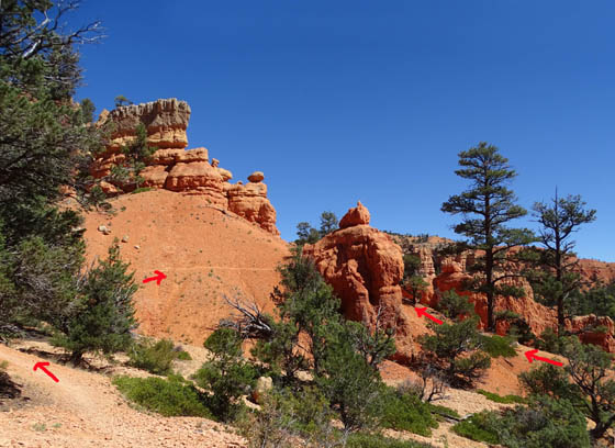
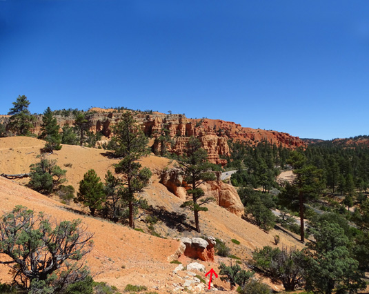
The trailhead for the Photo Trail
and one end of the Birdseye Trail are marked with an arrow.
The path is across from the first large
pull-off when visitors enter Red Canyon from the west.
I'll focus on those four trails in this entry, beginning with the
Photo Trail near the western entrance to Red Canyon.
I hiked all of these four short trails on our second full day in the
area and parts of three other ones. Within a few days Jim had hiked
these four, too. The photos cover various dates in September and
October.
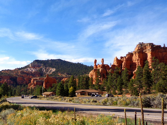
The Pink Ledges and Hoodoo trails
are behind the visitor center and to its left.
I went back several more times to hike Birdseye, Hoodoo, and Pink
Ledges. Even though they are all close to the visitor center I never saw very
many people on these trails.
The trails were close to our campground (a couple miles), easy enough on
my "rest" days (when I wasn't doing a long hike), and great for
walking with the dogs because no bikes are allowed on them -- they are
hiking-only trails. Dogs are allowed on ALL the trails in Red Canyon.
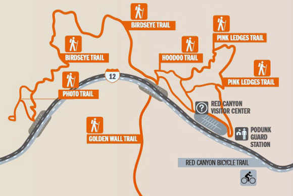
There's a good
trail map on the Forest Service
website. It's too large to print all the trails here so I just copied
the section with these four trails:
We highly recommend going to the visitor center first. After checking
out the exhibits and displays, ask the rangers any questions you have
and request one of the free trail maps. They can guide you to the trails
that are appropriate for your ability and the time you have.
Just beware of how the trails at Red Canyon can suck you in if you
don't have a strict itinerary.
We planned to stay in the area a week, maybe two. We loved it so much
we hung around for 31 days -- and returned for a month in the
spring of 2016 and another month in the fall
of 2016!
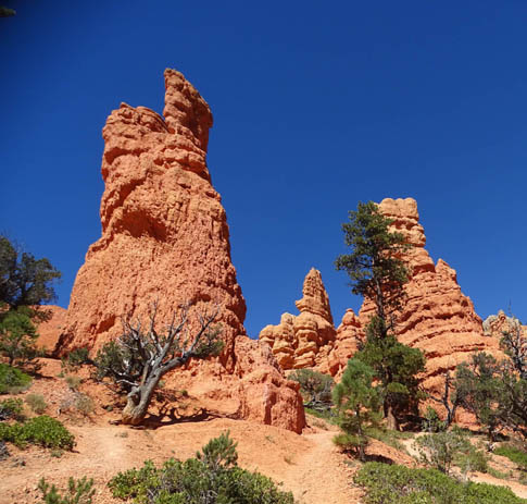
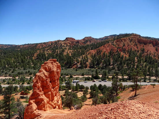
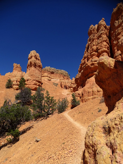
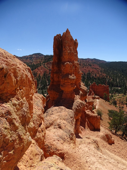
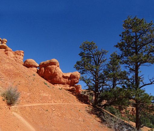
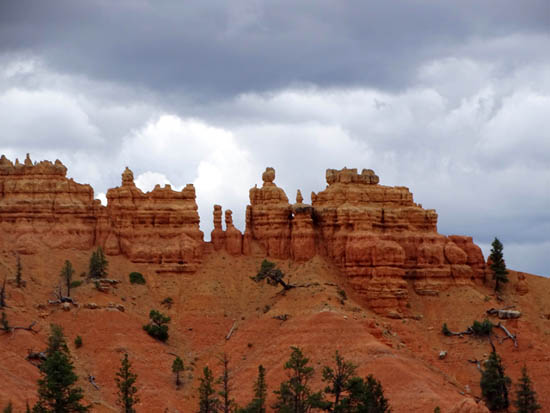
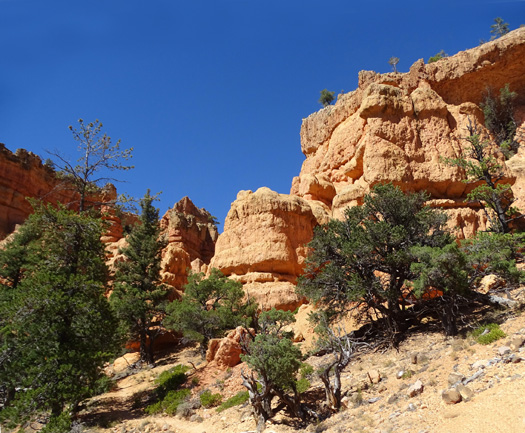
PHOTO TRAIL
This very short, branched trail has good views west toward the
US 89/Sevier River valley, the rock formations at the
entrance to the canyon, and east on Hwy. 12:
An easier way up and down this trail
is to go left here where it branches.
What this trail lacks in distance -- a quarter mile, tops
-- it makes up for in steepness.
I was able to climb up all of it OK to get photos but coming back
down part of it was an issue for me because of the loose sand and small rocks.
I had to sit coming down from my high point so I didn't slide and fall. I
only went back up part of the way when I showed the trail to Jim later.
I kept going up past the arrow --
my bad.
Looking back down; I didn't get a
picture at the very top
because I was focused on getting
my butt back down the hill. :-)
If you're younger or more flexible, you may not have any problems with the
steep grade or loose rocks. If I ever go up that far again I'll take
two trekking poles -- and wear rust-colored pants and thick
gloves so it's easier to slide down on my rear end!
None of the three remaining trails in this section near the visitor
center had such steep spots. If you're relatively fit, you should be
able to handle them even if you have older joints.
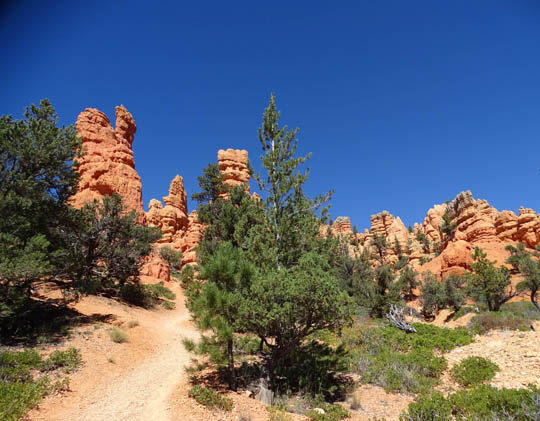
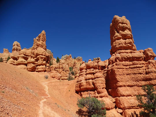
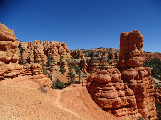
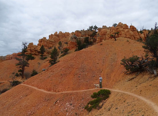
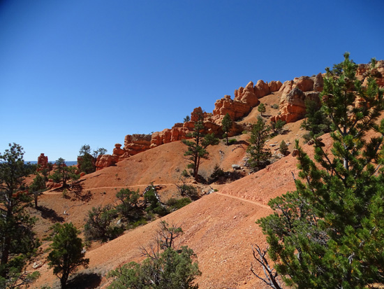
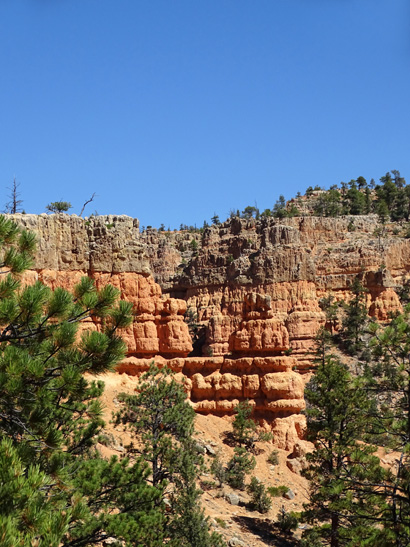
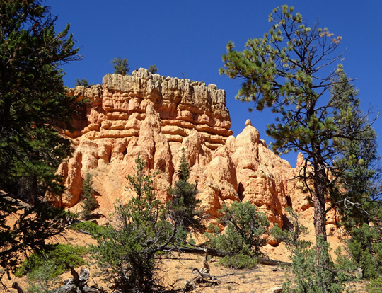
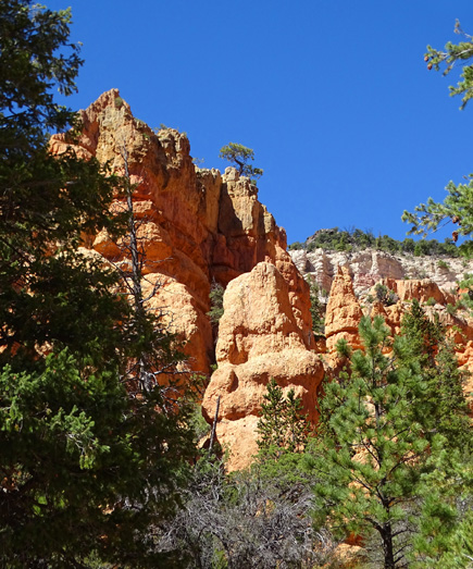
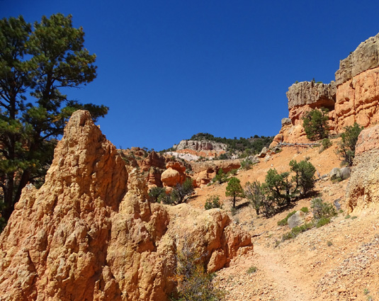
BIRDSEYE TRAIL
This trail is point-to-point so you can access it from the same
trailhead as the Photo Trail or at the end near the visitor center.
Here's one view that shows two ways to reach the Birdseye Trail from
the Photo Trail:
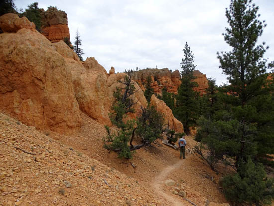
The Birdseye and Hoodoo Trails are the easiest of these four trails
to hike because once you gain about 100 feet of elevation above the
road, you just undulate across the face of the rock slopes in and out of
little canyons.
Some of the next photos are looking eastbound toward the visitor
center and some are looking westbound.
The high side of the slope will always be either on your right or
left, depending on the direction you're walking. The trail doesn't go
around the back side of these cliffs.
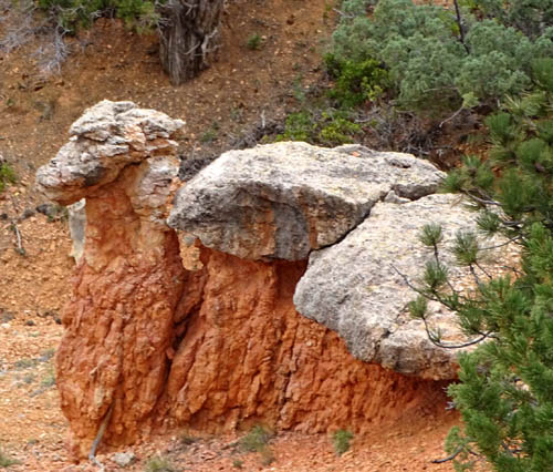
"Camel" formation from the back
(above) and front (below)
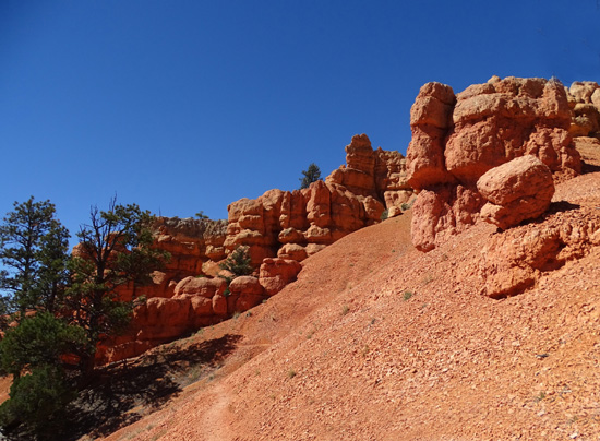
The trail gets its name from the "birds eye" view you get of the
interesting rock formations and hoodoos along the slope.
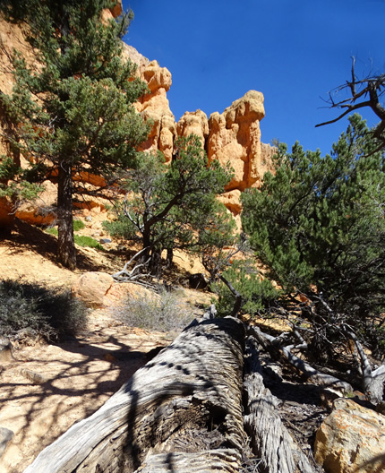
The trail is narrow in some places with a steep slope toward the road
but the footing is good:
Jim and Casey on one of the narrow trail sections
Zoomed in on the back side of the "castle" across
the road
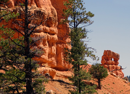
Note the "window" in the rock formation on the
right.
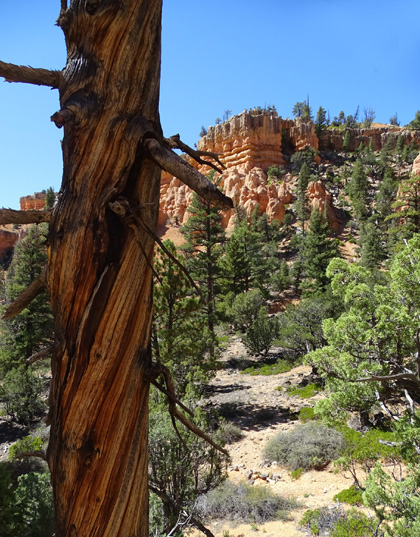
There are a lot of spiral tree trunks like this in
both Red Canyon and Bryce Canyon.
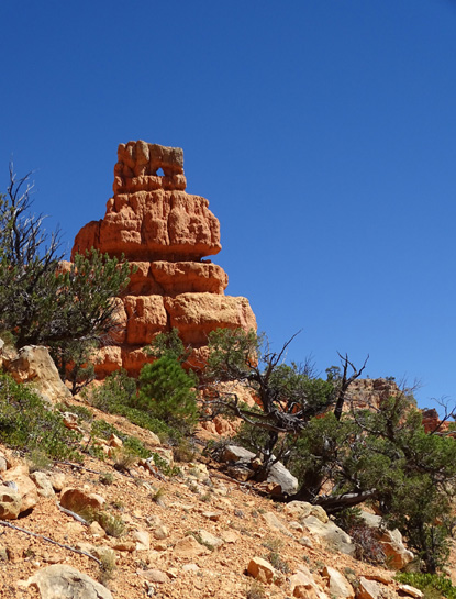
I have fun hunting for "windows"
like this.
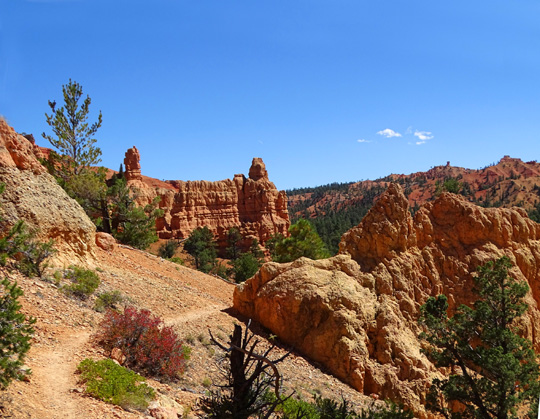
This trail is 8/10ths of a mile end to end. You can hike
it out and back or in combination with one or more of the other trails
near the visitor center.
Continued on the next page: interesting
rock formations on the Hoodoo and Pink Ledges trails
Happy trails,
Sue
"Runtrails & Company" - Sue Norwood, Jim O'Neil,
Cody the ultra Lab, and Casey-pup
Previous
Next
© 2015 Sue Norwood and Jim O'Neil
